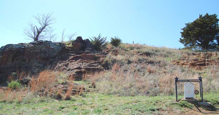
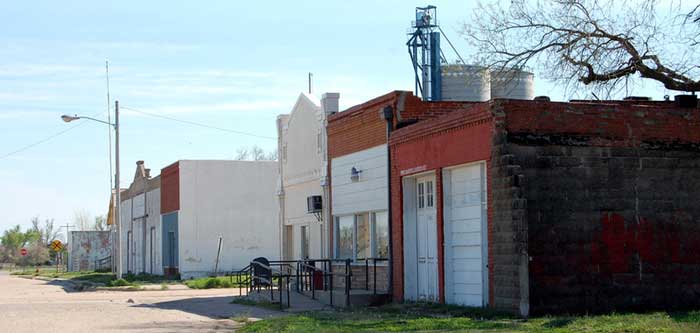
Pawnee Rock is a historic landmark on the Santa Fe Trail and a small town that grew up around the rock in present-day Barton County, Kansas. Located in the county’s southwest corner, the bluff, comprised of Dakota Sandstone, sits about 100 yards from the old Santa Fe Trail. Before this road was blazed, the large rock formation, rising out of the flat prairie, was where the Comanche, Kiowa, Arapaho, and Cheyenne Indians held councils of war and peace.
Many Indian battles were fought here, and the Native Americans also used the sandstone citadel as a vantage point to spot buffalo herds and later — approaching wagon trains. White explorers such as Zebulon Pike, Josiah Gregg, and Alexander Doniphan mentioned Pawnee Rock in their journals.
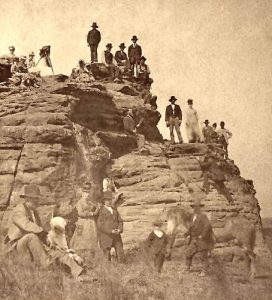
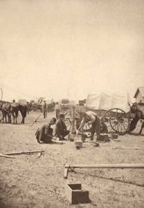
Pawnee Rock later became a popular stop on the Santa Fe Trail for the white settlers heading west searching for adventure and fortune. The Rock was considered the midpoint of the long road between Independence, Missouri, and Santa Fe, New Mexico, lying between long stretches of dry plains. Water, provided by the nearby Arkansas River, and fresh meat, obtained by plentiful game, were vital to the survival of the wagon trains.
As the hundreds of thousands of trappers, soldiers, gold seekers, and emigrants passed by, they carved their names into every conceivable place upon the sandstone face of the bluff. In 1848, James Birch, a soldier on his way to the Mexican-American War, wrote:
“Pawnee Rock was covered with names carved by the men who had passed it. It was so full that I could find no place for mine.”
Although the rock was one of the most famous landmarks along the 750-mile trail, it became known as one of the most dangerous points as the angry Pawnee Indians began ambushing the caravans. Word of the attacks spread from one end of the trail to the other, but the wagon trains still stopped at the vital campsite, needing fresh provisions for the rest of their journey.
The rock was much larger originally than it is presently, as a great deal of stone was taken from the bluff and used by settlers. There are two versions of how it was given its name. The first says it was after a skirmish with Pawnee Indians in which Kit Carson took part. The second says the name attached from the fact that the various tribes of Pawnee met in general council on top of it.
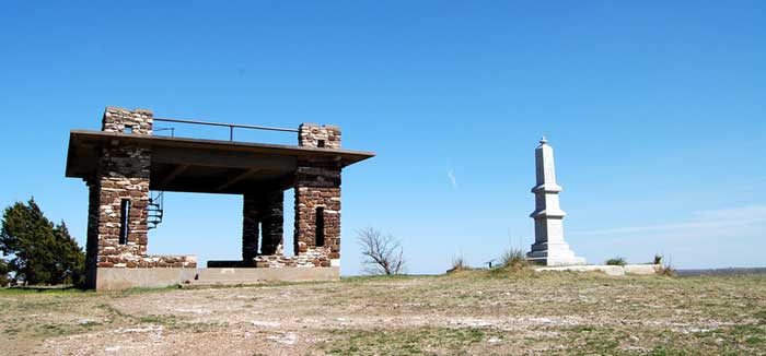
In 1908, the remaining portion of the bluff was acquired by the Woman’s Kansas Day Club, and the following year, it was turned over to the State of Kansas as a historic site. On May 24, 1912, a stone monument was dedicated with a grand celebration before a crowd of about 8,000 onlookers. Today’s state park provides a road to a shelter house and monument on the summit. An overlook, monument, and historical signs now grace its reduced summit, where visitors can stand, witnessing the view many throughout history have shared. The site is open from sunrise to sunset.
The town of Pawnee Rock started as a station along the Atchison, Topeka, & Santa Fe Railroad. Laid out in 1874 by the Arkansas Valley Town Company, it had many thriving businesses by the early 1880s. The first building to be constructed was the Rock Hotel, which quickly became a stopping place for travelers through the area.
Unfortunately, with the railroad coming and the town’s formation, the Pawnee Rock landmark began to be destroyed. The railroad company moved much of it to build foundations for water tanks, depots, and other buildings. The early settlers used more of the bluff to construct buildings.
W. H. Bowman, Aaron Garvick, and Eli Bowman built the first grain elevator in 1878. They also built a flour mill and operated it until 1899, when it was purchased and moved to Garfield, near Larned.
That same year, A.W. Metcalf opened a general merchandise store that carried all types of goods, including boots and shoes, harness and horse furnishing goods, tobacco, stationery, and notions. Several other commercial buildings and residences were also built in the small community.
Initially, The town grew slowly, but by 1887, it was large enough to be incorporated. The first officers were elected in April 1887 after an exciting campaign by the two opposing factions. The main issue was whether pool rooms should continue in the town.
By 1912, the town had become a supply point for a large territory in Barton, Pawnee, and Stafford Counties and a shipping point for grain, cattle, and other livestock. By then, it sported three general stores, two banks, two furniture stores, two hardware stores, five elevators, an electric light and ice plant, a weekly newspaper, three churches, and fine public schools. Its population at that time was over 450.
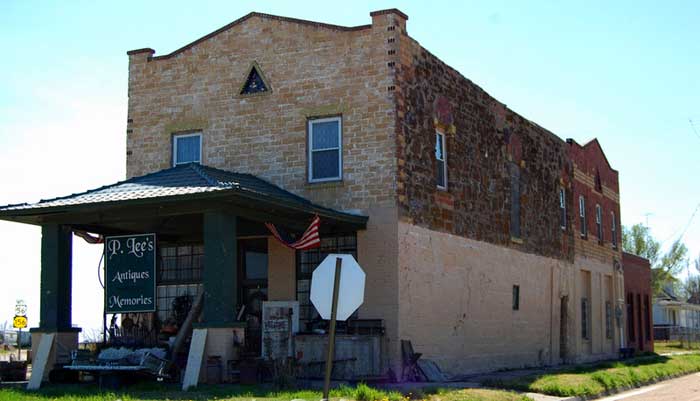
The old Opera House, one of the town’s earliest buildings, continues to stand. Photo by Kathy Alexander.
Over the years, Pawnee Rock moved into the future while maintaining its agricultural base. Today, its population is just about 350 people. Its history is retained in several old buildings, including the Opera Hall, one of the first buildings erected in the town.
The sandstone walls were made of stone taken from the Pawnee Rock outcropping. Later, it became the Knights of Pythias Hall before being utilized as a diner in the 1960s. Today, it houses an antique shop. Other old buildings include the post office, which formerly housed a bank; the American Legion Hall, which once housed a grocery store; the railroad depot; and other old brick buildings.
Pawnee Rock State Park is about ½ mile north of Highway 156 on Centre Street. The historical park protects the bluff, and visitors can climb the rock face or ascend the pavilion’s spiral staircase for a grand view of Barton, Pawnee, Rush, and Stafford counties.
Wagon trail ruts along Ash Creek, a tributary of the Arkansas River, can also be seen in the area.
More Information:
©Kathy Alexander/Legends of Kansas, updated March 2025.
Also See:
See Sources.

