
Kansas Counties Map.
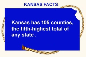
Kansas has 105 counties, the fifth-highest total of any state. Many counties in the eastern part of the state are named after prominent Americans from the late 18th and early to mid-19th centuries, while those in the central and western parts of the state are named after figures in the Civil War. Several counties are named for Native American tribes. The population of Kansas counties varies widely, from the smallest, Greeley County, with approximately 1,300 residents, to Johnson County, part of the Kansas City Metropolitan Area, with over 600,000 residents.
| County | County Seat | Established | Origin |
| Allen | Iola | 1855 | One of the original 36 counties. |
| Anderson | Garnett | 1855 | One of the original 36 counties. |
| Atchison | Atchison | 1855 | One of the original 36 counties. |
| Barber | Medicine Lodge | 1867 | From an unorganized area. |
| Barton | Great Bend | 1867 | From an unorganized area. |
| Bourbon | Fort Scott | 1855 | One of the original 36 counties. |
| Brown | Hiawatha | 1855 | One of the original 36 counties (Formerly Browne County). |
| Butler | El Dorado | 1855 | One of the original 36 counties. |
| Chase | Cottonwood Falls | 1859 | Formed from Butler and Morris Counties. |
| Chautauqua | Sedan | 1871 | Formed from Howard County. |
| Cherokee | Columbus | 1855 | One of the original 36 counties (Formerly McGee County). |
| Cheyenne | St. Francis | 1873 | From an unorganized area. |
| Clark | Ashland | 1885 | Formed from Ford County. |
| Clay | Clay Center | 1857 | From an unorganized area. |
| Cloud | Concordia | 1866 | Formed from Washington County (Formerly Shirley County). |
| Coffey | Burlington | 1855 | One of the original 36 counties. |
| Comanche | Coldwater | 1867 | From an unorganized area. |
| Cowley | Winfield | 1867 | Formed from Butler County. |
| Crawford | Girard | 1867 | Formed from Bourbon and Cherokee Counties. |
| Decatur | Oberlin | 1873 | From an unorganized area. |
| Dickinson | Abilene | 1857 | From an unorganized area. |
| Doniphan | Troy | 1855 | One of the original 36 counties. |
| Douglas | Lawrence | 1855 | One of the original 36 counties. |
| Edwards | Kinsley | 1874 | Formed from Kiowa County. |
| Elk | Howard | 1875 | Formed from Howard County. |
| Ellis | Hays | 1867 | From an unorganized area. |
| Ellsworth | Ellsworth | 1867 | From an unorganized area. |
| Finney | Garden City | 1883 | Formed from Arapahoe, Grant, Kearny, and Sequoyah Counties. |
| Ford | Dodge City | 1867 | From an unorganized area. |
| Franklin | Ottawa | 1855 | One of the original 36 counties. |
| Geary | Junction City | 1855 | One of the original 36 counties (Formerly Davis County). |
| Gove | Gove | 1868 | From an unorganized area. |
| Graham | Hill City | 1867 | From an unorganized area. |
| Grant | Ulysses | 1887 | Formed from Finney and Hamilton Counties in 1887. |
| Gray | Cimarron | 1887 | Formed from Finney and Ford Counties. |
| Greeley | Tribune | 1873 | From an unorganized area. |
| Greenwood | Eureka | 1855 | One of the original 36 counties. |
| Hamilton | Syracuse | 1873 | From an unorganized area. |
| Harper | Anthony | 1867 | From an unorganized area. |
| Harvey | Newton | 1872 | Formed from McPherson, Sedgwick, and Marion Counties. |
| Haskell | Sublette | 1887 | Formed from Finney and Ford Counties. |
| Hodgeman | Jetmore | 1867 | From an unorganized area. |
| Jackson | Holton | 1855 | One of the original 36 counties (Formerly Calhoun County). |
| Jefferson | Oskaloosa | 1855 | One of the original 36 counties. |
| Jewell | Mankato | 1867 | From an unorganized area. |
| Johnson | Olathe | 1855 | One of the original 36 counties. |
| Kearny | Lakin | 1887 | Formed from Finney and Hamilton Counties. |
| Kingman | Kingman | 1872 | Formed from Harper and Reno Counties. |
| Kiowa | Greensburg | 1886 | Formed from Comanche and Edwards Counties. |
| Labette | Oswego | 1867 | Formed from Neosho County. |
| Lane | Dighton | 1886 | From an unorganized area. |
| Leavenworth | Leavenworth | 1855 | One of the original 36 counties. |
| Lincoln | Lincoln | 1867 | From an unorganized area. |
| Linn | Mound City | 1855 | One of the original 36 counties. |
| Logan | Oakley | 1888 | Formed from Wallace County (Formerly named St. John County). |
| Lyon | Emporia | 1855 | One of the original 36 counties (Formerly Breckenridge County). |
| Marion | Marion | 1860 | From an unorganized area. |
| Marshall | Marysville | 1855 | One of the original 36 counties. |
| McPherson | McPherson | 1867 | From an unorganized area. |
| Meade | Meade | 1885 | Formed from Finney, Ford, and Seward Counties. |
| Miami | Paola | 1855 | One of the original 36 counties (Formerly Lykins). |
| Mitchell | Beloit | 1867 | From an unorganized area. |
| Montgomery | Independence | 1867 | Formed from Wilson County. |
| Morris | Council Grove | 1855 | One of the original 36 counties (Formerly Wise County). |
| Morton | Elkhart | 1886 | Formed from Seward County. |
| Nemaha | Seneca | 1855 | One of the original 36 counties (Formerly Dorn County). |
| Neosho | Erie | 1855 | One of the original 36 counties. |
| Ness | Ness City | 1867 | From an unorganized area. |
| Norton | Norton | 1867 | From an unorganized area (Formerly Billings County). |
| Osage | Lyndon | 1855 | One of the original 36 counties (Formerly Weller County). |
| Osborne | Osborne | 1867 | From an unorganized area. |
| Ottawa | Minneapolis | 1860 | From an unorganized area. |
| Pawnee | Larned | 1867 | From an unorganized area. |
| Phillips | Phillipsburg | 1867 | From an unorganized area. |
| Pottawatomie | Westmoreland | 1857 | Formed from Calhoun and Riley Counties. |
| Pratt | Pratt | 1867 | From an unorganized area. |
| Rawlins | Atwood | 1873 | From an unorganized area. |
| Reno | Hutchinson | 1867 | From an unorganized area. |
| Republic | Belleville | 1868 | Formed from Washington County. |
| Rice | Lyons | 1867 | From an unorganized area. |
| Riley | Manhattan | 1855 | One of the original 36 counties. |
| Rooks | Stockton | 1867 | From an unorganized area. |
| Rush | La Crosse | 1867 | From an unorganized area. |
| Russell | Russell | 1867 | From an unorganized area. |
| Saline | Salina | 1860 | From an unorganized area. |
| Scott | Scott City | 1873 | From an unorganized area. |
| Sedgwick | Wichita | 1867 | Formed from Butler County. |
| Seward | Liberal | 1873 | From an unorganized area. |
| Shawnee | Topeka | 1855 | One of the original 36 counties. |
| Sheridan | Hoxie | 1873 | From an unorganized area. |
| Sherman | Goodland | 1873 | From an unorganized area. |
| Smith | Smith Center | 1867 | From an unorganized area. |
| Stafford | St. John | 1867 | From an unorganized area. |
| Stanton | Johnson | 1887 | Formed from Hamilton County. |
| Stevens | Hugoton | 1886 | Formed from Seward County. |
| Sumner | Wellington | 1867 | Formed from Butler and Marion Counties. |
| Thomas | Colby | 1873 | From an unorganized area. |
| Trego | WaKeeney | 1867 | From an unorganized area. |
| Wabaunsee | Alma | 1855 | One of the original 36 counties (Formerly Richardson County). |
| Wallace | Sharon Springs | 1868 | From an unorganized area. |
| Washington | Washington | 1857 | From an unorganized area. |
| Wichita | Leoti | 1873 | From an unorganized area. |
| Wilson | Fredonia | 1855 | One of the original 36 counties. |
| Woodson | Yates Center | 1855 | One of the original 36 counties. |
| Wyandotte | Kansas City | 1859 | Formed from Leavenworth and Johnson Counties. |
| Extinct Counties | |||
| Arapahoe | Neither of the two Arapahoe Counties was organized. | 1855 and 1873 | The Kansas Territorial Legislature created Arapahoe County in 1855, named for the Arapaho tribe. It was situated immediately south of Sequoyah County and covered an area of 24 square miles. It was attached to Marshall County for all business purposes. Arapahoe County was never organized. In early 1859, it was divided into six counties: Arapahoe, Broderick, El Paso, Fremont, Montana, and Oro. When Colorado Territory was established in February 1861, these counties were absorbed into the new state.
In 1873, a second county, Arapahoe, was created in the southwestern part of the state from unorganized territory. Its population in 1880 was about ten inhabitants. This county contained no streams except the Cimarron River across the extreme southwest corner. There was no post office; the nearest railway station was Pierceville in Sequoyah County. No farming was done, and the county was considered suitable for grazing only during the early summer. In 1883, Arapahoe County disappeared. Its territory was included in Finney County, and in 1887, Haskell County was created from that part of Finney County. |
| Billings | None | 1873 | Billings County existed for less than one year and was organized because Norton County was established in August 1872. Billings did not have a county seat during its period of existence. The town of Norton was elected the county seat in February 1874, following the reinstatement of the name Norton County. |
| Breckenridge | 1855 | The Kansas Territorial Legislature organized Breckinridge County in 1855, attaching it to Madison County for civil, criminal, and military purposes. It was named for John C. Breckinridge, a United States senator from Kentucky. In 1861, Madison County was abolished, and Breckinridge County annexed its northern portion. The county was renamed Lyon County in February 1862 due to the Confederate sympathies of its namesake, John C. Breckinridge. | |
| Buffalo | Never organized | 1879 | It was bounded on the North by Lane County, East by Ness and Hodgeman Counties, South by Foote County, and West by Sequoyah and Scott Counties. In 1881, the northern tier of townships was transferred from Buffalo County to Lane County. The remainder was incorporated into a new county, Gray, which later merged to form Finney County. |
| Calhoun | Holton | 1855 | The Kansas Territorial Legislature organized Calhoun County in August 1855 and named it for John C. Calhoun, Kansas’ first surveyor-general. The county then embraced the southern portion of present-day Jackson County and the northern portion of Shawnee County lying north of the Kansas River. In 1857, the Legislature added the northern part of Jackson County. The county was organized in 1857. An October 1858 election to determine the county seat location resulted in Holton receiving a majority of the votes. A few days later, the county’s name was changed to Jackson. |
| Davis | Junction City | 1855 | The Kansas Territorial Legislature organized Calhoun County in August 1855 and named it for Jefferson Davis. It lost territory to Dickinson County in 1857 and Wabaunsee County in 1860; it gained territory from Dickinson County in 1860 and Riley County in 1873. The county’s name was changed to Geary in March 1889 because Jefferson Davis served as the President of the Confederate States. |
| Dorn | None | 1855 | The Kansas Territorial Legislature organized Calhoun County in August 1855. It was named in honor of either Earl Van Dorn, an army officer during the Mexican-American War and Indian campaigns, or, more likely, Andrew Jackson Dorn, also a Mexican-American War veteran and Indian agent for the Osage, Quapaw, Seneca, and Shawnee at the Neosho Agency from 1853 to 1861. Both men joined the Confederate Army in 1861, and the county was renamed Neosho. The county was never organized and was divided in June 1861 into the present counties of Neosho and Labette. |
| Foote | Changed to Gray County. | 1879 | Named in honor of Andrew Hull Foote, a United States naval officer during the Civil War. The boundaries encompassed the present-day Gray County, except for the southern tier of Congressional Township. In 1881, the county was attached to Ford County for judicial purposes, and another act of the same session changed the name to Gray. |
| Garfield | Ravanna and Eminence | 1887 | Most of the area was in Buffalo County, which was never organized. The remainder came from six congressional townships in Finney County and six in Hodgeman County. |
| Howard-Seward-Godfrey | None | 1855 | The Kansas Territorial Legislature organized Calhoun County in August 1855. In the original act, the name is spelled “Godfroy.” It was named for “Bill” Godfrey, a noted trader among the Osage Indians. It was attached to Allen County for civil and military purposes and was never organized. The name was changed to Seward County in June 1861 in honor of William H. Seward, and then to Howard County in 1867. In 1875, it was divided into the present counties of Elk and Chautauqua. |
| Hunter | None | 1855 | The Kansas Territorial Legislature organized Hunter County in August 1855. In 1857, the county was enlarged. In 1860, Irving County was created from the northern portion of Hunter County. In 1864, Butler County was enlarged to include both Irving and Hunter, which subsequently disappeared. A more significant portion of what was once Hunter County is now part of Cowley County. |
| Kansas | None | 1873 | Named in memory of the Kanza Indians, it was located in the southwest corner of Kansas. In 1883, Kansas County disappeared, with Seward County taking its place. Morton County was formed from Seward County in 1886, which was initially part of Kansas County’s boundaries. |
| Lykins | None | 1855 | The Kansas Territorial Legislature organized Lykins County in August 1855. It was named in honor of David Lykins, one of the county’s early settlers and a member of the territorial council. In 1861, the county’s name was changed to Miami in honor of the Miami tribe of Native Americans. |
| Madison | None | 1855 | The Kansas Territorial Legislature organized Madison County in August 1855. In 1861, the territory encompassed by the county was divided between Breckenridge (later Lyon) and Greenwood Counties, and Madison County was no longer included. |
| McGee | None | 1855 | The Kansas Territorial Legislature organized McGee County in August 1855. It was named in honor of Mabillon W. McGee, a member of the Kansas House of Representatives in 1855. The county was attached to Bourbon County for all civil and military purposes. In 1860, the county’s name was changed to Cherokee. |
| Otoe | None | 1860 | Otoe County was established in February 1860 and named for the Oto Indian tribe. On February 24, 1864, the boundaries of Butler County were enlarged to include Otoe County. Most of the territory once comprising Otoe is included in the present Butler County, with the remainder in the eastern parts of Harvey and Sedgwick Counties. |
| Peketon | Beach Valley | 1860 | Peketon County was established in February 1860. Because of its small population, the county was never organized, and its territory was merged into Marion County in February 1867. |
| Richardson | None | 1855 | The Kansas Territorial Legislature organized McGee County in August 1855. The territory was incorporated into Wabaunsee County in 1859. |
| St. John | None | 1881 | It was established in 1881 and named after John P. St. John, then the state’s governor. In February 1887, the legislature approved an act changing the name to Logan. |
| Sequoyah | Garden City | 1873 | Sequoyah County was created in 1873 by the Kansas Legislature and was attached to Ford County as a township for judicial purposes. The county covered 864 square miles, measuring 24 miles east-west and 36 miles north-south. It was named for Sequoyah, the Cherokee Indian who invented the written language of his tribe. This was a treeless region. The Arkansas River ran south of the county’s central portion, mainly in a southeasterly direction. Sandhills are located in the northeast and southeastern parts of the county. T.A. Carlon, J.R. Fulton, W.D. Fulton, C.J. Jones, and John Stevens were the first settlers in the county in 1878 and 1879. The points in the county are the following railroad stations: Pierceville, Garden City, and Sherlock (Holcomb). The territory within these boundaries now comprises the western two-thirds of Finney County, which was formed in 1883. |
| Shirley | None | 1860 | Shirley County was established in 1860. Its name changed to Cloud County in 1867. |
| Weller | None | 1855 | The Kansas Territorial Legislature organized Weller County in August 1855. The name was changed to Osage County in 1859, when the county was organized. |
| Wise | None | 1855 | The Kansas Territorial Legislature organized Wise County in August 1855. It was named after Henry A. Wise, governor of Virginia, who was in office during the John Brown raid on Harper’s Ferry. The name changed to Morris County in 1859. |
©Kathy Alexander/Legends of Kansas, updated July 2026.
Also See:
Sources:
Blackmar, Frank W.; Kansas: A Cyclopedia of State History, Vol I; Standard Publishing Company, Chicago, IL 1912.
Cutler, William G.; History of Kansas; A. T. Andreas, Chicago, IL, 1883.
Kansas History
Random Acts