
Dickinson County Landscape near Navarre, Kansas, by Kathy Alexander.
Towns & Places:
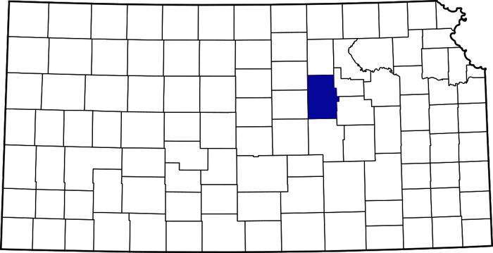
Dickinson County, Kansas, location.
Abilene – County Seat
Enterprise
Hope
Solomon

Dickinson County Map, by L.H. Everts & Co., 1887.
Talmage
Woodbine
Carlton
Detroit
Elmo
Herington Army Air Field
Manchester-Keystone
Navarre
One-Room, Country, & Historic Schools of Dickinson County, Kansas
Dickinson County Photo Gallery
In the state’s central portion, Dickinson County, Kansas, was created by an act of the legislature in 1857. It was named in honor of Daniel S. Dickinson, a New York senator. Abilene is the county seat and the most populous city. As of the 2020 census, the county population was 18,402.
The county is in the third tier of counties south of Nebraska and the sixth west of the Missouri River. It is bounded on the north by Clay County, on the east by Geary and Morris, on the south by Marion, and on the west by Saline and Ottawa Counties. Its area is 851 square miles.

Coronado Expedition by Frederic Remington.
It is supposed that the first white men to pass through the territory now embraced in Dickinson County were the Spanish explorer Francisco Coronado and his followers, and that the French explorer Etienne Veniard de Bourgmont probably passed through the county in 1724. A family named Lenon was located on Chapman Creek in 1855, but did not stay. In the fall of the following year, T.F. Hersey located on a claim on Mud Creek near the present city of Abilene, but there was an impression that land so far west was not fit for habitation, and settlement was slow. Some authorities estimate that there were not more than half a dozen families in the county at the time of its organization. Before that time, the county was attached to Geary County as a municipal township for all civil and military purposes.
The country’s surface is a gently rolling prairie that breaks into bluffs along some streams. River valleys average two miles in width, while the valleys of the creeks are only about a mile in width. This bottomland comprises about a quarter of the total area, and the soil is rich and deep, growing somewhat thinner on the upland. Timber — mostly walnut, ash, elm, hackberry, burr oak, cottonwood, hickory, honey-locust, box-elder, and sycamore — is found along the streams. The most extensive water course is the Smoky Hill River, which flows across the county from west to east, a little north of the center. This stream, with its tributaries, the most important of which are Chapman’s, Turkey, and Vine Creeks, waters the county. A few springs existed, and good well water was found at a depth of 30 feet. The county is well adapted to agriculture, the principal crops being winter wheat, corn, and other grains. Tame grasses and prairie hay are also important products, and Dickinson ranked high as one of the great stock-raising counties. There are more than 225,000 bearing fruit trees, about half of which are apples. Excellent-quality limestone was abundant; mineral paint and clay for brick and pottery were found near Abilene; gypsum is plentiful in the southwest and is extensively used. Saltwater was found at Solomon, in the western part of the county, and in Hope Township in the southwest. Two mineral springs in Abilene were believed to have medicinal properties, and the water was bottled and shipped to some extent.

The Smoky Hill River in Dickinson County, Kansas, near Enterprise, by Kathy Alexander.
C.W. Staatz settled on Lyon Creek in 1857; in 1858, several settlers arrived and located along different streams. Among them were Wilham Lamb, who took a claim on the Smoky Hill River; A.J. Markley, who settled on Turkey Creek; William Breeson, on Lyon Creek; and E.W. Bradfield, on Mud Creek. Although white settlers were coming into the county, the Smoky Hill Valley and the prairies were still the hunting grounds of various Indian tribes, and the pioneers, being far apart, had more frequent red than white visitors. The Indians committed some depredations and were at one time caught and punished by Captain Sturgis. Settlement was slowed by the Indians, who, while they professed friendship, could not be trusted. Slow ox teams brought supplies this far west only at significant risk and inconvenience. Kansas City and Leavenworth were the nearest points where grain could be ground and supplies purchased. Trips were usually made to these cities twice a year to market and mill, and the whole family went along, as it was unsafe to leave a few members alone, distant from other settlements.
Soon after the county was created in 1857, H.M. Rulison, Dr. Gerat, and Nicholas White formed a town company and located what was known as Newport, about a mile east of where Detroit now stands. The site was platted, and a cabin was built on each quarter section.
Dickinson County was organized in 1858 with the following officers: commissioners William Lamb, James Long, and William Mulligan; clerk Dr. Gerot; treasurer John Lamb; sheriff Henry Long; and register of Deeds John Long. The county board declared Newport the county seat. A voting precinct was established at Newport, and 20 votes were cast in the November election.
The first school was organized on Lyon Creek in Liberty Township in 1859 and taught by William Miller.

Mud Creek in Dickinson County, Kansas.
In 1860, C.H. Thompson moved to Dickinson County from Leavenworth, located on land east of and adjoining T.F. Hersey. He laid out a town on Mud Creek, which Mrs. Hersey named Abilene, and a few log houses were erected there. Another town, called Union City, was laid out south of the Smoky Hill River on Turkey Creek.
By 1860, Dickinson County’s population had increased to 378, and the first regular election was held in the fall.
The Methodists held Pioneer religious services. In the spring of 1861, they erected a log church on Lyon Creek, which was also used as a weekday schoolhouse. Peter May was the first pastor of this pioneer congregation. A man named Jones opened the county’s first store in Abilene in 1860.
The Smoky Hill River divides the county nearly in equal parts — the northern and southern. To accommodate the voters on both sides of the river, the county commissioners established two voting precincts, one on the north side at Newport and one on the south side at A.J. Markley’s house in Union City. The officers had hardly qualified when the county seat agitation began, the contesting points being Union City on the south and Detroit, Abilene, and Newport on the north side of the river. The settlers on the south side were fewer than those on the north side but were united, while those on the north side were divided. Thompson and Hersey saw that unless the people north of the river united, the county seat would go south of the river. A compromise was effected by the settlers on Chapman’s Creek, who withdrew their support from Newport in favor of Abilene, thereby making it the seat of justice. The election took place in 1861.

Drovers Cottage in Abilene, 1867.
The first railroad to enter the county was the Missouri Pacific Railroad, built along the Smoky Hill Valley in 1866.
The first hotel to open was the Drover’s Cottage in Abilene in 1866, owned by Joseph G. McCoy. V.P. Wilson established the Chronicle, the county’s first newspaper in Abilene, in February 1870.
A brick-and-stone courthouse was built at the corner of Broadway and Second Streets in Abilene in 1870. On January 17, 1882, the courthouse burned, and nearly all the county records were destroyed, except for those of the register of deeds, which were in another building. A new courthouse was soon contracted for $30,000 and was ready for occupancy late in the year.

Old Dickinson County Courthouse in Abilene, Kansas.
In 1910, the Union Pacific Railroad crossed the county from east to west, passing through Abilene with a branch south from Detroit. The Atchison, Topeka & Santa Fe Railroad crossed the southern boundary a few miles west of the southeast corner, traversed the county in a northwesterly direction, and at Abilene, branched out with one line running west into Saline County, the other running northwest to Concordia. A line of the Chicago and Rock Island Railroad crossed the county’s southeast corner, with a branch from Herington to Abilene and Salina. A line of the Missouri Pacific crossed the southern part of the county, east and west, passing through Herington. These lines gave the county more than 152 miles of main track road.
At that time, the county’s population was 24,361, a gain of 2,445 during the preceding decade. The value of farm crops in the same year was $3,293,338, and of all agricultural products, $5,610,505.
In the following decades, Dickinson County continued to thrive. Its population peaked in 1930 at 25,870.
The County has many historic sites, including Dwight D. Eisenhower’s home in Abilene, the Carnegie Public Library in Herrington, the Hoffman and Lamb Buildings in Enterprise, the Smoky Hill Trail and Butterfield Overland Despatch Segment in Chapman, and many others.
©Kathy Alexander/Legends of Kansas, updated May 2026.

President Dwight D. Eisenhower’s home in Abilene, Kansas, by Carol Highsmith.
Also See:
Sources:
Blackmar, Frank W.; Kansas: A Cyclopedia of State History, Vol I; Standard Publishing Company, Chicago, IL 1912.
Cutler, William G; History of Kansas; A.T. Andreas, Chicago, IL, 1883.
Wikipedia