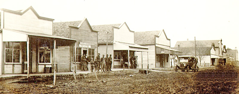
Carlton, Kansas, in 1915.
| Town | Post Office Dates | Additional Information |
| Acme | 1897-1906 | |
| Akron | 1874-1875 | |
| Aroma | 1869-1888 | The post office moved from Far West. Aroma was settled in 1859. It was located on Lyons Creek, in the southeastern part of Dickinson County. It was the first post office in southeast Dickinson County. In 1878, it had United Brethren and Lutheran congregations and a doctor. White City was the nearest shipping point. It was on the stagecoach line to Junction City and Marion, from which the mail was delivered semi-weekly to A.D. Blanchett, the postmaster. It was 26 miles from Abilene, the county seat. |
| Belle Springs | 1876-1890 | In the spring of 1879, River Brethren colonists migrated to Dickinson County, Kansas. These men founded the Belle Springs Creamery near Donegal. The groundwork for the creamery was laid in the summer of 1868. Business was so good that a larger creamery was needed, so a new plant was built in Abilene. |
| Bonaccord | 1884-1902 | It was in the western part of the county, not far from the Saline County line, about 12 miles from Abilene. |
| Buckeye | 1900-1904 |
Located in Buckeye Township, Buckeye was about eight miles north of Abilene. Universalist preacher Vear P. Wilson of Ohio started it as a colony/settlement. The group arrived in April 1870. Like many small towns in those days, a cheese factory was a main staple, as was a general merchandise store and a blacksmith shop. The colony soon had nearly 200 settlers, and the Buckeye Community Church of the Brethren was established in 1884. A post office was established on March 16, 1900. However, it lasted only a few years and was closed on February 29, 1904. The town’s population in 1910 was 40. Though continually dwindling in the next years, the church held periodic services until July 2024. Several homes are still in the area, and the town boasts an old business building, the church and a cemetery, and the Mutual Aid Agency continues to thrive. It is located at 3101 Jeep Road, about nine miles northeast of Abilene. |
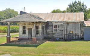
| Carlton | 1872-1995 | Named for a pioneer blacksmith. A station on the Missouri Pacific Railroad, it is located in the Holland Creek Valley, about 18 miles southwest of Abilene. |
| Cheever | 1873-1885 | A post office in the northern part of Dickinson County. Located on the mail route between Abilene and Clay Center, the mail was delivered four times weekly in 1878 to Dr. Thomas C. Ayres, postmaster. At that time, it had a Presbyterian congregation and two doctors. It was 12 miles from Abilene, the county seat and nearest shipping point. |
| Dayton | 1895-1917 | A station on the Missouri Pacific Railroad, it was located in Jefferson Township, 16 miles south of Abilene. In 1910, it had a money order post office, telephone connections, several general stores, a creamery, flour mills, and a population of 40. |
| Detroit | 1866-1961 | A station on the Union Pacific Railroad, it is located in Center Township, six miles east of Abilene. In 1910, it had a money-order post office with two rural routes, a graded public school, telegraph and express offices, telephone connections, general stores, and a population of 142. |
| Dillon | 1872-1944 |
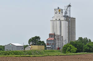
Named for the Dillon brothers, pioneers. It was located on Turkey Creek, in the southern part of the county. In 1878, it had a wagonmaker, a general store, a blacksmith, a shoemaker, a district school, Presbyterian and German Baptist congregations, and a population of 35. At that time, it shipped grain and hogs from Abilene, the most convenient railroad. It was on the stagecoach station to Abilene and Marion, from which its mail was delivered semi-weekly to A.L. Evers, the postmaster. Later, it was a station on the Missouri Pacific Railroad, and the railroad’s name was Swayne Station. In 1910, it had a money order post office with one rural route, a creamery, a flour mill, some well-stocked general stores, express and telegraph service, telephone connections, Methodist and Presbyterian churches, a good public school building, and a population of 161. It is located off Highway 4, east of Elmo. All that remains today is the grain elevator, which is still in operation today.
|
| Donegal | 1895-1906 | It was located in Turkey Creek Valley, about 12 miles south of Abilene. In 1910, the population was 70. |
| Elmo | 1884-1966 | A station on the Missouri Pacific Railroad is located in Banner Township. |
| Farmington | 1861-1863 | |
| Guthrie | 1872-1873 | |
| Haphazard | 1879-1882 | |
| Henry | 1880-1886 | |
| Holland | 1872-1875 1884-1906 |
Located on Holland Creek, it was about 14 miles southwest of Abilene and three miles north of Carlton, the nearest railroad station. In 1910, it was a trading center for the neighborhood with a population of 41. |
| Industry | 1876-1906 |
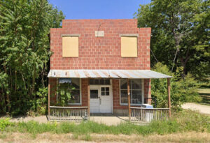
Settled in 1874, Industry straddles the Clay/Dickinson county line at the Chapman Creek crossing. The post office moved from Lovejoy and opened on February 21, 1876. In 1878, the settlement had a druggist, a grist mill, a wagonmaker, a general store, a district school, and a population of 40. At that time, it shipped grain, flour, and livestock from the railroad in Wakefield, 11 miles distant. Its mail was delivered semi-weekly to H. Rieck, the postmaster. In the fall of 1879, A. L. Beard, an Eastern speculator, laid out the town in Athelstone Township. In the early 1880s, it had a few business houses and a small hotel. It was not destined to grow, as it was 16 miles from the railroad. The post office closed on November 30, 1906. In 1910, it still had several business establishments, including two flour mills and a population of 250. In the following decades, the population fell, and the post office was never reopened. Several vacant business buildings remain today, and numerous homes are occupied in the community. Amazingly, a small town without a post office for more than a century continues to be called home to numerous residents and has an active Methodist Church. It is located approximately 13 miles north of Abilene. |
| Kennedy | 1892-1899 | |
| Lambs Point | 1863-1865 | The post office moved from Smoky Hill. |
| Littledale | 1884 | The post office was only open for about five months. |
| Lyona | 1869-1888 | The post office moved from Leon. Many settlers in the Lyona community were of German descent, and the German language was used in the church and school until after the turn of the century. Near the beautiful Lyona church is a small cemetery. |
| Manchester/Keystone | 1877-1993 | A tiny town located in Flora Township, the northwest corner of Dickinson County. Though it is officially “extinct” because it no longer has a post office, it had a population of 47 as of the 2020 census. |
| Midway | 1880-1886 | |
| Mole Hill | 1877-1880 | |
| Mont Cenis | 1872-1882 | Also spelled Mount Cenis, this was a post office in Sherman Township, 20 miles northeast of Abilene. Junction City is its usual railway point. The mail was delivered five times a week to Jesse Dever, the postmaster. |
| Moonlight | 1894-1905 | It was located seven miles northeast of Abilene and six miles from Detroit, the nearest shipping point. The population in 1910 was 25. |
| Navarre | 1884-1971 | Located on the Atchison, Topeka & Santa Fe Railroad in Logan Township, it was 12 miles southeast of Abilene. In 1910, it had a grain elevator, a creamery, a general store, telegraph and express offices, a money order post office, and a population of 75. |
| New Basel/New Basil | 1879-1897 | The name changed from New Basill to New Basel on May 29, 1882. |
| Newbern | 1872-1887 | A hamlet settled on Turkey Creek in the southern part of Dickinson County, 15 miles from Abilene, the county seat and nearest railroad station. In 1878, it had a flour mill, a Methodist Episcopal Church, and a common school. It principally shipped grain. It was on the stagecoach line to Abilene and Marion, from which its mail was delivered semi-weekly to S.M. Root, the postmaster. |
| New Chillicothe | 1873-1901 | It was located in the county’s northeastern corner, 15 miles from Abilene and 10 miles north of Chapman. Its population was 20 in 1910. |
| Pearl | 1883-1935 | This place started when John “Jackie” Taylor purchased ten sections of land in four separate townships for just $4 an acre in 1872. The Taylors were also responsible for the inception of Pearl, Kansas, which was named after Jackie’s youngest daughter, who was also a schoolteacher in the town named after her. In 1910, Pearl was located on the Chicago, Rock Island & Pacific Railroad, had a grain elevator, telegraph and express offices, a money order post office, and a population of 35. it was 12 miles southeast of Abilene. |
| Plympton | 1879-1888 | |
| Poplar Hill | 1875-1889 | Poplar Hill, located in Flora Township, was an early postal station. Daniel Emery came to this community in 1873, and two years later, the post office opened in a room of the Robert Lyday home, with Emery as the postmaster. It was eight miles south of Lovejoy. |
| Redwood | 1879-1886 | |
| Rhoades | 1878-1896 | |
| Rinehart/Rhinehart | 1896-1903 | The name changed from Rhinehart to Rinehart on April 15, 1902. |
| Rose Bank | 1879-1887 | |
| Shadybrook | 1901-1907 | Shady Brook was located near the Rock Island Railroad tracks and had a small depot, grocery store, creamery, elevator, stockyard, and post office. |
| Smoky Hill | 1860-1863 | The post office moved to Lambs Point. |
| Stitt | 1888-1902 | |
| Sunnyside | 1884-1894 | |
| Sutphen/Sutphen’s Mill | 1879-1905 | The name changed from Sutphen’s Mill to Sutphen on October 15, 1894. |
| Tell | 1888-1890 | Tell was founded soon after the Gfeller families came to Kansas from Switzerland and homesteaded the land in 1885. Peter H. and Adolph Gfeller settled south of where the Alida Community Church is located, which was built in 1881. The Gfeller brothers built a general store and cheese factory, two things seen in most communities. Peter Gfeller named this Hamlet Tell after the Swiss hero and patriot William Tell. The post office was on the ground floor of the cheese factory and was discontinued in July 1890. Tell was about four miles from Upland, Kansas. |
| Upland | 1898-1906 | |
| Union City | None | On Turkey Creek, on the south side of the Smoky Hill River. |
| Wesley | 1887-1895 | Wesley was South of the Good Hope Cemetery. There was once a school, church, post office, lodge hall, and creamery. |
| Willowdale | 1873 1875-1877 |
©Kathy Alexander/Legends of Kansas, updated May 2025.
Also See:
Dickinson County Photo Gallery
Sources:
1878 Gazetteer and Business Directory
Abilene-rc.com
Blackmar, Frank W.; Kansas: A Cyclopedia of State History, Vol I; Standard Publishing Company, Chicago, IL 1912.
Cutler, William G.; History of Kansas; A. T. Andreas, Chicago, IL, 1883.
Kansas Post Office History


