Towns & Places
Clay Center – County Seat
Longford
Morganville
Wakefield
One-Room, Country, & Historic Schools of Clay County
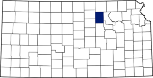
Clay County, Kansas, is located in the northcentral part of the state. Its county seat and most populous city is Clay Center. As of the 2020 census, the county population was 8,117.
When the Kansas Legislature created the first counties in 1855, the territory within the present limits of the county was attached to Riley County for all revenue and judicial purposes. Clay County was created from unorganized territory in 1857 and named in honor of the famous American statesman Henry Clay, a member of the United States Senate from Kentucky who served as Secretary of State. Subsequently, Clay was attached to Geary County.
It is located in the second tier of counties south of Nebraska, and its eastern boundary is about 100 miles west of the Missouri River. It is bounded on the north by Washington County, east by Geary and Riley, south by Dickinson, and west by Ottawa and Cloud, and has an area of 656 square miles.
At the time of settlement, the county’s surface was rolling except in the northern part of Oakland and the southern part of Five Creeks Townships, which were high and rocky. The river and creek bottoms varied from half a mile to a mile in width and comprised about one-twelfth of the area. Timber belts were common along the streams and consisted of cottonwood, red and white elm, oak, hackberry, and locust trees. Sandstone and magnesian limestone were abundant, clay for brick and pottery was plentiful, and red ochre and gypsum were also found.
The first white men to visit this part of Kansas were the French, who, in about 1724, passed up the rivers seeking to open up trade with the Indians. In 1830, David Atchison, an adventurous pioneer, penetrated as far west as present-day Clay County. Colonel John C. Fremont, in his expedition to the Rocky Mountains in 1843, crossed what is now the southwestern part of the county.
Among the first permanent settlers were the Younkins brothers from Pennsylvania, who, in April 1856, entered land on Timber Creek. Within a short time, they were followed by J. B. Quimby and William Payne, who took up land on the west side of the Republican River near the present site of Wakefield. The first settler on the site of Wakefield was James Gilbert, who located there in 1858. Mrs. Moses Younkins and Mrs. Quimby were the first white women in the county. In 1857, John Gill, Lorenzo Gates, and a man named Mall located on Deep Creek farther up the river. During the fall of 1857 and the spring of 1858, immigration was steady, some of the best claims being taken up by the new settlers.
The drought of 1860 almost entirely stopped immigration, and the county’s population increased little until the close of the war. Then, the second era of progress opened, and many settlers entered land for permanent homes. When these pioneers came to Clay County, they found the land in the possession of the Kanza Indians, who were comparatively peaceful. However, the settlers were so alarmed by reports of depredations in adjoining counties that they left their homes and fled to places of safety.
During the war between the Pawnee and Delaware in the Smoky Hill Valley in 1857, many pioneers sought refuge in Riley County. When they were assured that the Indians would not wage war in their locality, they returned. Late in the summer of 1864, Indian troubles in Nebraska again frightened the settlers in Clay County from their homes.
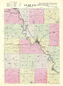
In the Historical Map Book of Clay County, the following statement is made: “In August 1864, the Indians made a raid on the settlers living on the Little Blue, in Washington and Marshall Counties. The settlers from the northern part of Clay and the southern part of Washington County fled from their homes and gathered at Huntress’ cabin, where about 200 of them encamped for a month… During the month, the mail went no farther than the encampment; the postmasters took their respective mails and distributed them there.”
In 1868, the Indians left their reservations, committed depredations in Cloud, Washington, and Republic Counties, and the frightened settlers hastened into Clay County from all directions.
At the outbreak of the Civil War, Clay was still an unorganized county with few inhabitants. However, 47 men responded to the calls for volunteers and enlisted in the Union Army. The settlers, few as they were, were much depleted by the troublesome times of the Civil War. In 1860, there were eleven families in what is now the Wakefield District, but by 1863, only two men were left, J. M. Quimby and Edward Kerby, while the only men left on Mall Creek were Lorenzo Gates and John Butler.
Before 1870, nearly all the settlements were made along the streams, as the early settlers did not believe farms would be opened on the upland. However, in the fall of 1869, a party of English colonists located on the prairie between the Republican River and Chapman’s Creek, where they entered the land and soon developed prosperous farms; the settlement became known as the Wakefield Colony. The first blacksmith shop in the county was opened there in 1859. The first mail route in Clay County was established in 1862. The route ran from Manhattan to Clifton along the river valleys. The first post office was on Mall Creek, and the first postmaster was Lorenzo Gates. The second was at Clay Center, with Orville Huntress as postmaster, and the third at Clifton, near the northern boundary, was kept by James Fox. The first carrier was James Parkinson, who made his initial trip on July 1, 1862. At first, the service was weekly but soon changed to tri-weekly, and Junction City became the southern terminus.
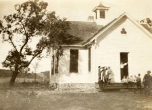
The settlers of Clay County took a deep interest in educational matters from the beginning, and in 1864, the first schoolhouse was built at Lincoln Creek on government land. It was a rude structure of logs and was nearly completed when Samuel Allen went to the land office at Junction City and filed on the land, thus appropriating the schoolhouse as his personal property. This made it necessary to secure another schoolhouse, and a log cabin was bought from F. Kuhnle. Mrs. Lack was engaged as a teacher and opened the first school in 1865 when the first district was organized.
The first physician in the county was Dr. J. W. Shepperd, who settled in 1862. Orville Huntress bought a stock of goods and opened a store in 1861, thus becoming the pioneer merchant of Clay County. At about the same time, he started the first hotel, where the military road crossed Huntress’ Creek. In 1865, H.N. Dawson established the first sawmill on Timber Creek, and the same year, the Dexter brothers started the first steam sawmill.
Dissatisfaction arose in 1866 in Clay County over the taxes imposed by Geary County authorities. A meeting was held at the schoolhouse in Clay Center on July 28 to consider organizing the county. At this meeting, Orville Huntress was chosen chairman and George D. Seabury clerk. A committee consisting of Lorenzo Gates, William Silvers, Joseph Ryan, and John G. Haynes was appointed to draft a petition and affidavit to be sent to the governor as required by law. On August 10, 1866, the governor appointed Lorenzo Gates, William Silvers, and Joseph P. Ryan county commissioners; George D. Seabury, clerk and named Clay Center as the temporary seat of justice.
At the first election on November 6, 1866, the county seat was permanently located at Clay Center. The county officers elected at this time were Thomas Sherwood, Henry Avery, and William Silvers, commissioners; S. N. Ackley, clerk; Orville Huntress, treasurer; S. N. Ackley, register of deeds; J. B. McLaughlin, surveyor; Russell Allen, sheriff; James Hemphill, coroner, and Orville Huntress, assessor. Lorenzo Gates was the first to represent Clay County in the state legislature’s lower house, and L. F. Parsons was the first state senator.
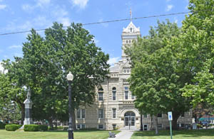
A stone courthouse was erected by the Dexter brothers in 1868 and used until 1875 when the county offices and records were moved into the Streeter Building. For several years, the building used as a county jail was rented.
The first board of county commissioners divided the county into three civil townships: Sherman, in the northern part; Clay Center, in the central; and Republican, in the southern part, each extending the full width of the county east and west. As the population increased, the original townships were divided to form Athelstone, Blaine, Bloom, Chapman, Clay Center, Exeter, Five Creeks, Garfield, Gill, Goshen, Grant, Hayes, Highland, Mulberry, Oakland, Republican, Sherman, and Union.
Judge James Humphrey opened the first term of the district court in Clay County on October 26, 1859.
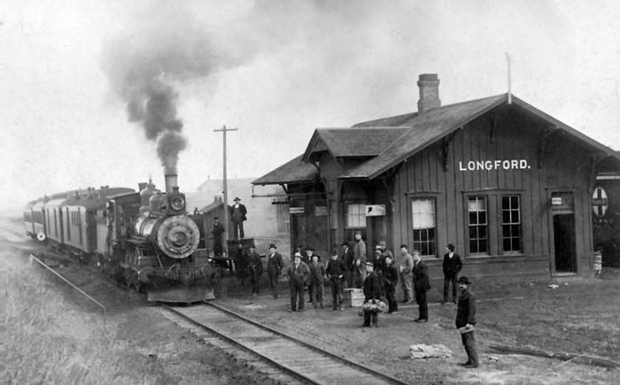
The first railroad to enter the county was the Junction City & Fort Kearney (later the Union Pacific), completed to Clay Center on March 12, 1873, and terminated there until 1878. It crossed the eastern boundary about seven miles north of the southern boundary and followed the river northwest through Clay Center to Clifton. The Kansas Central, at first a narrow gauge road, was built in 1883. It crossed the county east to west about the center, passing through Clay Center, and later belonged to the Union Pacific Railroad. Afterward, a line of the Chicago, Rock Island & Pacific Railroad was built from southeast to northwest through the county, following the general course of the Republican River. The Missouri Pacific Railroad crossed the northern boundary near Vining, and a branch of the Atchison, Topeka & Santa Fe Railroad crossed the southwest corner, giving the county over 95 miles of main track railroad within its boundaries by 1910.
The first issue of the Clay County Independent, edited by Houston & Downer, appeared on August 20, 1871, being the first paper in the county. On January 11, 1873, it was sold to J. W. Miller, who changed the name to the Dispatch, the first number of which appeared on March 12, 1873.
Reverend R. P. West of the Methodist Church preached the first sermon in the county, but the Baptists were the first denomination to organize a permanent congregation. That was in August 1868, and the church was dedicated in October 1874. The Presbyterian Church of Clay Center was organized in the schoolhouse on April 1, 1871, and the first minister was J. D. Perring. Father Tichler established the Catholic Church at Clay Center in April 1877. Afterward, nearly all denominations organized and erected churches in the county.
Clay County’s population peaked in 1890 at 16,146.
In 1910, agriculture was the principal occupation. Corn, winter wheat, and oats were the chief crops, while in 1907, there were 150,000 bearing fruit trees, peach and apple being the leading varieties. The county also prospered in stockraising and dairy products. The county’s population in 1910 was 15,251, and the value of the agricultural products, including livestock, was over $4,000,000.
In 2010, the Keystone-Cushing Pipeline was constructed north to south through Clay County, with much controversy over tax exemption and environmental concerns. A pumping station named Riley was built along the pipeline.
©Kathy Alexander/Legends of Kansas, updated January 2024.
Also See:
Sources:
Blackmar, Frank W.; Kansas: A Cyclopedia of State History, Vol I; Standard Publishing Company, Chicago, IL 1912.
Cutler, William G; History of Kansas; A. T. Andreas, Chicago, IL, 1883.
Wikipedia


