
Chisholm Trail near Caldwell, Kansas, by Kathy Alexander.
Towns & Places:
Argonia
Belle Plaine
Caldwell
Conway Springs
Geuda Springs/Geuda
Hunnewell – Ghost Town
Mayfield
Milton
Milan – Ghost Town
Mulvane
Oxford/Neptawah
South Haven
Wellington – County Seat
Ashton
Corbin
Drury
Hunnewell
Milan
Perth
Arkansas River
Arkansas River Lowlands
Chikaskia River
Drury Dam Waterfall
Ninnescah River
Wellington Lake

Sumner County, Kansas Location

Sumner County, Kansas by L.H. Everts & Co, 1887
Sumner County, Kansas, is located in the south-central part of the state. It was created from parts of Marion and Butler Counties on February 26, 1867. It was named in honor of Charles Sumner, a U.S. Senator from Massachusetts who strongly advocated for Kansas to become a Free State.
The county seat is Wellington. As of the 2020 census, the population was 22,382, and the total area was 1,185 square miles, of which 1,182 square miles was land and three square miles was water.
Cherokee Strip
The county lies in the southern tier, on what was Indian land. Cutting three miles from the southern part of the county was the Cherokee Strip, the pathway the tribe used to reach their western hunting grounds. From this to the north line of the county was the Diminished Osage Reserve, known as the ’30-mile strip,’ extending to the western line of the State. The 1867 Legislature defined the county’s boundaries, and on May 27, 1868, the Sturgis Treaty was signed with the Indians. Eight million acres of land were then sold to the Leavenworth, Lawrence & Galveston Railroad.
Cowley County borders the county to the east, the Oklahoma State line to the south, Harper and Kingman counties to the west, and Sedgwick County to the north.
When the county was first settled, it had 20% bottomland and 80% upland. Prairies covered 97% of the land, and forests covered 3%.
Arkansas River at Geuda Springs, Kansas, by Kathy Alexander.
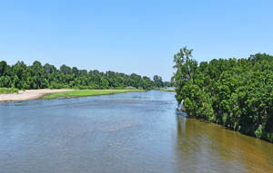
The principal water courses are the Arkansas and Ninnescah Rivers, the former cutting across the county’s northeast corner and the latter running from near the north-central line of the county to its confluence with the Arkansas River at Oxford. Slate, Chikaskia, Fall, Bluff, and Cowskin Creeks follow the same general course until emptying into the Arkansas or Cimmaron River. There were also numerous springs, and water was readily available at depths of 10 to 40 feet.
Along the streams’ borders were narrow belts of timber, varying in width from 100 to 700 feet. The varieties were cottonwood, elm, hackberry, walnut, box elder, and ash. Many timber claims were taken, and farmers planted large areas of cottonwood, box elder, walnut, and smaller tracts of peach and apple, which did remarkably well here.
A fine-quality limestone was readily procured at almost any point in the county. Sandstone was also found, though not as plentiful or of good quality. Fire clay and gypsum were found, but generally at such a depth as to preclude profitable working.
Salt existed in large deposits, and the county was noted for the number and quality of its mineral springs. Salt springs were found in Valverdi and Walton Townships, and in the latter were the Salt Creek Springs near Salt City. Well water was found at depths of ten to 40 feet.

Ninnescah River.
The principal stream is the Arkansas River, which flows south along the eastern boundary. The Ninnescah River flows from the north, southeast to the eastern border, where it joins the Arkansas River. The Chikaskia enters from the west and flows southeast. Slate Creek in the East and Bluff Creek in the West are important streams.
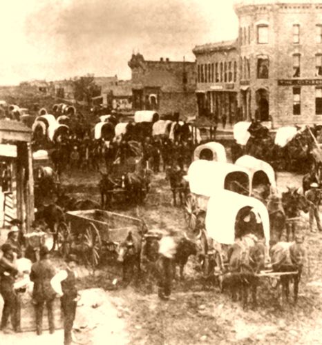
After the Kansas Pacific Railroad reached Abilene in 1867, cattle drives from Texas across what became the Chisholm Trail led settlers to the area.
In early 1869, John Degolia and A. Cadou built a ranch on Slate Creek in Sumner Township. On April 9, J.M. Buffington crossed the Arkansas River and built a house. On May 16, Lafayette Binkley and John Horton arrived at Big Cottonwood Crossing, where Oxford now stands, and built a log trading store, later occupied by John Hardman. The same month, Charles Wichern settled on the Ninnescah River. On June 15, Edwin Wiggins, Charles Russell, and Frank Holcroft took claims where the cattle trail crossed Slate Creek, about eight miles above Wellington. On June 20, J.D. Holmes and company settled on the Ninnescah River in London Township. On June 21, J.J. Ferguson, J.L. Ferguson, and J.O. West settled in Belle Plain Township.

Old Oxford Mill, Oxford, Kansas.
In the fall of 1870, Sumner City, a few miles from Wellington, was laid out, and preparations were made to present its claims to the county seat honors to the Governor. In this movement, certain parties, including Charles A. Phillips, J.J. Albert, William J. Uhler, and E.H. Nugent, all from Wichita, camped four miles southeast of Wellington on December 26, 1870. They met Colonel A.J. Angell with a surveying party, running section lines there. Overtures were made and accepted by Angell.
By the end of 1870, several trading posts had been established: one on the site of Oxford, where several families had been located; one on Slate Creek, and one at Ninnescah.
In 1871, there was a large influx of settlers, and several towns were founded. On January 1, 1871, Belle Plaine was established by George A. and James L. Hamilton, J.L. Kellogg, W.P. Hackney, E.M. Miller, and J.C. Thurman. David Richards put the first ferry in the county into operation there.
Wellington was founded in early 1871 for the same purpose, and Sumner City started around the same time.
On January 15, 1871, Meridian was established on Section 32, Township 32, Range 1 East. John C. Nugent created a false census and reported that the county had 651 inhabitants. Colonel Angell started for the capital with this document and arrived on February 7. J.M. Steele was already in the city on behalf of Sumner City. Still, Angell secured an interview with Governor James Harvey and, before Steele knew of his presence, had secured the appointment of Meridian as the county seat.

Washington Avenue in Wellington, Kansas, about 1885.
On February 1, Reverend W. Perkins preached the first sermon in the county in Binkley’s dug-out at Big Cottonwood Crossing. Soon, the Napawalla Town company was formed, and a town of that name was laid out on the site of Oxford. The Oxford Town company was formed shortly afterward. A printing outfit was ordered, and an attempt was made to make Oxford the county seat.
The county was organized on February 7, 1871. William J. Uhler, John J. Albert, and John S. McMahon were appointed County Commissioners, and Meridian was designated as the temporary seat of justice. Sumner County was divided into 30 townships.
On February 25, David Richards established the first ferry in the county across the Arkansas River opposite Belle Plaine. On the same day, the first store in the county opened in Belle Plaine, and the Napawalla Town Company was formed. On February 28, Dr. P.A. Wood and Dr. C.R. Godfrey, the first resident physicians to practice in the county, arrived.

Early day, Oxford, Kansas, Main Street.
On March 6, the Oxford Town and Immigration Company was formed in Oswego, Kansas, and soon set out for Napawalla (Oxford). They arrived at the Arkansas River on March 26, crossed over, and bought the old town of Napawalla, consisting of a single dug-out. On March 31, the Town Company ordered a printing press.
That year, the citizens, thinking a corps of county officers would improve social conditions, petitioned Governor James Harvey for organization. To frustrate Sumner City’s plans to become the county seat, the petition asked that Meridian be named the temporary county seat and that William J. Uhier, John J. Albert, and John S. McMahon, three Wichita men favorable to Wellington, be nominated as commissioners. This occurred, and the commissioners camped on the bare prairie, where Meridian was supposed to be, and awaited developments. Their first record of the County Commissioners was dated June 4, 1871, and they found that since the county had failed to provide buildings at Meridian, the county business should be transacted at Wellington until the permanent seat was chosen by ballot. One of the commissioners went to another county, and the remaining two appointed David Richardson in his place. Clark R. Godfrey was appointed county clerk.
Caldwell, Kansas, 1880s.
The first recorded murder in the county took place at Caldwell on July 3, when O. Bannon shot George Peay. On July 4, the first general celebration of the National holiday, including speech-making and other festivities, was held at Belle Plaine, Sumner City, and Wellington. On August 8, a company was formed to build a bridge across the Arkansas River, a much-needed project given the treacherous fords.
The second meeting of the county commissioners was held on August 10, 1871. The first question raised was the licensing of taverns or bars, also known as dram shops. It was decided to charge $20 per month for licenses. On August 23, 1871, the county was divided into three County Commissioners Precincts, the voting place in No. One at Belle Plaine; in No. Two, at the house of Henry Brown and Shell Creek, and in No. Three, at the house of Colson & Ryland, on the Showcaspah River. A special election of county officers was ordered for September 26.
The first county-seat election took place on September 26, 1871, and gave Belle Plaine 384 votes, Wellington 221, Oxford 119, Sumner City 79, and Meridian 2.
This left the question still open. A second election was ordered for November 10. This election resulted in 420 votes for Belle Plaine, 285 for Wellington, 129 for Oxford, 111 for Sumner City, and 2 for Meridian. As there was no prospect of a speedy decision and Meridian was still a bare prairie, the County Commissioners, on December 21, 1871, ordered that county business be done at Wellington. That town should be the temporary county seat. On the same date, W.A. Thompson was elected Clerk of the District Court, and George N. Godfrey was elected the first County Attorney.
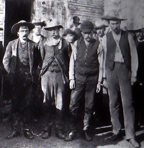
Henry Newton Brown Gang, 1884.
Sumner County was unusually turbulent in the early days, with 20 or more cases of violence, ranging from single murders and lynchings to fights with whole gangs of outlaws in which several men were killed. Before the county organization, citizens had various committees for dispensing justice, including vigilantes who dealt with justice and sometimes injustice in summary fashion.
In August 1871, a company was formed to build a bridge across the Arkansas River. That month, the county was divided into three election precincts, and an election for the county seat and officers was scheduled for September 26. Wellington, Snmner City, Meridian, and Belle Plaine were the contesting towns for the county seat. The total number of votes cast was 805, and the chosen officers were Clerk C.S. Brodbent; Clerk of the District Court W.A. Thompson; Superintendent of Public Instruction A.M. Colson; County Attorney George N. Godfrey; Probate Judge George M. Miller; Sheriff J J. Ferguson; Register of Deeds, J. Romine; County Treasurer R. Freeman; two of the three commissioners were A.D. Rosencrans and R.W. Stevenson.
The county business was still transacted at Meridian, where a temporary county building had been erected. There was no choice of county seat, and, pending the second election, to be held in November, the citizens of Wellington took a wagon to Meridian to take possession of the county records. They saw a party from Oxford bent on the same mission, just coming over the hill as they came to the place. Wellington secured the books without trouble, but a hand-to-hand fight occurred over the commissioners. Ultimately, the Wellington party secured two, minus some of their clothes. The November election failed to settle the matter, and another was held in January 1872. The vote of this election was never canvassed due to the sudden resignation of one of the commissioners. Another election was held in March, in which Wellington received the most votes and Oxford the second-most. A vote taken the following month favored Wellington. A petition for relocation was presented in January 1873. It was denied, and no further effort was made to change the seat of justice.
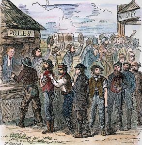
Kansas voters.
Another election was called for January 29, 1872, and on February 3, the Commissioners met at Meridian to canvass the vote. Objection was made to R.W. Stevenson acting as Commissioner, and during the ensuing argument, Commissioner A.D. Rosencrans resigned. The Board then adjourned, and the vote was never canvassed.
March 26, 1872, came the third effort to locate the county seat, and Wellington, though not receiving enough votes to secure the prize, was evidently in a fair way to get it. The vote stood: Wellington, 398; Oxford, 297; Belle Plaine, 282; Caldwell, 2. The final election between the two candidates receiving the most votes took place on April 9, 1872, and resulted in Wellington’s victory by a score of 571 to 426.
As soon as Wellington was picked as the county seat, Sumner City folded, and many of its buildings moved to Wellington.
The first county courthouse was a small frame building built on the Meridian townsite. When the commissioners decided to transact business at Wellington, this structure was secured and occupied until a new county courthouse could be built. The second courthouse was also a frame structure that was later moved to 215 West Lincoln Avenue and has since been demolished.
The Wellington Township Hall, located at the northwest corner of 7th Street and Washington Avenue, was built in 1873 for $5,000 as the third courthouse and was once occupied by county officials. A tornado destroyed this building in 1892.

Grasshoppers, 1874.
Settlement was so rapid that by 1874, the county had 8,000 people. That year proved disastrous in many ways. Added to the grasshopper plague, which was general throughout Kansas, were the drought and the Indian raids. While the Indians did not come into Sumner County, attacks were threatened at various times, and the settlers were kept in a constant state of excitement for several months. They left their homes and gathered in the towns; hundreds encamped at Wellington. Finally, many became discouraged and left for the East, some in unfortunate poverty and despair.
Many years before Sumner County finally got a railroad, there was a great need for one. An 1877 Letter to the Editor from a Guelph, Kansas, resident spoke of how well crops were doing, but that a railroad was badly needed, as the crops had to be taken to Wichita for sale.
On July 2, 1877, the Solomon, Arkansas Valley & Eastern Narrow Gauge Railway was, by a vote of 833 to 626, given aid to the amount of not more than $4,000 per mile in bonds. The Kansas City, Burlington & Southwestern Railway and telegraph line made the second of these propositions. This provided for the issuance of bonds not to exceed $4,000 per mile, or a total of $170,000. The election took place on December 3, 1878, and resulted in the proposition’s defeat by a vote of 929 to 1,761.
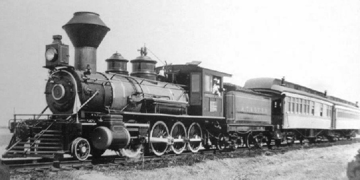
Atchison, Topeka & Santa Fe Railway.
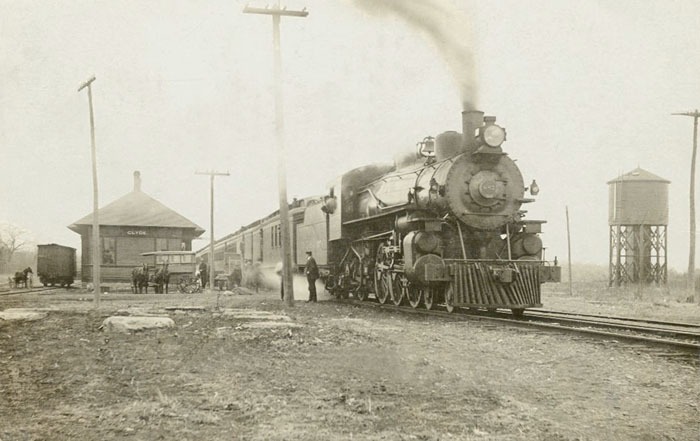
Finally, in 1878, the Atchison, Topeka & Santa Fe Railroad settled its plans with the county. It began work on an extension from Wichita to Mulvane, through Belle Plaine, Wellington, and Caldwell. This extension was incorporated as the Cowley, Sumner & Fort Smith Railroad, an extension of the Wichita branch of the Atchison, Topeka & Santa Fe Railroad. The line was opened to Wellington, and on September 8, 1879, the first locomotive arrived, an occasion of great rejoicing. The line came into Wellington from the northeast and ran across the northern part of town. Just north of 16th Street in Wellington were railroad yards, stockyards, a depot, a water tower, and a hotel. The road to Caldwell was completed on May 31, 1880.
A contract for constructing a one-story brick county jail measuring 22 by 32 feet was signed on November 16, 1878, to P.J. Pauly & Brothers of St. Louis, Missouri, for $5,000. Work was begun at once, and the jail was completed in the spring of 1879.
At a special election held on July 1, 1879, the Southern Kansas & Western Railway received aid in the amounts of $18,000 from Oxford, $20,000 from Wellington, and $16,000 from Dixon Township. The proposition to issue bonds was defeated in Avon and Osborn Townships. This Leavenworth, Lawrence & Galveston Railroad branch was completed in Oxford on March 6, 1880, and in Wellington on March 27. On the 28th, the first passenger train was run. On June 8, 1880, the bonds of Oxford and Wellington townships were issued, but those of Dixon were withheld, and on July 2, an injunction was issued to restrain their delivery to the railway company.

Sumner County Poor Farm.
On February 3, 1880, the proposition to purchase a poor farm and erect suitable buildings was carried by a vote of 1526 to 695. Work was begun on February 3, 1881, and the buildings were completed in April of the same year for $1,850.
On May 11, 1880, South Haven Township petitioned for a special election on aiding the Sumner County Railway, which ran south from Wellington to Hunnewell. An election soon occurred, and South Haven secured the bonds with a vote of 144 to 43. Wellington City also took $10,000 in bonds. An election was also held in Guelph Township, but the proposition was defeated. The road was built southward through Rome, South Haven, and Hunnewell. The line was completed to Hunnewell on June 16, 1880. Points further south were still Indian Territory. It was soon successfully operated by the Kansas City, Lawrence & Southern Kansas Railroad. The line was eventually sold to the Atchison, Topeka & Santa Fe Railroad and became the Hunnewell District of the Panhandle Division. Today, it is owned by the Southern Kansas and Oklahoma Railway and runs into Oklahoma through Braman and Blackwell.
The Southern Kansas and Western Railroad was completed in 1880 and eventually purchased by the Atchison, Topeka & Santa Fe Railroad. It became known as the First District of the Panhandle Division of the Atchison, Topeka & Santa Fe Railway Company.
The Wellington and Western Railway reached the Chikaskia River on September 4, 1880. It was purchased by the Atchison, Topeka, and Santa Fe Railroad in 1881, and word spread that work would soon begin to extend the line westward to Anthony. However, the Atchison, Topeka & Santa Fe Railroad closed the line instead, and it was torn out.
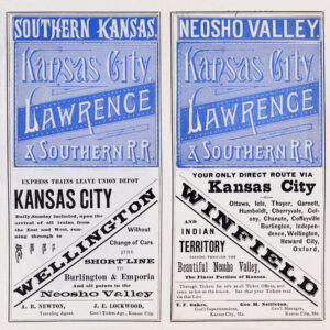
Kansas City, Lawrence, and Southern Kansas Railroad Timetable.
Joining the Atchison, Topeka & Santa Fe Railway Company east of Wellington in 1880 was the Kansas City, Lawrence, and Galveston Railroad Company. This line originated from Independence and Chanute and eventually became known as the Kansas City, Lawrence, and Southern Kansas Railroad in 1885, when it consolidated into the Southern Kansas Railway. It was eventually sold to the Atchison, Topeka & Santa Fe Railroad in 1899. This line ran through Oxford and Dalton before reaching Wellington.
One railroad ran from Argonia northeast to Conway Springs and Sedgwick County. Another ran across from Conway Springs to Riverdale to Belle Plaine. One crossed the southern part of the county from Blackstone to Caldwell, to South Haven, through Portland and Ashton, and on to Geuda Springs. Another ran from Geuda Springs to Oxford to Belle Plaine.
In 1880, 20,886 people lived in the county, and 200,000 acres of land were under cultivation, half of which was sown to wheat. Flour mills had been erected, and the first railroads were built that year to market the product.
On August 8, 1882, an order was issued for an election to be held on November 7 to decide upon the question of making, during the years 1883 and 1884, a tax for courthouse and bridge purposes. A majority of 1,001 votes carried this.
Sumner County Courthouse in 1884.
On September 6, 1882, the Wichita and Southwestern, Harvey County, and Cowley, Sumner, and Fort Smith roads were consolidated, and H.C. St. Clair and J.H. Folks were elected directors. There was virtually no change in ownership, with all roads part of the Atchison, Topeka & Santa Fe Railroad system. On October 6, the railroad was consolidated into the Wichita and Southwestern Railway Company. The railroad yards and stockyards were vacated, and the depot was used as a freight terminal, but it was finally abandoned in 1891.
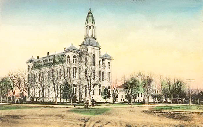
The fourth courthouse was designed by Smith and White and built from 1884 to 1885 at Washington and 10th Streets. It continued in service until 1940 when the building was condemned.
Chicago, Rock Island, & Pacific Railroad in Kansas.
In 1887, the Chicago, Kansas, and Nebraska Railroad built a branch line north-south from Herington to Caldwell. This branch line would connect Herington, Lost Springs, Lincolnville, Antelope, Marion, Aulne, Peabody, Elbing, Whitewater, Furley, Kechi, Wichita, Peck, Corbin, Wellington, and Caldwell. The line ran parallel with and just west of the old Wichita Southwestern Line from Wellington to Caldwell. The first train, a mixed passenger/freight train, reached Wellington on November 10, 1887. The Chicago, Kansas, and Nebraska Railway was foreclosed in 1891 and overtaken by the Chicago, Rock Island, and Pacific Railway.
By 1893, the Chicago, Kansas, and Nebraska Railway was built to Fort Worth, Texas.
In 1901, the Old Wichita Southwestern Railway was sold to the Atchison, Topeka & Santa Fe Railway Company. The Santa Fe Railroad also purchased the Cowley, Sumner, and Fort Smith lines running from Wellington to Caldwell the same year.
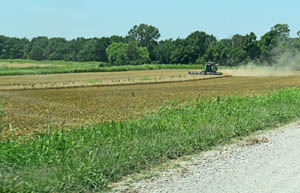
Sumner County Farming Today by Kathy Alexander.
The 1901 wheat yield was 6,812,102 bushels, more than was produced in the same year by the whole state of Texas, North Carolina, or in any one of 22 other states and territories, and exceeded by over a million bushels the aggregate of the wheat raised in New England, Mississippi, New Jersey, New Mexico, and Wyoming.
In 1906, Sumner County ranked highest in corn and led all Kansas counties in winter wheat and oats production.
In 1910, the county had 252 miles of main track, ranking it among the first in the state in terms of railroad facilities. A line of the Atchison, Topeka & Santa Fe entered in the northeast, crossed southwest to Wellington, and then south into Oklahoma, with a branch southwest from Wellington to Caldwell in the southwest. Another line of the same system from Winfield, Cowley County, entered from the East and crossed directly west through Wellington into Harper County. A branch of this road northwest of Winfield crossed the extreme northeast corner and west a few miles along the northern border. A line of the Missouri Pacific Railroad entered the East and crossed northwest and west into Kingman County, and a branch of the same road from Wichita entered the north and crossed southwest into Harper County. The Chicago, Rock Island, and Pacific enters in the north, crosses south to Wellington, and southwest to Caldwell. The Kansas City, Mexico & Orient Railroad crosses the extreme northwest corner. The Kansas Southwestern, a railroad from Anthony, Harper County, to Arkansas City, crosses the southern part east and west.
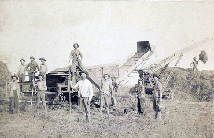
A threshing crew in Geuda Springs, Kansas.
At that time, the area was 1,188 square miles (760,320 acres), of which about 600,000 had been brought under cultivation. From its early beginnings, Sumner County has been a leader in agriculture and has often ranked first in the state.
According to the government census, the population in 1910 was 30,654, a 20% increase from 1900. The assessed valuation of the property was approximately $53,758,000, making the wealth per capita slightly more than $1,700. Many farmers paid for their farms entirely with a single crop of corn or wheat. There was room in Sumner County for 4,725 farms of 160 acres each.
The farm produce per annum ranged from $4,000,000 to $7,000,000. In 1909, it brought $6,870,000. The product for 1910, which was below average, was nearly $5 million. Wheat in that year brought $441,000; corn, $951,000; hay, $385,000; oats, $1,178,000; and livestock, nearly $1,000,000. Other important products are rye, Irish potatoes, sorghum, Kafir-corn, poultry, and dairy. There are 250,000 bearing fruit trees.
The Cowley, Sumner, and Fort Smith Railroad tracks were vacated and removed in the fall of 1918.
The Chicago, Kansas, and Nebraska Railroad became part of the Chicago, Rock Island & Pacific Railroad in 1937. The line was later sold to the Missouri, Kansas, and Texas Railway and eventually became part of the Union Pacific Railroad.
In 1940, a citizen going up the courthouse’s front stairway fell through the rotted boards, narrowly escaping injury. The courthouse was condemned and torn down.
The fifth courthouse was Harvey House, located next to the Atchison, Topeka & Santa Fe Railroad Depot, and it was used until 1952. The City Hall, located on the northwest corner of 7th Street and Washington Avenue, was also used as office space. Unfortunately, the Harvey House and the depot were torn down in 1965.
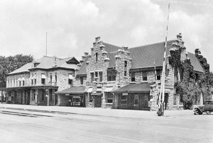
Harvey House in Wellington, Kansas, about 1925.
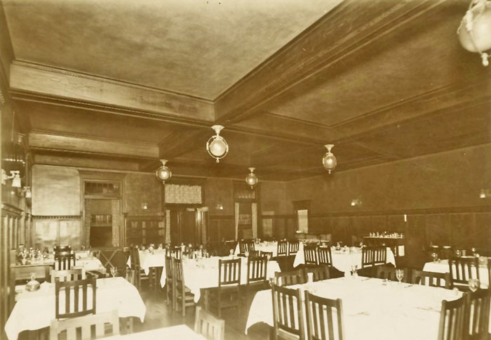
Interior of Harvey House in Wellington, Kansas.
The sixth and present courthouse was constructed from 1951 to 1952 for $650,000. The three-story gray-colored limestone, glass, and concrete structure was designed in the Art Deco style.

Sumner County, Kansas Courthouse, courtesy Google Maps.
In 1980, the Chicago, Kansas, and Nebraska Railway shut down and was reorganized as the Oklahoma, Kansas, and Texas Railroad. In 1988, it merged with the Missouri Pacific Railroad, and in 1997, it merged with the Union Pacific Railroad. Most locals still refer to this railroad as the Rock Island.

Kansas Star Casino in Mulvane, Kansas.
In December 2011, the Kansas Star Casino opened approximately 4.5 miles west of Mulvane’s center, adjacent to an exit on the Kansas Turnpike added in the mid-1980s. The casino is located a couple of blocks west of the Turnpike exit.
Today, the primary lines of the Atchison, Topeka & Santa Fe Railroad are still intact. Consolidated with the Burlington Northern, the railway company is now the Burlington Northern & Santa Fe Railroad. Its line runs from Mulvane to Belle Plaine, Wellington, and through Mayfield, Milan, and Argonia before entering Harper County. Another branch runs from Mulvane southeastward to Udall and eventually through Winfield.
The Union Pacific Railroad runs from Peck through Riverdale, Wellington, Perth, Corbin, and Caldwell.

School District Building in Wellington, Kansas, by Kathy Alexander.
The Southern Kansas and Oklahoma Line runs from Wellington to Rome, South Haven, and Hunnewell, while the Central Kansas Railway runs from Conway Springs to Wichita.
©Kathy Alexander/Legends of Kansas, updated December 2025.
Also See:
Sources:
Blackmar, Frank W.; Kansas: A Cyclopedia of State History, Vol I; Standard Publishing Company, Chicago, IL 1912.
Courthouses
Cutler, William G.; History of Kansas; A. T. Andreas, Chicago, IL, 1883.
Sumner County, KS
Wikipedia