
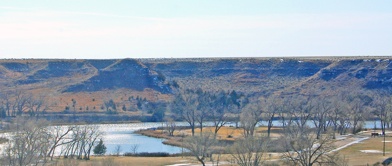
Lake Scott, Kansas, by Kathy Alexander.
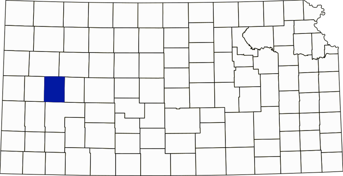
Scott County, Kansas Location.
Towns & Places:
Scott City – County Seat
Shallow Water – Extinct
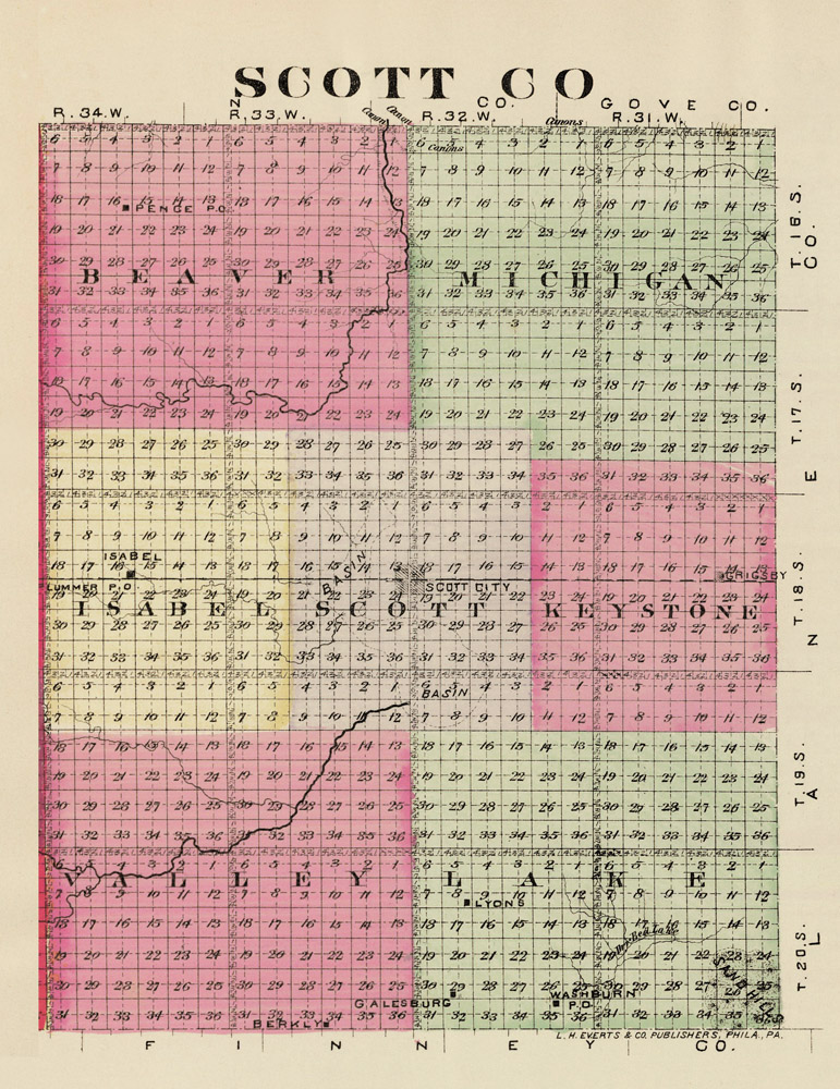
Scott County, Kansas map by L.H. Everts & Co., 1887.
Lake Scott State Park & Wildlife Area
The Ghost of White Woman Creek
Scott County, Kansas, is in the western part of the state, and its county seat is Scott City, the county’s only incorporated city. As of the 2020 census, the county population was 5,151, and its total area was 718 square miles of Kansas prairie, of which 718 square miles were land and 0.1 square miles were water.
It is the third county East of Colorado, the fourth South of Nebraska, and the fourth from the state’s southern boundary. Logan and Gove Counties border it to the North; Lane County to the East; Finney County to the South; and Wichita County to the West.
The county covers 720 square miles and 460,800 acres, with an elevation of 2,979 feet. Scott County is rectangular, measuring 30 miles North to South and 24 miles wide. The general surface is an undulating prairie with a few sand hills. Four-fifths of the county is billowy prairie, with long reaches of low-lying bottomlands skirting clear, winding streams, generally flanked by low hills and occasional picturesque bluffs. In the center of the county, a few miles South of Scott City, lies the famous White Woman Basin, a tract of low bottomland of 25,000 acres.
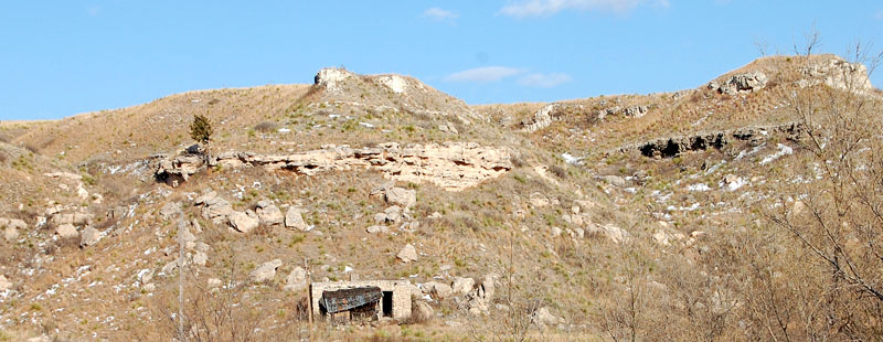
Scott County, Kansas Landscape by Kathy Alexander.
The principal stream is Ladder Creek. It enters from the West, flows East for about nine miles, then turns North into Logan County, where it empties into the Smoky Hill River. White Woman Creek enters from the Southwest and flows East and northeast to the center, where it sinks beneath the surface in a large basin that fills only during the wet seasons. The river’s annual overflow, which has its source in the foothills of Colorado, floods the basin with surplus water, which quickly sinks again into the bed of the lost stream. It is claimed that the current of this subterranean river is so strong at flood time that the sound of its swift waters can be heard distinctly some distance from the mouth of several sinkholes.
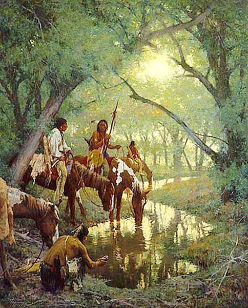
Cheyenne at the Disappearing Creek, called White Woman by Howard Terpning, photo courtesy Swoyer Fine Art & Collectibles.
Ladder and White Woman Creeks have numerous spring brook tributaries reaching out in different directions, which have always supplied pure water for the stockman. The county also boasts many fine, flowing springs, and wells of both hard and soft water are readily accessible at depths of 15 to 50 feet for irrigation. Quarries of building stones are found in certain sections of the county, including the white, gray, and cream-colored magnesian limestone. Sandstone, gypsum, and cement rock also exist in limited quantities. Native timber was limited to small belts and groves along the streams.
Like all counties in Kansas, Scott County’s first inhabitants were nomadic Plains Indians.
The Dismal River Culture inhabited the Ladder Creek area before written history began. Around 1664, Taos Indians escaped Spanish rule and settled in what is now Lake Scott State Park. These Indians lived here for a few years, until around 1701. Pueblo El Quartelejo is roughly translated as ‘old barracks’ or ‘distant quarters’. Initially, it was a stone-and-adobe building, 32 by 50 feet, divided into seven rooms. A Spanish expedition led by Lieutenant Juan de Archuleta soon chased down the Pueblo Indians and returned them to Taos, New Mexico.
In 1706, Juan Uribarri claimed the spring-fed valley that protected El Quartelejo for Spain and called it San Luis Province. This is the only known pueblo in Kansas and is the farthest North and East known in America.
Frenchmen are believed to have used El Quartelejo as a trading post before 1724.
The Legislature created Scott County by act in 1873. It was named in honor of United States Army Major General Winfield Scott, a hero of both the War of 1812 and the Mexican-American War. Scott served under every president from Thomas Jefferson to Abraham Lincoln, spanning 14 administrations, and served on active duty for 13 of them, for a total of 47 years. Historians rank him highly as both a strategist and a battlefield commander.
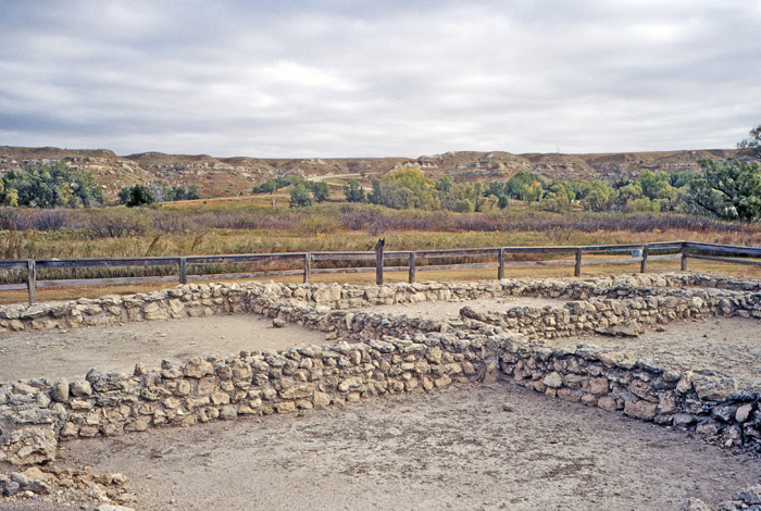
El Quartelejo Pueblo in Scott County, Kansas, courtesy of the Kansas Geologic Survey.
For several years, the county had no population and therefore required no local form of government; however, it was attached to Ford County for judicial purposes. After people began to settle there, a petition signed by the required number of citizens was presented to the Finney County Board of County Commissioners, requesting that Scott County be organized as a municipal township and attached to Finney County for judicial purposes. Scott County was organized as a township of Finney County, and Scott Center (present-day Scott City) was designated as the place of transacting public business.
The first settlers came into the county in 1874. The first white women were Mrs. M.E. DeGreer and her daughter, Mrs. Ida Eastman, both widows.
The Battle of Punished Woman Fork was the last battle between the United States Cavalry and the Indians in Kansas. Chief Dull Knife and Little Wolf of the Northern Cheyenne, and their people, slipped away from the reservation in Oklahoma in 1878. They were en route to Yellowstone when military personnel discovered them. The troops met up with the Indians in the canyons along the southern edge of what is now Scott County State Park on September 27, 1878. Little Wolf led the Indians in battle, while Lieutenant-Colonel William H. Lewis, commander at Fort Dodge, led the troops.
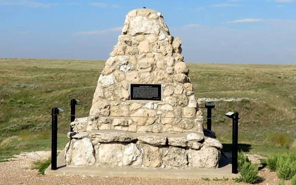
Battle Canyon Monument in Scott County, Kansas.
Women, children, and the elderly hid in the cave while the warriors fought the advancing soldiers. Lieutenant-Colonel William H. Lewis was wounded in the thigh. That night, the Cheyenne escaped, crossed the Smoky Hill River, and headed northwest. The following day, Lewis was placed in a military ambulance, and the soldiers made their way to Fort Wallace, Kansas, about 40 miles to the northwest. Along the way, he died of his wounds, becoming the last Kansas military casualty of the Indian Wars. Meanwhile, the Cheyenne continued to Yellowstone after slipping away during the night.
In 1884, people discovered the ruins of a prehistoric pueblo in Scott County, about 12 miles North of Scott City.
That year, settlement began in earnest when people from the East came to claim homesteads advertised by the government. The homesteader could obtain a patent for the land after living on and improving it for five years. Mrs. M.E. DeGeer and her daughter, Mrs. Eastman, became the first permanent settlers in October 1884.
By 1885, 91 people lived in Scott County, many of them from Illinois, Iowa, and Missouri. Scott City was founded in September 1885 by the Scott City Town Company, composed of Dr. Hall, F.A. Parsons, S.W. Case, Mrs. M.E. De Geer, Mrs. F.A. Parsons, Mrs. I.L. Eastman, W.E. McLain, Mrs. D.F. Hall, and Messrs. Sangster and Swan, who filed their charter in that month and soon after laid out the town. They changed the name from Scott Center to Scott City at this time.
A township election was held in Scott Centre on July 7, 1885, and the following officers were elected: Trustee, Charley L. Waite; Treasurer, C.R. Swan; Clerk, M.H. Bailey; Road Overseer, W.E. McLain; Justice of Peace, S.W. Case and Joseph Hollister; Constable, Ira J. Woif.
In June 1886, the governor appointed Charles Reed enumerator of Scott County. The returns were made on June 29 and showed a population of 2,675, of whom 701 were householders. The property was valued at $364,063, of which $109,030 was real estate. Governor Martin proclaimed on the same day that he organized the county, named Scott City, located at the county’s geographical center, as the county seat, and appointed the following officers: County Clerk, Charles S. Reed; Commissioners, Marion Cunningham, A.H. Kilpatrick, and Eugene McDaniels.
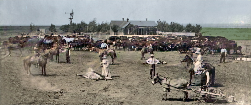
Branding cattle in Scott County, Kansas.
The county was declared organized on July 5, 1886, and that day, the appointed commissioners and county clerk met in a special session, with Eugene McDaniel as chairman. The county was divided into the following townships: Beaver, Isbel, Keystone, Lake, Michigan, Scott, and Valley.
An election was called to be held on August 10, 1886, and at that time the following officers were elected: Charles Reed, County Clerk; W.R. Hadley, Treasurer; B.F. Griffith, Register of Deeds; S.T. Burgess, Clerk of the District Court; J.F. Daniels, Sheriff; Lulu Boling, County Superintendent; Dr. J.F. Bond, Coroner; Eugene McDaniel, Commissioner of 1st District; H.M. Connor, Commissioner of 2nd District; C. Garrett, Commissioner of 3rd District. The county seat was located at Scott Center by unanimous vote.
The post offices were Grigsby, Manning, Modoc, Pence, Scott, and Taft. The Missouri Pacific Railroad entered the county from the northeast, crossed Southwest to Scott City, and then continued directly West into Wichita County. A branch of the Atchison, Topeka & Santa Fe Railroad from Great Bend entered from the East and crossed West to Scott City, where it terminated.
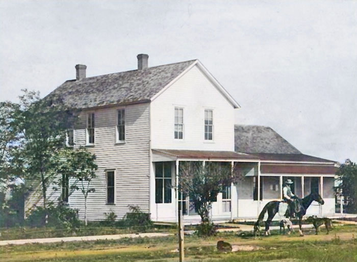
Scott County Courthouse in Scott City, Kansas, in about 1890.
The original frame courthouse was constructed in 1888 on the Northeast corner of the courthouse square.
The county’s population in 1890 was 1,262. Over the next three or four years, the population declined slightly due to adverse conditions. The county commissioners visited the state capitol in Topeka, Kansas, to secure state aid, but were unsuccessful. In 1893, 300 families remained, but only 75 survived the Winter.
Professors visited the ruins of Pueblo El Quartelejo in 1898. S.J. Willston and H.T. Martin of the University of Kansas derived many interesting facts and recovered numerous relics. They found stone, flint, and bone implements, milling stones, pots, herds, a quantity of charred corn, and other items used and found in the Indian pueblos of the Rio Grande in New Mexico.
In 1900, the population was 1,098.
In 1910, the county’s population was 3,047. The property’s assessed valuation was $5,913,442, and average wealth per capita was $1,940. At that time, less than half the county’s land was cultivated. Farm products were valued at $607,766, and livestock on hand at $768,013.
The current Scott County courthouse was constructed in 1924 on the site of the original courthouse, which had been demolished.
Scott County’s population peaked in 1980 at 5,782.
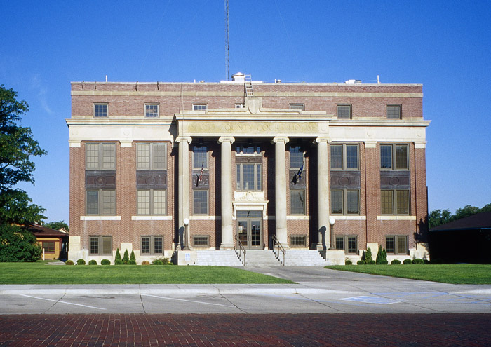
Scott County Courthouse in Scott City, Kansas, courtesy of the Kansas Geological Survey.
Two school districts have territory in the county. Scott County USD 466 has nearly all of the land, while a small portion is in Healy Public Schools USD 468.
©Kathy Alexander/Legends of America, updated September 2026.
Also See:
Sources:
Blackmar, Frank W.; Kansas: A Cyclopedia of State History, Vol. I; Standard Publishing Company, Chicago, IL 1912.
Fort Hays State University
Kansas Post Office History
Scott County, Kansas
Wikipedia