
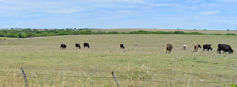
Mitchell County, Kansas landscape, by Kathy Alexander.
Towns & Places
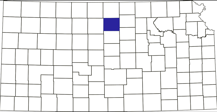
Mitchell County, Kansas Location.
Asherville – Extinct
Beloit – County Seat
Cawker City
Glen Elder
Hunter
Scottsville – Extinct
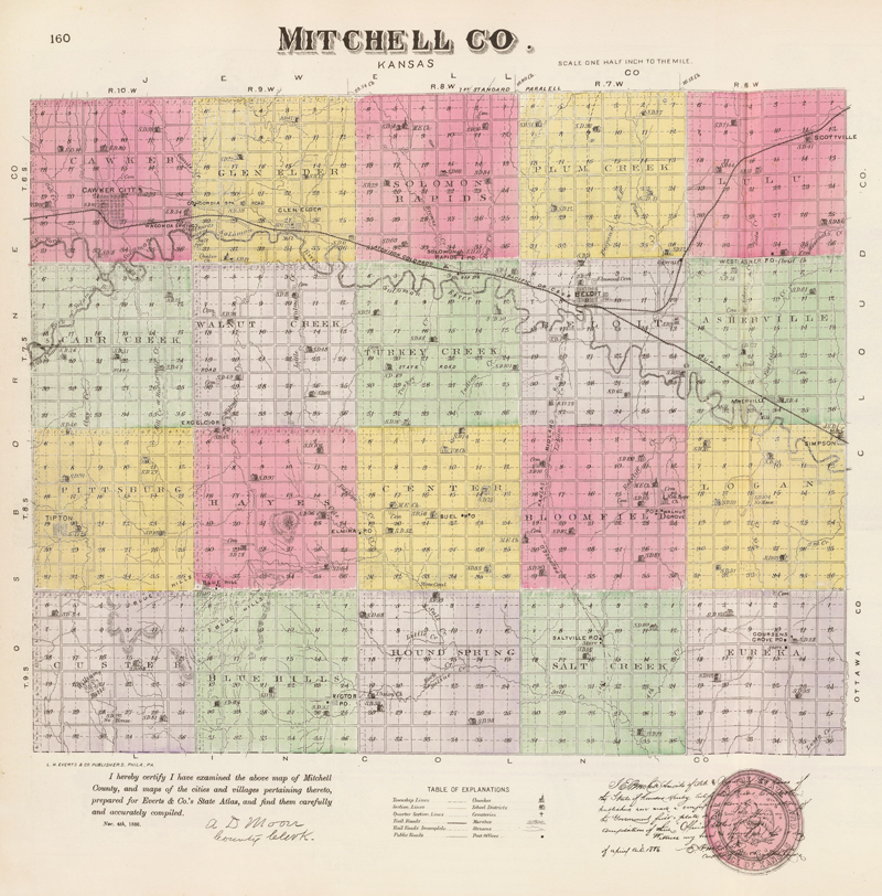
Mitchell County, Kansas by L.H. Everts & Co., 1887.
Solomon Rapids – Extinct
Tipton
Glen Elder State Park
Waconda Lake
Extinct Towns of Mitchell County
Kansas Industrial School for Girls
~~
Mitchell County, Kansas, is in the North-central part of the state. Its county seat and largest city is Beloit. As of the 2020 census, the county population was 5,796, and it had a total area of 719 square miles, of which 702 square miles is land and 17 square miles is water.
Settled after the Civil War, the county was named in honor of Captain William D. Mitchell, who enlisted in the Union Army as a private soldier in the Second Kansas Cavalry and, after being promoted to captain, was killed at Monroe’s Cross Roads in North Carolina in 1865.
Mitchell County is centrally located East and West, and is the second county south of Nebraska. It is bounded on the North by Jewell County; on the East by Cloud and Ottawa Counties; on the South by Lincoln, and on the West by Osborne.
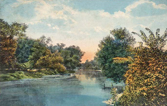
Solomon River in Beloit, Kansas.
The general surface of the county was rolling prairie with bottom lands about miles wide along the Solomon River, and from one-quarter to one-half mile wide along the creeks. The North and South Forks of the Solomon River joined just within the western limits of the county, forming the main river, which flowed southeast into Cloud County. It had several small tributary streams within the county, among them being Salt, Oak, Brown’s, Limestone, Walnut, Carl, Plumb and Asher Creeks. Salt marshes were plentiful in the southern part of the county, and Waconda Spring was heavily laden with salt. Magnesian limestone and sandstone, of good quality for building material, are extensively quarried along the bluffs. Potter’s clay and gypsum are found in several localities.
Mitchell County was first settled by Joseph Decker, who located North of Glen Elder early in 1866, filing on this quarter section of land at the Junction City Land Office, and came on with a large herd of cattle, built a dug-out, and broke a little spot for a garden. Before fall, the Indians drove off his cattle, and he abandoned the country.
At about the same time, John Rees, an Englishman and Civil War veteran, came to the Asherville area on April 26, 1866.
John Rees opened the first store in the county in 1867.
In 1867, several people settled in the county, and by early spring of 1868 the following had started improvements: Thomas Howie and William Joiner, just below the forks of Asher Creek; Mathias Nelson, David Bogardus, and B. Bell at the mouth of Plumb Creek; Whit McConnell and Tunis Bulis between Asher and Plumb creeks on the river; James Farrow and James Duff just above Plumb Creek on the river; H.A. Bell, John Whitehurst and his sons, Vinton and Abraham, on the Solomon River where Beloit now stands; and John Smith at Solomon Rapids. Andrew Peterson settled in Logan Township in 1868. Other early settlers were Abram Marshall, Charles Welsh, B.F. Moody and A.A. Bell.
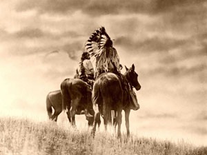
Cheyenne Warriors.
In August 1868, roving bands of Cheyenne and Sioux visited the settlements and lingered about the mouth of Plumb and Asher Creeks for several days, hoping to steal something from the settlers. Finally, to intimidate the settlers, they called B. Bell and David Bogardus from their cabin and shot them. Mrs. Bell was fatally wounded in attempting to avoid being carried away. They killed Mr. Hewitt of Brown Creek and wounded his son. Two sons of Abram Marshall and a man named Thompson lost their lives in pursuing the Indians, and two young daughters of A.A. Bell were stolen but were afterward abandoned by the Indians and picked up by the settlers on the Saline River.
A stockade was established at Howie’s ranch, just below the forks of Asher Creek, a few miles above the present town of Asherville, and nearly all the settlers spent the next winter there. They were joined by George Ealand, William Holton, John Cushing and John Owen. The latter, who led a wild life as a trapper, was unanimously elected commander of the stockade. Finding his protests in vain, he secretly packed his traps and fled to the headwaters of the Cimarron River in the Texas Panhandle. Shortly after the raid, Company G of the Seventh U. S. Cavalry made a reconnaissance of the Solomon Valley. The Indians managed to escape, although hard pressed on two occasions. That fall the soldiers built a blockhouse on the Solomon River, two miles south of Cawker City, but did not remain long.
Early in 1869 Dr. Rose of Junction City filed on the tract of land occupied by the blockhouse, but was driven out by the Indians and killed near Glen Elder in trying to make his escape. Later in the year, the government established a post West of Waconda and North of the river, where Battery B of the Fourth U.S. artillery, under Captain H.C. Hasbrouck, was stationed.
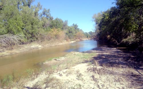
Solomon River in Kansas.
The milling interest was the most important manufacturing industry in the county, and the Solomon River afforded an abundance of water and plenty of fall. Beginning at the East line of the county, at the little village of Simpson, was Simpson’s Mill, with two runs of stones and a strong power. This was one of the oldest mills in the county. The next mill on the river grew out of the one started by T.F. Hersey at Beloit in 1869.
John Rees kept the first post office, which was established in Asherville on November 15, 1869
Battery B of the Fourth U.S. artillery was relieved in April, 1870, by G Troop of the Seventh U. S. cavalry, under Lieutenant C.C. de Rudio, with Lieutenant McIntosh, a full-blooded Chippewa, second in command.
The raids of the Indians became less frequent, but on May 9 a party of Cheyenne and Arapaho came upon four men—Lew J. Best, John Hatcher, R.G.F. Kshinka and John A. Seger— on Oak Creek near the West line of the county. The men made such a determined resistance that the Indians gave up, passed on down the river, and made an attack at Glen Elder, killing Solomon Meiser, John Greer and a Mr. Kenyon. Most of the settlers then took refuge in a stockade built on the farm of George W. Stinson. The soldiers from the post followed the Indians, who divided themselves into two bands and escaped.
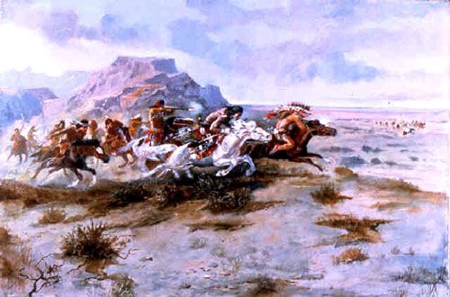
Indian Attack by Charles Russell.
The Indians reappeared three weeks later at Cawker City, where John Seger led them into thinking the place was well manned. They then went on West and stole 10 horses from the ranch of Best & Hatcher, where a dozen men were concealed, but did not dare attack the Indians.
The final raid took place July 2, 1870. A settlement was made near the center of the county in the spring of that year by C.J. Brown, G.W. Anderson, R.C. Clark and J.S. Smith. They built a stockade and lived together. Civilization was then pretty well established. The last buffalo seen in the vicinity came down the main street of Cawker City, in July, 1872.
Mitchell County’s organization was effected in 1870, when the governor appointed J.M. Myers, William E. Schooley, and Charles Brown as commissioners, and Don A. Peaslee as clerk. The commissioners held their first meeting in October, 1870. At the first election, Beloit was selected as county seat, and the following officers were chosen: Commissioners, C.L. Brown, William E. Schooley and Lew J. Best; clerk, L.C. Smith; probate judge, James Britt; sheriff, W.B. Smith; county attorney, Don A. Peaslee; treasurer, H.J. Messenger; superintendent of public instruction, J.W. Elliott; coroner, J.W. Clark; representative, E. Harrison.
A courthouse building was needed at once, and T.F. Hersey built one in 1871 and presented it to the county. The building cost about $4,000, and was amply sufficient for the county at that time. The county built a jail shortly after, at an expense of $800. However, about the only prisoners ever confined there were a couple of alleged horse thieves, who stole the extra blankets provided by kind-hearted Sheriff Hatcher, took out the horrid grates which obscured the window, and passed through them. They were never heard from again, and the frugal janitor of the courthouse appropriated the hole to toss coal through for winter consumption in the various county offices.
There were originally 17 townships: Asherville, Beloit, Bloomfield, Blue Hill, Cawker, Cedar Creek, Center, Glen Elder, Hayes, Logan, Lulu, Pittsburg, Plumb Creek, Salt Creek, Solomon Rapids, Turkey Creek, Walnut Creek. Cedar Creek has disappeared, and the following have been added: Carr Creek, Custer, Eureka, and Round Springs.
At Glen Elder, Kaull & Nash had a flouring mill built in 1871 by Neve & Spencer. It had three runs of stone and did a large business. It was soon one of the most valuable establishments of the kind in the West part of the State.
Three miles south of Cawker City, T.F. Hersey located his homestead, and commenced building a mill in 1872, in company with John Curtin. They labored under many difficulties on account of frequent floods, but in 1873 the dam was completed, and the mill continued in operation. It operated four runs of stone, and was valued at $15,000.
The first school houses in the county outside of Beloit, four in number, were built in 1872, in Lulu, Bloomfield, Center and Solomon Rapids Townships.
The first church was built in Blue Hills Township by the Baptists in 1873; the second was built at Beloit by the Methodists in 1874.
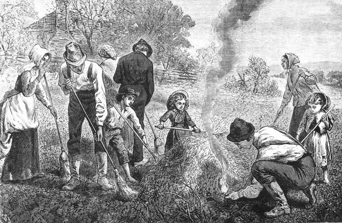
Grasshopper Plague in Kansas.
A stone-grist mill owned by B.W. Tanquary was five miles West of the county line. It was built in 1874 by Williams & Finnegan, of Beloit. With four runs of stones, this mill had a large business, running night and day, and the property was valued at $18,000.
Mitchell, like many other western counties of Kansas, suffered from the ravages of the grasshoppers in 1874, and many settlers left the county to provide food for themselves during the winter. Much assistance was rendered the needy settlers through the organized State and county societies, for the distribution of Eastern charity.
On the West line of the county, the Jackson Brothers had a splendid milling property built in 1875 that did a vast business. The property was valued at $15,000.
Good crops in 1875 and 1876 brought back the population which the county had lost, and Mitchell again began to prosper. At that time, the county was well settled, nearly every quarter section being under a degree of improvement. The abundance of good building rock led to the erection of a class of buildings, both farm and business houses, which are both beautiful and substantial.
The Central Branch of the Missouri Pacific Railroad came through the county in the summer of 1879 and was aided by the people to the extent of $50,000. The Solomon Valley Railway, a branch of the Kansas Pacific division of the Union Pacific Railroad, was extended from Solomon City to Beloit the same year.
The Missouri Pacific entered the county in the northeast corner, ran southwest to Beloit, where it connected with the Union Pacific Railroad, then West through Solomon Rapids, Glen Elder, and Cawker City, leaving the county a few miles south of the northwest corner.
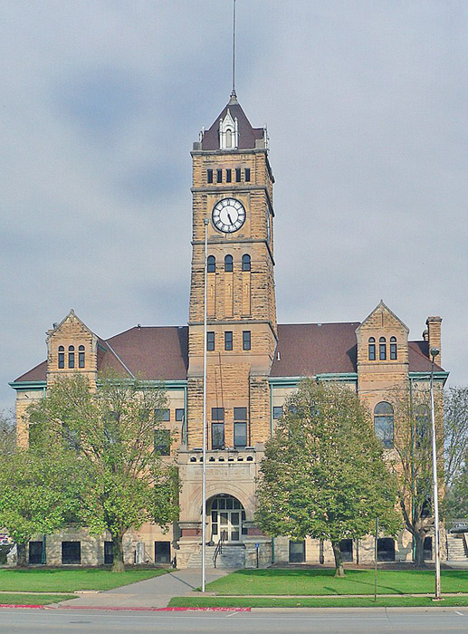
Mitchell County Courthouse in Beloit, Kansas, courtesy Wikipedia.
The second and present courthouse was constructed in 1901 to 1902 for $38,310. The Richardsonian Romanesque building was designed by J C Holland and Company of Topeka, Kansas, and built by Cuthbert & Sargent of Topeka. This building continues to be utilized today. It was listed on the National Register of Historic Places in 1977.
The west-facing building is three stories tall and built of dark yellow post rock limestone and concrete. The building is located on spacious landscaped grounds in the center of Beloit. The West front has an arched portico on the first story with a Syrian archway. Behind the portico is a high six-story square stone tower with a steep roof, a four-faced clock, and a 1500-pound bell installed in 1904. On the North and south sides, there are projecting sections that rise to peaked dormers at the roofline. Inside are 25 rooms on three floors with original stone floor tiles, decorative metal ceilings, and embossed wall coverings. The original ornate fireplaces are in several offices. The third story is open space under the roof with a door to the clock tower. The County District Court courtroom is located along the East side of the second story. The building houses the County District Court of the 12th Judicial District, which also includes Cloud County, Jewell County, Lincoln County, Republic County and Washington County.
In 1910, the county covered 720 square miles, or 460,800 acres, of which about 300,000 acres were under cultivation. The total farm production that year amounted to over $4,000,000. The corn and wheat crops were almost even in value, running over $1,000,000 each. Livestock for the same year was worth $750,000, and the assessed value of property was $28,648,000. The population was 14,089, which makes the wealth per capita about $2,100.
Mitchell County’s population peaked at 15,037 in 1890. In the next decades, the number of residents gradually declined.
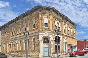
Beloit, Kansas business building by Kathy Alexander.
Today, visitors and residents enjoy Cawker City’s Largest Ball of Twine, the Little Red Schoolhouse, the Waconda Springs Replica, and a relaxing drive through the Blue Hills and towns to discover post-rock limestone buildings and explore Glen Elder State Park. Three museums, including the Cawker City Museum, the Mitchell County Museum in Beloit, and the Tipton Heritage Museum, provide views of the past and more information regarding Mitchell County.
©Kathy Alexander/Legends of Kansas, updated July 2026.
Also See:
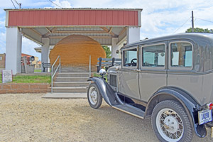
Ball of twine in Cawker City, Kansas by Kathy Alexander.
Sources:
American Courthouses
Blackmar, Frank W.; Kansas: A Cyclopedia of State History, Vol I; Standard Publishing Company, Chicago, IL 1912.
Cutler, William G.; History of Kansas; A. T. Andreas, Chicago, IL, 1883.
Discover Mitchell County
Wikipedia