Towns & Places:
Bucyrus – Unincorporated
Fontana
Hillsdale – Unincorporated
Louisburg
Osawatomie
Paola – County Seat
Marais des Cygnes River
Osage River
Pottawatomie River
Hillsdale State Park – Reservoir and Wildlife Area
Hunters Lake
Louisburg City Lake
Louisburg Middle Creek State Lake
Miami County State Lake
Miami State Fishing Lake
Miola Lake
Osawatomie Lake
Paola Lake
Wagstaff Lake
Battle of Osawatomie
Indian History
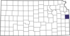
Miami County, Kansas, located in the east-central part of the state, is part of the Kansas City metropolitan area. As of the 2020 census, the county population was 34,191. Its county seat and the most populous city is Paola.
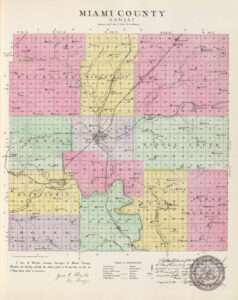
The county is located in the eastern tier of counties, next to Missouri, and in the second tier south of the Kansas River. It is bounded on the north by Johnson County, on the east by Missouri, south by Linn County, and west by Franklin County. It was one of the original 33 counties created by the first territorial legislature. It was initially named Lykins County in honor of David Lykins, an early resident of the county and member of the first Territorial Council. In 1861 the name of the county was changed to Miami for the Miami Indians.
The general surface of the country is undulating prairie, with a few bluffs and some broken land along the streams. In its early years, the valleys of the rivers and creeks averaged about a mile in width and comprised about one-fourth of the area. Belts of timber were found along the streams, the principal varieties of trees being walnut, cottonwood, oak, hickory, hackberry, ash, elm, soft maple, coffee bean, and box elder. Artificial groves were later planted on the uplands. The soil is exceedingly fertile. According to the U.S. Census Bureau, the county has a total area of 590 square miles, of which 576 square miles is land and 15 square miles is water.
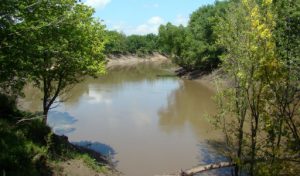
The principal water courses are the Marais des Cygnes and Pottawatomie Rivers. The former enters the county on the west. It flows in a general easterly direction for eight miles, where it is joined by the Pottawatomie, which crosses the western boundary about four miles north of the southwest corner and flows northeast. The main creeks in the north are Bull, Ten Mile, Wea, and Middle, and the southern portion is watered by Mound, Middle, and Sugar Creeks.
It is believed that the first white man to visit the country through which the Osage River flows was Claude Charles du Tisné, a French officer sent out by the governor of Louisiana to explore the country west of the Mississippi River in 1719.
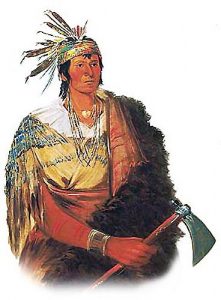
The area’s first settlements were made by Native American Indian tribes, primarily in the 1820s through the 1840s. This was due to their removal from Ohio, Illinois, and Indiana and the area’s designation as part of the Indian Territory.
The county was called home to the Miami, the Potawatomi, the Shawnee Indians, and the Confederated Tribes, comprised of the Piankashaw, Kaskaskia, Wea, and Peoria. The original Miami reservation consisted of approximately 500,000 acres.
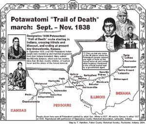
A notorious path known as the Pottawatomi Trail of Death has been officially recognized by the states of Indiana, Illinois, Missouri, and Kansas. A treaty signed in 1836 forced Indian tribes in the Eastern United States to move west of the Mississippi River. However, Pottawatomi Chief Menominee, his tribe, and others refused to leave their land. In the autumn of 1838, the Pottawatomi were removed by force from their villages and underwent a treacherous two-month journey. On the trip, 42 of the 859 Native Americans died, most of them children and the elderly, from typhoid fever and the stress of the passage. They were buried along the route. When they reached Kansas, some Pottawatomi lived for about a decade in Linn County at Sugar Creek Trading Post, now St. Philippine Duchesne Memorial Park. Other Pottawatomie tribes were relocated to various eastern parts of the state.
The trail, which marks the Pottawatomi’s route, begins in Rochester, Indiana, and meanders through Illinois and Missouri to end in eastern Kansas. Travelers on the trail today can view artifacts from the Pottawatomi Tribe along with other historical displays at the Miami County Historical Museum located in Paola.
The Methodists established a mission in the county in 1837, a little east of the present town of Osawatomie. However, it was abandoned in 1847 when the Pottawatomi moved to their reservation on the Kansas River. In 1840 the Baptists established a mission a little east of the present city of Paola. This was followed in 1847 by the Miami mission about ten miles southeast of Paola. The Catholics established their mission among the Pottawatomi in 1850.
Two notable members of the Confederated Tribes were Christmas Dagnette and Baptiste Peoria. Dagnette was born in 1800 and was a nephew of a Wea chief, originally from Indiana. He had received some formal education and spoke several Native American languages, plus English, French, and Spanish. He had served as an interpreter to the U.S. Government by age 16. Having moved to the area that is now Miami County with the Wea tribe, he served as chief for several years before he died in 1848.
Baptiste Peoria was also born around 1800. While he didn’t receive formal education like Dagnette, he learned the Shawnee, Delaware, and Pottawatomi languages and several more Confederated Tribes. In addition, he spoke English and French. Peoria was of both French and Native American Indian ethnicity and, like Dagnette, served as an interpreter and as a chief for some time. Baptiste Peoria became a respected member of the Paola Town Company and was instrumental in the founding and developing the city of Paola in the early and mid-1860s. He moved to Oklahoma with his tribe in 1868 and died there in 1878. Some Native American Indians stayed in the area and became citizens of the United States.
Early white settlers during that time primarily served as missionaries to the tribes. One of the first white men to come to Miami County as a permanent settler was David Lykins, after whom the county was first named. He came as a missionary to the Confederated Tribes in 1844.
Over time, other settlers continued to arrive to build homes on the Miami reservation, and by 1854, the U.S. Government purchased all but 72,000 acres from the Miami tribe.
Some of the first men who came after the organization of Kansas Territory to make homes and develop the country were S. H. Houser, who located in Stanton Township; Daniel Goodrich, C. A. Foster, John Childers, C. H. Crane, S. L. Adair, and others took up claims in Osawatomie Township; T. J. Hedges, the Shaw brothers, and D. L. Perry were the first settlers in Paola Township; and A. Mobley settled in Osage Township in 1854. The following year Charles Alexander, S. P. Boone, Elias Hughes, W. D. Hoover, James and Joseph Lykins, J. H. Phillips, Allen Ward, and several others settled near the present city of Paola. Thomas Roberts, James Williams, S. M. Merritt, and John Littlejohn were among the first to take claims in what is now Osawatomie Township. John Brown, Jr., Jason, Owen, and Salmon Brown all took claims on the banks of Middle Creek.
Paola was laid out in the spring of 1855 and later incorporated by the legislature. A store was opened there in 1856, and it became one of the flourishing villages of the early period. H. B. Stanford located at the Stanton in the summer of 1855. A post office was established the following year, and a store was opened. Osawatomie, one of the most historic towns in Kansas, was surveyed in February 1855 by A. D. Searl. The name was formed by combining the first part of the name Osage with the last portion of Pottawatomie, the names of two streams that unite near the town site to form the Osage River. Settlement had been made in this locality early in 1854, and the first post office was established in 1855 with Samuel Geer as postmaster.
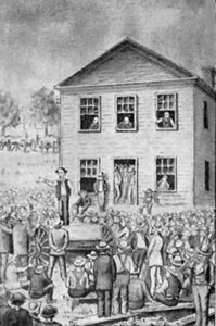
Trouble between the pro-slavery and Free State settlers began early in Miami County. Most of the actual settlers of Miami County were free-state men opposed to the laws passed by the first territorial legislature, which had been forced upon the territory’s residents by Missourians. On April 16, 1856, a meeting of the free-state men was called at Osawatomie, at which resolutions were adopted opposing the payment of taxes levied under the laws of this legislature. At this meeting, John Brown made a spirited speech against the bogus laws and legislature, as did others present. At the May term of the second judicial district court, the grand jury found an indictment against John Brown, John Brown, Jr., O. C. Brown, O. V. Dayton, Alexander Gardiner, Richard Mendenhall, Charles A. Foster, Charles H. Crane, William Partridge, and William Chestnut, in which it was charged that they “did unlawfully and wickedly conspire, combine, confederate and agree together to resist the enforcement of the laws passed by the legislature for the collection of taxes.”
This indictment, and other incidents about the same time, caused the smothered blaze to break into open flame. There had been no act of hostility by either side in Miami County up to that time, but on June 7, a company of about 170 pro-slavery men under the leadership of John W. Whitfield entered the county. At Osawatomie, which was defenseless, they plundered several stores and houses and carried off several horses. This affair was known as the first battle of Osawatomie. The Missourians were gathering their forces just across the border preparatory to entering Kansas, intending to wipe out some of the strongest free-state towns, among them Osawatomie. The party chosen for this purpose was under the command of General John W. Reid. On the morning of August 30, they were approaching Osawatomie from the northwest, intending to surprise the town, when they were discovered by Frederick Brown, who was on his way to Lawrence. He returned to the town and gave the alarm about 20 minutes before sunrise. John Brown, Sr., Dr. W. W. Updegraff, and Captain Cline commanded the defense.
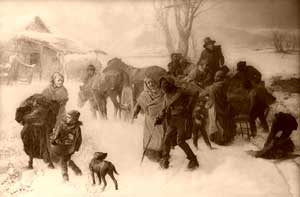
Underground Railroad by Charles T. Webber, 1893.
One of the routes of the Underground Railroad was through Miami County, with Osawatomie as its most important station. It is well known that a number of negroes escaping from the slave states were assisted on their way to Canada by the free-state residents of Miami, who provided clothing, food, and safe conduct to the stations beyond.
When Miami County was created, provision was made for the election of county commissioners, and Paola was named the county seat. The body corresponding to the board of county commissioners of today consisted of the probate judge and two commissioners. According to the records that have been preserved, the first board consisted of A. H. McFadin, probate judge, James Beets, and L. D. Williams, commissioners, who first met on April 2, 1857.
The other county officers in 1857 were E. W. Robinson, clerk; Richard Mendenhall, assessor; L. McArthur, clerk of the district court; B. P. Campbell, sheriff; W. A. Heiskell, register of deeds; Allen T. Ward, treasurer; J. N. Roscone, surveyor; Cyrus Holdridge, coroner, and B. F. Simmons, county attorney. On July 27, 1857, the first steps were taken toward erecting a courthouse for the county. The commissioners ordered an issue of $15,000 in ten percent on that date. Bonds were the money to erect a building at Paola for court-house purposes, but the bonds were never issued, and no courthouse was built. Union Hall was rented and used for such purposes when the county offices were moved into the second-story office building.
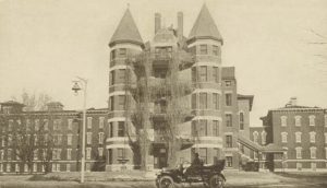
The earliest school of which there is a record was that taught in Paola in the fall of 1856 by Mrs. May Williams. That year, the Methodist Church was organized at Osawatomie, though missions among the Indians had existed for years. By an act of the legislature of 1863, the first state insane asylum was established at Osawatomie. The first newspaper in the county was the Southern Kansas Herald, which was started at Osawatomie about the beginning of 1857.
Miami County was the cradle of the Republican Party in Kansas, as it was organized at the Osawatomie convention called May 18, 1859. This was the territory’s most important and notable political event that year.
In 1860 the county commissioner form of government was established, and the new board’s first meeting was held on April 2, 1860. It comprised Israel Christie, John M. Ellis, and R. W. Shipley.
At the outbreak of the Civil War, the men of Miami County showed their patriotism by enlisting for the defense of the Union. Company D of the Tenth Kansas infantry; Companies C and D of the Twelfth Kansas; Company F of the Fourteenth Kansas cavalry, and Company C of the Fifteenth cavalry were all recruited in Miami County. During the war, Miami County suffered perhaps less than any other border county from Confederate raids and border warfare.
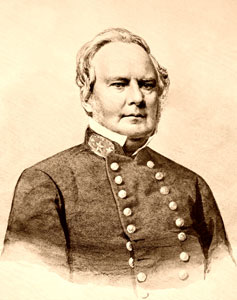
On Oct. 24, 1862, General Sterling Price, with his Confederate army, entered the southeast part of the county and passed through into Linn County in retreat. The most important event of the war was the passage through the county of William Quantrill, the famous guerrilla leader, and his forces after the sack of Lawrence. The news of the enemy’s approach was brought, and preparations were made at Paola for defense. Quantrill heard of this and when two miles west of the town turned northward, camping for the night on the west side of Bull creek. A Union force following Quantrill spent the night at Paola, but no attack was made, and Quantrill continued into Missouri.
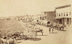
Immediately after the war, a great deal of interest was manifested in Kansas in railroad building. In 1865 Miami County voted bonds to the amount of $150,000 to aid in the construction of the Kansas & Neosho Valley Road, and in 1869 $100,000 and $125,000 were voted, respectively, to the Paola & Fall River and the Paola & State Line Roads, which were to be completed in 1871. The Kansas & Neosho Valley Road was changed to the Missouri River, Fort Scott & Gulf, and the Paola & State Line Road to the Missouri, Kansas & Texas. Some of the bonds were forfeited because the roads were not completed on time, but $225,000 became a valid lien on the county.
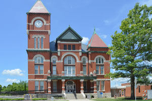
On May 8, 1876, the old school building of Paola was rented for a courthouse, and in the fall, it was purchased by the county for the sum of $9,200.
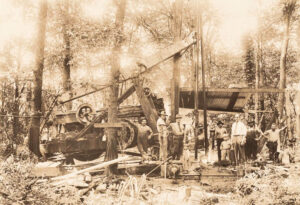
In 1882, a large deposit of natural gas was discovered in rural Miami County, seven miles east of Paola. By 1886 a pipeline was completed to the town’s square, illuminating lamps there. Other fields of natural gas were discovered throughout Miami County by 1887, and for a time, the area around Paola was considered a gas belt.
In 1910, the St. Louis and San Francisco Railroad, the Missouri, Kansas & Texas Railway, and the Missouri Pacific Railroad had lines radiating in six different directions from Paola; a branch of the Missouri Pacific ran west from Osawatomie to Ottawa, and a line of the Atchison, Topeka & Santa Fe Railroad crossed the extreme northwest corner. Altogether there were about 100 miles of main track in the county, affording good shipping facilities to all parts except a district in the southeast corner.
The population of Miami County in 1910 was 20,030. All farm products, including livestock, etc., were valued at $3,496,104. The five principal crops were: Corn, $1,017,060; hay, $443,132; wheat, $355,535; oats, $249,264; flax, $53,662. The value of animals slaughtered or sold for slaughter was $1,073,343.
Livestock raising was an important and productive industry; large quantities of poultry and eggs were sold. There were 150,000 fruit trees of bearing age. Limestone and sandstone for building were plentiful. Marble of good quality was found and quarried near Osawatomie and Fontana. Potters’ clay existed in several localities; salt water was found in places, and coal was mined for local consumption. Natural gas was abundant in most parts of the county. Wells had been sunk at Osawatomie, Louisburg, and Paola, and the gas was extensively used for heating and lighting. There were numerous oil wells near Paola, where a refinery was established.
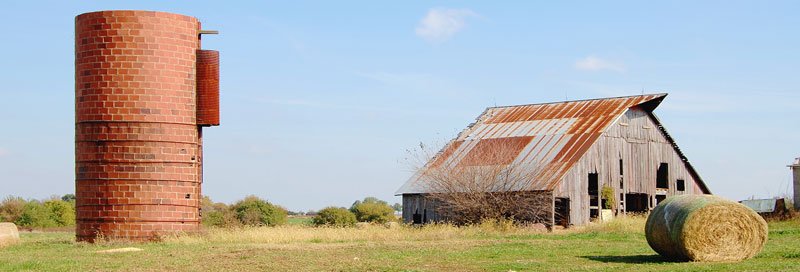
Today, Miami County offers a slower-paced lifestyle in a more rural setting. Residents can access jobs and larger entertainment areas while living in the region’s rolling, wooded hills. Visitors enjoy lakes, wineries, an observatory, a wakeboarding facility, a cider mill, museums, and a large cat sanctuary.
© Kathy Alexander/Legends of Kansas, updated March 2023.
Also See:
Sources:
Blackmar, Frank W.; Kansas: A Cyclopedia of State History, Vol I; Standard Publishing Company, Chicago, IL 1912.
Cutler, William G; History of Kansas; A. T. Andreas, Chicago, IL, 1883.
Wikipedia

