Pottawatomie River
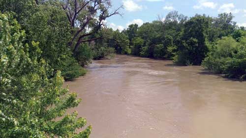
Pottawatomie Creek, named after a Native American tribe, is an 84.9-mile stream in Miami, Franklin, Anderson, and Coffey Counties in east-central Kansas. It has two branches in eastern Kansas. The north fork rises in the southwest corner of Anderson County, about two miles south of the village of Westphalia, and flows in a northerly and northeasterly course.
The South Fork rises in Richland Township, also in Anderson County, about two miles west of Selma, and flows northwest.
Its headwaters rise in northeast Coffey County approximately 3.7 miles southeast of the community of Waverly. The creek flows to the south-southeast for 6.2 miles and enters Anderson County, and turns to the northeast, passing under State Highway K-31. The stream passes under K-31 again about seven miles west of Garnett, then flows 1.5 miles southeast of the community of Pottawatomie. It continues to the northeast, passing under U.S. Highway 59 approximately 3.2 miles north of Garnett. It continues northeast, moving northwest of Greeley and into southeast Franklin County before passing Lane and entering Miami County. It then flows east-northeast, passes south of Osawatomie, and runs under U.S. Route 169 to its confluence with the Marais des Cygnes River just east of Osawatomie in Miami County.
The first white settlers established homesteads near Greeley in the Spring of 1854.
The Pottawatomie Massacre of May 24-25, 1856, occurred on the banks of Pottawatomie Creek.
©Kathy Alexander/Legends of Kansas, updated May 2026.
Also See:
Sources: