
Lake Perry, in Jefferson County, Kansas, by Kathy Alexander.
Towns:
Grantville
McLouth
Meriden
Nortonville
Oskaloosa – County Seat
Ozawkie
Perry
Valley Falls
Williamstown
Extinct Towns of Jefferson County
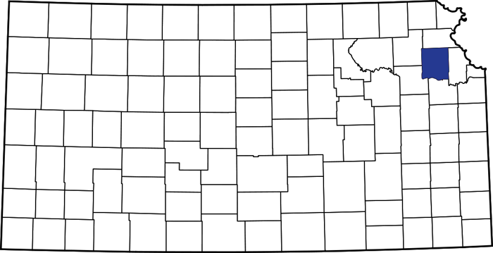
Jefferson County, Kansas, location.
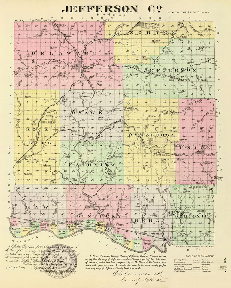
Jefferson County, Kansas Map by L.H. Everts & Co., 1887.
Jefferson County, Kansas, was one of the counties formed and organized by the first territorial legislature in 1855.
It is in the northeastern part of the state, the second county west of the Missouri River, and the third south of the Nebraska line. It is bounded on the north by Atchison County, on the east by Leavenworth, on the south by the Kansas River, which separates it from Douglas County, and on the west by Shawnee and Jackson Counties.

Barn and silo near Meriden, Kansas, by Kathy Alexander.
The general surface is an undulating prairie with a few rough places. The bottomlands along the creek beds and the Kansas River comprise about 15 percent of the total acreage. The Kansas River flows east along the southern border except for about six miles of the southeast corner. The Delaware River enters on the northern border about four miles from the west line and, flowing south, joins the Kansas River at Perry. This stream was large enough to furnish power for mills. Big Slough Creek is the main branch of the Delaware River. Muddy Creek crosses the southwest corner of the county.
Jefferson is one of the older settled counties in the state, and some of the most important events in Kansas history took place within its borders.
One of the first visits by white men to what is now Jefferson County was by Professor Say and his party. He accompanied the United States Government Exploring Expedition under Major Stephen Long in 1819. Leaving the expedition to pursue its way up the Missouri River, Professor Say and his party proceeded nearly as far west as Manhattan on the Kansas River. From that point, they took a direct course, as nearly as possible, to Cow Island, in the Missouri River, just below Atchison, Kansas, where they met the main party. On this route, they entered the county at the southwest corner of Delaware Township and proceeded to the falls of the Delaware River. Called Grasshopper River, where they camped on the night of August 27, 1849, and on the following day, traveled in the same general direction, crossed the northern boundary of what is now Jefferson County.

Kanza Men.
On June 3, 1825, the United States Government made a treaty with the Kanza tribe, by which, among other provisions, it was agreed that the government should furnish the Indians with 300 head of cattle, 300 hogs, 500 fowls, three yokes of oxen, two carts, and such farming tools as the superintendent deemed necessary and that he should employ such persons to aid and instruct the Indians in their farming pursuits.
General Clarke signed the treaty on behalf of the United States Government, and by 12 Kanza chiefs representing the Indians. White Plume, Great Valor, Little White Bear, Real Eagle, and Great Doctor were among them.
Under the treaty, Major Daniel Morgan Boone, son of the famous Kentuckian, was selected to instruct the Indians in agricultural principles. His title was “Farmer for the Kansas Indians.” He was appointed in the spring of 1827 and at once removed with his family to the Kansas Valley, erected buildings, and began his duties. The point where he settled was on the north bank of the Kansas River, in the extreme southern part of Jefferson County, and about two and one-half miles distant from Williamstown. On August 22, 1828, his son was probably the first white child born in Kansas. Subsequently, a settlement grew up, and its ruins were found near the present village of Williamstown by settlers in 1854.

Mormon Wagon Train
In 1851, a few Mormon families en route from Missouri to Salt Lake City, Utah, stopped in Jefferson County, where Thompsonville was located. They initially refused to accompany the main group led by Brigham Young to the Salt Lake Valley. They remained for several years and made some improvements. Three log cabins were built, and about 15 acres of land were cultivated. Three of the women in the company died of cholera. They were buried on the edge of the timber, and tombstones were put up with the names cut on them. When Kansas became a territory, the border war began, and, finding they could not obtain land in Kansas, they moved on.
A military and freight road was built from Fort Leavenworth to Fort Riley before the permanent settlement of the county. It extended across Jefferson County, entering the county from the east at a point not far from the northeast corner, extending southwest to Winchester; then nearly west to Hickory Point, southwest to Osawkie, where it crossed the Delaware River; then west and southwest to Mount Florence, about one and a half miles southwest of the present town of Meriden; from which point it crossed the western boundary of the county.

Delaware River in Kansas.
Even before Kansas became a Territory, people began to settle in the area. In February of 1854, Henry Zen, located at the falls of the Delaware River, where Valley Falls now stands, built a cabin and made some improvements.
On May 30, 1854, Kansas was admitted as a Territory, and the rush of settlement immediately began. Treaties had been made with the Delaware Indians, to whom the lands that now comprise Jefferson County belonged, but the lands were not yet opened to settlement or surveys made. However, no attention was paid to this fact, and during the year, many people selected claims within the county’s limits.
When Kansas was admitted as a Territory, Solomon Everett, a mixed-race Delaware Indian who had been with General John Fremont on his Rocky Mountain expedition, conceived the idea of building a sawmill on the Delaware River. Everett’s dam was built of logs. Thompson’s Mills later occupied the site he chose.

Rock Creek Perry Lake, Kansas.
Most of the settlers of that year settled on or near the freight road, with a few along the Kansas River Valley and some in other parts of the county. The principal settlement was at the crossing of the Delaware River, at Osawkie, where the brothers, William F. and George M. Dyer, started a trading ranch and did good business with the travelers over the Government road. In the summer of 1854, Henry Chubb, located at Mount Florence, about one mile west of the present town of Meriden, and William R. Wade, Sidney Steward, and Aaron Cook settled near there along Rock Creek and the Delaware River. R.P. Beeler, Jefferson Riddle, and J.T. Wilson settled in the southwestern part of the county on the Kansas River. John Scaggs settled on the Delaware River in Kentucky Township. Thomas R. and Alexander Bayne settled along the Kansas River near present-day Williamstown. In June, Charles Hardt settled at Hickory Point on the Government road and established a trading post. That year, several other people settled in the county.
Upon arrival, the settlers staked off claims and began improvements, built cabins and fences, and planted a small acreage of crops. The first cabins were built of round logs just cut down, the crevices chinked with blocks of wood and stone, daubed with mud, and the roof constructed either of dirt or clapboards. These cabins generally had no floors and no windows. Fireplaces were constructed of logs plastered with mud, and the chimneys were built of wood.

Hickory Point, Kansas area by Kathy Alexander.
They understood they could bid on their holdings at the appraised value when these lands were offered for sale. This was the famous “squatter’s right” that caused so much trouble in territorial days, and this condition obtained nearly all the best lands in Jefferson County. There were, however, few crops of any kind raised owing to the wild state of the soil and the severe drought of that year.
Ozawkie and Hickory Point were the first settlements of any note in the county.
In 1855, Jefferson County was established and was named for President Thomas Jefferson.
As the county continued to improve, there was a marked difference in the cabins’ structures. They were then built of hewn logs, the cracks filled with lime, the roofs shingled, the walls covered with clapboards inside and out, and they had windows. Later, many buildings were made of stone and native lumber.
The Delaware purchase lands included the greater part of the county, except a large tract held by the Delaware Indians as a diminished reserve. The Kanza half-breed lands also comprised sixteen tracts of 648 acres each that bordered the Kansas River.
Most of the Delaware purchase was to be sold at public sale to the highest bidder at Leavenworth, Kansas, in November 1856. The remainder of these lands was to be sold at Ozawkie in July 1857.
Before the land sales, the settlers had no right whatever to the land which they occupied, except a “squatter’s right,” which was simply a right by possession, with an understanding that each settler should be allowed to bid on the land he claimed, at its appraised value, on the day of sale.
The squatters’ rights proved a source of many serious troubles. There was much contention about the ownership of claims and a question about which constituted a settlement. At first, a habitation was required, but soon, a mere foundation was regarded as sufficient to hold a claim. This was subject to many cases of abuse, for it was not long until many tracts of land were covered with “foundations,” which, in a majority of cases, were formed of four twigs laid in the form of a square and by men who came in from other states only to vote on election days, or intending to secure claims for future speculation.

Governor Andrew Reeder.
After the arrival of the first Territorial Governor, Andrew H. Reeder, in October 1854, he divided the Territory into elective districts. He set November 29 as the date for electing a delegate to Congress. The polling place was at the house of George M. Dyer in Ozawkie. At the election, 71 votes were cast, of which 69 were for J. W. Whitfield, the pro-slavery candidate. A great deal of bitterness existed between the pro-slavery and Free-State men, who were driven from the polls by Missourians, who had come to Osawkie to control the election.
During the summer, Congress established two mail routes across the county. One was along the old military road, and the other was from Fort Leavenworth to the Big Blue River by Valley Falls. The first post office was established in Ozawkie on March 15, 1855, with George M. Dyer as postmaster. Hickory Point was established soon afterward with Charles Hardt as postmaster, and in December 1855, Valley Falls was established with A.J. Whitney as postmaster.
In the 1855 election, Hickory Point was the polling place. Large numbers of pro-slavery men came into the territory the day before, camped near Hickory Point, laid off claims, and demanded the right to vote the next day. On being refused, an argument ensued, and the election board, finding it impossible to secure a fair election, refused to serve. When the free-state voters arrived, they found the polls in the hands of non-residents and left without voting.
The first county officers were appointed in 1855 as follows: Franklin Finch, probate judge; W.F. Dyer, treasurer; G.M. Dyer, sheriff; Marion Christison, register of deeds; William Sprague, assessor; Garret Cozine, surveyor; James A. Chapman, coroner; N.B. Hopewell, O.B. Tebbs, and Henry Owens members of the county court, which was the same as the board of commissioners.
At that time, Ozawkie was designated as the county seat. The county’s first term of the district court was held at Ozawkie the last week in March 1856, with Samuel D. Lecompte as the presiding judge. At this time, it was not safe to be abroad unarmed, as the border war was in progress, and bands of armed men from other parts of the state and Missouri frequented the settlements of Jefferson County. If a band of border ruffians caught a free-soiler, he was apt to be killed.

Battle of Hickory Point in Jefferson County, Kansas.
During the absence from Valley Falls of the free-state defense organization, the pro-slavery men visited the place, insulted the women, and made various threats. In retaliation, a free-state band under the leadership of Clark made a raid and killed a man named Jackson, who was responsible. For the death of Jackson, Valley Falls was raided on September 8, 1856, by a body of armed ruffians. The town was completely sacked, and the store of William and R.H. Crosby was burned. Both sides were now at arms. Some South Carolinians who had been committing various depredations were discovered and captured on Slough Creek but were released on promising to leave the territory. The trouble culminated in the Battle of Hickory Point.
Early in 1858, the legislature authorized a county seat election. The contesting towns were Oskaloosa, which received 177 votes; Valley Falls, 173; Ozawkie, 94; Hickory Point, 50; and Fairfield, 10. Another election was held, in which Oskaloosa received 294 votes; Valley Falls, 271; Ozawkie, 103; Hickory Point, 107; and Defiance, 3. A third election was held between the two highest towns, in which Oskaloosa received the majority and was made the county seat.
The first schools were opened in 1859.
In 1860, the county’s population was 4,446, and the assessed property valuation was $925,003. The drought of 1860 and the war beginning the ensuing year retarded growth and development in the county.

Early Kansas Militia.
A regiment known as the Fourth Kansas Militia was organized in Jefferson County, with S.S. Cooper as a colonel during the Civil War.
In 1864, the legislature authorized another county seat election, in which Oskaloosa was victorious.
By 1865, there were 20 school districts.
The Jefferson County Courthouse was built on the town square in Oskaloosa in 1867.
Before 1870, 50 more school districts had been added to the county, and new, well-equipped schoolhouses had replaced the log structures.
In 1870, the county had a population of 12,565, and the assessed valuation of farmlands was $4,218,363.

Jefferson County Courthouse in Oskaloosa, Kansas, about 1925.
By 1910, Jefferson County was well supplied with railroads, including the Leavenworth, Kansas & Western (Union Pacific) that entered a few miles south of the northeast corner, crossed to Valley Falls, and then northeast into Atchison County, a branch of the Missouri Pacific entered in the east and crossed northwest through Valley Falls into Jackson County; a line of the Atchison, Topeka & Santa Fe Railroad entered from the southwest, crossing the county in a northeasterly direction, a branch diverging at Meriden and running east into Leavenworth County; and the Union Pacific Railroad crossed the extreme southern border, following the Kansas River. The total mileage of the railroad was 121.44. The population of the county in 1910 was 15,826.
In May 1960, the original courthouse in Oskaloosa was destroyed by a tornado. At the time of its destruction, it was the oldest courthouse in Kansas. In 1962, Jefferson County occupied a new courthouse built in the same location.
The Perry Lake dam was constructed on the Delaware River to help control flooding downstream in the Delaware and Kansas Rivers. Completed in 1966, the lake is a water reserve for nearby areas and a regional recreation lake. The lake covers approximately 11,000 acres and has over 160 miles of shoreline. The reservoir is impounded at its southern end by Perry Dam.
The Perry Lake reservoir inundated the original town of Ozawkie. The town was rebuilt on higher ground west of the original site along the Delaware River.

Wellman School in Oskaloosa, Kansas, by Kathy Alexander.
At the 2020 census, the county population was 18,368. Oskaloosa remains the county seat, and Valley Falls is the most populous city.
©Kathy Alexander/Legends of Kansas, updated May 2026.
Also See:
Jefferson County Extinct Towns
Jefferson County Photo Gallery
Sources:
Blackmar, Frank W.; Kansas: A Cyclopedia of State History, Vol I; Standard Publishing Company, Chicago, IL 1912.
Cutler, William G; History of Kansas; A. T. Andreas, Chicago, IL, 1883.
Jefferson County, Kansas
Kansas Memory
Wikipedia