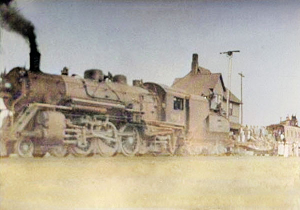
Arkalon, Kansas Depot.
Arkalon, Kansas, is a ghost town located northeast of Liberal on the west side of the Cimarron River in Seward County.
After the Chicago, Rock Island & Pacific Railroad was built through the area in 1888, a post office was established on May 7, 1888. The town was named Arkalon for Arkalon Tenney, the father of the first postmaster of the town, Hosea Eugene Tenney.
Three days later, the townsite was platted by the Arkalon Town Company on May 10, 1888. It was situated in Fargo Township at the point where the Chicago, Rock Island & Pacific Railroad crossed the Cimarron River. Town lots were cheap, and people flocked in by the hundreds. Many of its settlers moved here from Fargo Springs and Springfield.
The Arkalon News newspaper was first published in April 1888. That year, a railroad trestle bridge was built across the Cimarron River. However, it soon washed away.
A large stockyard was erected for shipping cattle to market. While the nearby river held promise for the early settlers, they soon found that the bottomland next to the Cimarron River was too sandy for farming and flooded too often. Additionally, the deep sand of the area was a severe handicap to the movement of horse-drawn freight.
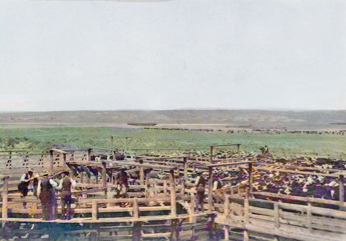
Shipping pens in Arkalon, Kansas.
In 1891, a one-room schoolhouse was established.
The Arkalon News was discontinued in December 1892.
In 1910, Arkalon had an international money order post office and was an important shipping point, especially for grain and livestock. However, the town was in a hilly area with deep sand, which caused many problems with getting supplies in and out of town. Despite the unforgiving terrain, Arkalon was a vital shipping hub for nearly 20 years.
The flood of 1914 that doomed Arkalon was caused by the washing out of a bridge over the Cimarron River that led to the town. Shortly afterward, the Chicago, Rock Island and Pacific Railroad moved its operations to Liberal.
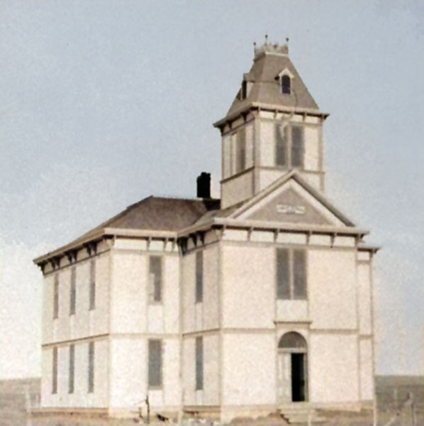
Arkalon, Kansas, two-story school.
By the 1920s, most of the early settlers had left for Liberal, leaving only the railroad and stockyards behind.
The post office closed on November 15, 1929.
In the following decades, one by one, the railroad bridges across the Cimarron River malfunctioned due to frequent flooding, costing the Rock Island Railroad thousands of dollars in equipment, supplies, time, and manpower. Even when the bridges were operational, the river’s changing elevation and shape required hairpin turns and miles of curved track, drastically slowing freight.
On August 18, 1938, the problem with the railroad bridge across the Cimaron River came to a head. The Rock Island’s fast freight train, the Gold Ball, pulling 30 tank and freight cars, slowed down to 30 miles per hour to negotiate the first part of the hairpin turn at the Arkalon crossing. In an instant, the bridge gave way completely. The engine and 12 of the freight and tank cards fell into the swollen river. The final collapse resulted in two deaths, four injuries, and an engine and 30 train cars falling into the Cimarron River. Crews immediately worked around the block to repair the damage, and three days later, the bridge reopened. A month later, more rain washed away the newly-repaired bridge.
Families began to congregate around the river to gawk, and hamburger stands popped up near the site of the crash. Fed up, Rock Island’s Chief Operating Officer, John Farrington, made the bold decision to route the railroad high over the river.
The new bridge, called the Samson of the Cimarron, is a majestically named railroad bridge that towers over the Cimarron River and spans U.S. Highway 54 in southwestern Kansas. When it was completed on July 8, 1939, it elevated the train tracks 113 feet above the riverbed below, solving more than half a century of headaches, including bridge collapses, train wrecks, and the disappearance of the city of Arkalon. The bridge is 1,268 feet long, and its concrete pillars have been driven 65 feet deep below the riverbed into the soft sand.
It was one of the outstanding engineering achievements of its era. The railroad bridge is about ten miles northeast of Liberal, Kansas. There is a picnic area off of U.S. Highway 54 near the east end of the bridge.
In recent years, the Cimarron River has appeared calm and gentle. However, in the past, the river overflowed and spread across the entire bottomland beneath the long bridge. Today’s travelers feel reassured by the size and strength of the high bridge.
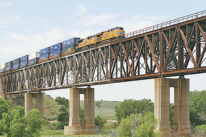
Sampson of the Cimarron bridge in Seward County, Kansas, courtesy of Kansas Sampler.
Arkalon was 13 miles northeast of Liberal, the county seat.
©Kathy Alexander/Legends of America, October 2025.
Also See:
Extinct Towns of Seward County
Sources:
Blackmar, Frank W.; Kansas: A Cyclopedia of State History, Vol I; Standard Publishing Company, Chicago, IL 1912
Fort Hays State University
Historic Marker Database
Wikipedia