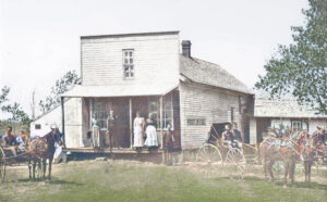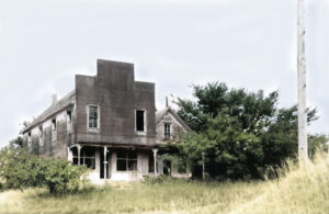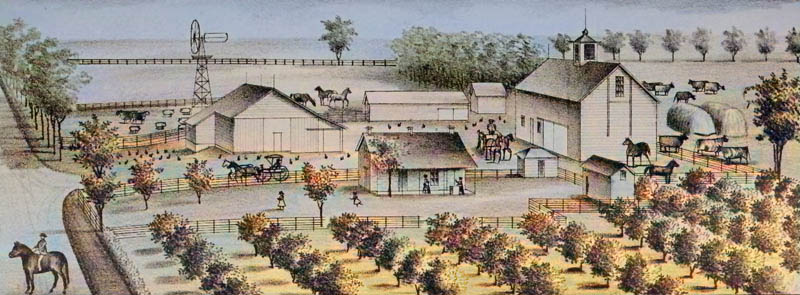
A farm in Sheridan Township of Washington County, Kansas, 1890.
| Town | Post Office Dates | Additional Information |
| Albia | 1873-1905 | A country post office 18 miles north of Washington, the county seat. In 1910, Albia was described as a small hamlet. It was located near the Nebraska line, ten miles north of Morrowville, where the rural free delivery system delivered its mail. Endicott, Nebraska, was the nearest railroad station. |
| Ballards Falls | 1869-1902 | Ballard’s Falls was a little hamlet on the Little Blue River, about 12 miles east of Washington, the county seat, and five miles north of Barnes, from which place mail it received its mail by rural free delivery after its post office closed. |
| Beekman | 1872-1876 | |
| Bell | 1876-1878 | |
| Blocker | 1881-1884 | When the post office closed, it moved to Morrow Station. |
| Brantford | 1871-1908 |
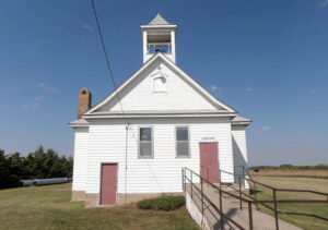
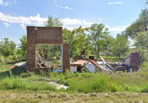
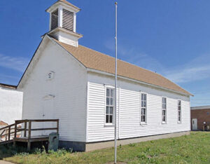
Located near the Republic County line, this village’s mail was supplied by rural free delivery from Clyde when its post office closed. In 1910, it had a population of 75. It was about 20 miles southwest of Washington, the county seat. The town still boasts the old Brantford School, which now serves as a community center, a fallen business building, and a few area homes. |
| Brown Rock | 1871-1872 | |
| Calderhead | 1898-1901 | |
| Campbell | 1894-1901 | |
| Chepstow | 1870-1872 1874-1905 |
This little hamlet was situated in the Coon Creek Valley in Lincoln Township, about 16 miles southeast of Washington, the county seat. After its post office closed, mail was received by rural delivery from the Greenleaf post office. Barnes, on the Missouri Pacific Railroad, was the nearest railroad station. In 1910, it had a population of 25. Nothing is left but a cemetery. |
| Clara | 1892-1904 |
This village was about 12 miles southwest of Washington, the county seat. In 1910, it had a population of 40, and its mail was delivered through the Haddam post office, the nearest railroad station. |
| Cromwell | 1882-1884 | |
| Day | 1883-1930 | This little village was a station on the Greenleaf & Lenora division of the Missouri Pacific Railroad. In 1910, it had a money order post office, some local trade, some shipping, and a population of 35. It was five miles east of Clifton and about 17 miles southwest of Washington, the county seat. |
| Dewey | 1884-1893 | |
| Dewitt-De Witt | 1874-1897 | The name changed from De Witt to Dewitt on November 22, 1894. |
| Doane | 1873-1875 | |
| Donald | 1870 | The post office was open for about ten months. |
| Elm Grove | 1872-1877 | The post office moved to Barnes when it closed. |
| Emmons | 1885-1918 |
A village of Charleston Township, Emmons was a station on the Chicago, Burlington & Quincy Railroad four miles northeast of Washington, the county seat. In 1910, it had a money order post office, telegraph and express offices, some general stores, and a population of 50. The old Emmons School was moved to Washington, Kansas, near the museum. |
| Enosdale | 1884-1903 | Enosdale was about four miles south of Morrow, the nearest railroad station, and seven miles southwest of Washington, the county seat, from which its mail was received by rural delivery after its post office closed. |
| Erin | 1868-1872 | The post office moved to Pursley when it closed. |
| Gaskill | 1884-1903 | Gaskill was a small hamlet located about four miles south of the Nebraska state line and ten miles northwest of Washington, the county seat, from which place its mail was received by rural delivery after its post office closed. |
| Gerardy | 1895-1903 | A small village in Washington County, it was a station on the Chicago, Burlington & Quincy Railroad, 7 miles northeast of Washington, the county seat, and five miles north of Hanover. Mail was delivered by rural carrier from there. The population in 1910 was 57. |
| Greenwood | 1875-1876 | The post office was only open for about five months. |
| Hopewell | 1879-1890 | |
| Hopper | 1871-1874 | The post office moved from Prospect Hill. When it closed, it was moved to Round Grove. |
| Jonah | 1898-1902 | Jonah was eight miles southeast of Washington, the county seat, and five miles from Greenleaf, the nearest shipping point and the postoffice from which its mail was distributed after its post office closed. |
| Joy Creek | 1870-1878 | |
| Kara-Dewey | 1894-1899 1899-1901 |
The town’s name changed from Dewey to Kara on March 3, 1896. |
| Kimeo | 1872-1904 |
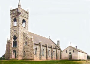
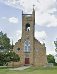
A farming hamlet, the Kimeo area was established by Irish settlers in the 1870s. St. Michael’s Catholic Church, built of native limestone, was constructed in 1904. The church has been closed for several years but remains a local landmark that can be seen from several miles away. The population in 1910 was 50. It was nine miles south of Greenleaf, from which its mail was distributed by rural route after its post office closed. Kimeo was located 16 miles south of Washington, the county seat. |
| Koloko | 1877-1891 | |
| Lanham | 1914-1923 |
Lanham is an unincorporated community in Washington County, Kansas, and Gage County, Nebraska. The Kansas-Nebraska state line runs down its main street. Lanham was named for a railroad official. A post office was opened in Lanham on the Kansas side in 1914 and remained in operation until 1923. The post office moved back into Gage County, Nebraska. It is seven miles north of Hanover, Kansas, and 6.5 miles from Odell, Nebraska. It is located along State Line Road, about a half mile west of K-148/Nebraska Highway 112. |
| Limestone | 1864-1872 | |
| Luther | 1895-1904 | Though the post office was authorized, it was never in operation. This hamlet was located 12 miles southwest of Washington, the county seat, five miles from Palmer, the nearest shipping point, and ten miles from Clifton, the post office from which it received its mail. |
| Mayton | 1874-1879 | |
| McKinley | 1892-1895 | Though the post office was authorized, it was never in operation. |
| Mormon Springs | None | Mormon Springs on Ash Creek in Washington County, Kansas, was a favorite camping ground of the Latter-Day Saints when they traveled to Utah on the South Fork of the Mormon Trail. |
| Parallel | 1863-1905 | |
| Peach Creek-Mount Clifton | 1870-1878 | The name was changed from Mount Clifton to Peach Creek on April 13, 1871. D.T. Smouse laid out Peach Creek Village in 1871, containing several stores and about 40 people. It was on the main road from Waterville, Marshall County, to Clyde, Cloud County, in southern Washington County. |
| Prospect Hill | 1870-1871 | When the post office closed, it moved to Hopper. |
| Pursley | 1872 | The post office moved from Erin. It was open for less than a month. |
| Reiter | 1871-1884 | |
| Rogersville | 1860-1864 | Rogersville was on Judge S.F.Snider’s farm in Charleston Township. |
| Round Grove | 1871
1874-1877 |
When the post office closed, it was moved to Greenleaf. |
| Spence | 1898-1899 | The post office was open for less than a year. |
| Springville | 1871-1875 | |
| Strawberry | 1871-1904 |
This country hamlet was located 12 miles southwest of Washington, the county seat, and eight miles west of Linn on the Missouri Pacific Railroad, the nearest shipping point and the post office from which it received mail after its post office closed. The population in 1910 was 52. |
| Tansel | 1892-1895 | |
| Throop | 1890-1903 | This country hamlet in Coleman Township, Throop, was ten miles southwest of Washington, the county seat, and seven miles south of Morrowville, the nearest railroad station and the post office from which it receives mail after its post office closed. The population in 1910 was 28. |
| Tremont | 1873 | The post office was open for less than a month. |
| Weltbote-Ardale-Butler | 1870-1898 | When a post office was established on July 29, 1870, the town was called Butler. On August 18, 1885, the town’s name was changed to Ardale. On December 12, 1888, the town’s name was changed again to Weltbote. The post office closed for the last time on July 30, 1898. |
| West Union | None | West Union was a paper town about four miles west of Washington on the McNulty claim. |
©Kathy Alexander/Legends of Kansas, updated December 2024.
Also See:
Washington County Photo Gallery
Sources:
Blackmar, Frank W.; Kansas: A Cyclopedia of State History, Vol I; Standard Publishing Company, Chicago, IL 1912.
Cutler, William G; History of Kansas; A. T. Andreas, Chicago, IL, 1883.
Kansas Post Office History

