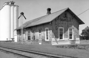
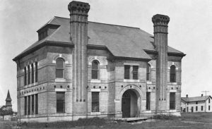
Garfield, Kansas, is a small town on the Arkansas River in Pawnee County. As of the 2020 census, the city’s population was 151, and its total area was 0.54 square miles.
Garfield was first called Camp Criley when it was founded in 1872. A supply station for workmen building the Atchison, Topeka & Santa Fe Railroad, the town was named after Captain J.D. Criley, the construction superintendent.
Soon, numerous Ohio emigrants came to the area, taking up residence in about 30 homes. When the town gained a post office on May 28, 1873, it was renamed Garfield after then-congressman from their old district in Ohio and later President of the United States, James A. Garfield. After taking his name, James Garfield promised to give a bell to the first church built in the community.
The Garfield Town Company officially platted the town in December 1873, and the Atchison, Topeka & Santa Fe Railroad Company located an experimental forestry garden here. It extended across Big Coon Creek and included a wide variety of trees.
When the Congregational Church was built in 1875, it received the bell, now housed at the Garfield Memorial Wayside Chapel, a replica of the original church. The roadside chapel is located in Downey Park in Garfield on Highway 56.
On July 25, 1874, grasshoppers plagued Garfield, destroying the area’s crops. By the turn of the century, Garfield had become a primary shipping point. He sported a bank, a money order post office, a telegraph, express, and telephone accommodations, a flour mill, four grain elevators, a hotel, a public library, schools, several churches, and several retail stores.
The town was officially incorporated in 1910, when it had 333 residents. At that time, it was still on the Atchison, Topeka, and Santa Fe Railroad and was a shipping point of considerable importance. It had a post office with a money order, one rural route, telegraph, express, and telephone accommodations, a flour mill, four grain elevators, a hotel, a public library, a grade school and high school, Congregational, Methodist, and Swedish Lutheran Churches, and a number of well-stocked mercantile establishments.
The community is served by the Fort Larned USD 495 public school district.
Garfield is located on Highway 56, about 11 miles southwest of Larned.
©Kathy Alexander-Alexander/Legends of Kansas, updated November 2025.
Also See:
Extinct Towns of Pawnee County
Fort Larned National Historic Site
Museums & Historic Sites
Pawnee County
Pawnee County Photo Gallery
Santa Fe Trail in Pawnee County
Sources:
Blackmar, Frank W.; Kansas: A Cyclopedia of State History, Vol I; Standard Publishing Company, Chicago, IL 1912.
Wikipedia


