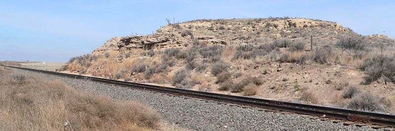
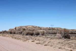
Finney County Point of Rocks is one of at least four similarly named sites along the Santa Fe Trail that aided travelers in navigating the road. The trail passed to the immediate south of this
formation and became the foundation for modern-day Mansfield Road.
The natural feature was associated with transportation and commerce along the trail from 1821 to 1870.
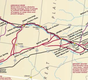
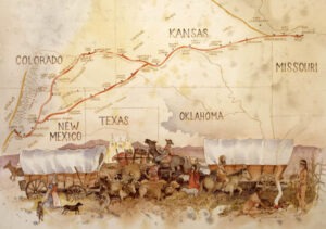
It is located on an 85-mile stretch of the trail that connected the Lower and Upper Arkansas River Crossings. The Upper Arkansas River Crossing was the last major opportunity for westbound travelers to decide between the Cimarron Route and the Mountain Route for the remaining journey to Santa Fe, New Mexico. This formation helped travelers along the Cimarron Route find their way to Middle Spring, one of the few reliable water sources in that area. Those traveling the Mountain Route continued westward to Bent’s Fort in Colorado.
The site reflects important historical events of several historical contexts, including International Trade on the Mexican Road, 1821-1846; the Mexican-American War and the Santa Fe Trail, 1846-1848; Expanding National Trade on the Santa Fe Trail, 1848-1861; The Civil War and the Santa Fe Trail, 1861-1865; and The Santa Fe Trail and the Railroad, 1865-1880.
William Becknell initiated travel to Santa Fe in 1821. In Kansas, his expedition generally followed what later became the Mountain Route, so most likely, he would have passed this site on his way to New Mexico. The first recorded travelers to pass the Point of Rocks in Finney County were George Sibley and Joseph Brown during their 1825 trail survey. Though neither site was recorded, Brown’s map indicates they traveled to this section of the trail.
No known references to this site along the Arkansas River mention the name Point of Rocks. The known references, however, are to what became known as Pawnee Fort, with the earliest mention occurring in the 1850 memoir of Lewis Gerrard, who, in 1846, at the age of 17, joined a caravan to Santa Fe via the Mountain Route.
According to Gerrard, his party passed “Pawnee Forts, a grove of timber in which a war party of Pawnee some years before fortified themselves when besieged by a hostile tribe. Nothing now remains but a few crumbling logs to mark the sight of this Indian bulwark.” This was a crude “fort” built by a group of Pawnee to take refuge from Cheyenne or Comanche during a siege in the early 19th century.
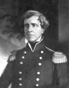
On July 22, 1846, Colonel Stephen Watts Kearny and the Army of the West passed Pawnee Fort, an old decayed stockade, after camping near the Caches in Ford County.
William Salisbury, a young gold-seeker from Ohio, also mentioned this site in his diary entry from May 28, 1859: We were on our road at the usual time this morning. Nothing occurred of any account. It is clear and pleasant. Found the road very good except for some sandy hills. Came to Pawnee Fort about three o’clock p.m. Saw up under the shelving rocks [Point of Rocks] where an Indian had been buried and had been dug up by the wolves.
Major Wickliffe Cooper was commanded by General Winfield Hancock to “Patrol the roads – westward as far as the Pawnee Forts…” in April 1867.
Pawnee Fort is thought by historians to have been across Mansfield Road from Point of Rocks. By today’s estimations, Point of Rocks is approximately 35 miles from the site of Fort Atkinson and just under 40 miles from Chouteau’s Island.
In the late 1860s, the Kansas Pacific Railroad approached the Colorado state line, truncating the length of the wagon route to Santa Fe. The Barlow & Sanderson Stage Company continued to use this truncated trail route from 1866 to June 1868.
When the Union Pacific Eastern Division reached the short-lived city of Sheridan, near Fort Wallace in Wallace County, Kansas, in June 1868, the trail’s eastern terminus shifted to this area approximately 100 miles north-northwest of Point of Rocks. That portion of the trail east of Sheridan was subsequently abandoned. By March 1870, the railroad had reached Kit Carson, Colorado, spelling the end of trail traffic along the Santa Fe Trail to the east of this town.
Later, the Atchison, Topeka, and Santa Fe Railroad generally followed the trail’s Mountain Route throughout western Kansas.
Other sites on the Santa Fe Trail that were also called Point of Rocks are a formation near Springer, New Mexico; the Point of Rocks is located seven miles northwest of Elkhart within the Cimarron National Grassland in Morton County, Kansas; and another Point of Rocks formation was located on the north side of US-50 Highway, 2.3 miles west of Dodge City, Kansas until a road widening project in 1931 destroyed it.
Point of Rocks is part of a vast hard caliche bluff running in a northwest-southeast orientation, overlooking the Arkansas River, approximately 1/2 mile to the southwest. The bluff rises from an elevation of 2775 feet at the southern boundary to 2850 feet generally along the site’s northern boundary. Part of the formation contains a small cave large enough to accommodate three to four people, though it is not tall enough to allow standing. The site contains 304.79 acres and includes the highest rocky outcropping along the trail in that vicinity.
The Atchison, Topeka & Santa Fe Railroad, which is now known as the Burlington Northern Santa Fe, cuts through the southern portion of the rock outcropping between it and Mansfield Road.
The site was listed on the National Historic Register in 2013.
The Finney County Point of Rocks is three miles northwest of Pierceville on Mansfield Road.
©Kathy Alexander/Legends of Kansas, updated July 2024.
Also See:
Santa Fe Trail in Finney County
Sources:
Finney County Point of Rocks National Register Nomination
Wikipedia

