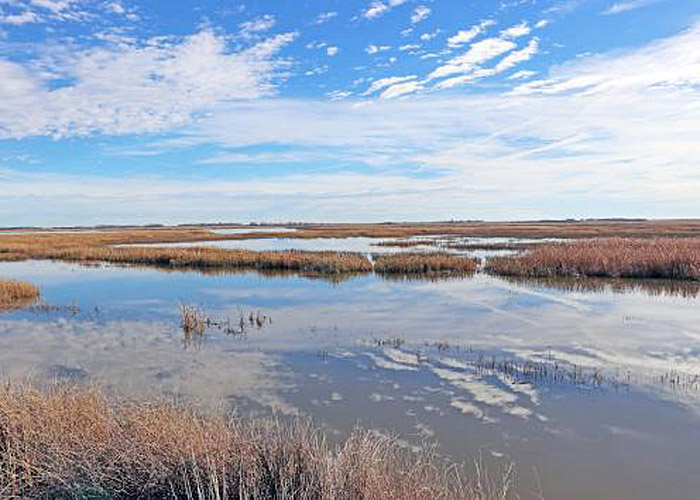
Cheyenne Bottoms in Barton County, Kansas, courtesy of the Kansas Geological Survey.
Cheyenne Bottoms is a wetland in central Kansas that occupies approximately 41,000 acres and is the largest in the interior United States. As a stopping point on the central flyway for millions of birds, this Kansas wetland is a bird lover’s paradise. It is the largest wetland in the interior United States.
In 1900, a project known as the Koen Ditch attempted to divert water from the Arkansas River to the Bottoms for irrigation. The canal began approximately six miles southwest of Great Bend, Kansas, in Barton County, and extended north and northeast for a total length of approximately 12 miles. It was constructed using ditch plows pulled by 12 horses and was completed by 1901. The project faced significant challenges, including lawsuits from landowners who felt they were not adequately compensated for their condemned land. The final blow came in a 1904 flood, which washed out the diversion dam on the Arkansas River and inundated nearby farmland, leading to the project’s abandonment.
During the 1920s, various plans were put forth to drain the Bottoms and convert it to farmland. However, residents downstream in Hutchinson, Kansas, protested that doing so would cause flooding.
The importance of the Cheyenne Bottoms was recognized in 1925, when the Kansas Forestry, Fish, and Game Commission was established to manage the area as a wildlife habitat.
In August 1927, 14 inches of rain upstream turned it overnight into “Lake Cheyenne,” causing flooding downstream of Little Cheyenne Creek. Kansas politicians made an unsuccessful plea for federal funding to convert it into a National Wildlife Refuge. Following the enactment of the Pittman–Robertson Federal Aid in Wildlife Restoration Act of 1937, which taxed sporting arms and ammunition, funds became available to develop the Bottoms.
During the 1940s and 1950s, the State of Kansas acquired the land, and dikes were constructed to impound water in five pools. Canals and dams were constructed to divert water from the nearby Arkansas River and Wet Walnut Creek to supplement the flow of two intermittent streams, Blood and Deception Creeks.
In 1952, after the construction of dikes, roads, and hunting blinds, part of the area was opened to public hunting. In 1957, a new canal connecting to the Arkansas River was constructed. However, relatively little water from the Arkansas River was pumped into the wetland due to drought and competing claims on the water supply. In the 1990s, an extensive renovation subdivided the marshes. The renovations made the marshes more self-sustaining, although an adequate water supply and effective water-level management remain critical challenges. During that time, the Nature Conservancy began acquiring land adjacent to the state wildlife area.
Cheyenne Bottoms is at an elevation of 1,795 feet. It lies in central Kansas in the Arkansas River Lowlands region of the Great Plains. Its primary inflows are two small local streams, Blood Creek and Deception Creek, which flow into it from the northwest. Its other inflow is an inlet canal from Walnut Creek to the southwest. The wetland’s primary outflow is an outlet canal to Little Cheyenne Creek to the southeast. Little Cheyenne Creek empties into Cow Creek, a tributary of the Arkansas River. Cheyenne Bottoms lies entirely within Barton County.
The entire wetland occupies a natural land sink spanning 41,000 acres (64 square miles). Of that area, 19,857 acres constitute the Cheyenne Bottoms Wildlife Area. It is critical to the survival of many species. At least 340 species of birds have been observed at Cheyenne Bottoms, including the Bald Eagle, Whooping Crane, Peregrine Falcon, Least Tern, and Piping Plover.

Pelicans at Cheyenne Bottoms, Kansas, courtesy of the Kansas Geological Survey.
As many as 600,000 shorebirds from 39 species pass through Cheyenne Bottoms during spring migration and up to 200,000 in fall. About 45% of all shorebirds in North America utilize the area. Cheyenne Bottoms is a critical habitat for many endangered species, including the whooping crane. Whooping cranes are an endangered species with fewer than 700 remaining in the wild.
Birds here migrate north as far as western Alaska and the tundra at the edge of the Arctic, and south to Louisiana, Texas, Central America, and the far reaches of South America.
Cheyenne Bottoms has historically fluctuated in size, serving as a lake, mudflat, or dry area. Through management efforts that control water levels, it now provides a secure resting area for migrating waterfowl and shorebirds. The wildlife management area comprises five pools, separated by dikes, canals, and pathways, and covers most of the region. The average depth of these pools is less than one foot. Pools one and five are closed to all human activities. Surrounding the pools are mudflats, ponds, and islands, and the elevated areas are primarily grasslands with some trees. Waterfowl hunting, mainly for geese, is allowed along the southern border of the state wildlife management area.
The formation of the wetland in a natural basin in a semi-arid area is not entirely understood. It is surrounded on the north, east, and west by bluffs as high as 100 feet.
The Kansas Department of Wildlife and Parks owns a core 19,857-acre parcel. The Nature Conservancy owns an adjacent 7,300 acres (11.41 sq miles). The Kansas State and Nature Conservancy lands are managed to provide diverse marsh habitat for migrating and breeding waterfowl and shorebirds.
The Kansas Wetlands Education Center within the wildlife management area interprets the wetlands and wildlife for visitors. Approximately 600 people visit Cheyenne Bottoms yearly.
On January 29, 2008, Quivira National Wildlife Refuge and Cheyenne Bottoms were jointly named as one of the 8 Wonders of Kansas.
Cheyenne Bottoms is part of the National Wetlands & Wildlife National Scenic Byway. Along the drive, visitors encounter landscapes and communities shaped by the powerful forces of motion and change. This region is shaped by ancient and ongoing geological forces, and is a land of stunning bird migrations, wild winds and weather, and a richly layered human history.
U.S. Route 281 runs north-south two miles west of the Bottoms. Kansas Highway 4 lies to the north and runs east-west, and Kansas Highway 156 runs northeast-southwest through the wetland’s southeast portion. The Bottoms is also directly accessible via a network of unpaved gravel roads, several of which run along the tops of the dikes.
The road passes through radiant wetlands teeming with wildlife, prairie vistas with expansive blue skies, and seven rural communities shaped by nature and entrepreneurial spirit. The inland salt marshes that anchor this drive, Cheyenne Bottoms and Quivira National Wildlife Refuge, are international birders’ treasures nestled in the heart of America and the Central Flyway.
Cheyenne Bottoms is located at 204 NE 60 Road, eight miles northwest of Great Bend, Kansas. Access is also available from K-156 or by turning off K-4 Highway at Redwing.

Cheyenne Bottoms, courtesy of Wikipedia.
©Kathy Alexander/Legends of Kansas, December 2025.
Also See:
Sources:
Kansas Department of Wildlife & Parks
Kansas Geological Survey
Kansas Tourism
Nature Conservancy
Wikipedia