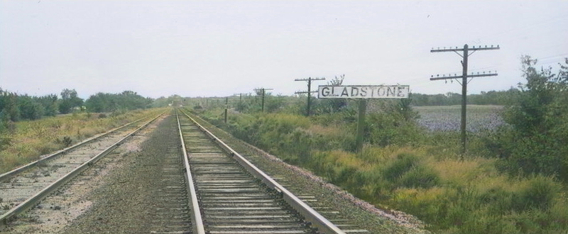
Atchison, Topeka & Santa Fe Railroad signboard in Gladstone, Kansas by H. Killam, 1964.
Town |
Post Office Dates |
Additional Information |
| Achilles | 1879-1951 | Achilles, Kansas, on Sappa Creek, in Jefferson Township of Rawlins County, is an extinct town, as its post office closed decades ago. The town is gone today. |
| Beardsley | 1889-1899 1906-1955 |
The post office moved from Greshamton when it was established in Beardsley in 1889. In 1910, Beardsley was a station on the Chicago, Burlington & Quincy Railroad, had a money order post office, served as a supply point for the neighborhood, handled the shipping of grain and livestock, and had a population of 50. It was ten miles west of Atwood, the county seat. |
| Beaverton-Bird | 1880-1894 1899-1900 |
This place was first called Bird when a post office was established on May 24, 1880. A little more than a month later, the name was changed to Beaverton on June 28, 1880. The post office closed on August 18, 1894. It reopened on April 13, 1899, and closed for the final time on June 30, 1900. It was in Atwood Township, southwest of Atwood. |
| Beaverview | 1906-1912 1914-1916 |
Beaverview was a post-village on Beaver Creek, about 18 miles southwest of Atwood, the county seat, and 12 miles southeast of McDonald, which was the nearest railroad station. |
| Blakeman-Weeks | 1887-1952 | Blakeman, Kansas, in Logan Township of Rawlins County, is an extinct town today. The Burlington and Missouri River Railroad built tracks to the north of Atwood in 1886-1887, and the tracks continued along the creek to the junction of the Middle and North Beaver Creeks, which was five miles west of Atwood. At that junction was to be the new townsite of Blakeman. |
| Boyer | 1881-1882 | |
| Burntwood | 1866-1899 1903-1907 |
|
| Celia | 1880-1888 | This place was centrally located in Celia Township. The post office moved to McDonald when it closed. |
| Chardon-Sappaton | 1884-1939 | A post office called Sappaton was established on April 29, 1884. The town’s name was changed to Chardon on February 17, 1888. It was in Clinton Township, between two branches of Sappa Creek and about 12 miles south of Atwood, the county seat. In 1910, it was a trading point for that section of the county. |
| Ludell-Danube-Kelso | ||
| Dearborn | 1880-1881 | The post office was only open for about ten months. It was in Celia Township, south of Beaverton. |
| Enne | 1882-1891 | |
| Gibson | 1900-1903 | |
| Gladstone | 1885-1903 | |
| Greshamton | 1883-1889 | The post office moved to Beardsley after it closed. |
| Ilion | 1886-1893 | |
| Jerome | 1880-1883 | |
| Laing | 1879-1881 | Laing, in Jefferson Township, was 16 miles southeast of Atwood. |
| Linda | 1891-1934 | Linda, a country post office in Rawlins County, is located in Grant township, 18 miles southwest of Atwood, the county seat, and 16 miles from Colby in Thomas County, the nearest shipping point. The population in 1910 was 23. |
| Ludell | 1876-2002 | Ludell, Kansas, is a tiny town and census-designated place on Beaver Creek in Ludell Township in southeast Rawlins County. It is also officially an extinct town, as its post office closed years ago. As of the 2020 census, the population was 41. |
| McCloud | 1881-1886 | McCloud was in the southwest part of the county. |
| Minor | 1910-1920 | |
| Mirage | 1885-1895 | |
| Oak Ranch-Pentheka | 1890-1909 | This place was first called Pentheka when a post office was established on April 26, 1890. The name was changed to Oak Ranch on January 15, 1903. It was located in the Beaver Creek Valley, 20 miles southwest of Atwood, the county seat, and 10 miles south of McDonald, the nearest railroad station. It received its mail from Colby after its post office closed. |
| Prag | 1876-1890 | The post office moved to Kelso after it closed. |
| Rotate | 1885-1891 | |
| Sappa | 1881-1883 | Sappa was in the southeastern part of Atwood Township. |
| Scio | 1881-1894 | Scio was in the southeastern part of the county. |
| Thornton | 1887-1899 | |
| Tully | 1888-1919 | Tully was located in Clinton Township, 18 miles southeast of Atwood, the county seat, and about 10 miles from Gem, the nearest shipping point. In 1910, it had a money order post office, one rural route, and a population of 15. |
| Vaughn | 1886-1903 | Vaughn was located at the headwaters of the Driftwood, 15 miles northwest of Atwood, the county seat, and eight miles north of Beardsley, the nearest railroad station. In 1910, it received mail from Benkelman, Nebraska, 15 miles to the northwest, and had a population of 24. |
©Kathy Alexander/Legends of Kansas, updated September 2025.
Also See:
Sources:
Blackmar, Frank W.; Kansas: A Cyclopedia of State History, Vol I; Standard Publishing Company, Chicago, IL 1912.
Cutler, William G. History of Kansas; A. T. Andreas, Chicago, IL, 1883.
Fort Hays State University
Kansas Post Office History