
An old Homestead near Lakin, Kansas, by Kathy Alexander.

Kearny County, Kansas, Location.
Towns & Places:
Deerfield
Battle of Chouteau’s Island (1816)

Kearny County, Kansas Map by L.H. Everts & Co., 1887.
Kearny County, Kansas, is located in the southwest portion of the state. Its county seat and most populous city is Lakin. As of the 2020 census, the county’s population was 3,983, and it has a total area of 871 square miles, comprising 871 square miles of land and 0.4 square miles of water. It was named after General Philip Kearny, a notable officer in the American Civil War and Indian Wars.
The county is bounded on the north by the county of Wichita; on the east by Finney; on the south by Grant, and on the west by Hamilton. The Arkansas River, as it enters the county, some 12 miles from its southern boundary, runs in a southeasterly direction, and before it crosses its center line from east to west, its course is northwesterly.
The county’s surface is level or rolling, with an average elevation of 3,000 feet. Water was easily accessible, and the bottom lands of the Arkansas Valley were from four to six miles in width. This river enters from the southwest and flows across the southeast, east, and northeast. Limestone and sandstone are abundant for construction. Blue limestone, from which lime is made, and gypsum are common.
Prior to settlement, Kearny County was an unorganized territory that was entirely “cow country,” undeveloped, with no agricultural activity except for cattlemen grazing their herds. The region was part of the vast open range found in the American West at that time.
The county was established when the Atchison, Topeka & Santa Fe Railroad was completed through Lakin, Kansas, in December 1872. At this time, there was nothing but a telegraph office on the railroad.

John O’Loughlin’s general store in Lakin, Kansas.
The first settler of the county, John O’Loughlin, an Irishman, made his home in what is now Lakin in February 1873. He established a trading post in a dug-out that the railroad crew had used. He had earlier served in the Grand Army of the Republic Quartermaster Corps as a wagon master under General George Custer and Philip Henry Sheridan. O’Loughlin began a trading post and toll bridge over the Pawnee Creek on the Fort Hays-Fort Dodge Road. With his new post located on the Santa Fe Trail, he was soon doing a booming trade with the freighters. The site he selected was halfway between Dodge City, Kansas, and Granada, Colorado. A savvy businessman, banker, rancher, and farmer. He and his wife, Mary Farrell, raised seven children and made significant contributions to the establishment of Lakin.
A post office was established in Lakin on March 6, 1874, with John O’Loughlin appointed postmaster.
The first regular station agent and telegraph operator was Mr. A.B. Boylan, who came in 1875.
Kearney County held its first election as a township at Lakin on July 7, 1879, with 38 votes cast.
In 1879, Kearny County was attached to Hamilton County for judicial purposes.

A wheatfield in Kearny County, Kansas.
The county’s population in 1880 was 159. This county contained the finest building stone, comprising both sandstone and limestone varieties. Cement and potters’ clay were also abundant. The Atchison, Topeka & Santa Fe Railroad passed through the county from east to west, as did the Arkansas River, the only principal stream.
In 1881, Kearny County was one of the unorganized counties attached to Ford County for judicial purposes.
The Lakin townsite was platted in 1882. Its namesake was a trustee of the Santa Fe Railroad, David Long Lakin. Lakin was initially established in Finney County in 1884, but after the county boundaries were adjusted, the town was located in Kearny County by 1887.
The first issue of the Lakin Herald was published on December 2, 1882, under the editorship of Joseph Dillon, who was also the proprietor. It was a nice, well-conducted, seven-column newspaper, and it entered upon its second year with excellent prospects.
Prior to 1885, the county had few residents. At that time, the Alameda Grape Growers Association caused a boom by the purchase of 21,000 acres of land in the vicinity of Lakin, and in the spring of 1886, several thousand acres were planted to vines. The population of Lakin increased by approximately 400 people at the time this work was being conducted, and agitation for county organization was initiated by county newspapers published in Lakin, Hartland, and Kearney, all of which were candidates for the county seat.
By the early 1880s, Kearny County had a stone schoolhouse, a stone courthouse, and numerous dwellings.
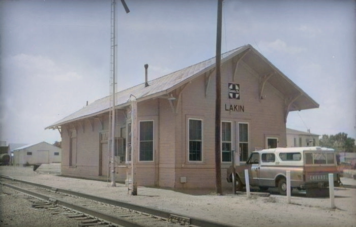
ATSF Depot in Lakin, Kansas.
Lakin’s depot was built in 1882 with an upper story used for living quarters.
The first settlement was made at Deerfield in 1885.
In the mid-1880s, homesteaders began to pour into the area, initiating conflicts with the existing cattle-ranching industry as they claimed land and fenced off the open range. The homesteaders were perceived as a threat to the cattle industry’s way of life, with numerous allegations of ranchers attempting to drive settlers off by destroying crops and setting prairie fires appearing in local newspapers. Towns such as Leeser, established in 1885, and Pierceville, established in 1886, were established to serve the cattle industry but disappeared as homesteading displaced the large cattle herds.
Among the settlers were a small number of Danes and Swedes. In 1885-1886, 13 men purchased claims, among them brothers Hans P. and Rasmus P. Eskelund and their brother-in-law, Louis Hoi. Their families joined them in January 1886, but Louis Hoi and his family returned to New York after three years.
A Jewish Agricultural colony called Touro was founded in Kearny County in 1886.
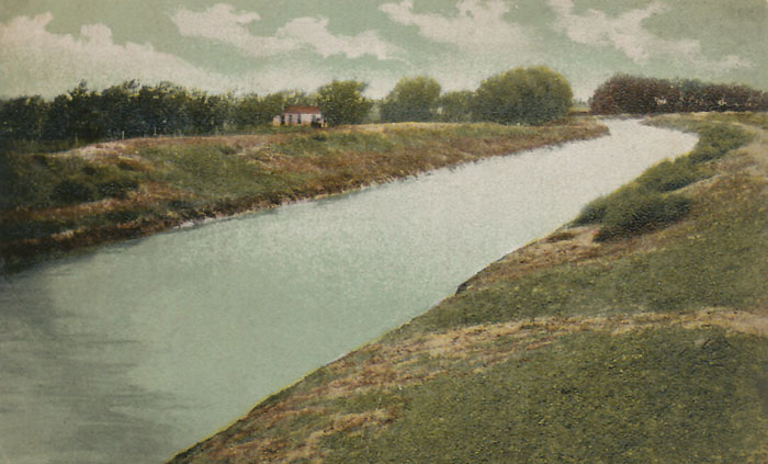
Amazon Ditch.
In 1887, the 42-mile Amazon Ditch was conceived by Asa Soule and C.J. “Buffalo” Jones. These entrepreneurs recognized that to make this part of the country thrive, they needed to harness the Arkansas River for irrigation. Construction began in 1889, and upon completion, the canal had a capacity of 400 cubic feet and could irrigate 8,000 acres. It ran from five miles west of Hartland east to the Finney County line. It was the most significant irrigation feature ever constructed in Kansas. This ditch, along with others in the area, remained in use into the 20th century because many farmers lacked access to windmill-powered irrigation. Many of them learned to raise good crops of certain vegetables without irrigation by cultivating in a manner that conserves moisture. The ditch remains in use and is owned by irrigation farmers today.
In response to a petition, Governor Alexander Martin appointed S.S. Prouty a census taker in 1887. The count of the inhabitants was not an easy undertaking, owing to the fact that each legal voter was entitled to sign the petition of someone in the towns for the county seat. The promoters representing each town did everything they could to ensure that as many as possible were counted who would support them, while leaving those opposed uncounted. This led to several confusing situations. It was alleged that Lakin shipped between 200 and 300 transient voters from Colorado, who were distributed throughout the county. These charges originated in Chantilly, which replaced Kearney as the candidate in the northern part of the county and remained far ahead until the very last of the enumeration, lending some credence to the charges. Hartland openly offered town lots in exchange for signatures to their petition. Governor Martin advised that no person be enumerated who had not been in the county at least 30 days before the beginning of the census.
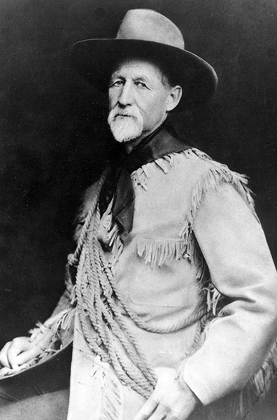
Charles Jesse “Buffalo” Jones.
When Mr. Prouty’s report was submitted to the governor in July, it showed a population of 2,891, comprising 812 householders. The valuation of property, exclusive of railroads, was $1,079,091, of which $799,824 was real estate. Lakin appeared to have the most names on her petition. Still, the attorneys of Chantilly appeared before the governor with charges of fraud, and several hearings were held over the matter that summer. It was later taken to the Shawnee County court. The courts did not sustain the charges against Chantilly.
While all this was happening, the county was growing and prospering. In 1887, an irrigation ditch was projected in the northern part by C.J. Jones. He succeeded in engaging the farmers in that area, and 100 miles of ditch were constructed. This was much more important for the future than the fight over the county seat. A few years ago, the government established an irrigation plant in Deerfield, making it one of the country’s principal irrigation facilities. A reservoir for storing floodwaters from the Arkansas River was constructed in the southeastern region. It was miles long and had a storage capacity estimated at 2.352 billion cubic feet, providing irrigation for approximately 100,000 acres.
In March 1888, Governor Martin issued a proclamation organizing the county, with Lakin as the temporary county seat and naming the following officers: Commissioners, W.J. Price, H.A.W. Cornfield, and Samuel R. Hibbard; county clerk, J.H. Waterman; sheriff, R.F. Thorne. Price and Cornfield were arrested in 1889 on charges of forgery, and Judge A.J. Abbott sustained the charges.
In February 1889, a county seat election was held. Hartland defeated Lakin, but the county officers, who were Lakin men, refused to relocate the offices. Again, the matter was taken to court, and after considerable litigation, the Supreme Court ordered that the records be transferred to Hartland in January 1890.
The Kearney House in Hartland served as a courthouse until it was destroyed by fire on January 17, 1894.
The Columbia schoolhouse was built north of Lakin in 1893, with Willard Miller serving as the first teacher.
Hartland continued to serve as the seat of justice until September 1894, when the county seat was relocated to Lakin, where it has remained ever since.
In 1905-1906, a colony of Mennonites from Harvey, Reno, and McPherson Counties in Kansas settled in the southwest part of the county and the southeast part of Hamilton County.
R.B. Glass built a 12-sided barn in 1909 just west of Lakin with stalls for four horses and six cows and a well in the center. The rigging on the windmill was used to access the loft. The barn was restored and moved onto the museum grounds in 2001. A variety of farm and ranch equipment is available inside, with additional implements located outdoors in the barn and machinery yards.
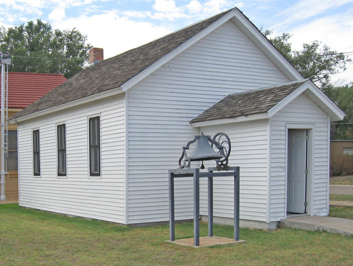
Columbia schoolhouse in Lakin, Kansas. Photo courtesy of the Kearny County Historical Society.
One of the most important crops is broom-corn, which in 1910 brought $225,048. Sugar beets are raised extensively and marketed in Garden City. In 1910, the crop was valued at $97,000; the hay crop at $108,094; wheat at $50,000; and the total value of farm products at $355,094. The assessed valuation of property in 1910 was $5,961,662. The population in the same year was 3,206, an increase of 2,099 (nearly 200%) over the 1900 figure.
The Columbia schoolhouse was used until 1912. It was later gifted to the Kearny County Historical Society.
In the 1930s, the area’s prosperity was severely affected by its location within the Dust Bowl. This catastrophe intensified the economic impact of the Great Depression in the region.
In August 1939, a new courthouse was completed in Lakin at a cost of $70,000. A federal public works grant of $31,5000 helped fund the construction. The Art Deco building at 304 North Main Street continues to serve the county today.

Kearny County Courthouse in Lakin, Kansas, by Kathy Alexander.
In 1974, Jennie Rose O’Loughlin, daughter of John and Mary O’Loughlin, deeded a 1/2 block of land to the Kearny County Historical Society to be used for a museum complex.
The depot closed in 1982, and the historical society purchased the building and relocated it from Main Street. Railroad enthusiasts will appreciate the assortment of telegraphic equipment, train memorabilia, Santa Fe calendars, and insulators on display.
The county’s population peaked in 2000 at 4,531.
Of the dozen or so settlements established in Kearny County, only Lakin and Deerfield remain today.
Today, the Kearny County Museum complex spans over 20,000 square feet of historical displays, comprising the main museum building and annex, the Great White House, the Columbia School, the Santa Fe Depot, the Round Barn, and the Machinery Building.

Lakin, Kansas Museum by Kathy Alexander.
Also Part of the Kearny County Historical Society are Charlie’s Ruts, a set of five swales of parallel ruts and twelve parallel sets of Santa Fe Trail wagon ruts created by the thousands of wagons that traveled the Santa Fe Trail. The ruts are fenced off, but a gate is available, and visitors are encouraged to explore the swales created by 19th-century wagons. They are located about four miles east of Lakin, just off Highway 50
There are two more conspicuous Santa Fe Trail landmarks in Kearny County. About six miles southwest of this, Lakin, on the north side of the river road, is a place called Indian Mound. Even before the Santa Fe Trail was established, this naturally occurring rock formation was used as a wayfinder for nearby Chouteau’s Island. After establishing trade with Santa Fe, this mound was used to denote the location of the Upper Arkansas River crossings and the last significant opportunity to choose between the Mountain or Cimarron routes of the Santa Fe Trail. It is located six miles southwest of Lakin, Kansas, on the north side of River Road.
Located south of Indian Mound, Chouteau’s Island was once a place. Although it has long since been eroded by the Arkansas River, it was once a significant landmark on the trail. It was near here, in the spring of 1816, that Auguste P. Chouteau’s hunting party was traveling east with a winter’s catch of furs when they were attacked near the river by 200 Pawnee Indians. The men retreated to Chouteau’s Island to resist the attack and repel the Indians. In the Battle of Chouteau’s Island, the trappers lost one man, and three were wounded. Seven of the Indians were killed.

Arkansas River, near Lakin, KS. Photo by Kathy Alexander.
©Kathy Alexander/Legends of Kansas, updated December 2025.
Also See:
Santa Fe Trail in Kearny County
Sources:
Blackmar, Frank W.; Kansas: A Cyclopedia of State History, Vol I; Standard Publishing Company, Chicago, IL 1912.
Blanchard, Leola Howard. The Conquest of Southwest Kansas, The Wichita Eagle Press, 1931.
Cutler, William G.; History of Kansas; A. T. Andreas, Chicago, IL, 1883.
Fort Hays State University
Kansas Guidebook – Dead Link
Kansas Post Office History
Kanas Travel
Kearny County Museum
Wikipedia