
Salt Fork of the Arkansas River in Oklahoma by the Department of the Interior.
The Salt Fork of the Arkansas River, a tributary of the Arkansas River located in southern Kansas and northern Oklahoma, has been known by various names in the past, including Grand Sabine River, Grand Saline River, Little Arkansas River, Red Fork of the Arkansas River, and several others/
The approximately 192-mile-long waterway rises in Comanche County, Kansas, and flows initially southeastward through Barber County, Kansas, into Woods County, Oklahoma, where it turns eastward for the remainder of its course through Alfalfa, Grant, Kay, and Noble Counties in Oklahoma. It flows into the Arkansas River in southern Kay County, about seven miles south of Ponca City, Oklahoma.
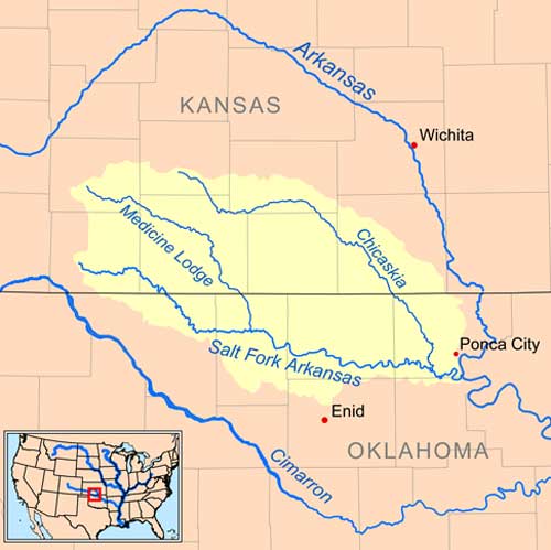
Salt Fork of the Arkansas River Map, courtesy Wikipedia.
In Alfalfa County, Oklahoma, a dam on the river maintains the Great Salt Plains Lake, which is lined with salt flats and is the site of the Great Salt Plains National Wildlife Refuge and a state park. The Salt Fork’s largest tributaries are the Medicine Lodge River, which joins it in Alfalfa County, and the Chikaskia River, which joins it in Kay County, Oklahoma.
©Kathy Alexander/Legends of Kansas, updated May 2026.
Also See:
See Sources.