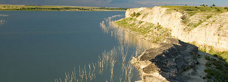
Cedar Bluff Reservoir, Kansas.
The Smoky Valley Scenic Byway is a 60-mile horseshoe path that travels through Trego and Ness Counties in west central Kansas and the Smoky Hill River Valley.
Traveling the byway offers many changing landscapes with rock outcroppings hinting at what lies in the foundation of the chalky limestone left by ancient seas. Along the way, visitors see magnificent landscapes with native grasses and wildflowers, windmills, limestone bluffs, historic trails, and the Smoky Hills, named for their hazy blue-gray appearance at sunrise and sunset.
The Smoky Hills provide a transition between the more easterly mixed-grass prairie and the short-grass of the Great Plains.
The byway crosses the historic Smoky Hill Trail upon which the Butterfield Overland Despatch stage line was established at the end of the Civil War to carry goods and travelers, gold diggers, and pioneers from Fort Leavenworth, Kansas, to Denver, Colorado. Although it was the shortest route to Denver, the trail was considered dangerous, and travel often required the protection of troops stationed at Fort Hays, Kansas.
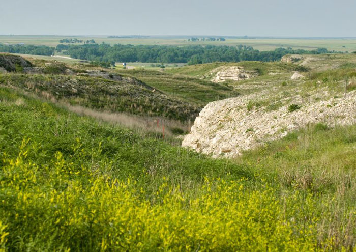
Threshing Machine Canyon, courtesy Kansas Tourism.
Carvings and markings, some 200 years old, can still be seen where travelers carved their names on the walls of Threshing Machine Canyon near Cedar Bluff State Park. Today, two limestone markers along the byway mark where it crosses the Butterfield Overland Despatch Trail.
Threshing Machine Canyon near Cedar Bluff State Park and Reservoir is the site of a 1867 Native American attack on a wagon train transporting a threshing machine to Brigham Young in Salt Lake City, Utah. Smoky Hill Trail travelers carved their names in the canyon walls.
Named for the 100-foot-tall, cedar-covered limestone bluffs along the south side of the Lake, the Cedar Bluff State Park and Reservoir is an excellent place to camp, hike, fish, view wildlife, birdwatch, boat, and play volleyball and horseshoes. The Reservoir hosts many fishing tournaments and other special events throughout the year.
The cities of Ogallah, Brownell, Ransom, and WaKeeney have much to offer while on the scenic drive.
Route Description:
From Ogallah, Kansas, head south on KS-147 South toward K Rd for 24.9 miles; Turn right onto KS-4 West Smoky Valley Scenic Byway for .6 miles; Turn right onto 5th Street to Brownell; then head south on 5th Street toward Davis Ave Smoky Valley Scenic Byway. Turn right at the first cross street onto KS-4 W Smoky Valley Scenic Byway and continue to follow KS-4 West for 8.3 miles, then turn right onto US-283 North for 26.2 miles to WaKeeney, Kansas.
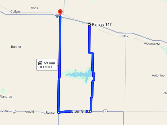
Smoky Hill Scenic Byway Map, courtesy Google Maps.
©Kathy Alexander/Legends of Kansas, September 2025.
Also See:
Sources:
America’s Scenic Byways
Kansas Tourism
National Scenic Byway Foundation
Wakeeney Kansas
Wikipedia