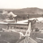
Aiken & Sons Mill on the Verdigris River in Guilford, Kansas, about 1870.
| Town | Post Office Dates | Additional Information |
| Barretts Hill | 1867-1870 | |
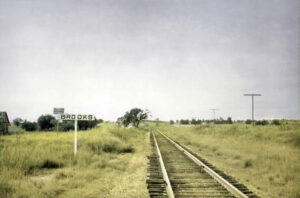
| Brooks | 1880-1905 |
A station on the St. Louis and San Francisco Railroad near the south line of the county. It was located in Newark Township, 15 miles southeast of Fredonia. After its post office closed, it received its mail from Cherryvale in Montgomery County. The population in 1910 was 21. |
| Buffville | 1910-1943 | |
| Buxton | 1887-1921 | The post office moved from Jurett. Established in 1886 when the railroad was built. The Arkansas Valley Town and Land Company owned the land, which was laid out into lots. A station on the Atchison, Topeka & Santa Fe Railroad near the west line, in Duck Creek Township. It was ten miles southwest of Fredonia. In 1910, it had a money-order post office and a population of 50. Buxton was credited with being the most important hay shipping station in the county. |
| Clarke | 1869-1871 | |
| Coyville | 1866-1991 | Coyville, Kansas, the oldest town in Wilson County, is a small community on the Verdigris River in Verdigris Township. It is also an “extinct town,” as its post office closed decades ago. |
| Dildine | 1892-1900 | Located in the extreme northeastern corner of the county, 21 miles from Fredonia and about five miles north of Vilas, the nearest railroad station. After its post office closed, it received its mail from Chanute in Neosho County. |
| Dun | 1879-1905 | A station on the St. Louis and San Francisco Railroad, eight miles southeast of Fredonia and four miles from Neodesha, from which place it received its mail after its post office closed. The railroad’s name was Lazarus Station. |
| Fort Row | None | Fort Row, Kansas, was a small headquarters of the Union Army’s local volunteer-mounted militia in Wilson County. Under the leadership of Captain John Row, the militia was formed in the summer of 1861 to defend the area against raids by Confederate guerrillas operating in eastern Kansas. |
| Greystone | 1867-1887 | The post office moved to Sidell. |
| Guilford | 1868-1886 1888-1922 |
Guilford, Kansas, was a small town on the Verdigris River in Guilford Township of Wilson County. The old townsite is abandoned today. |
| Jurett | 1871-1887 | The post office moved to Buxton. |
| Kalida | None | Kalida, also known as Clifton, was a paper town in the northwest quarter of Section 16, Township 28, Range 15. |
| Lafontaine/La Fontaine | 1879-1991 | Located in Talleyrand Township of Wilson County, Kansas, this town started on March 14, 1879, when a post office was established. Today, it is a ghost town. |
| Middletown | 1873-1903 | Located in Verdigris Township, 14 miles north of Fredonia and eight miles west of Buffalo, the nearest railroad station was. When its post office closed, it received its mail by rural route from Buffalo. |
| Mound Springs | 1870-1872 | |
| Newark | 1870-1871 1882-1884 |
|
| North Altoona | 1911-1918 |
North Altoona was home to the Portland Cement plant, which encompassed 500 acres and was the most modern in the world. Employing 150 to 200 men, it was in operation by January 1, 1909. The plant was managed by Victor Beautner (pronounced Boyntner), who also built a castle for his family above a cliff overlooking the river and the railroad. It towered over the surrounding trees and shrubbery, standing like a sentinel overlooking the countryside. This wealthy family enjoyed a different, more elaborate standard of living, and the local neighborhood was impressed by the Beautner family and their apparent wealth. At the beginning of World War I in 1917, North Altoona and the Portland Cement were among the busiest and most successful in Kansas. After the war, the plant went bankrupt and never operated again. Afterward, visitors toured the plant and the castle, but both were destroyed in 1922, when they were deemed too dangerous for visitors. The plant was located four miles north of Altoona. |
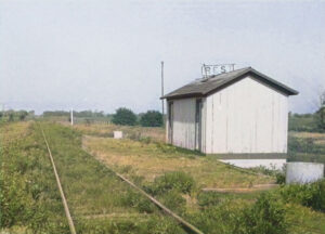
| Rest | 1877-1955 |
A station on the Atchison, Topeka & Santa Fe Railroad, it was located on the line between Colfax and Pleasant Valley Townships, 14 miles northeast of Fredonia. Rest was a trading post before the railroad was built and had several stores, several residences, and a G.A.R. hall. In 1910, it had telephone connections with all other towns in the vicinity, general stores, a money-order post office, and a population of 35. |
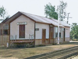
| Roper-Sidell | 1887-1933 |
The town was started in 1886 when the Missouri Pacific Railroad was built. The post office moved from Greystone. The name changed from Sidell to Roper on February 10, 1891. It was located where two branches of the Missouri Pacific Railroad diverged, both heading south, approximately 12 miles northeast of Fredonia. A telephone system connecting Roper to nearby towns went into operation in 1901. In 1910, it had telegraph and express offices, a money order post office, and a population of 40. |
| Sexton | 1900 | The post office order of change was rescinded after five months. |
| Stella | 1898-1900 | |
| Verdi | 1868-1876 | J.A. Beam and three sons settled at Verdi in the winter of 1866-7, and G.W. Hatler took a claim on the west side of the Verdigris River in the spring of 1867. Upon locating, Beam began preparations to install a water mill. That year, A. Pollock took a claim, and Asa Belote, Mr. Ballinger, W.R. Shoup, and Jake Fernwaldt also came. The following year, E.K. Parris and A. Tucker moved their store at Shawver’s Ford to Verdi, where business resumed. The Verdi post office was established on February 5, 1868, with E.K. Parris as postmaster. In May 1869, Verdi received 75 votes for the county seat. By 1870, Verdi had about a dozen houses. Its post office closed on February 7, 1876. |
| Vilas-Burdgeville | 1882-1954 |
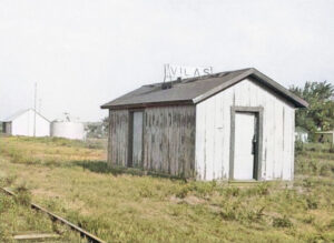
The name changed from Burdgeville to Villas on March 13, 1888. A station on the Atchison, Topeka & Santa Fe Railroad, it was located in Colfax Township, near the eastern county line, 16 miles northeast of Fredonia. The town was started after the building of the railroad in 1886. It was on the border of a splendid gas field, and the strongest well in the county was located three miles northeast. In 1910, it had an express office, a money order post office, and a population of 58. |
| Ward | 1872-1901 | It was located near the east line of the county in Pleasant Valley Township, about 18 miles northeast of Fredonia, the county seat, and 3 or 4 miles south of Vilas. |
| Wilson Creek | 1879-1880 |
©Kathy Alexander/Legends of Kansas, updated January 2026.
Also See:
Sources:
Blackmar, Frank W.; Kansas: A Cyclopedia of State History, Vol I; Standard Publishing Company, Chicago, IL 1912.
Cutler, William G.; History of Kansas; A.T. Andreas, Chicago, IL, 1883.
Kansas Post Office History

