Towns:
Barton County, Kansas
Albert
Claflin
Ellinwood
Great Bend – County Seat
Hoisington
Olmitz
Pawnee Rock
Beaver
Boyd
Dundee
Galatia
Fort Atkinson at Walnut Creek
Fort Zarah/Zarah
Heizer-Heizerton
Odin
Susank
Cheyenne Bottoms Wildlife Area
Quivira National Wildlife Refuge Wetlands
Wetlands and Wildlife National Scenic Byway
Museums & Historic Sites
Santa Fe Trail in Barton County
~~
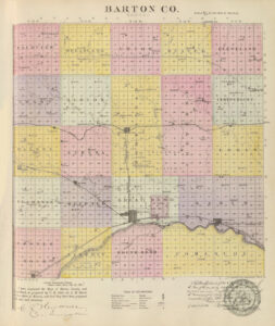
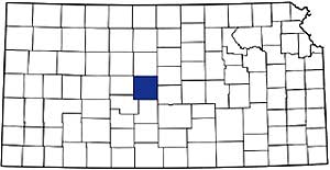
Nearly in the state’s geographical center, Barton County, Kansas, was created by a Legislative Act in 1867 and was named in honor of Clara Barton, the American Red Cross Association founder. The southern half was once part of Washington County, created by a Legislative Act in 1855. The northern portion was first included as part of the unorganized territory attached to the counties lying east of it.
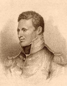
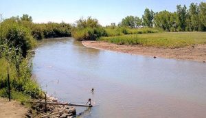
It is thought that the first white men who saw this part of Kansas were the Spaniards under Francisco Vazquez de Coronado. Lieutenant Zebulon Montgomery Pike was the first American to visit Barton County, who led an exploring expedition to the Rocky Mountains in 1806. On October 13 that year, Pike reached the most northern bend of the Arkansas River, about six miles east of present-day Great Bend, where he encamped for several days. Several years later, the Robert McKnight party, with a train of pack mules, followed the trail along the Arkansas River in 1812. In 1820, Major Stephen Long’s expedition passed along practically the same course. This early route later became the historic Santa Fe Trail.
For the next 50 years, wagons hauled valuable trading supplies up and down the Santa Fe Trail through present-day Barton County, leaving a volume of history in their wake. Along this path came such men as Kit Carson and General Stephen Kearny, leading his “Great Army of the West” in 1846 to fight the Mexican-American War. In 1849, thousands of people blazed the trail to find their fortunes during the California Gold Rush.
Many of these travelers faced Indian attacks, including a Cheyenne raid a few miles near Great Bend in 1853. As a result, soldiers were ordered to briefly establish a camp near present-day Great Bend in June 1853, but they stayed only about a month.
In 1855, Lieutenant Francis T. Bryan of the Corps of Topographical Engineers blazed the Fort Riley-Fort Larned Military Trail that crossed Walnut Creek seven miles northwest of its mouth on the Arkansas River. Later, a branch connected the trail to Fort Zarah. That same year, the first white men — William Allison and Francis Boothe, built an adobe trading post near present-day Great Bend.
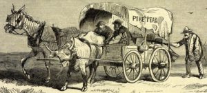
Two years later, Boothe became the first settler to be murdered when a Mexican man, passing along the Santa Fe Trail, split his head with an ax in 1857. The remaining owner, William Allison, prospered as the trail once again boomed in 1858 with the start of the Pike’s Peak Gold Rush, as many took the “Mountain Branch” of the Santa Fe Trail from Dodge City to Colorado. However, Allison died of heart failure in 1859, and the ranch was then taken over by a man named George Peacock, and the posts’ name was changed to Peacock Ranch. But for Peacock, his time would also be short.
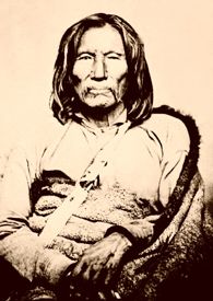
In 1859, a local Kiowa Chief named Satank (Sitting Bear) was arrested after almost “passing out” after drinking too much at the Peacock Ranch. Satank escaped and, the following year, asked Peacock to write a letter of introduction saying he was a “good Indian.” However, Peacock instead wrote that Satank was a “bad Indian,” and Satank, who couldn’t read English, passed it on. He later learned of Peacock’s deceit and, in the fall of 1860, led his warriors to the ranch, where they killed Peacock and five other men and stole all of the livestock.
The trading post was then taken over by a trader and buffalo hunter named Charles Rath, and the post became known as Rath’s Ranch. Rath expanded the operations to include a stagecoach hotel, a restaurant, a post office, and a saloon.
On May 17, 1864, Cheyenne Indians attacked the site, but fortunately, Rath, who was married to a Cheyenne woman, had learned of the attack and escaped.
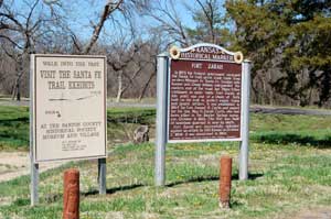
Due to the frequent Indian attacks in the area, Camp Dunlap was established two miles east of present-day Great Bend in July 1864. Situated where the Santa Fe Trail crossed Walnut Creek, it was initially little more than a camp of tents and dugouts near the Rath Ranch Trading Post site. However, work soon began on a more permanent facility about 100 yards distant, which was renamed Fort Zarah. Though the area then had a military presence, the Indian attacks would continue for several years, including numerous attacks on the fort itself.
By 1867, the Atchison, Topeka & Santa Fe Railroad was pushing through the county, and William F. “Buffalo Bill” Cody spent a considerable amount of time hunting buffalo to feed the railroad workers. During this time, he was captured by Kiowa Indians but was later able to escape. That same year, Charles Rath was accused by the U.S. Army of selling liquor to the Indians at his trading post. He left the area to make a name for himself in Dodge City.
On May 19, 1868, the trading post, which had long been the only building in the county, was destroyed by the Cheyenne and never rebuilt. By the following year, the vast majority of the area’s Indians had been brought “under control,” and Fort Zarah closed.
The first settlers to file for land ownership in Barton County were John Reinecke and Henry Schultz in April 1870 in what would become the settlement of Heizer on Walnut Creek, about six miles northwest of present-day Great Bend.
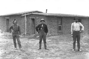
Others who came to the county in 1870 were W. C. Gibson, Gideon F. Mecklem, William Jous, Antone Wilke, George Berry, and Mike Stanton. They also settled along Walnut Creek in Buffalo and Walnut Townships. Most of the pioneer homes were rude dugouts and sod houses. The first log house was built late in 1870 by Mr. Mecklem and was provided with loopholes and small windows as a defense.
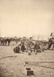
The principal occupation of the early settlers was killing buffalo. They used the flesh and tongues for food, sometimes selling the meat at the nearest settlements, while the hides were tanned and sent to the markets in the east. A few tried farming but were unsuccessful, as the buffalo tramped out the crops and wallowed in the soft plowed ground.
Zarah was the first town established in the county. It took its name from Fort Zarah and was established by a party from Ellsworth, Kansas, in 1870. Located about a mile east of the fort, the first post office was established at Zarah in 1871. The town would later disappear when Fort Zarah was torn down, the property sold, and nearby Great Bend began to emerge.
The first recorded settlers in Great Bend Township were Edward J. Dodge, who made a homestead entry on January 23, 1871, and D. N. Heizer, who settled in May of the same year. Other pioneers of that year were John Cook, W. H. Odell, Thomas Morris, George Moses, and Wallace Dodge.
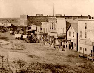
The first permanent business building in present-day Great Bend was built in the fall of 1871 — a hotel called the Great Western. At the time, only about ten people were living there. That year, because of its location on the railroad, Great Bend became a secondary market in the cattle trade, bringing it all the rowdy aspects of other Kansas cowtowns. In the winter, the first murder occurred in Zarah when a Texas cowboy was pistol-whipped and shot to death by Jack Jaminson. A few more would follow during Great Bend’s cowtown heydays before it would settle into a quieter agricultural community and regional trade center. In 1873, one of Great Bend’s first settlers, Edward J. Dodge, built a stone house that continues to survive and stands at the Barton County Historical Museum today.
Barton County was attached to Ellsworth for judicial and revenue purposes for about five years after its creation. Still, in 1871, voters and populations were required to be entitled to a separate organization. Accordingly, a petition was presented to the governor asking that the county be organized. On May 16, 1872, Governor Fred Harvey proclaimed the organization of the county and declared Great Bend the temporary county seat. By the following year, officers and commissioners had been elected, and a vote placed Great Bend as the permanent location of the county seat, winning out over Ellinwood and Zarah.
Soon after Barton County was organized, some difficulty arose between the authorities of Ellsworth and Barton Counties concerning the payment of taxes. Some of the settlers had already been placed on the tax rolls by the assessor of Ellsworth County before Barton was organized and had paid their taxes to the Ellsworth County Treasurer. For a time, the Ellsworth County officers refused to pay over to Barton County the taxes thus collected, but matters were finally amicably adjusted.
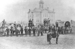
The settlement of Barton County was both rapid and steady. The first school in the county was a private one established in 1872 by James R. Bickerdyke. However, in December of that year, bonds were voted for the first public school. Soon, an election passed bonds to build a courthouse and jail, which was completed in 1873.
Several Germans lived around Ellinwood, where F. A. Steckel opened a store in 1874 and started a grist mill. The following year, the first brewery in the county and the first in this part of the state was erected at Ellinwood. Several Russians also immigrated to the area, settling about seven miles west of Great Bend.
Many early settlers were Catholics who erected the first church building in the county in Lakin Township in the fall of 1877. The Methodists built the second church the following winter.
Though the county did not grow quickly, it had about 10,000 residents by 1880, most of whom worked in farming, timber, and raising livestock. With several railroads running through the county, it continued to develop as a transportation hub and, by 1910, reported almost 18,000 people.
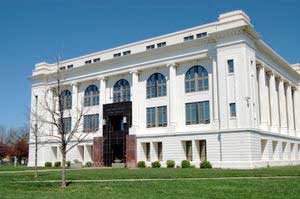
As the county prospered, a new courthouse was built in 1917 in the Classical Revival style, which continues to stand today. The 1930s brought more prosperity when oil was discovered near Great Bend. Within no time, there were some 3,000 producing wells in the county.
The county’s population peaked in the 1960s, with more than 32,000 people calling it home. Today, Barton County’s estimated 26,100 residents are supported by a diverse economy, including agriculture, oil, manufacturing, and medicine as its primary businesses.
Barton County’s rich history can be seen at the Barton County Historical Society Museum and Village in Great Bend, the Hoisington Historical Museum in Hoisington, and the Pawnee Rock State Historic Site. This sandstone citadel marked the halfway point of the Santa Fe Trail. The county is also home to the Cheyenne Bottoms Wildlife Area, a portion of the Wetlands and Wildlife National Scenic Byway, and Quivira National Wildlife Refuge Wetlands.
©Kathy Alexander/Legends of Kansas, updated December 2024.
Also See:


