
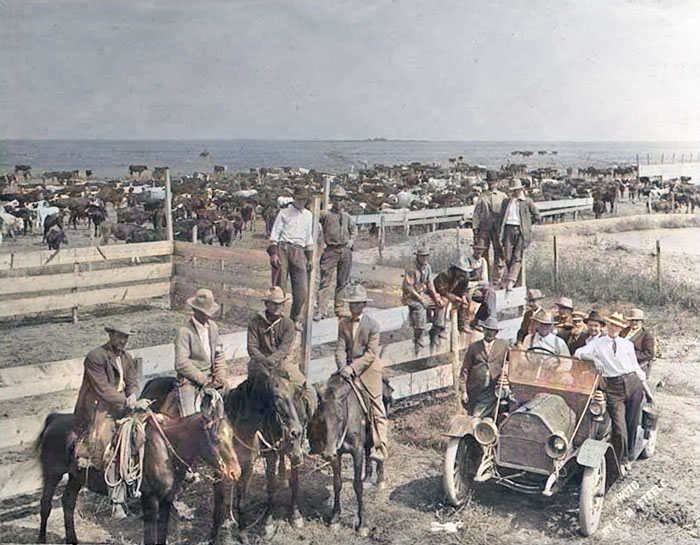
Haskell County Cattle at Farm Pond by Francis Marion Steele, about 1900.
Haskell County, Kansas, location.
Towns & Places
Satanta
Extinct Towns of Haskell County
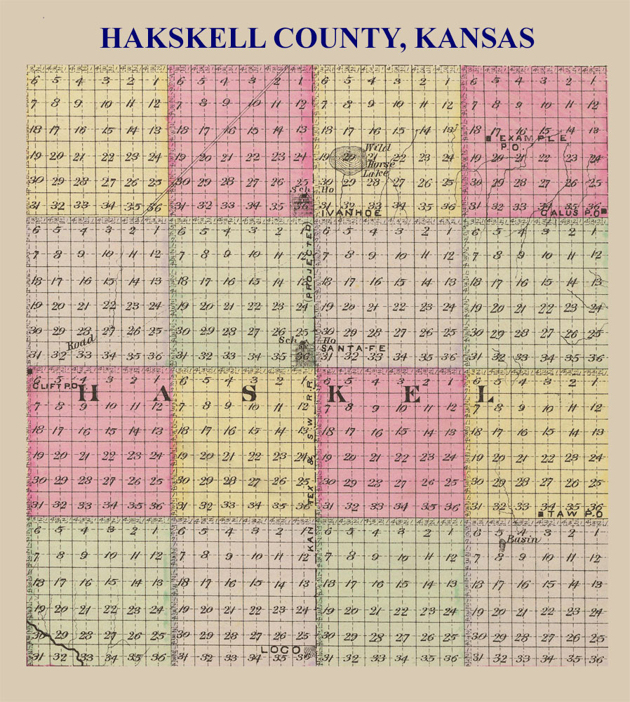
Haskell County, Kansas Map by L.H. Everts & Co, 1887.
Santa Fe Trail in Haskell County
Haskell County, Kansas, located in the southwestern part of the state, lies about 30 miles north of Oklahoma and 53 miles east of Colorado. It is situated in the High Plains region, where the Ogallala Aquifer supplies water for these vast flatlands. It is the most level county in Kansas. Its county seat and most populous city is Sublette. As of the 2020 census, the county population was 3,780, and the total area was 578 square miles, of which 578 square miles is land and 0.4 square miles is water.
The surface of Haskell County is generally level or gently rolling prairie. The only watercourse in the county is the Cimarron River, which flows across the extreme southwest corner; the absence of streams resulted in a corresponding scarcity of timber. However, a few artificial groves were planted early on. There are a few natural springs in the county, and good, healthy water was obtained at depths of 50 to 100 feet.
Haskell County Cattle Men by Francis Marion Steele, about 1900.
The Cimarron Route of the Santa Fe Trail passed through Haskell County. This shorter, faster alternative to the Mountain Route presented other challenges. It crossed dry, rugged terrain that offered little water. It also passed through Plains Indians‘ hunting lands.
Haskell County’s first settlers began arriving in 1885. A small number of them were immigrants from England, Germany, and Ireland. The remainder came from the eastern Midwest, including Illinois, Ohio, Iowa, and Missouri. A few cattlemen established ranches, and emigrants from the older states added to the population.
Many newcomers took advantage of the Homestead Act by filing claims for 160 acres and agreeing to reside on them for five years.
Very early records show that the first transcript from Finney County recording Haskell County land was dated August 10, 1885, and recorded from the Ivanhoe Town Company to Theodore Haering.
Haskell County was created by a legislative act on March 5, 1887, and was named after Dudley Haskell, a U.S. Congressman from Lawrence, Kansas.
On March 31, 1887, Governor John Martin appointed Charles A. Stauber to take a census and appraise the property in the county. Stauber filed his report with the governor on June 27, showing that there were 2,841 inhabitants, of whom 556 were householders, and that the value of the taxable property was $850,119. Upon receipt of this information, the governor issued his proclamation on July 1, 1887, declaring the county organized. He appointed as commissioners James E. Marlow, Joseph Comes, and C.H. Huntington; the county clerk, Lowry C. Gilmore; the sheriff, J.B. Shumaker; and designated Santa Fe as the temporary county seat. The question of the location of the county seat had been decided by popular vote before the governor issued his proclamation, with Santa Fe receiving 562 votes, Ivanhoe 396, and Lockport 1.
Because the county lacked a railroad in its early years, stage lines connected the towns of Ivanhoe, Santa Fe, and Loco.
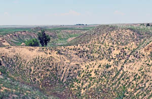
The Cimarron Riverbed near Satanta, Kansas, is dry by Kathy Alexander.
At the general election on November 8, 1887, a full quota of county officers was chosen as follows: Representative, M.C. Huston; Probate Judge, A.P. Heminger; Clerk of the District Court, W.F. Felton; County Clerk, W.E. Banker; County Attorney, C.R. Dollarhide; Register of Deeds, L.A. Crull; Treasurer, J.M. Beckett; Sheriff, J.P. Hughes; County Superintendent of Schools, L. McKinley; Surveyor. W.M. Haley; Coroner, J.C. Newman; Commissioners, James E. Marlow, C.H. Huntington, and A.T. Collins.
Originally, Haskell County was divided into nine townships, including Example, Lockport, Boone, Ivanhoe, Haskell, Loco, Arapahoe, Dudley, and Review. However, soon afterward, these were combined into the three present-day townships—Dudley, Haskell, and Lockport —each eight miles wide and 24 miles long.
The first school district in the county was founded in Santa Fe in 1887.
Haskell County is bounded on the north by Finney County; on the east by Gray and Meade; on the south by Seward, and on the west by Grant County. It is exactly 24 miles on a side, with an area of 576 square miles (368,640 acres).
Because the county lacked a railroad in its early years, stage lines connected the towns of Ivanhoe, Santa Fe, and Loco. Santa Fe was named the first county seat.

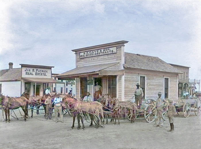
Santa Fe, Kansas, Main Street.
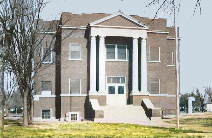
The county was established in 1887, and Santa Fe was designated the county seat. The first courthouse was a wood-frame structure erected in 1887.
First Haskell County Courthouse in Santa Fe, Kansas.
The opening of new lands in Oklahoma and the lack of railroad facilities led many early settlers to leave the county. In 1890, the population was 1,077, less than one-half of what it had been when the county was organized, and by 1900, it had declined to 457.
In 1910, the decline reversed, and the county’s population was 993, a gain of 536 in ten years, or more than 120%. Completing the Garden City, Gulf & Northern Railroad through the center of the county, north and south, provided the county with improved shipping and transportation facilities.
At that time, the county reported 19 organized school districts with a school population of 340. Agriculture was the principal occupation, with the leading crops being wheat, milo, maize, Kafir corn, sorghum, and broom corn. The value of farm products in 1910 was $214,337, and the assessed property valuation was $2,321,605.
When the Atchison, Topeka & Santa Fe Railroad reached the county in 1912, it bypassed the county seat of Santa Fe. At that time, there were 250 to 300 people in Santa Fe. The line was constructed from Dodge City to Elkhart, Kansas, bypassing Santa Fe by seven miles and sealing its fate.
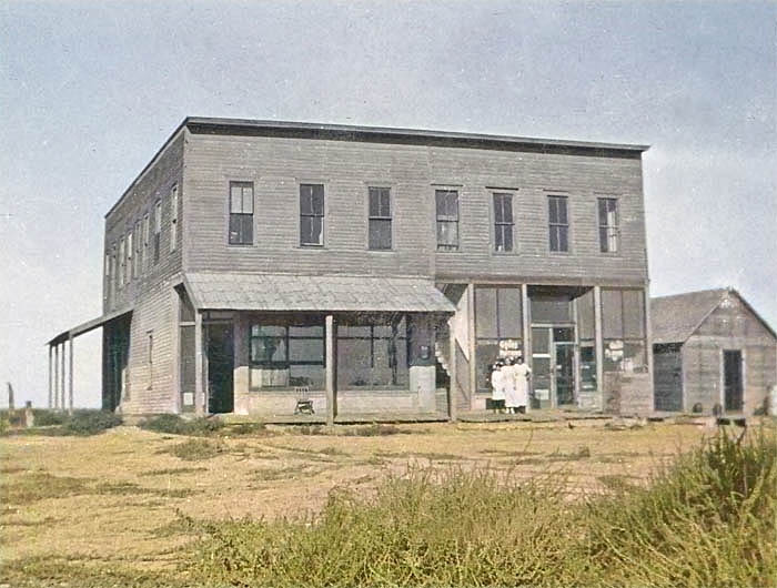
Moving S.E. Cave’s office building from Santa Fe to Sublette.
Steve Cave was the first to prepare to move, trading his Santa Fe lots to the railroad for new lots in Sublette. Jim Patrick moved his real estate office to Satanta, nine miles southwest of Sublette. A considerable part of Santa Fe’s population followed him there, but most of them went to Sublette. Sublette was named the county seat for fur trapper William Sublette.
On February 5, 1913, a referendum was held in Haskell County to relocate the county seat to Sublette, approximately eight miles to the southeast. It would be the first election in which women were eligible to vote. However, the measure failed.
The first rodeo and fair of Haskell County was held in Sublette in 1916, and the fair continues at the same location.
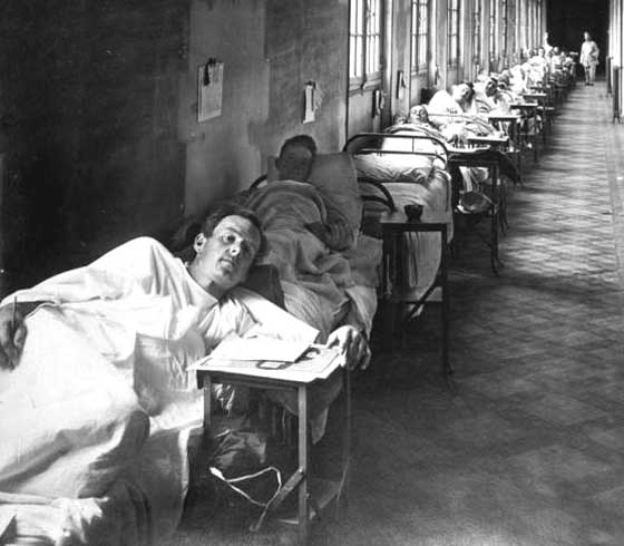
Soldiers With Flu, 1918.
In 1918, Historian John M. Barry concluded that Haskell County was the location of the first outbreak of the Spanish flu pandemic, which killed between 21 and 100 million people. Dr. Loring Miner, a Haskell County doctor, warned the editors of Public Health Reports of the U.S. Public Health Service about the new and more deadly variant of the virus. It produced the common influenza symptoms with a new intensity: “violent headache and body aches, high fever, and non-productive cough… This was violent, rapid in its progress through the body, and sometimes lethal. This influenza killed.
Soon, dozens of patients — the strongest, the healthiest, the most robust people in the country were being struck down as suddenly as if they had been shot.” Barry wrote that in the first six months of 1918, Miner’s warning of “the influenza of a severe type” was the only reference in that journal to influenza anywhere in the world. Unfortunately, Miner’s report was not published until April 1918 and failed to attract the attention it required. It was not until after 2000 that historians’ research revealed the origin of one of the deadliest epidemics in human history.
If the virus did not originate in Haskell County, there is no plausible explanation for its arrival there. There were no other known outbreaks anywhere in the United States from which someone could have carried the disease to Haskell County, and no suggestions of influenza outbreaks in either newspapers or reflected in vital statistics anywhere else in the region. And unlike the 1916 outbreak in France, authorities could trace with perfect definiteness the route of the virus from Haskell County to the outside world.
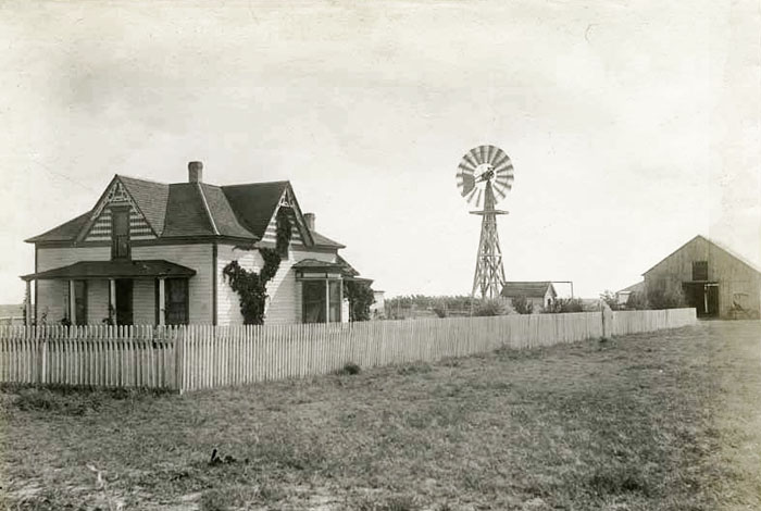
Haskell County Farm by Francis Marion Steele, about 1900.
Historians have generally reported that the disease spread beyond Haskell County when newly inducted soldiers from the county traveled 200 miles to Camp Funston (now Fort Riley) and were then deployed to Europe at the beginning of the United States’ involvement in World War I.
Haskell County is situated in a central migratory flyway for 17 bird species. Scientists wonder whether migratory birds could have played a role in the spread of the 1918 Spanish flu. In February 1918, residents of the county fell ill. The Santa Fe Monitor reported numerous accounts of pneumonia, sickness, and “la grippe.” Men who lived in the county were called to duty at Camp Funston in Riley County. Days later, on March 4, 1918, the first soldier reported ill with influenza. Within two weeks, 1,110 soldiers were admitted to the hospital.
However, Haskell County’s role in the pandemic is widely disputed. Many pathologists believe that Haskell County did not play a role in the virus’s origin and that historical accounts are entirely coincidental.
The 1920s saw agricultural fortunes improve as bumper crops were harvested, but crop prices fell sharply.
The second Haskell County Courthouse was built in Sublette in 1923.
The second courthouse was designed by Smith & English and constructed by L.E. Riggs & Company in 1923.
Haskell County, like the nation as a whole, was thrust into the Great Depression of the 1930s. Perhaps the farmers could have survived one disaster, but concurrent with the Depression was the severe drought that found the county in the heart of the Dust Bowl, and conditions gradually worsened. Once again, an exodus began, and as the population shifted mainly to the far West and Northwest, abandoned farmsteads were abundant in Haskell County, many never to be reclaimed or rebuilt.
The railroad, the development of oil and gas fields in the 1930s, and the siting of many deep wells for irrigation significantly improved the area’s economy, helping to overcome the “Dust Bowl” of the period. Haskell County was among the hardest-hit counties in the Midwest during the 1930-1937 drought. Farmers learned to adapt agricultural methods to minimize erosion. Crop rotation and irrigation also helped farmers recover, and agriculture remained the primary industry until oil and gas production expanded to the county in the 1940s.
In 1945, ambitious young men returned from the war, some to study agriculture or other subjects in college under the G.I. Bill, many to return to the farm for practical experience and education. New technologies across all areas were being explored. A tremendous boost was given to the area when the Hugoton Gas Field expanded, and Haskell County, at last, had an industry other than agriculture. Its cities no longer depended entirely on farmers and ranchers. In 1945, 41 gas wells were brought online. The population increased with the appearance of gas wells across much of the county, accompanied by the many people who drilled, produced, and sold gas and oil.
In the next three decades, the supply of underground water brought to the surface increased, and Haskell County finally lived up to its promise of “The Garden of the West.” It soon became one of the state’s top-producing irrigated counties, attracting individuals to drill and service wells, sell equipment, and work in the fields. Still, more workers were needed in the many feedlots our county acquired through irrigation and the resulting abundant feed grains.
In the 1980s, Haskill County again experienced a recession driven by surplus crops, low prices, and declining irrigation water.
Haskell County’s population peaked in 2000 at 4,307.
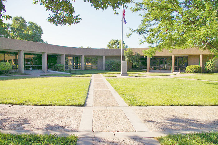
Haskell County Courthouse in Sublette, Kansas, courtesy of American Courthouses.
The present-day courthouse in Sublette was built from 1977 to 1978 at 300 South Inman Street and East Chouteau Avenue. It was designed in the Modern style by the Gibson and Mancini Partnership and built by the McBride and Dehmer Construction Company. The one-story glass-and-concrete building faces north on landscaped grounds in the center of Sublette. The building forms a semi-circle facing northwest onto a grass courtyard. Concrete pillars support the extended roof, which features recessed glass walls. The roof line is flat. In the interior, the County District Court courtroom is located at the southwest corner. The building houses the County District Court of the 26th Judicial District, which includes Grant County, Morton County, Seward County, Stanton County, and Stevens County.
By 2017, the county was second in oil production in the state.
Exceptionally well-suited to wheat and cattle production, ranching has been an essential part of Haskell County, where cattle, hogs, and other types of livestock have flourished. Today, the county has one of the largest inventories of cattle and calves in the state. Farming also remains important and is among the top producers of corn and sorghum.
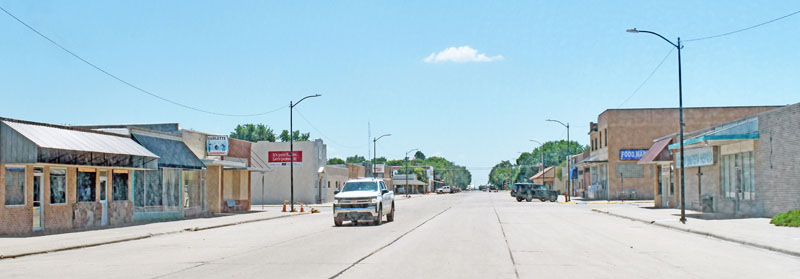
Sublette, Kansas Main Street by Kathy Alexander.
©Kathy Alexander/Legends of America, December 2025.
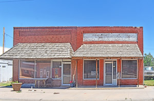
Main Street buildings in Satanta, Kansas, by Kathy Alexander.
Also See:
Extinct Towns of Haskell County
Santa Fe Trail in Haskell County
Sources:
American Courthouses
Blackmar, Frank W.; Kansas: A Cyclopedia of State History, Vol I; Standard Publishing Company, Chicago, IL 1912.
Digging History
Fort Hays State University
Kansapedia
Kansas Gen Web
Kansas Memory
Wikipedia