Kaw Point Park, in the Fairfax District of Kansas City, Kansas, marks the spot where the Kansas River — informally called the Kaw — flows into the Missouri River. Upstream from the rivers’ confluence, the meandering Missouri River doubles as the boundary between Kansas and Missouri. Downstream, the river and state line part ways where the river makes a sharp turn into Missouri, and the state line heads south and west through the state of Missouri to the Mississippi River at St. Louis.
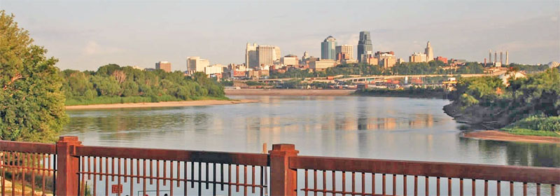
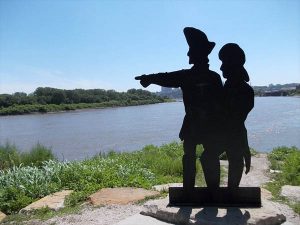
The ten-acre park in Wyandotte County offers a sweeping view of the rivers and the surrounding urban landscape, including the Kansas City, Missouri, skyline and the visible line where the darker water of the Kansas River meets the lighter-brown Missouri. Trails, picnic areas, a boat ramp and docking area, and an outdoor amphitheater equipped with electricity for performing arts and special events are among the amenities. An open-air education pavilion highlights the Lewis and Clark Expedition. The park is in a natural state with beautiful wooded trails, wildflowers, and wildlife.
Kaw Point is within the land claim bought by the United States as part of the massive Louisiana Purchase in 1803; it was previously claimed by Spain, then by France.
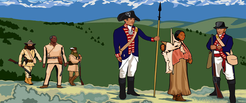
On May 14, 1804, President Thomas Jefferson sent Captain Meriwether Lewis and Lieutenant William Clark, along with the initial crew of 51 men, “to trace the Missouri to its source, to cross the Highlands, and follow the best water communication which offered itself from thence to the Pacific Ocean.”
The Lewis and Clark Expedition arrived at Kaw Point on June 26, 1804. The expedition camped there for three days to rest, repair their boats, hunt, take mathematical measurements of the area, build a six-foot-high temporary fortification of logs and brush, and explore the surrounding countryside.
Lewis weighed the water of the two rivers and found the Missouri’s to be heavier, meaning it carried more mud. Still, Clark found “the waters of the Kansas are very disagreeably tasted to me.”
They also saw their first buffalo, but they had to wait eight more weeks, until August 23, before they succeeded in killing one.
Captain William Clark wrote on June 27, 1804, that “the country about the mouth of this river is very fine. The expedition’s journals noted that the location would be appropriate for a fort, and teemed with deer, elk, bison, bear, and many “Parrot queets”, the now extinct Carolina parakeet.
The group also engaged in martial law for the first time during their journey. Just after midnight, June 28-29, Private John Collins was on guard duty. He tapped a community whiskey barrel, thinking, “Just one little sip wouldn’t hurt. Just one more. Another.” Soon, he was drunk. When Private Hugh Hall came to relieve him of his duty, Collins offered him a drink, and Hall accepted, and they were soon drunk together. At dawn, the sergeant-of-the-guard put them under arrest, and shortly thereafter, Clark began drawing up court-martial papers to be presented to a court composed of the men of the expedition.
Collins was sentenced to 100 lashes on his bare back, and Hall was sentenced to 50. “The Commanding Officers approve of the Sentence of the Court and order that the punishment take place at half past three this evening.” Afterward, the expedition didn’t lose their services; both men were at the oars – groaning, but at the oars – as they left Kaw Point that afternoon.
Kaw Point defined Missouri’s western border from Iowa to Arkansas when it became a state in 1821.
Kaw Point became part of the Kansas Territory in 1854 when the United States Congress passed the Kansas-Nebraska Act, which opened the area for white settlement.
In 1859, the city of Wyandotte, which included Kaw Point, was incorporated. Kaw Point became part of Kansas City, Kansas, as part of the consolidation of 1886.
Starting in the early 20th century, the once wider and muddier Missouri was engineered to control flooding, enhance navigation, and provide hydropower and water for cities and industries. The Kansas River, which starts at the confluence of the Republican and Smoky Hill rivers in Junction City, is a source of drinking and industrial water, sand and gravel, and recreation.
The National Park Service established Kaw Point Park, a 10-acre area including Kaw Point, a wooded area, a boat launch ramp, an amphitheater, and a tribal memorial.
Today, the confluence of the two rivers is thought to have shifted a quarter mile upstream on the Missouri due to flooding, erosion, and other forces.
By the early 2000s, the area around the confluence was strewn with overgrown brush, rusted steel drums, old equipment, and abandoned cars in the midst of industrial development. As the bicentennial of the Lewis and Clark Expedition drew near, the site was revamped and opened to the public. The nonprofit Friends of Kaw Point Park, Inc., manages it.
In 2012, Kaw Point Park was designated as a Lewis and Clark Destination Site on the Lewis and Clark National Historic Trail by the National Park Service.
Located along the river, the park has access to highways with an infrastructure that supports a large number of visitors.
The park is open from 7:00 a.m. to 10:00 p.m. daily.
©Kathy Alexander/Legends of America, September 2025.
Also See:
Corps of Discovery – The Lewis & Clark Expedition
Old West Explorers, Trappers, Traders & Mountain Men
Sources:


