Towns & Places:
Altamont
Bartlett
Chetopa
Dennis – Unincorporated
Edna
Labette – Extinct
Mound Valley
Oswego – County Seat
Parsons
Extinct Towns of Labette County
Big Hill Lake
Idle Hour Lake
Lake Parsons
The Bloody Benders – Serial Killers of Kansas
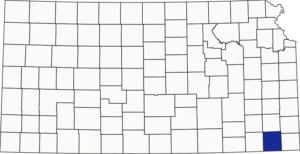
Labette County, Kansas, is located in the southeast part of the state. It was named after Labette Creek, the county’s second-largest creek, which runs from near Parsons to Chetopa. The county seat is Oswego, and Parsons is the most populous city. As of the 2020 census, the county population was 20,184, and the total area was 653 square miles, of which 645 square miles was land and 7.8 square miles was water.
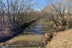
Labette Creek was named after French-Canadian fur trapper Pierre LaBette, who moved to the area in the 1830s and 1840s, lived along the Neosho River, and married into the Osage tribe.
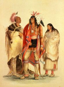
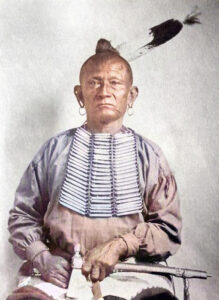
The first white man to make a permanent settlement within the county’s limits was John Mathews, who established a trading post among the Osage Indians, where Oswego now stands, in 1840. At that time, Labette County’s population consisted mainly of Osage Indians, with many Cherokee and Euro-Americans as well. Many of the Euro-Americans were merchants with Osage or Cherokee wives.
Larkin McGee, who came to the county in 1847 and established a trading post where Chetopa now stands, found five families there. They were the families of Mrs. Tianna Rodgers, William Blythe, Finchel Monroe, Daniel Hopkins, and a man named Tucker. John Mathews had attained considerable prosperity by that time, owning a two-story frame house, fine-blooded racehorses, and a private race track. He took his horses to all the big races in the West and was very successful.
James Childers established one of the earliest trading posts in the county.
In 1857, Dr. George Lilse, formerly a prominent physician of Belmont, Ohio, obtained leave from A.J. Dorn, Indian Agent, to settle in the southeast part of the county. Lisle, along with Abraham Ewers, George Ewers, and Samuel Steel, came to the present-day site of Chetopa, built a double-log house, a shop, and an office, and established a trading post and a gun shop at the former site of James Childers’ trading post.
In early 1858, J.P. Barnaby, a preacher from the Southern Methodist Church, established a circuit that included this settlement and encompassed a radius of about 150 miles. In October of that year, Reverend J.E. Ryan succeeded in the circuit. These parties, with several half-breeds and Cherokee Indians along the Neosho River, made up the bulk of the settlement that had been made within the territory afterward, including within the limits of Labette County, up to the beginning of the Civil War.
The first post office in the county was granted to Chetopa in 1859. However, there was no mail route to that point and no means of securing the service, so the office did not open until 1861, when a route was established.
During the Civil War, very little was done regarding settlement. At an early stage of the war, John Mathews allied himself to the cause of the Confederacy, was commissioned a captain, and led a meeting on June 4, 1861, to organize Cherokee, Osage, and white people living in the area known as “the Neutral lands” to join the Confederacy. Some of these men killed Union men, brutally treated the residents, and burned the town of Humboldt in September and October 1861, leaving only the Masonic lodge standing, and led a raid on Father Schoenmakers’ Jesuit-run Osage Mission’s post in present-day St. Paul. Mathews was killed by Union soldiers from Fort Scott, Kansas, on September 18, 1861.
However, the trouble with the Confederate bands continued until United States troops finally pursued them in November 1863, when about 300 soldiers, comprised of half-breed Indians and whites, under the command of Captain Willits, Adjutant Able, and Lieutenant Joslyn, came into the county. Stating that they were acting under orders from their superior officers, the soldiers burned about 40 houses and property near Chetopa to prevent their falling into the hands of the rebel army. The settlers were driven to Council Grove, and James Childers was brutally murdered for his money and left unburied as his neighbors were refused permission to bury him. The male residents were all arrested and tried by court-martial on the charge of assisting the rebels. This devastation of the country temporarily destroyed the settlement. Most had left for more secure quarters, others entered the armies of the North or South, while some fell victim to this difference of opinion upon the threshold of their homes.
Afterward, only two white men lived within the county’s limits: S.M. Collins and A.T. Dickerman, who had received Osage Chief White Hair’s consent to locate four miles south of present-day Oswego.
In 1865, news of the treaty with the Osage tribe triggered a surge of immigrants into Labette County, who settled on the land even before the treaty was ratified and while the Osage were away on a hunting expedition. When the Indians returned and found their lands occupied by the whites, they were very much dissatisfied and asked their agent to have the intruders removed. An order was issued commanding all settlers to leave the Osage lands. This created considerable consternation and prompted approximately 300 settlers to meet at Hickory Creek. A deputy was appointed to deliver a petition to the Indian agent, requesting permission for the settlers to reside on their claims. An agreement was finally reached, under which each claim holder was to pay the Indians $1 per year until the treaty was ratified and they received compensation for their lands, which occurred the same summer.
In the fall of 1865, immigration began again, and among those who settled at this time were J.C. Rexford, A.P. Elsbee, C.C. Clover, D.M. Clover, Bergen VanNess, C. E. Simmons, Norris Harrar, Cal Watkins, William White, and Sons, and Grant Reeves, most of them located along the Neosho Valley.
The winter of 1866 was unusually harsh. The weather was cold and bleak, and the cabins were insufficiently insulated. The streams were swollen, so securing provisions was impossible for some time. The food for cattle and horses ran out, and as it was impossible to procure more, most of the animals died of starvation or disease. In the spring, many settlers lacked the means to farm their land. The Indians, who had been paid for their lands and had moved away, came back to steal from the settlers and intimidate as many as possible into paying rent.
In February 1866, the settlers of Labette and Hackberry Creeks formed the Hackberry Mutual Protection Society to protect their members and property from the Indians. Similar organizations were established in other parts of the county, and a countywide organization was established in May. Speedy retribution was imposed on perpetrators of various forms of lawlessness.
The 1867 legislature established Labette County, and the governor temporarily designated Oswego as the county seat. The question of selecting a permanent county seat location was submitted to the voters in the regular election on the third Tuesday of May 1867. Three places were voted upon: Oswego, Montana, and Salem. The vote on these stood as follows: Oswego, 156; Montana, 145; and Salem, 84. Since no one place received a majority of all votes cast, no choice was made. The commissioners then ordered a special election to determine the seat of government, to be held in two weeks. The two places that received the most votes in the last election were Oswego and Montana. The election was duly held and resulted in a victory for Oswego, where the seat of government was permanently established.
The first courts were held on the second floor of the Buntain Building and the second floor of the Fleming Building in Oswego. The first courthouse was a one-story frame building erected in 1868 and transferred to the county in 1869.
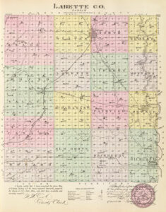
The county was divided into 16 civil township organizations.
Upon the organization of the county, J.F. Newton was appointed County School Superintendent by the governor. Immediately upon assuming office, he officially organized school districts in the eastern part of the county, numbered from one to twenty-five. The district in which Oswego is situated, being the first organized, became No. 1, and Robert Elliott taught the first public school at a salary of $50 per month. However, no school building was erected; instead, a small frame house was rented and furnished with essentials suitable for the school’s needs. The second school in the county was District No. 19, located in a small log house on Big Hill Creek, approximately midway between Cherryvale and Mound Valley.
Labette County is the second county west of the Missouri line in the state’s southern tier. It is bounded on the north by Neosho County, on the east by Crawford and Cherokee, on the south by the State of Oklahoma, and on the West by Montgomery County.
The county’s surface is generally an undulating prairie with gentle slopes and numerous streams. Bottomlands comprised about one-fifth of the area, and ten percent was forest. The most significant stream is the Neosho River, which flows south through the eastern tier of townships to Oswego.
Labette Creek rises in the northwest and flows southeast across the county. Big Hill, Pumpkin, and several smaller creeks drain different parts of the county. Well water was found at depths of 20 to 40 feet. Coal was found underlying 75% of two townships, ranging in thickness from 10 inches to 2 feet and in depth from 2 to 12 feet. The quality was good, and large shipments were affected. Common limestone was used for flagging, and a superior-grade sandstone was abundant. Brick clay, coal, and salt were sold in commercial quantities. Oil and gas underlie almost the entire county.
Mrs. Herbaugh taught the first school in Oswego in 1867. The house in which it was kept stood on Tibbett’s farm in the southern part of the town. The building was made of logs and had no floor except bare earth, with rude seats and no desks.
Some of the early post offices were Chetopa, Montana; Benjamin F. Simmons, postmaster; Jacksonville, M.L. McCaslin, postmaster; Oswego, D.N. Carr, postmaster; and Neola, in the same year, with W.J. Connor, postmaster.
In 1867, 73 children attended school: 15 in subscription schools and 58 in public schools.
The first newspaper was The Eagle, published in Jacksonville in 1868 by B.K. Land.
The second courthouse, a moderately large, plain, two-story stone structure, was erected by J.H. Swain in 1869. In 1870, Reverend Joseph A. Cox built an addition for $900.
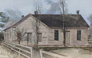
That year, when Robert Elliott was County School Superintendent, institutes began training teachers to improve their efficiency. The institutes were held in a small frame building, and the first session was enjoyable and fruitful, with about 30 teachers in attendance and several valuable instructors. Afterward, these institutes were held annually.
The Missouri, Kansas & Texas Railway, passing along the county’s east side from north to south, was built in 1870. The line was projected from Hannibal, Missouri, to Denison, Texas. At about the same time, a branch called the Neosho Division was also built from Parsons to Junction City on the Kansas Pacific Railroad. The county’s population in 1870 was 9,973.
The Kansas City, Lawrence & Southern Kansas Railroad, built in 1871, passed through the county’s northwest corner near Morehead Station.
In February 1871, the Bender family, originally from Holland, settled on a claim in the western part of the county, about 13 miles west of Parsons near the wagon road leading from Osage Mission to Independence. The family consisted of John Bender, aged 60; his wife, aged 55; Kate, aged 23; and a young man and a son of about the same age. The latter’s relationship is uncertain, as the young woman sometimes passed herself off as the young man’s wife and at other times as his sister.
Standing in a vast open prairie about six miles from Cherryvale, the Benders kept an inn for travelers to stop for meals and often took lodging overnight. The house was a small, frame structure, measuring 16 by 24 feet, divided into two apartments by a cloth partition. The front room was a storeroom where they kept a small stock of goods. Between 1871 and 1873, at least eleven people vanished near an inn and general store operated by the Bender family. The Benders, fearing detection, fled the place sometime in April 1873. Following their disappearance, it was discovered that they had murdered several travelers. Between eight and eleven bodies were discovered buried on the premises. Governor Thomas A. Osborn offered a reward of $2,000 for the apprehension of the Benders, and numerous attempts were made to find them, but no trace of them was discovered.
The county’s population in 1875 was 14,574. About 64% were engaged in farming, 9% in trade and transportation, and 10% in mining and manufacturing.
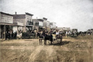
In 1876, the water power of the Neosho River powered a brewery, steam flouring mill, broom factory, cabinet factory, brick factory, and cheese factory in Oswego; in Richland Township, there was a steam furniture factory and two steam flouring mills; in the city of Parsons, a foundry and machine shop, a pottery and drain tile factory, a brewery and a steam furniture factory; in Montana, a flour mill and sawmill, and Chetopa a steam foundry. At that time, there were four banks in the county — two in the city of Parsons and two in Oswego, the county seat. Five newspapers were published—one in Chetopa, two in Oswego, and two in Parsons —all weekly. There were 95 school districts and 86 schools, with a total value of $118,270. There were 15 fine churches, estimated at $ 53,000. Libraries were reported to total 12,230 volumes.
The St. Louis and San Francisco Railroad entered the county on the east side about midway from north to south and, passing across the county in the direction a little north of West, was constructed in 1879. The Memphis, Kansas & Colorado Road, a narrow-gauge line that passed across the northern part of the county and terminated at Cherryvale, was built during the same year. At that time, there were 97 school districts and a school population of 7,273.
H.C. Hall and C.O. Perkins built the third Labette County courthouse in 1880 when the county’s population was 22,736.
In 1882, there were 105 organized districts, a population of 8,661, an enrollment of 7,062, and an average daily attendance of 4,045, with instruction provided by 130 teachers.
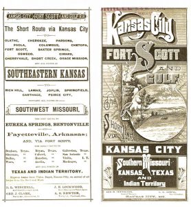
In the fall of 1882, the Memphis, Kansas & Colorado Road came under the control of the Kansas City, Fort Scott, and Gulf Railroad, was converted to standard gauge, and its name was changed.
That year, 175,120 acres were under cultivation, and 229,080 acres were not under cultivation, with an aggregate value of $1,324,865, and railroad property was $582,726.44. At that time, the principal crops were winter wheat, rye, corn, barley, oats, buckwheat, potatoes, rice, grasses, and pasture. There were also nurseries covering 359 acres, along with numerous fruit trees and vineyards. The county’s population was 25,347.
By 1910, 415,360 acres, of which nearly 300,000 acres had been brought under cultivation. The farm products for 1910 were valued at $2,855,112, of which corn brought $643,776; oats, $610,160; wheat, $116,953; hay (including alfalfa), $318,695; animals sold for slaughter, $572,963; poultry and eggs, $155,070; and dairy products, $259,977. The county’s population in 1910 was 31,423, an increase of 4,036 over the preceding decade, and the assessed valuation of all property was $35,377,355.
Labette County’s population peaked in 1920 at 34,047.
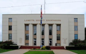
From 1947 to 1949, the fourth and present courthouse was built at 517 Merchant and 6th Streets. The modern Art Deco-style courthouse was designed by Thomas W Williamson and Company of Topeka; Dalton Construction Company of Joplin, Missouri, built it. The three-story cream-colored stone-and-concrete structure is located on landscaped grounds in the center of Oswego. The interior features an entrance lobby with two staircases leading to the third story. The County District courtroom is located on the third floor, at the center of the building’s west side. It has wood paneling. The building houses the County District Court of the 11th Judicial District.
In 1979 and 1980, a County Judicial Center was built in Parsons. The modern-style building was designed by Peters, Williams, and Kubata of Lawrence, Kansas, and constructed by Midland Development Inc. of Independence, Kansas. The one-story red brick-and-concrete structure houses two County District Court courtrooms of the 11th Judicial District at 201 South Central Avenue and Katy Drive.
Following an amendment to the Kansas Constitution in 1986, the county remained a prohibited, or “dry,” county until 1996, when voters approved the sale of alcoholic liquor by the individual drink, subject to a 30% food sales requirement.
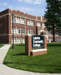
Today, Labette County has four school districts, plus the Labette Community College in Parsons.
The county seat, Oswego, is 162 miles south of Topeka, Kansas.
©Kathy Alexander/Legends of Kansas, updated February 2026.
Also See:
Sources:
American Courthouses
Blackmar, Frank W.; Kansas: A Cyclopedia of State History, Vol I; Standard Publishing Company, Chicago, IL 1912.
Case, Nelson; History of Labette County, Kansas, Biographical Publishing Co., Chicago, Ill. 1901.
Cutler, William G.; History of Kansas; A. T. Andreas, Chicago, IL, 1883.
Tuttle, Charles Richard; A New Centennial History of the State of Kansas; Inter-State Book Company, January 1876.
Wikipedia


