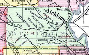
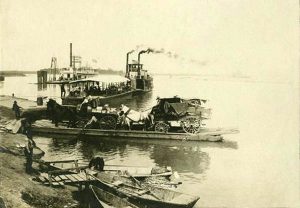
Port Williams in Atchison County, Kansas was the next settlement above Iatan, Missouri. Located in Walnut Township, the town was incorporated by the legislature of 1855 and was located about two miles northwest of Oak Mills and about eight miles below Atchison, at a big bend in the Missouri River, which has since disappeared. A hand ferry was established to this point from the Missouri side in about 1854, by Jake Yunt, who did quite a thriving business.
A post office was established on April 4, 1856.
This primitive mode of transportation soon gave way to steam in order to keep up with the rush of settlers. The town never attained any great size but was quite well known over the country, its ferry no doubt being accountable for this.
It “had its town bullies, and fights were of frequent occurrence… It was common for farmers to go to Port Williams every Saturday afternoon to witness the fights and drunks.”
According to W.J. Bailey, the place was probably named for William Johnson, owner of the claim and cabin called “Fort Williams,” and called Port Williams after steamboats and ferryboats began to land.
The post office closed on April 19, 1860.
Later, Port Williams was located on the Missouri Pacific Railroad.
Compiled by Kathy Alexander/Legends of Kansas, June 2022.
Also See:
Source – Kansas Historical Society


