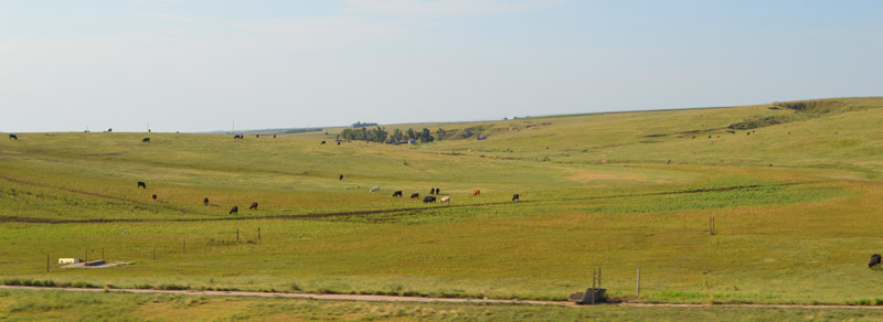
Sheridan County, Kansas Landscape by Kathy Alexander.
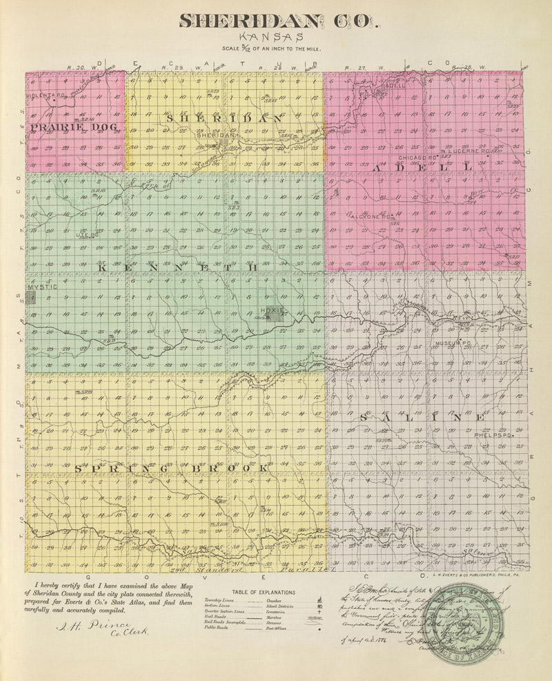
Sheridan County, Kansas Map by L.H. Everts & Co., 1887.
Towns & Places:
Hoxie – County Seat
Seldon
Studley – Unincorporated-Extinct
Tasco – Unincorporated-Extinct
Extinct Towns of Sheridan County
Cottonwood Ranch State Historic Site
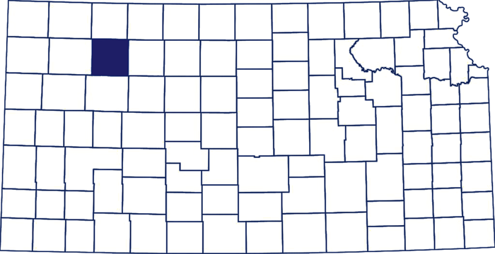
Sheridan County, Kansas, Location.
Sheridan County State Lake
Sheridan County, Kansas, is located in the northwestern part of the state. It was created by an act of the Legislature of 1873 and named in honor of General Philip H. Sheridan, a Union general during the Civil War. Its county seat is Hoxie. As of the 2020 census, the county population was 2,447. The county has a total area of 896 square miles, of which 896 square miles is land and 0.3 square miles is water.
It is located in the second tier from the north line of the state and is the third county east of Colorado. It is bounded on the north by Decatur County, on the east by Graham County, on the south by Gove County, and the west by Thomas County.
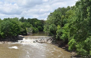
Soloman River in Kansas by Kathy Alexander.
The county is well watered. The Solomon River’s South and North Forks flow through the county, and the Saline River rises here. The creeks were small but numerous, permeating the county in all directions. There was good water power on the North Fork of the Solomon River, with abundant springs, and good well water could be found at about 30 feet. The streams were fringed with thin belts of timber containing cottonwood, ash, hackberry, elm, box elder, and wild cherry.
About 97% of the land is upland prairie, with three bottoms; the average width of the bottoms is one mile. The prairies are gently undulating and quite level in the western part of the county. Bottomlands comprised 25% of the total area, averaging 1 mile in width. The soil is generally of a deep, rich black loam. Building stone was abundant, mostly of white Magnesian limestone.
The lands were primarily subject to entry at the Oberlin Land Office in the Northern District, though those on the southern side of the county were entered at Wakeeney in Trego County. In the early spring of 1878, Captain G.C. West located 32 quarter-sections of school land here.
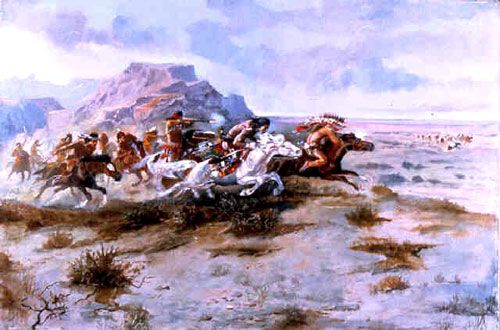
Indian Attack by Charles Russell.
Before the county was created, Cheyenne Indians were on the warpath in 1857, and United States troops were sent to western Kansas to check them. The two forces met on the Solomon River in Sheridan County, and a battle broke up that band of Cheyenne.
A buffalo hunter first settled the county in 1874. Immigration was slow then and did not become heavy until 1879.
The Sheridan County Tribune, at Kenneth, was established on July 1, 1879, by George N. Palmer, editor and proprietor. He died on December 9, 1881, in Toledo, Iowa, and the paper was then managed by E.J. Turner, J. B. Hitchcock, W.L. Humes, and others.
By 1880, there was a sufficient population to organize the county. The governor appointed George W. Crane and D.E. Barnes as census takers. A public meeting was held at Kenneth, an early town about two miles north of the present-day site of Hoxie, and the men to be recommended to the governor for temporary officers were elected. They were County Clerk William Stephens and commissioners W.M. Rodgers, K.A. Ellithorpe, and W.S. Hausufus. On June 2, 1880, Governor St. John proclaimed, appointed the officers, and recommended naming Kenneth as the temporary county seat.

Covered wagons on the Solomon River in Sheridan County, Kansas.
A deputy superintendent from Rooks County organized School Districts No. 1 and No. 2, and both sustained a three-month term of school during the school year ending July 31, 1880. By that time, there were 51 people of school age, with a school enrollment of 37.
The election of November 1880 resulted in the following officers: County clerk, W.M. Rodgers; treasurer, G.W. Crane; register of deeds, A.C. McClurg; sheriff, J.H. Carey; superintendent of public instruction, E.P. Weida; probate judge, S.P. Davidson; surveyor, W.C. Blackstone; coroner, W.H. Pierce; district clerk, A.W. Stone; and commissioners, W.C. Hausufus, M.M. Scott, and M.G. Haskell. Kenneth was made the county seat.
The county was divided into 13 townships: Adell, Bloomfield, Bow Creek, Kenneth, Logan, Parnell, Prairie Dog, Saline, Sheridan, Solomon, Spring Brook, Union, and Valley.
By then, the Congregationalist Church of the Disciples and the Methodist Episcopal Church had been established in the county.

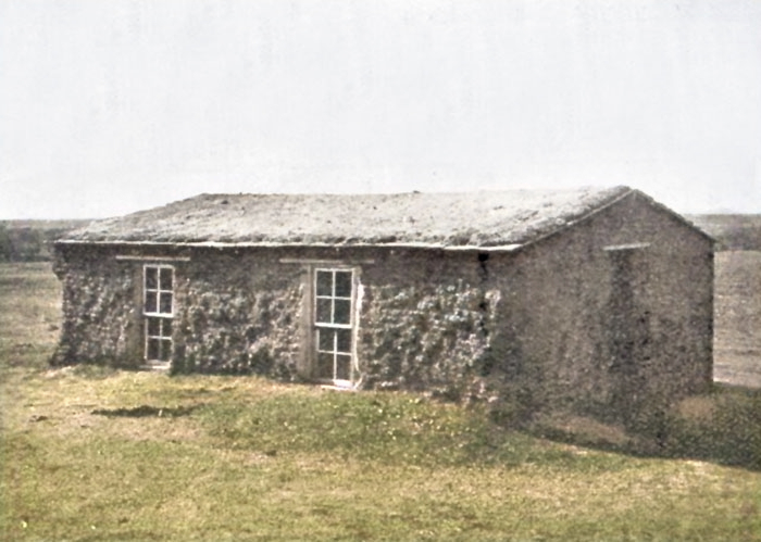
Sod houses in Sheridan County, Kansas.
Grainfield, in Gove County, on the Kansas Division of the Union Pacific Railroad, was the accessible railroad station south of Kenneth. Lenora, on the Central Branch of the Missouri Pacific Railroad in the southeast corner of Norton County, was the accessible station to the northeast. There was daily mail from Grainfield and Oberlin in Decatur County and semi-weekly mail from Lenora.
The Sheridan County Agricultural, Horticultural, and Mechanical Association was organized in June 1881. D.E. Barnes was the first president; George W. Crane was the secretary.
Sod school in Sheridan County, Kansas.
School enrollment in 1881 was 122.
The county’s property valuation for 1881 was returned at $54,321.24; in 1882, it was $42,185.76. Its taxable acres under cultivation were 460; those not under cultivation, 3,100. It had 17 improved taxable town lots and 309 unimproved town lots. The valuation of its personal property was $32,772.76.
The statistics for 1881 and 1882 showed the comparative meagreness due to the sparsity of population. The wool clip of 1881 was 4,200 pounds; the number of sheep in 1882, 2,418; of swine, 342; of milch cows, 533; other cattle, 1,772; mules, 89; horses, 500. The butter product was 18,444 pounds; the value of slaughtered animals was $12,388; of poultry and eggs was $9,793. The acreage of winter wheat was 403; of spring wheat, 24; rye, 291; oats, 42; potatoes, 57; sweet potatoes, 36; sorghum, 507; castor beans, 19; broom corn, 138; millet and Hungarian, 747.
In 1882, the county had nine organized school districts and 172 school enrollments. The average monthly salary of male teachers is $20; for female teachers, it is $16.75. That year, the money received for school purposes was $460.70, of which $179.27 was State funds.
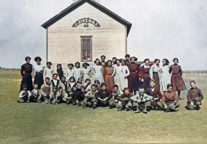
Two-room school in Studley, Kansas.
By then, the country’s post offices and objective points were in Arkona and Sheridan in Sheridan Township; Adel, Alcyone, Chicago, Hortonville, and Lucerne in Adell Township; Advance and Rurdon in Saline Township; Milligan in Spring Brook Township; and Kenneth, the county seat. Francella, Port Byron, and St. Paul were other points.
The assessed valuation of the property in 1882 was $42,185. There were nine school districts that year, and the school population was 360.
Livestock numbered 5,654 heads, nearly half of which were sheep. 18,444 pounds of butter were sold, $12,388 worth of animals for slaughter, and $9,783 worth of poultry and eggs. The number of acres under cultivation was about 2,300.
In 1886, it became apparent that the railroad line coming to the area would run south of Kenneth, and the new town of Hoxie was founded. It was named after Mr. Hoxie, who was interested in building a railroad to the new town but died before he could accomplish the project. W.P. Price was the leading member of the Hoxie Town Company.
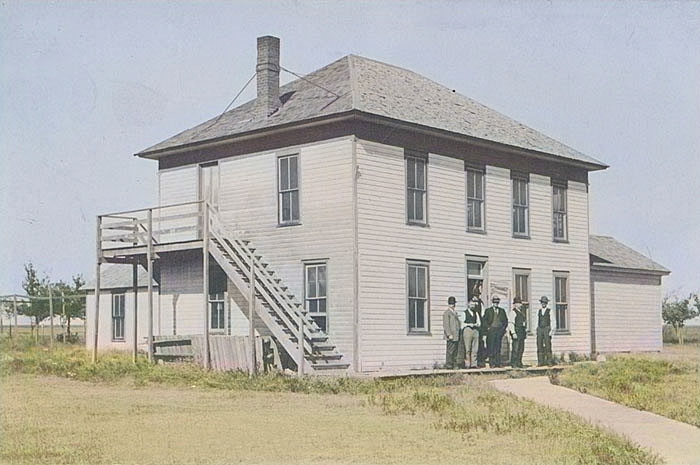
The first courthouse in Hoxie, Kansas.
A special county seat election was held in July 1886. There were 516 votes cast, of which Hoxie received 422 and became the permanent county seat. The residents of Kenneth accepted an offer to get new lots in Hoxie and move their buildings at no expense, and the county seat was transferred to Hoxie.
The first courthouse was a two-story frame structure erected in Hoxie in 1886.
The Union Pacific Railroad was built in 1888. It ran from east to west through the central part of the county. Before long, a line of the Chicago, Rock Island & Pacific crossed the northwest corner.
The county population in 1890 was 3,733.
In 1900, the county’s population was 3,819.
In 1907, there were 70 organized school districts, with 1,838 people of school age.
In 1910, there were post offices in Angelus, Guy, Hoxie, Lucerne, Seguin, Selden, and Studley.
At that time, the county’s population was 5,651, and the average wealth per capita was nearly $1,800. The assessed valuation of the property was $9,962,451.

Sheridan County, Kansas Courthouse by Kathy Alexander.
In 1910, the number of acres under cultivation was 385,950. The value of the farm products was $1,521,856. Wheat, the leading crop, brought $478,219; corn, $145,556; oats, $62,756; barley, $56,001; sorghum, $51,791; hay, $268,359; animals sold for slaughter, $252,532; poultry and eggs, $52,687; dairy products, $55,872. The value of the livestock on hand was $1,481,437, and the number of heads was 31,981, primarily cattle and swine.
The population of Sheridan County grew in the early 20th century. The second and present courthouse was constructed from 1917 to 1918. The Classical Revival building was designed by Thomas W Williamson & Company of Topeka and built by George Cope and Sons. It stands at 925 9th Street and Royal Avenue.
The county’s population peaked in 1930 at 6,038 residents. Since then, the population has steadily declined as part of the general depopulation of the Great Plains.
In 1993, flooding east of Plainville damaged the railroad line, and the railroad concluded that rebuilding would not be cost-effective. By 1998, the entire line from Plainville to Colby had been abandoned.
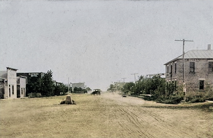
Vintage Main Street in Selden, Kansas.
©Kathy Alexander/Legends of Kansas, updated January 2026.
Also See:
Sources:
American Courthouses
Blackmar, Frank W.; Kansas: A Cyclopedia of State History, Vol I; Standard Publishing Company, Chicago, IL 1912.
Cutler, William G; History of Kansas; A. T. Andreas, Chicago, IL, 1883.
Federal Writers’ Project of the Works Progress Administration; Kansas: A Guide to the Sunflower State; 1939.
Wikipedia