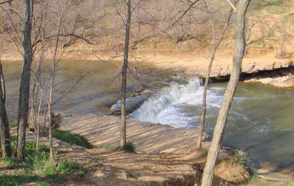
Wakarusa River Falls, Kansas, courtesy Wikipedia.
The Wakarusa River, a tributary of the Kansas River, is an approximately 50-mile-long waterway in eastern Kansas that drains an agricultural area of rolling limestone hills south of Topeka and Lawrence.
It rises from several branches located southwest of Topeka, the main branch coming from the Wabaunsee–Shawnee County line, approximately ten miles southwest of Topeka, and flowing east. The south branch rises in eastern Wabaunsee County, approximately 15 miles southwest of Topeka, and flows northeast, joining the main branch south of Topeka. The main branch generally flows east, south of Lawrence, and joins the Kansas River in Douglas County at Eudora, approximately eight miles east of Lawrence.
One of the earliest mentions of the waterway was by Stephen H. Long, the explorer, in 1819. The name is said to come from an Indian legend in which a maiden sought to cross the waterway on horseback when the stream was overflowing. As she proceeded across, the waters grew deeper until her body was half-immersed, and she exclaimed, “Wakarusa!” meaning hip-deep.
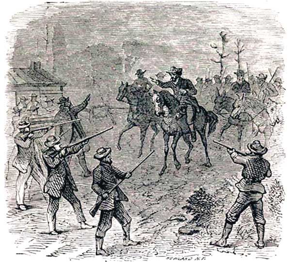
Wakarusa War during the Bleeding Kansas era.
This river was first inhabited by various Native American tribes, including the Kanza and Osage, in the 18th century. After the U.S. acquired this region, the Shawnee people were relocated here. The Methodist Episcopal mission was located near the mouth of the stream in about 1842.
During the Great Migration of 1843, the fords across this meandering river were among the many challenges emigrant wagon trains faced along the Fremont-Westport Trail, later called the California Trail during the 1849 Gold Rush. Also traveling along the river were wagon trains along the Santa Fe and Oregon Trails. Several Shawnee Indians created ferry operations at river crossings in the 1850s, including Blue Jacket’s Ferry near Coal Creek at Sebastian. During the troublous early territorial days, the region along the Wakarusa River was the scene of much strife between pro-slavery parties and Free-State forces, with the celebrated “Wakarusa War” fought there on November 27, 1855.
Clinton Dam, located near Lawrence, was completed in 1977 to reduce seasonal spring flooding. Though this significantly reduced the replenishment of wetlands below the dam, a remaining tract of 600 acres, known as the Haskell–Baker Wetlands, is located south of Lawrence near the Haskell Indian Nations University.

Clinton Dam on the Wakarusa River near Lawrence, Kansas.
Compiled by Kathy Alexander/Legends of Kansas, updated January 2026.
Also See:
See Sources.