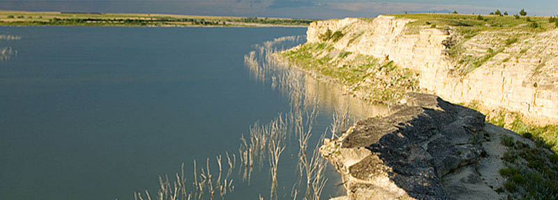
Cedar Bluff Reservoir, Kansas.
Bluffton Station in Trego County, Kansas, was a stop on the Butterfield Overland Despatch stage line on the Smoky Hill Trail.
The station was named for its location beneath an almost perpendicular 75-foot bluff. Here, several travelers inscribed their names to such an extent that it was said that the pillar rivaled Independence Rock in Wyoming for names per square foot. One of the earliest recorded names was that of T.R. Hunt of New Jersey in 1849. He was probably a member of the government surveying party authorized by Congress as a result of John Fremont’s report to determine whether the Smoky Hill route would be practical for a government road to the west. Two other deeply inscribed names were C. Kelley and W.W. Spencer in 1859. The outline of an antelope and a well-defined Masonic square and compass accompanied these names. These men were likely among those who took the short route, the Smoky Hill Trail, to the Colorado goldfields.
However, the bulk of the early names were carved into the rock in 1865. Many were members of the Third Wisconsin Cavalry, which accompanied the survey party of Lieutenant Julian Fitch in the summer of 1865.
However, David Atchison’s plan for the Butterfield Overland Despatch stage line did not fully consider the fury of the Plains tribes, who recognized the threat to their traditional way of life from the rush of incoming settlers after the Civil War.
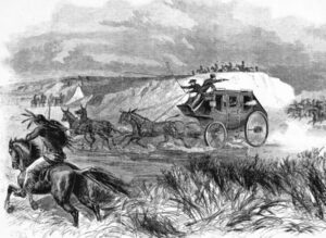
When the stage line was up and running, the Indians began to regularly attack settlers, railroad workers, and travelers, particularly along the Smoky Hill, Saline, and Solomon Rivers. After several attacks in the area, Bluffton Station was abandoned in favor of White Rock Canyon further to the west.
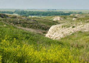
“On the south side of the river, opposite this point, we discovered high bluffs covered with cedar (Cedar Bluffs). Chalk Bluffs, Blufton, a picturesquely located station, we found deserted and burned. What strange convulsion caused this strange crag-like mass? It rises from the plains like a vast castle, fashioned by the most ancient of architects. A fine spring, the water of which is strongly impregnated with magnesia, is located here.”
— Stagecoach traveler, 1865
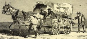
After the station closed, travelers still used the place as a campsite. In 1867, freighters who were transporting several horse-powered threshing machines to be delivered to Brigham Young at Salt Lake City, Utah, camped for the night beneath a bluff overlooking the canyon floor. This was a mistake. They would have been safer had they camped on the grassy flat where the station once stood. Their site under the bluff was bordered by a deep rocky gully that afforded Indians easy and hidden access to creep up upon the men. The warriors killed the freighters at their campfire and set everything on fire. Afterward, the site was called Threshing Machine Canyon.
Remains of the burned machinery remained at the site for years, and many travelers picked up pieces as souvenirs. Decades later, the charred remains of a Threshing Machine were moved to the Trego County Historical Museum in WaKeeney, where they can be seen today.
Today, the Cedar Bluff Dam, just a little over a mile to the east of the canyon, backs up water to the bluff’s base and covers most of the old trail in the area. Some of the carvings on the bluff walls can be seen in the wildlife area.
A stone marker for the Butterfield Overland Despatch Trail can be seen along the highway near the Cedar Bluff dam.
The Indian raids of the area in 1867 resulted in the recall of George Armstrong Custer from enforced leave after his court-martial. The Winter Campaign resulted in the attack on Black Kettle’s camp on the Washita River in Oklahoma in November 1868.
©Kathy Alexander/Legends of Kansas, updated September 2025.
Also See:
Sources:
The Raynesford Papers
Ringer, Roger L.; Kansas Oddities, History Press, Charleston, SC, 2018
Travel Kansas
Wakeeney – Gateway to Cedar Bluff


