
Hamilton County, Kansas Landscape by Kathy Alexander.
Towns & Places
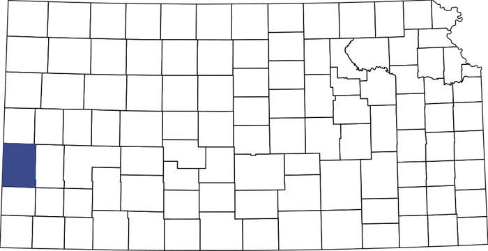
Hamilton County, Kansas Location.
Kendall – Unincorporated
Syracuse (county seat)
Extinct Towns of Hamilton County

Hamilton County, Kansas, in 1887, by L.H. Everts & Co.
Aubry Cut-off of the Santa Fe Trail
Cottonwood Flats Wildlife Area
Hamilton County Santa Fe Trail
Hamilton State Fishing Lake & Wildlife Area
Stage Station Loot in Hamilton County, Kansas
~~
Hamilton County, Kansas, is in the southwest part of the state. It was located on the Mountain Branch of the Santa Fe Trail and was home to Fort Aubrey, a short-lived outpost that protected the route.
The county was established in 1873 and named for Alexander Hamilton, a founding father of the American Republic, who was killed in a duel with Aaron Burr. Syracuse is the county seat and most populous city. As of the 2020 census, the county population was 2,518, and it is 998 square miles, of which 997 square miles is land and 1.1 square miles is water. It is three-quarters the size of Rhode Island.
Long before the county was established, the land was home to the Cheyenne, Comanche, and Kiowa Indians, and bison were plentiful.
Zebulon Pike crossed the area during his 1806 expedition, Stephen Long traveled through it during his 1820 expedition, and the Glenn-Fowler Expedition passed through in 1821. Soon, wagon trains passed through the Plains Indians’ territory as they carried goods along the Santa Fe Trail.
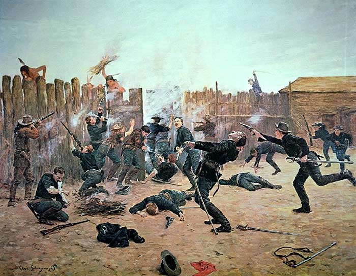
U.S. Cavalry Defending Fort Aubrey, Kansas from an Indian Attack by Charles Schreyvogel.
A stagecoach station was located in Spring Creek on the Santa Fe Trail. Later, Fort Aubrey was established at this location in September 1865 to protect travelers from attacks by Indians and renegades. It was named after Francis Xavier Aubry, a French Canadian merchant, wagon train captain, and explorer of the American Southwest. The troops built homes of sod, lived in dug-outs, and lumber was imported. E.P. Barber built the first lumber home, which served as a refuge for the townspeople during the Indian Scares. The house still stands and is preserved by the Hamilton County Historical Society. In early 1866, 130 soldiers were assigned to the post, which was closed that April. Following its military use, the fort served as a station for the Overland Express and later as a ranch.
In 1871-1872, the Atchison, Topeka, and Santa Fe Railroad reached Hamilton County. Eventually, the railroad added stops at Syracuse, Kendall, and Coolidge, a division point where two lines met.
With the arrival of the railroad, the importance of the Santa Fe Trail faded.
Located in the sandy plains of the Arkansas River Lowlands on the western border, Hamilton County was once part of the land of the old Washington County, Peketon County, and later, an enlarged Marion County. Hamilton County was created on March 6, 1873, when an act of the legislature discontinued several western counties. At that time, the boundaries of Hamilton County were extended to include the western half of the present-day counties of Grant and Kearny, as well as all of Stanton County.
On March 23, 1873, a colony from Syracuse, New York, made the first permanent settlement in the county. Having organized in New York on October 23, 1872, a committee consisting of Evelin P. Barber, S.R. Jones, and D.G. Ackland was sent to Kansas to select a location before the county had been created by legislative enactment. These colonists tried to rename the county Onondaga after their former county in New York, but the legislature declined to comply with their request.

Grasshopper Plague in Kansas.
The crops planted by the settlers were not suited to the Kansas climate, and they were adversely affected by drought and the Grasshopper Plague of 1874. The swarms were so thick that they could cover the sun for up to six hours, and some described the locusts as looking like a great white cloud or a big snowstorm. The locusts ate crops, grass, plants, trees, leather, wood, sheep’s wool, and, in some cases, even clothes. The plague caused millions of dollars in damage and led to famine for many settlers. Afterward, many settlers moved on.
In the 1880s, several families came from Iowa, Ohio, Illinois, and Eastern Kansas. These settlers included several Mennonite families from McPherson and Marion Counties who settled in the southeast part of the county. This was known as the Menno community, and a church was built. However, due to their disappointing years of farming, some began to leave within a few years.
Thirteen years after the county was created, a memorial signed by 250 county citizens was presented to Governor John A. Martin, who appointed Alfred Pratt to take a county census. The census showed 1,893 people, of whom 614 were householders. On January 29, 1886, the governor issued his proclamation declaring the county organized.

Arkansas River near Syracuse, Kansas.
The governor appointed J.H. Leeman of Hartland, Lawrence W. Hardy of Medway, and Dennis Foley of Syracuse as commissioners. Thomas Ford was appointed county clerk, and Kendall was designated as the temporary county seat.
A county seat election was held that year, and Syracuse was chosen as the county seat. However, Kendall residents soon raised accusations of election fraud, refused to turn over the records, and filed a petition asking the Kansas Supreme Court to remove the alleged county officers. In the meantime, the bitter contest between Kendall and Syracuse for the permanent seat of justice included restoring the old county lines by reestablishing Grant, Kearny, and Stanton counties. At an election on April 1, 1886, Syracuse was declared the county seat, but Kendall charged gross fraud by Syracuse’s advocates and appealed to the Supreme Court. The court soon threw out the vote from Syracuse township and ordered the county officers to return to their offices in Kendall until another vote could be taken at the general election the following November.
At the November election, the vote for county seat was as follows: Syracuse, 785; Kendall, 390; Coolidge, 224; Johnson City, 93; and scattering, 4, giving Syracuse a majority of 75 over all competitors. At the same election, the following county officers were chosen: Representative J.T. Kirtland; probate judge W.C. Higgins; Clerk of the district court W.P. Humphrey; county clerk J.M. Hicks; Sheriff C.C. Mills; Treasurer J.H. Bentley; register of deeds, J.P. Gardner; county attorney, G.N. Smith; county superintendent of schools, C.N. Gartin; surveyor, J.W. Beatty; coroner, J.N. Slown; commissioners, L.C. Swink, A.A.G. Stayton, and S.S. Taggert.

Early day, Syracuse, Kansas.
The Kansas legislature gave women the vote in city elections on February 13, 1887. That cleared the way for voters to elect an all-woman city council in Syracuse on April 5, 1887, the first in the nation. N.E. Wheeler was elected mayor; Caroline Johnson Barber, Mrs. W.A. Swartwood, Mrs. S.P. Nott, Mrs. Charles Coe, and Mrs. G.C. Riggles were elected council members; and J.D. Woodruff was elected police judge.
An act of March 5, 1887, restored Hamilton County’s original boundaries, which remain the same today. The county is bounded on the north by Greeley County, on the east by Kearny, on the south by Stanton, and on the west by the State of Colorado.
The county seat remained in place for some years, with two sets of county officers elected and the county records divided, until the Supreme Court finally decided the question in favor of Syracuse as the rightful county seat in 1888.

Coaling Station in Syracuse, Kansas.
The county’s surface is level in the north and rolling prairie in the south. The Arkansas River enters the county from the west, near the center, and flows southeasterly until it enters Kearny County. Along this river, the bottom lands are two to four miles wide. There is little native timber, but several artificial groves have been planted. White Magnesian limestone is abundant along the river bluffs, and some gypsum deposits have been found.
The county is divided into eight townships: Bear Creek, Coolidge, Kendall, Lamont, Liberty, Medway, Richland, and Syracuse. In the 1880s, the county had more than 30 school districts.
When the Atchison, Topeka, & Santa Fe Railroad relocated its connections to Syracuse and records to La Junta, Colorado, in 1890, Coolidge struggled, and its Harvey House was moved.

Dust Bowl in Southwest Kansas by Frank Durnell Conard, 1935.
In 1910, the county had 27 organized school districts, with county high schools at Coolidge and Syracuse. The county’s population that year was 3,360, a gain of 1,934 over the preceding decade, representing over 100%. The value of the taxable property was $5,257,355, and the value of farm products, including livestock, was nearly $372,500. The principal crops were broomcorn, milo, maize, hay (including alfalfa), sorghum, and wheat.
During the Dust Bowl years of the 1930s, dust storms were common in western Kansas. Wind erosion was a problem during this time, and Hamilton County and a broad area were severely affected. This catastrophe intensified the economic impact of the Great Depression in the region.

Hamilton County Courthouse in Syracuse, Kansas, courtesy Wikipedia.
The Hamilton County Courthouse was built in 1937 as part of the Public Works Administration. It was designed by C.F. Boucher and H.G. Overend and constructed by Frank E. Blaser. The Public Works Administration supplied a $29,250 grant for the project, which cost $65,007. The two-story, buff-colored brick-and-concrete rectangular structure is located at 219 North Main Street in the center of Syracuse.
Hamilton County’s population peaked in 1950 at 3,696. Since that time, it has gradually declined.
Today, the county is primarily agricultural, and the cattle industry is also important. Several feedlots operate, and the “world’s largest beef packing plant” is just 50 miles away. Wheat ranks second in value production and is the principal crop, followed by hay, corn, and sorghum. Irrigation plays a prominent role in the agricultural economy.
Hamilton County properties in the National Register of Historic Places and Register of Historic Kansas Places include Fort Aubry, the Northrop Theater in Syracuse, and Menno Community Hall in Kendall.
The entire county is served by the Syracuse United School District 494.
©Kathy Alexander/Legends of Kansas, updated December 2025.

Abandoned farm near Syracuse, Kansas, by Russell Lee, 1939.
Also See:
Kansas Santa Fe Trail Photo Gallery
Santa Fe Trail – Pathway to the Southwest
Sources:
Blackmar, Frank W.; Kansas: A Cyclopedia of State History, Vol I; Standard Publishing Company, Chicago, IL 1912.
Fort Hays State University
Hamilton County, KS
Kansas Historical Society
Living New Deal
Wikipedia