| Town | Post Office Dates | Additional Information |
| Alpha | 1880-1897 | |
| Battle Hill | 1876-1894 | |
| Big Turkey | 1860-1866 | |
| Bloomingdale | 1871-1872 | The post office moved to Roxbury. |
| Bonaville | 1875-1881 | |
| Calmar | 1871-1880 | |
| Cedar | 1878-1879 | |
| Conway | 1880-1983 |
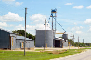
In southwestern Jackson Township, Conway was a station on the Atchison, Topeka & Santa Fe Railroad. In 1910, it had telegraph and express offices, a money order post office with two rural routes, and a population of 125. Today, it is home to a large underground refined petroleum storage facility that holds approximately 30% of the propane stored in the United States. It is on U.S. Route 56, west of McPherson. |
| Craventon | 1884-1887 | |
| Crooked Creek | 1872-1876 | The post office moved to Christian. |
| Delmore | 1873-1902 | An inland hamlet, it was on the Atchison, Topeka & Santa Fe, and the Chicago, Rock Island & Pacific Railroads. It was 12 miles northeast of McPherson and eight miles north of Galva. |
| Dolespark | 1898-1918 | On the Chicago and Rock Island Railroad in 1887. A country post office in Canton Township. It was about four miles from Canton, the most convenient railroad station in 1910. |
| Eden Prairie | 1873-1883 | |
| Elkhart | 1875-1879 | |
| Elyria | 1887-1954 |
Elyria was a station on the Missouri Pacific Railroad in King City Township. In 1910, it had a post office, general stores, an express office, and a population of 100. It is seven miles southeast of McPherson. |
| Empire/Lone Tree | 1872-1888 | The name changed from Lone Tree to Empire on August 10, 1880. |
| Farland | 1872-1887 | |
| Farms | 1873-1887 | |
| Fremont/Smoky/Smoky Hill | 1873-1932 |
Fremont was located in the northwestern part of the county on a branch line of the Missouri Pacific Railroad. The name changed from Smoky Hill to Smoky on September 27, 1894. The name changed again from Smoky to Fremont on January 23, 1895. In 1910, it had a population of 15. The nearest significant town was Lindsborg, about seven miles east. |
| Groveland | 1874-1883 1887-1912 1915-1939 |
A station on the Chicago, Rock Island & Pacific Railroad six miles southwest of McPherson. In 1910, it had telegraphic communications, an express office, a post office, and a population of 20. |
| Hyco | 1869-1871 | |
| Johnstown | 1883 1885-1904 |
Named for John Johnson, the postmaster. A hamlet with a station on the Salina & McPherson branch of the Union Pacific Railroad. It was six miles south of Lindsborg, the nearest significant town. |
| King City | 1871-1887 | In the spring of 1871, a colony from Ashtabula County, Ohio, settled in the southern part of McPherson County, Kansas, and established King City. |
| Lake View/Lake Village | 1870-1889 | The name changed from Lake Village to Lake View on June 6, 1872. |
| Lilly | 1874-1879 | |
| Little River | 1875-1877 | |
| Little Valley | 1873-1888 | |
| Lookout | 1879-1880 | |
| Monitor | 1874-1902 | |
| New Gottland
|
1872-1883
|
|
| Schley | 1898-1902 | |
| Sharpscreek/Sharp’s Creek | 1872-1899 | The name changed from Sharp’s Creek to Sharpscreek on October 15, 1894. |
| Sparta | 1874-1902 | |
| Spring Valley | 1872-1902 | |
| Sweadal | 1869-1872 |
First county seat. L.N. Holmburg, the first storekeeper, served as postmaster. |
| Wakeman | 1894-1899 | |
| Westfield | 1874-1888 | |
| Wheatland/Bachelor | 1874-1896 | The name changed from Bachelor to Wheatland on January 24, 1876. |
| Winnesheik | 1874-1902 |
©Kathy Alexander/Legends of Kansas, updated July 2025.
Also See:
McPherson County Photo Gallery
The Santa Fe Trail Across Kansas
Sources:
Blackmar, Frank W.; Kansas: A Cyclopedia of State History, Vol I; Standard Publishing Company, Chicago, IL 1912.
Cutler, William G.; History of Kansas; A. T. Andreas, Chicago, IL, 1883.
Kansas Post Office History
Wikipedia

