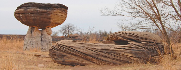
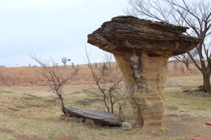
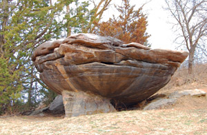
Located in the Smoky Hills southwest of Salina, Kansas, Mushroom Rock State Park includes beautiful sandstone formations and is rich in early Kansas history and railroad lore. The Fremont Trail passed to the north, which the Kaw-Santa Fe Freight Company used, and became the first route for the overland stages to California until they were forced to a northern trail by hostile Indians.
Throughout the five-acre park, dozens of pedestal or mushroom-shaped rocks are the remains of beach sands and sediments of the Cretaceous Period, dating from 66 to 144 million years ago. At one time, Kansas was in the bed of an inland sea, and the action of the receding waters produced the beginnings of these stone shapes. Later, a very deep layer of Dakota Sandstone covered the entire area.
Though the effects of wind erosion can be seen throughout the Great Plains, they are particularly evident here. Made of Dakota Sandstone and sedimentary rock, natural cement holds the formations together. The Dakota Sandstone resists erosion while the underlying softer stone weathers away, forming a pedestal. Over millions of years, the violently swirling winds have gradually shaved away the soft sandstone, leaving small islands of resistant sandstone. The two most extensive formations are approximately 25 feet tall, with caps about 15 feet wide. Another form that looks like a shoe.
Accounts of the unique geologic formations began appearing in scientific and popular literature in the late 1860s. But, long before then, the unique geological oddities were a landmark for Native Americans. In July 1844, Captain John Charles Fremont, known as “The Pathfinder,” traveled eastward across the plains, returning from his first California expedition. Frontier scout and guide Kit Carson described it as his “favorite little place.”
Later, when gold was found in Cherry Creek (now in Denver, Colorado) in 1859, thousands wanted to go to the Rocky Mountains to find their fortunes. There was no “official path” across Kansas at this time, and the westernmost post was in Salina. But, when the news of Colorado Gold reached Kansas City, pioneers were determined to find a faster way to get there and soon developed the Smoky Hill Trail. The path, which followed an ancient Indian trail along the Smoky Hill River, traveled near today’s state park, and early travelers would venture off the trail to visit the rocks.
The area around Mushroom Rocks was surveyed in 1862 by the Kansas Pacific Railroad, and the first geology reports appeared in 1866 and 1868. Initially, the most significant formation was called Pulpit Rock on Alum Creek. An article in Harper’s Weekly from July 15, 1867, was accompanied by an illustration of Pulpit Rock from a survey engineer’s drawing. While the Kansas Pacific Railroad later consolidated with the Union Pacific Railroad and no longer exists, the Union Pacific Railroad still runs just south of Carneiro, about ½ mile north of Mushroom Rocks
Until 1963, the only way to see these fascinating formations was by traveling a rough trail on privately owned land. However, that year, Ellsworth County constructed a road that allowed access by automobile. Soon afterward, the Ellsworth County Historical Society secured five acres from two individual owners to be utilized and preserved as a park. The land was then deeded to the Kansas Department of Wildlife and Parks. On April 25, 1965, with over 300 people in attendance, Mushroom Rock State Park was officially presented to the state and dedicated as a state park.
A satellite park of Kanopolis State Park, it is designated as a day-use area only. There is no camping allowed. Admittance is free, and no permits are required. The park is one mile south of Carneiro, Kansas, in Ellsworth County. It can be reached via a short drive south from K-140 at Carneiro on 25th Road or by driving west from K-141 via Avenue K, also a county road.
More Information:
Mushroom Rock State Park
200 Horsethief Rd.
Marquette, Kansas 67464
785-546-2565
GPS: N38 43.568′ W098 01.783′
©Kathy Alexander/Legends of Kansas, updated July 2025.
Also See:
See Sources.


