Towns & Places:
Carona
Crestline
Columbus – County Seat
Melrose
Scammon
West Mineral
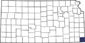
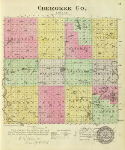
In the extreme southeastern part of the state, Cherokee County, Kansas, was created by the first territorial legislature in 1855 and named McGee County for Mabillon W. McGee. However, as he was a pro-slavery man, the Free-State Legislature of 1860 changed the name to Cherokee in honor of the Cherokee Indians. When Cherokee County was first established in 1855, it was attached to Bourbon County for all military and civil purposes. It would be more than a decade before the county would become self-sufficient.
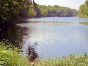
The general surface of the county is undulating prairie, interrupted by shallow draws. The Spring River and its tributaries drain the eastern half of the county, the most important of which are Cow, Shawnee, and Brush Creeks, and the western portion is drained by the Neosho River and its tributaries, the largest of which are Lightning, Cherry, Fly, and Four Mile Creeks.
Before 1825, the land belonged to the Osage Indians; however, in a treaty made that year, they ceded their lands in Arkansas, Missouri, and those between Texas and the Kansas River, except for a strip 50 miles wide. This strip, running westward from the Missouri border, was referred to as the Osage Neutral Land, and in this tract, neither Indians nor white settlers were allowed to remain. In 1835, a treaty was concluded between the government by which the Cherokee were granted this neutral land. The strip subsequently became known as the “Neutral Lands,” which were opened to settlement under the treaty provisions of 1868.
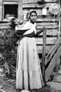
As early as 1820, a Presbyterian mission was established on the Marais des Cygnes River and another a few miles south on the Neosho River. The missionaries were the first whites in what would later become Cherokee County. The next settlers were mixed-breed Cherokee who had first settled in Indian Territory (Oklahoma) from Georgia. However, in 1835, several members of the tribe, who had trouble with the tribal officers in the Indian Territory, withdrew and settled in what would become Cherokee County.
The first attempt at a settlement was made in 1842 when a detachment of United States soldiers attempted to establish a fort on the Spring River. The site they selected was owned by John Rogers, one of the Cherokee men who had settled there in 1835. However, when Rogers asked $4,000 for the piece of land, and the soldiers’ budget was only $1,000, they moved on and eventually established the post at Fort Scott, Kansas.
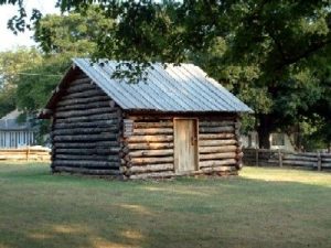
In the spring of 1849, the Reverend John Baxter, his wife, and eight children moved from Missouri to 160 acres of land near the Spring River. Flowing from the side of a hill near the Military Road between Fort Scott, Kansas, and Fort Gibson, Oklahoma, was the natural spring the Osage had long visited. Near the spring, he set up “Baxter’s Place,” an inn and general store.
However, Baxter would not live to see the city that would eventually take his name. The Reverend Baxter, well-known in the area as a gun-toting preacher, was gunned down in a property dispute with a man named Commons in 1859. Baxter’s son-in-law was also killed. Both families moved away and were never heard from again. Baxter Springs was named for the preacher.
A few more white settlers also made the area home, but in 1859, at the solicitation of the Osage Indians, President Buchanan ordered them off. They were forced to leave by United States troops, and their houses were burned.
By 1860, the population was about 1,500 people. Before the Civil War, there were but two settlements in the county — one at the military road crossing over Shawnee Creek and the other on the “mound” on the west side of Spring River. Both were little more than trading posts and were demolished during the war. Baxter Springs claims the honor of being the oldest permanent settlement in the county.
During the Civil War, Fort Blair was established in the spring of 1862 in Baxter Springs to protect Kansas residents against the frequent attacks from Confederate regular and guerilla forces. Here, the Baxter Springs Massacre occurred when Confederate guerillas, under the command of William Quantrill, attacked the fort on October 6, 1863. They then massacred a contingent of troops led toward Fort Smith, Arkansas, by General James G. Blunt. Nearly 100 Union soldiers were killed in the guerilla attack and are buried in the Baxter Springs Cemetery, just west of the city.
In 1866, the U.S. Government entered another treaty with the Cherokee that ceded their Neutral Land in Kansas and moved them to Indian Territory. That same year, in August, the county began to be officially organized, with the governor appointing temporary county commissioners and officers and placing the temporary county seat at Pleasant View. A few months later, an election was held on November 6 to elect permanent officers and commissioners. The following year, on November 5, 1867, an election was held to determine the permanent home of the county seat.
Columbus, then known as Cherokee Center, and Baxter Springs were the contestants. Baxter Springs received 136 votes, and Cherokee Center 3. The commissioners held their last meeting at Pleasant View on April 10, 1868, and the first at Baxter Springs on April 14.
John Appleby was the first to settle at what would become the city of Columbus in 1868. Judge Fry, who built a house and opened a hotel, was followed. In the summer of 1868, the first schoolhouse was erected at Wirtonia and, soon after that, churches in Baxter Springs and Columbus. The first newspaper established in the county was the Baxter Springs Herald in 1868, which lasted only briefly. The Cherokee Sentinel, the second paper in the county, appeared at Baxter Springs in October 1868.
In the meantime, many people in the county were not happy with the county seat location at Baxter Springs. Another election was held on May 12, 1868, between Baxter Springs, the county’s geographical center, Columbus, and Cherokee Center. However, none of the three received a majority vote. Another vote was held just a few weeks later, on May 26, and Baxter Springs retained the county seat. Still, the people were unhappy, and yet another election was called to settle the matter on February 17, 1869.
A fair election was believed to result in the county’s geographical center as the vast majority of the population supported that location. However, Columbus was chosen, but it was suspected that both the supporters of Baxter Springs and Columbus had practiced fraud concerning the ballots. The county records were transferred to Columbus and established in a room of a house on the south side of the public square, where they remained until a temporary courthouse was erected in the spring of 1871 on the northeast corner of the public square for $1,500.
More and more white settlers moved into the area, and by 1870, more than 11,000 people were calling Cherokee County home. Most settlers emigrated from Illinois and Indiana, with a few from New York, Pennsylvania, and Ohio. Late in 1869, the Kansas City, Fort Scott, and Gulf Railroad was completed to Fort Scott, and from there, it was pushed southward to Columbus, arriving in April 1870. A branch of the same road was finished to Baxter Springs that year, and later, it was extended to Galena. In 1872, the St. Louis and San Francisco Railroad was extended through Cherokee County, and a narrow-gauge road was built from Weir City in the northern part of the county to Messer, but it was later abandoned. In the fall of 1876, the St. Louis & San Francisco was completed to Columbus.
The railroads’ arrivals were timely, as zinc began to be mined near Empire City in 1877. Rich in mineral resources, the Indians had known of the existence of lead and zinc ores long before white settlement began. However, it wasn’t discovered by the white man until 1872.
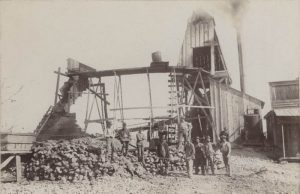
Until 1876, however, it was unknown if the ore existed in sufficient quantities to be of commercial value. In the spring of 1877, John Shoe and John McAllen, two miners from Joplin, Missouri, began to examine an area on Short Creek and soon obtained permission to sink a shaft. At a depth of 15 feet, they discovered a rich zinc deposit. The West Joplin Zinc company soon bought the land for $1,000, establishing Empire City. Lead was also discovered nearby, and people flocked to the area, establishing the town of Galena. Coal was also discovered, and the first coal shaft opened in Kansas south of the Leavenworth district was also established in 1877, along with the town of Scammon, which soon became one of the most significant coal shipping points in southwestern Kansas.
More railroads came to the county, including the Nevada & Minden Railroad (later absorbed by the Missouri Pacific Railroad) in 1886, and the Missouri, Kansas & Texas Railroad extended a branch from the mainline at Parsons to Mineral City in 1894.
In the meantime, the county had grown so quickly that a new courthouse had been built in Columbus in 1889 for $70,000.
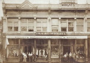
The population of Cherokee County peaked at the turn of the century, supporting more than 42,000 people. By this time, Cherokee County was the second-largest coal-producing county in Kansas, and the southeastern part of the county sat in the heart of one of the nation’s wealthiest and most productive lead and zinc regions. In 1901, the Missouri, Kansas & Texas Railroad was completed through Columbus and Galena to Joplin, Missouri, so the area provided excellent transportation facilities by its many railroads.
In addition to its rich minerals, the county also thrived on agriculture, primarily producing corn, wheat, and oats and having about 300,000 fruit trees. Plentiful limestone was quarried, and an abundance of clay was found in many parts of the county was used to manufacture bricks.
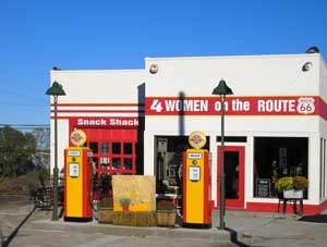
Three towns in the very southeast portion of the county got a bump when Route 66 was developed in 1926. Travelers could then travel from Chicago, Illinois, to Los Angeles, California, in their Model-Ts. Fondly called the Mother Road, Galena, Riverside, and Baxter Springs greeted and served thousands of travelers across the western half of the United States. The route crossed just 13 short miles through the mining towns of southeast Kansas, and for more than three decades, business prospered along the highway. However, when US-66 was bypassed by Interstate 44 in 1961, it crossed directly from Missouri to Oklahoma, bypassing Kansas entirely and, no doubt, sounding the death knell for several businesses.
Like numerous other mining meccas, the resources were exhaustible. The number of operating mines in the early 1900s was estimated to be in the hundreds, but the output from the Cherokee County mines peaked in the 1920s and 1930s and diminished afterward. Several small smelters were operated throughout the county, but all were consolidated into a single site at Galena, Kansas, in about 1920. The last mine in the county, located just west of Baxter Springs, Kansas, closed in 1970. The Galena smelter closed the same year. Over the years, many of Cherokee County’s mining towns ceased to exist.
With the mines playing out, the population dropped, and its citizens settled into a quieter lifestyle primarily based on agriculture.

Big Brutus in West Mineral Kansas stands testimony to the prosperous mining days of Cherokee County by Kathy Alexander.
Contact Information:
Cherokee County Economic Development
104 S. Kansas
Columbus, KS 66725
620-762-0717
©Kathy Alexander/Legends of Kansas, updated August 2023.
Also See:
Southeast Kansas Photo Gallery
Sources:
Blackmar, Frank W.; Kansas: A Cyclopedia of State History, Vol I; Standard Publishing Company, Chicago, IL 1912.
Cutler, William G; History of Kansas; A. T. Andreas, Chicago, IL, 1883.
U.S. Fish & Wildlife (broken link)
Cherokee County Economic Development


