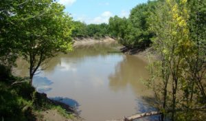
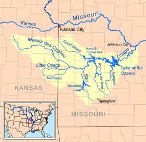
The Marais des Cygnes River, a principal tributary of the Osage River, is located in eastern Kansas and western Missouri, and is approximately 217 miles long.
The river is formed about three miles north of Reading in western Lyon County, Kansas, by the confluence of Elm Creek and One Hundred Forty-Two Mile Creek. It flows east-southeastwardly through Osage, Franklin, Miami, and Linn Counties in Kansas and Bates County in Missouri. It joins the Little Osage River at the boundary of Bates and Vernon Counties in Missouri to form the Osage River, six miles west of Schell City. The name Marais des Cygnes translates to “Marsh of the Swans” in French, referring to the Trumpeter Swan, which was historically abundant in the Midwest.
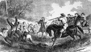
On the Marais de Cygnes River in Linn County, the Marais des Cygnes Massacre occurred in May 1858, an altercation between pro-slavery and Free-State forces during the Bleeding Kansas days leading up to the Civil War.
The river has long been notorious for flash flooding, the first of which was known as “Big Water” in Native American legend, occurring in 1844. Though no measurements were taken, it is estimated to have crested at 40 feet. Later floods included a 1909 flood that crested at over 36 feet, a 1915 flood that crested at 31 feet, another in 1928, when the water rose more than 38 feet, and the last major flood in 1951, which crested at over 42 feet. In this last major flood, 41 people were killed, and damages were estimated in the millions. As a result, the U.S. Army Corps of Engineers built levees and flood control systems on the Marais des Cygnes River in the 1960s.
A U.S. Army Corps of Engineers dam forms Melvern Lake in Osage County, Kansas, located near Eisenhower State Park. The river runs directly through the 7,500-acre Marais des Cygnes National Wildlife Refuge near Pleasanton, Kansas.
©Kathy Alexander/Legends of Kansas, updated September 2025.
Also See:
See Sources.


