| Town | Post Office Dates | Additional Information |
| Austin | 1870 1874-1895 1896-1905 |
Austin was a Missouri, Kansas & Texas Railway station in Canville Township. It was 11 miles northwest of Erie and four miles from Chanute. |
| Big Labette | 1870-1871 | |
| Canville | 1866-1872 | |
| Chard | 1879-1888 | Located in northern Grant Township, Chard was established in July 1878 and named after Charles Chard. |
| Cremona | 1869-1878 | |
| Earlton | 1871-1976 |
Earlton was founded in 1870. Not much progress was made until about 1876, when a railroad depot was built there. The town’s name was first spelled Earleton until it was changed to Earlton in 1950. Its post office closed on July 3, 1976. As of the 2020 census, the population of this tiny town was 60. |
| Haden | None | |
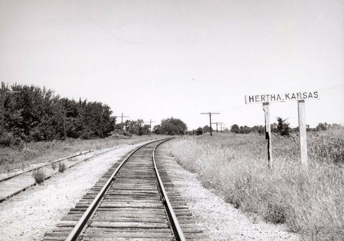
| Hertha | 1887-1932 |
Hertha was on the Missouri, Kansas & Texas Railway six miles south of Erie. In 1910, it had an express office and a post office, with a population of 40. |
| Irwin | 1871 | The post office was only open for about six months. |
| Island | 1871-1878 1880-1901 |
In southeast Neosho County, L.F. Rogers established the first settlement in 1869. It was called Island because of its location at the foot of the Big Island, on the Neosho River. L.F. Rogers built a sawmill in 1869 and a gristmill in 1873. M.S. Austin opened a general store in 1880. That year, T.M. Warne purchased the entire townsite, including the stores, mills, and houses, which housed five or six resident families. |
| Jacksonville | 1867-1882 | Jacksonville was situated at the intersection of Crawford, Neosho, and Labette Counties, and was approximately 100 yards from the corner of Cherokee County. |
| Kimball-Kimbal-Dalton | 1888-1956 | Kimball was located in Grant Township on the Missouri, Kansas & Texas Railway. The plat was filed in May 1888 under the name of Dalton, but the post office and railroad station were called Kimbal in honor of C.H. Kimball, president of the town’s first railroad. It was about eight miles northeast of Erie. |
| Ladore-Fort Roach | 1867-1901 |
Located in southern Neosho County, Ladore was named initially Fort Roach in honor of James N. Roach, its principal founder. The report that it was probably made the railroad junction, where shops and businesses were to be built, was the cause operating in favor of its rapid advancement, which, for a time, was scarcely paralleled. |
| Morehead | 1873-1954 |
Morehead, Kansas, is an unincorporated community in Shiloh Township, Neosho County. It is also an extinct town, as its post office closed decades ago. |
| Newport | 1870-1871 | The post office was only open for about eight months. |
| Odense | 1872-1902 | Odense was located in the northern part of the county, nine miles south of Erie. It had a population of about 24 in 1910. |
| Orcuttville | 1870-1871 | The post office was only open for about five months. |
| Ord | 1870-1872 | |
| Palo Alto | 1870-1872 | |
| Prairie Du Chien | 1868-1871 | The post office moved to Thayer when it closed. |
| Rochester | 1869-1870 1872 |
|
| Roger’s Mills | 1865-1870 | The post office moved to Tioga when it closed. |
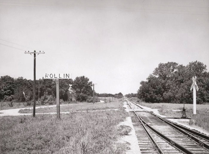
| Rollin | 1890-1901 |
Rollin was an Atchison, Topeka & Santa Fe Railroad station in Erie Township. The population in 1910 was 24. It was eight miles northwest of Erie and five miles west of Shaw. |
| Rose Hill | 1870-1871 | Rose Hill was about one mile south of the present town of Galesburg. It was a town of three or four houses, and a store on the claim of Squire Rosa, the postmaster of the place. It was deemed advisable to consolidate Rose Hill with the new town of Galesburg. John Snyder procured an ox team and had his store building moved to the new location. The post office moved to Galesburg when it closed. |
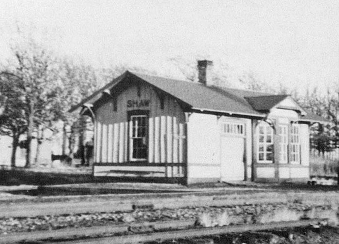
| Shaw | 1885-1954 |
Founded in 1885, Shaw was located in Erie Township on the Atchison, Topeka & Santa Fe Railroad. In 1906, it had two grain dealers, two real estate dealers, a hotel, a livery, and E.E. Eckley was the postmaster and proprietor of a General Store. In 1910, it had telegraph and express offices, a good local trade, and a money order post office with one rural route and a population of 125. There are still a few buildings in the area, including the Shaw Cemetery. It was four miles west of Erie.
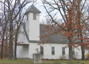 Christian Church in Shaw, Kansas, Jimmy Emerson, Flickr. |
| South Mound | 1872-1971 |
South Mound is an unincorporated community located on the Missouri-Kansas-Texas Railroad. The railroad tracks were removed in 1989 following the merger with the Missouri Pacific Railroad. As of the 2020 census, the population of the community and nearby areas was 27. It is located in Lincoln Township, 11 miles south of Erie.
|
| Tioga | 1870-1872 |
Tioga is now part of Chanute.
|
| Trent | 1894-1901 | A station on the Atchison, Topeka & Santa Fe Railroad, it was about two miles east of Erie. |
| Urbana | 1870-1957 |
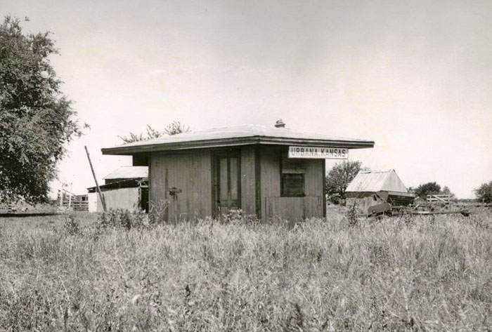
Urbana is an unincorporated community founded and platted in 1870 by Dr. Peters. It was located on the Missouri Pacific Railroad. From 1877 to 1878, Urbana was the site of the short-lived “Esperanza Community,” described as “a colony of communists.” They bought a hotel and ran a newspaper called The Star of Hope. In 1910, it was located on the Missouri, Kansas & Texas Railway and had express and telegraph offices, as well as a money order post office. The population in 1910 was 85. As of the 2020 census, the population of the community and nearby areas was 30. It is located in Chetopa Township, 10 miles west of Erie. |
| Valley City | 1867-1871 | |
| Vietsburgh-Flat Rock | 1870-1888 | The first Postmaster in Flat Rock was A. Markham. In 1879, Mr. Vietz opened a store in Section 36, and the post office was moved there. On August 11, 1879, the name changed from Flat Rock to Vietsburgh. Afterward, Mr. Williams bought the store and became the postmaster. It was located in the southern part of Grant Township. |
©Kathy Alexander/Legends of Kansas, updated December 2025.
Also See:
Sources:
Blackmar, Frank W.; Kansas: A Cyclopedia of State History, Vol I; Standard Publishing Company, Chicago, IL 1912.
Cutler, William G.; History of Kansas; A. T. Andreas, Chicago, IL, 1883.
Kansas Post Office History
Standard Atlas of Neosho County, Kansas, George A. Ogle & Co., 1906.


