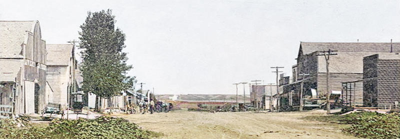
Early day Webster, Kansas.
Webster, Kansas, was an unincorporated community on the south fork of the Solomon River, in Belmont Township of Rooks County. It is also an extinct town, as its post office closed decades ago.
In 1876, before the town’s founding, a small trading post was established on the south side of the south fork of the Solomon River for buffalo hunters and early settlers in the county. It was named in honor of August Belmont of New York, one of the leading Democrats of the nation. The natural resources, such as underground water and fertile soil in the area, made it possible for farmers to settle, break the land, and raise cattle.
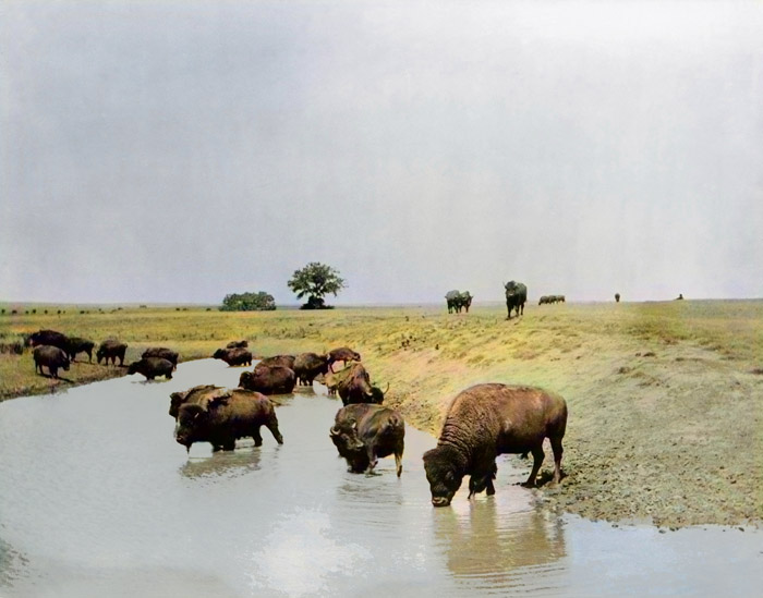
Buffalo on the Great Plains.
In the spring of 1878, there were still buffalo in the area.
The town of Belmont was officially surveyed on August 20, 1878, although the plat was not filed at the Rooks County Courthouse until March 24, 1881.
The Webster School, District #23, was organized on March 20, 1879. School was held in John Enick’s old log house with a dirt floor, with 21 students sitting on planks placed on blocks of wood.
Due to flooding, the Belmont settlement was moved across the river, adjoining a settlement called Webster. Belmont was the first to apply for a post office, but the application was denied because another Kansas town had already been granted the name. Instead, Webster was granted a post office on December 8, 1879, with John Stephenson as the first postmaster. It was located on the south side of town. It was named after Daniel Webster, one of America’s greatest statesmen.
To cross the Solomon River, it was necessary to go upriver to the ford about a mile southwest of town. Early on, there was a wooden bridge that often washed out.
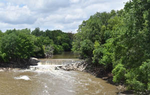
Solomon River in Kansas, by Kathy Alexander.
An early Catholic missionary priest from Plainville included Webster in his circuit, but a church was never established. The Seventh-day Adventists preached in the schoolhouse or other locations, but had no church building.
The Methodist Episcopal Church was initially on a circuit with Mt. Pleasant and Liberty. Their first regular pastor was sent to the Webster charge in 1881. They and the Baptists both held separate worship services in a little stone building that was also used as the town hall and later became part of a residence.
The first school was established in 1882, with George McCubin as the first teacher. Other early teachers were Matt Keer, Vandy Bruton, Minnie Mathews, and Ustel Hubbel. Lola Thompson taught school during the summer of 1882 for three months at a salary of $12 per month, with the privilege of boarding with local families. The first school, built that fall, was a small one-room rock building.
Webster boomed in 1885 when the railroad was being built from Downs in Osborne County up the Solomon River into Rooks County.
Webster’s patent for 48 acres was issued in June 1885 and surveyed on June 23, 1885, with the plat filed two days later. The new patent for Belmont was issued September 15, 1885, and covered 120 acres adjoining the south side of Webster. Both towns shared two common avenues: Main Street, which ran north to south connecting them, and Broadway Street, which ran East and West separating them. Both towns were surveyed again, on November 10, 1885, replatted, and listed only as Webster with no mention of Belmont. The town was never incorporated.
In 1886, plans were begun to build a church in Webster. The Baptists were in charge of the enterprise, but they worked with the Methodists to build the small wooden structure. Both denominations worshipped in this building for several years.

Livery and Feed Store in Webster, Kansas.
By that time, there were 36 new buildings, the lumber for them hauled from Hays, a distance of 60 miles. That year, a two-story frame school was built for $1,200.
In 1888, the Webster Enterprise newspaper showed that nearby farmers and Webster’s 300 residents were served by one bank, two hotels, four grocery stores, three livery barns, two blacksmith shops, three real estate and loan offices, a furniture and harness shop, a hardware store, lumber yard, telephone system, newspaper, barbershop, drugstore, two physicians, two churches, a school, soft drink factory, and a large city park called The Grove featured towering cottonwood trees.
On August 23, 1888, a contract was let for an all-steel bridge at a cost of $2,424, which was completed by November 1888 just south of town.
In 1892, the Methodists selected a building site and laid the cornerstone, but due to hard times, the project was abandoned.
In 1901, a small parsonage was built for the Methodist preacher.
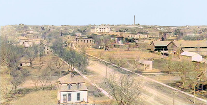
Early day, Stockton, Kansas.
The railroad stopped in Stockton. However, in 1907, Webster’s hopes were revived with the surveying of a north-south railroad. The roadbed was completed from Plainville to a few miles north of Webster when the Panic of 1907, also known as the 1907 Bankers’ Panic, hit, and was never continued.
In 1910, Webster had a hotel, a bank, several retail establishments, a daily mail stage to Stockton and Bogue, a money order post office with one rural route, and a population of 200.
That year, the Methodists began to raise funds to build a new church. In the first two months, $3,200 was raised, and the foundation was established. Miss Alice Mott was visiting in the community at the time and offered to give $250 if the church were named Philander Mott Memorial in honor of her father. The donation was accepted, and the church became known as the Philander Mott Memorial Methodist Episcopal Church. The $6,000 cinder block building was debt-free at the June 11, 1911, dedication service.
In 1911, the village school was consolidated with adjoining districts in Belmont and Rush Townships. School consolidation in Kansas was an experimental project, with Webster being only the second in the state. The new school, Union 3, voted on bonds and built a suitable modern two-story brick building. New school desks were purchased for the classrooms and opera chairs for the auditorium.

Webster School, 1914.
In 1914, a consolidation was made with the rural area, and a new schoolhouse was built. It was dedicated on January 1, 1914, and the students were transported by horse-drawn buses. There were 29 high school students in 1915, with Ellsworth Dodrill serving as superintendent. The high school was soon fully accredited with courses in Vocational Agriculture, Home Economics, Normal Training, and Music. Webster had a reputation for its fine teams in both boys’ and girls’ basketball, as well as other areas of competitive schoolwork. Enrollment increased rapidly, and the first graduating class was in 1918.
In about 1920, the Pentecostal Assembly Church met in a store building on Main Street. When the Baptists closed their doors, the Assembly purchased the church and property. Sometime later, plans were made to build a new church, but only the basement and foundation were ever completed.
That year, the highway was moved two miles north, leaving Webster isolated.
In the 1920s, Webster’s high school was the only school in Rooks County qualified to meet the U.S. Department of Agriculture requirements. Several years later, a gymnasium was added to the north of the school and a shop to the West. When the government lunch program began, a lunch room was added West of the shop.
Throughout the 1920s and 1930s, a post office, a bank, three grocery stores, and two churches were among the few remaining buildings. A grain elevator had been built, but was of little use due to the lack of a railway to support it. The town had lost business, but not its people.
Webster’s last bank closed in 1926. A few years later, oil was discovered two miles south of the town, but there would be no boom.
The shocks of the Great Depression and the Dust Bowl were more than the community could take. A prolonged drought in the 1930s emphasized the need for storing water for irrigation.
As early as 1932, Webster resident Mrs. Lavinia Fry corresponded with Kansas State officials, urging that a dam be built across the South Solomon River to control floods. Her scrapbook held 22 letters, 228 column inches on the subject from the Rooks County Record, and her statement that she had 83 letters from George Knapp regarding a dam.
An organizational meeting was held in Webster in 1938, and a committee was formed to circulate petitions that received 1,186 signatures and were then sent to the Army Corps of Engineers. In 1940, the Kansas Reclamation Association was formed to promote such projects, and the Water Resource Division of the Kansas State Board of Agriculture, headed by George Knapp, became interested in it.
The Webster Unit was approved and authorized for construction under the Flood Control Act of 1944 as a unit of the Missouri River Basin Plan.
On December 17, 1944, a fire destroyed the interior and contents of the Methodist Church building, including two pianos. Only the cement block walls were left standing. Some thought that when pre-warming the church for the Christmas program, a small stove exploded, causing the fire; others said it was arson.
In 1947, $500 of the $2000 insurance check was used to purchase the country schoolhouse from Fairview District #99, which had recently consolidated with Webster.
Church services were held in the High School auditorium after the fire until 1950. The schoolhouse was moved to the old location, then remodeled and refurbished, mostly by volunteer labor. The dedication service was held on May 21, 1950.
At about the same time, Brown-Atchison Electric brought electricity to the area, and dial telephones were installed in 1952.
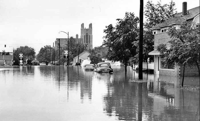
Flooding in Hays, Kansas, 1951.
The Kansas River Flood of July 1951, which was very destructive all the way to the Missouri River, washed out Webster’s steel bridge, which increased demand for adequate flood control. This led to the U.S. Bureau of Reclamation surveying three sites in the area, including one mile West of Stockton, between Stockton and Woodston, and the Webster townsite. Approximately $1,000,000 was appropriated for the foundation of the dam.
By the autumn of 1952, the Bureau’s land agents and lawyers were busy negotiating and dealing with landowners. Haste was at a premium, as Reclamation scheduled the town of Webster for underwater burial by the spring of 1953. To fill a diversion pool, Reclamation planned to relocate houses, businesses, and the town cemetery, submerging any structures left behind. Those who abandoned their buildings received compensation for the salvage value from the Bureau. Operating on a $40,000 budget, the Farm Unit Development/Settler Assistance program had, by the end of 1952, acquired 55 of 164 parcels earmarked for the future lake.
Earth-moving work on the dam’s foundation began on March 14, 1953. Still, the Bureau granted a 60-day extension the following day for locals to relinquish possession of their property so that Webster’s children could complete the school year in the community schoolhouse. The dam was completed on December 2, 1953, but there were still doubts about Congress allowing money to complete the dam. After much persuasion from Kansas politicians and citizens, in December 1953, a contract for the completion of the Webster Dam was awarded for approximately $6,000,000, with work to begin in March 1954 and be completed in July, 1956.
The 1954 High School class was the last to graduate from the old 1911 brick building, one of the many brick-and-limestone buildings demolished to make way for the Webster Dam.
After many town meetings, a new townsite was founded two miles southeast of old Webster. A new $186,000 school structure was built, and the Methodist Church and several residences moved to the new location. Sixty-six adults and 59 children moved out of the Webster Reservoir area because the dam was being built, but only a dozen or so residents moved to the new town, with the rest moving elsewhere. Approximately 30 buildings were moved to the Stockton area. Harry Griffin of Stockton Monument Service moved all of the bodies from the Webster Cemetery, 200 to the Stockton Cemetery, and 29 to other parts of the state.
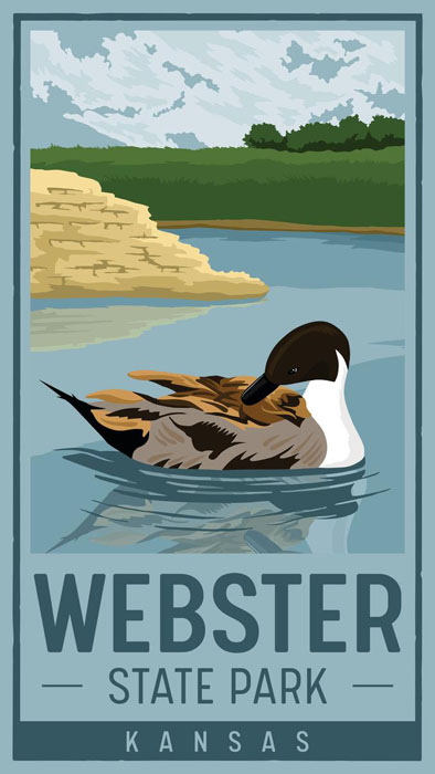
Webster State Park.
Dr. H.C. Brown was the last medical doctor in Webster, who moved his practice to Stockton. The Methodist and Pentecostal Assembly Churches, Fry’s Store, and Northup’s Store, which included the post office, were the last churches and businesses in Webster. The last stamping at the old Webster post office was June 30, 1953, by Margaret H. Northup, postmistress.
The dam was completed on July 26, 1956. Water was impounded on May 13, and on July 23, 1956, it covered 700 acres, marking the end of old Webster. The dedication program was held on October 5, 1956, in Stockton, with a parade on Main Street and an evening dance at the city auditorium. The official dedication was held the next day, October 6, at the Webster Dam site, with a free barbecue. The speaker was Fred G. Aandahl, Assistant Secretary of the Interior. The main purpose of the dam is for flood control, but irrigation, recreation, fishing, and wildlife are all important reasons for its construction. The dam stores flood runoff of the South Fork of the Solomon River to permit the irrigation of 8,500 acres of land in the lower valley between Woodston and Osborne. The maximum water storage during a flood period is 415,000 acre feet, covering a surface area of 19 square miles. At the time the dam was built, a small airstrip was put in at the south end of the dam, but it has since been closed.
The last high school graduating class was in 1963, and the grade school transferred to Stockton in the fall of 1969.
Webster lies approximately 0.5 miles south-southeast of Webster Dam. Webster is 0.3 miles East of Kansas Highway 258, 2.5 miles south of U.S. Route 24, and roughly 8 miles west-southwest of Stockton, the county seat. What is left of Webster lies at the intersection of two unpaved county roads — 11 Road, which runs north-south, and M Terrace, which runs east-west.
©Kathy Alexander/Legends of America, updated June 2026.
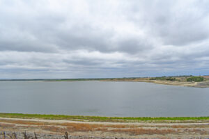
Webster Reservoir, Kansas by Kathy Alexander.
Also See:
Sources:
Blackmar, Frank W.; Kansas: A Cyclopedia of State History, Vol I; Standard Publishing Company, Chicago, IL 1912.
Bureau of Reclamation
Chesney, Billie; Dammed if You Do, Dammed if You Don’t: A Case Study of Webster Belmont Township, Rooks County, Kansas 1885-1954, Kansas State University Chapman Center for Rural Studies, Fall 2012.
Fesler, Myrtle D.; Pioneers of Western Kansas, Midwest Genealogy Center, 1962.
Fort Hays State University
Wikipedia