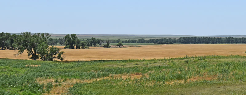
Wallace County Landscape.
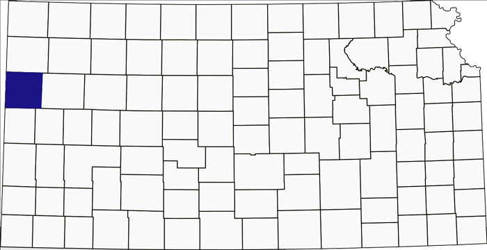
Wallace County, Kansas Location.
Towns & Places:
Sharon Springs – County Seat
Wallace
Weskan
Mount Sunflower
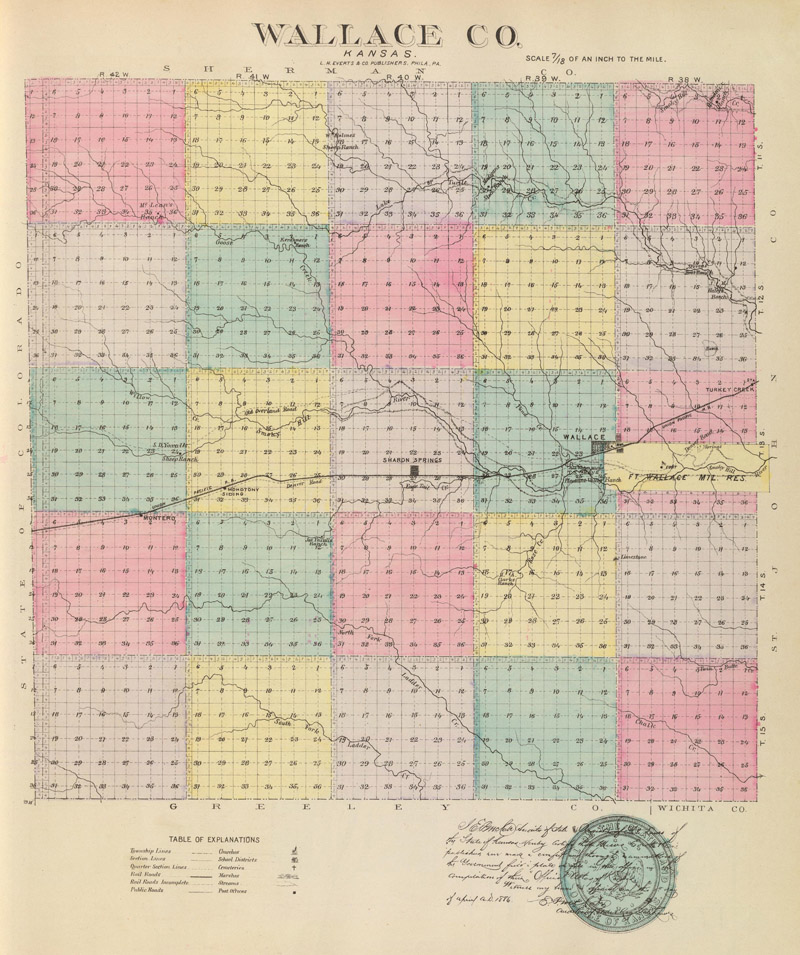
Wallace County, Kansas, by H. Everts & Co., 1887.
Wallace County is located in Northwest Kansas. Its county seat is Sharon Springs. As of the 2020 census, the county population was 1,512, making it the second-least populous county in Kansas. The county covers 914 square miles, of which 914 square miles is land and 0.05 square miles is water.
Wallace County, one of the westernmost in the state, is in the third tier South of Nebraska. It is bounded on the North by Sherman County; on the East by Logan; on the South by Greeley and Wichita Counties, and on the West by the State of Colorado.
Early native peoples camped here in the High Plains during the hunting season, when plentiful herds of bison roamed. Stone circles were found at a site in Wallace County that provide information about early life on the plains. These stone circles marked where Native peoples placed tipis while hunting in the area. Sometimes they returned to the same spot in later hunting seasons, creating shallow depressions where the tipis stood. These types of archaeological remains are rare in Kansas.
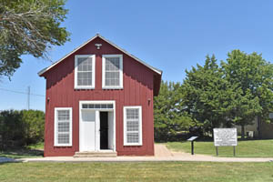
Pond Creek Station at Fort Wallace, Kansas by Kathy Alexander.
Before Wallace County was created, Fort Wallace, Kansas, was first established as a Butterfield Overland Dispatch station on the Smoky Hill Trail in 1865. The stagecoach service and mail route went from Atchison, Kansas, to Denver, Colorado. It was initially called the Pond Creek Stage Station. Located 1.5 miles West of present-day Wallace, Kansas, the stop was a rest station that provided food to travelers. However, the route was not without peril, and the station saw so many Indian attacks that a temporary military camp called Camp Pond Creek was situated right next to it.
In 1865, General Tecumseh Sherman authorized the military post of Fort Wallace. Its mission expanded to protect railroad construction.
Because of Indian raids, the stage line soon became insolvent, and in 1866, it was sold. The soldiers moved a few miles East to the South Fork of the Smoky Hill River, and the new post was named Fort Wallace in honor of General W.H.L. Wallace, who died at the Battle of Shiloh, Tennessee, in the Civil War. Built by the soldiers, the buildings were constructed of native stone or wood, with a peak of 40.
In 1867, Lieutenant Lyman Kidder and ten members of the Seventh Cavalry, stationed at Fort Wallace, encountered Sioux and Cheyenne forces in present-day Sherman County. All the U.S. troops were killed in this skirmish, called the Kidder Massacre. As tensions with the Plains Tribes in the area grew, Fort Wallace experienced more encounters than many other frontier forts. Additional funding enhanced its fortifications, leading to the construction of 40 buildings made from native stone and wood. The fort typically housed around 75 soldiers, with a maximum capacity of 350. Notable figures associated with Fort Wallace included George Armstrong Custer, George Forsyth, Buffalo Bill Cody, and Wild Bill Hickok. The fort struggled to maintain supplies, such as food, because of its remote location in the West. Additionally, soldiers contended with illnesses like dysentery and cholera.
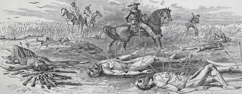
“The Kidder Murder.” From “My Life on the Plains” by Gen. George A. Custer (1874).
The county was created in 1868 and named for Brigadier General W.H.L. Wallace, a veteran of the Mexican-American War who died from wounds received in the Battle of Shiloh, Tennessee, during the Civil War. The county initially included all territory now in Wallace and Logan counties, and the Legislature defined its boundaries. It was attached to Ellis County for judicial purposes.
That year, the Kansas Pacific Railroad reached Wallace, which added to the number of settlers. Personnel from Fort Wallace protected the railroad’s workers as they laid the rails through Wallace County. The town of Wallace was two miles West of Fort Wallace. It was initially called Wallace Station. Construction continued westward through the county for two years, connecting Wallace, Sharon Springs, and Weskan, and crossing the Kansas-Colorado line in 1870.
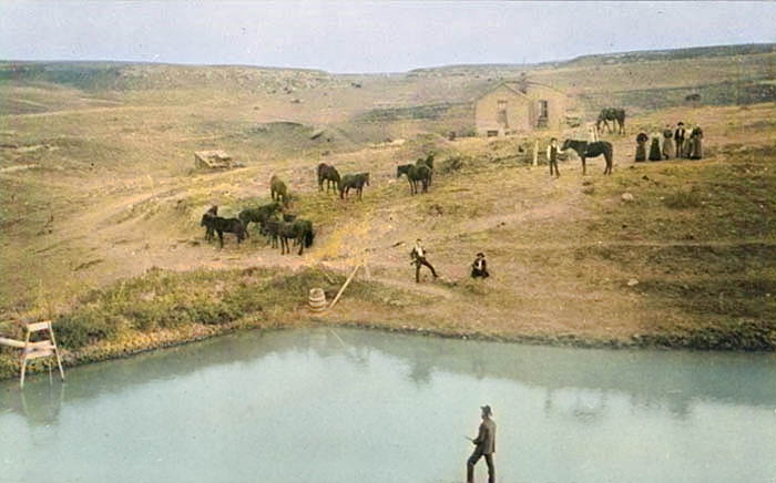
Wallace County, Kansas homestead, 1870s.
A summer census showed a population of 609. W.H. Bush, W.L. Todd, and Richard Blake swore it on August 17. On August 25, Governor Samuel J. Crawford issued a proclamation organizing the county, designating Pond City as the temporary county seat, and naming the following officers: county clerk, Welcome Hughes; justice of the peace, John Whiteford; commissioners, W.L. Todd, Richard McClure, and Richard Blake.
The general surface was undulating with rough lands along the streams. Timber is scarce. Bottom lands average from one-fourth mile to one mile in width. The Smoky Hill River, which enters across the West line from Colorado, and its numerous branches form the water system. Magnesian limestone, native lime, and gypsum were common.
Between 1870 and 1890, Wallace served as a division point on the Kansas Pacific Railroad between Kansas City, Missouri, and Denver, Colorado. Wallace had railway yards, a roundhouse, offices, a hotel, and a restaurant.
In 1874, a German family was traveling through the area headed West when they encountered Cheyenne Indians. Five members of the family were killed; four girls survived. They were taken to different places but eventually were found and reunited.
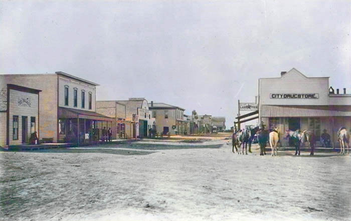
Wallace, Kansas, about 1880.
Wallace became the Wallace County seat in 1875. That year, the county elected officers, and only 24 votes were cast. All of them were for Wallace as county seat. That year, the county’s boundaries were enlarged by a tract 52 miles long and six miles wide on the North and another 36 miles long and six miles wide in the East.
During the next few years, no representative was sent to the Legislature, and the few people remaining in the county wanted relief from the burden of separate government. In 1879, the Legislature voted to dissolve the government if the Supreme Court decided it had been fraudulently organized, as some citizens claimed.
By the 1880s, Wallace had become a thriving town of 3,000. During its reign as the railroad’s westernmost division point, Wallace was the only outfitting and shipping point between the Union Pacific main line along the Platte River in Nebraska and the Gulf of Mexico.
In 1881, the county took its final form, and the boundaries were redefined.
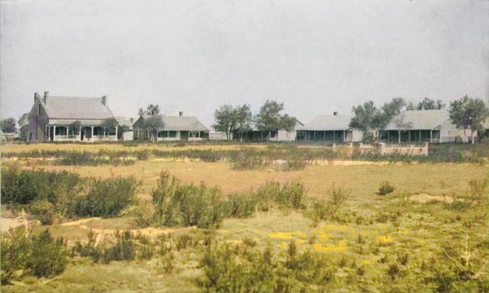
Fort Wallace in the 1880s.
Fort Wallace was abandoned in 1882.
The county population was 500 in 1884.
In 1886, Wallace County was attached to Trego County for judicial purposes, but that same year Wallace County citizens, wishing to resume separate government, asked for reorganization. The attorney-general looked into the matter and decided that no reorganization was necessary, stating that the Supreme Court had never reorganized the county. Accordingly, the county officers elected in 1875 who remained resumed their duties at Wallace, the former county seat. Those present were Commissioner T.F. Hayes, County Clerk F. L. Amet, and Deputy County Clerk Charles J. Smith. They appointed James Yoxall and Lewis Winans county commissioners to fill the vacancies and voted to ask the governor to appoint Samuel A. Chisum as sheriff.
The county was divided into voting precincts in preparation for the fall election. The element around Sharon Springs objected, but a mass meeting was held at Wallace, and resolutions were adopted recognizing the county as organized and ordering that the regular election be held in November. The following officers were then elected: County clerk, I.T. Teeters; treasurer, George W. McEwen; sheriff, Samuel Chisum; attorney, Thomas D. Hamilton; clerk of the district court, George R. Allaman; register of deeds, J.V. Campbell; superintendent of public instruction, Parminis Smith; coroner, H. H. Yost; surveyor, Thomas L. Dellinger; commissioners, Myner T. Griggs, Thomas Madigan and James Yoxall.
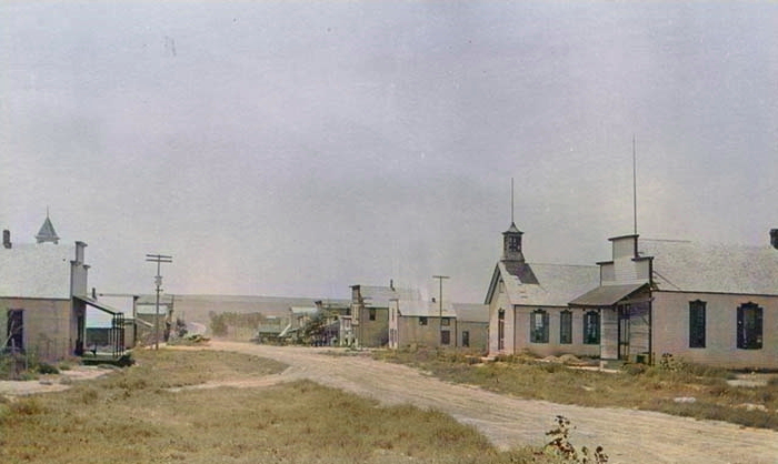
Sharon Springs, Kansas, about 1885.
The Sharon Springs faction took the matter to the Supreme Court, and in January 1887, it ruled that the county was not organized and that the officers were not legally elected. This news startled many couples who had been married by the probate judge and now feared their marriages were not legal. The county government was set aside, and Wallace again became attached to Trego County for judicial purposes.
The county seat was moved to Sharon Springs in 1887, and the first courthouse was built that year.
In 1888, the old military reservation opened to settlement.
In the fall of 1888, C.L. Vanderpool was appointed census taker. His report showed a population of 2,357, of whom 692 were householders. The assessed valuation of property was $327,618, of which $140,812 was real estate. In his proclamation issued January 5, 1889, Governor Martin named Sharon Springs the temporary county seat and appointed Samuel L. Kay as county clerk; James Yoxall as sheriff; and O.R. Brown, John W. Gessell, and Myner T. Griggs as commissioners. The commissioners met and divided the county into voting precincts. The Legislature passed a bill granting the commissioners the power to retain Sharon Springs as the county seat for five years without an election. This unusual proceeding caused great dissatisfaction in some parts of the county, especially in Wallace, and the feeling ran very high between the two factions.
Wallace County is divided into seven townships: Harrison, Morton, North, Sharon Springs, Stockholm, Wallace, and Weskan.
At the special election, held on April 15, 1889, the Wallace faction voted for their own town, which received 330 votes out of 606, which would have been sufficient to have made it the county seat. The Sharon Springs supporters did not vote on the county seat question and would not recognize it as before the people. The following officers were elected: clerk, Edwin H. Soule; treasurer, John Zencker; probate judge, John M. Ewell; sheriff, Fred P. Manzer; attorney, Joseph M. Sanders; district clerk, John F. Stevens; superintendent of public instruction, James M. Robinson; surveyor, Thomas L. Dellinger; commissioners, Eden Lewis, George Robinson and James Yake.
The clerk, sheriff, and district clerk, being of the Wallace faction, moved their offices to that town, while the other officers remained in Sharon Springs. The sheriff called a special election for September 18 to select a county seat. Wallace received 343 votes, which would have made that town county seat under ordinary circumstances. The Sharon Springs faction did not vote. The Supreme Court ruled that Sharon Springs was the county seat and refused a rehearing. They built a courthouse there, and the county clerk was compelled to move the records there.
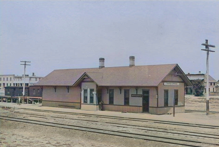
Railroad depot in Sharon Springs, Kansas.
In 1890, the Kansas Pacific Railroad moved this division point to Cheyenne Wells, Colorado. This move decimated Wallace; the population dwindled, and the economy disintegrated. That year, the county’s population was 2,468.
In 1900, the county’s population fell to 1,178. The division point was moved back East to Sharon Springs, Kansas, in 1909 and remained there until the late 1940s.
By 1910, the county’s population had grown to 2,759. At that time, the Union Pacific Railroad entered on the East line, crossed Southwest to Sharon Springs, then West into Colorado. In 1910, farm products were valued at $384,671, with corn, the leading crop, worth $55,206. Property was assessed at $5,240,975.
By 1910, Wallace had only 20 houses.
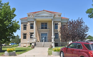
Wallace County Courthouse in Sharon Springs, Kansas, by Kathy Alexander.
The second and present courthouse was constructed in Sharon Springs from 1914 to 1915. Located at 313 Main Street and 3rd Street, the Classical Revival building was designed by William Earl Hulse & Company of Hutchinson, Kansas, and built by William Foley. The east-facing building is a two-story, buff-colored brick-and-concrete structure on spacious, landscaped grounds in the center of Sharon Springs. The East front has two large columns supporting a portico at the top of the second story. Large steps on the East side lead up to the entrance. Two large columns stand at the South entrance. Inside, the County District Court courtroom is located on the North side of the second story. The building houses the County District Court of the 15th Judicial District, which also includes Cheyenne County, Logan County, Rawlins County, Sheridan County, Sherman County, and Thomas County.
In 1926, a large cloud of dust and loud rumbling announced a sinkhole’s appearance in the county. The noise continued as the sinkhole expanded from 50 feet wide to 300 feet wide and 450 feet long; the depth was never known. Water, earth, and rock eventually filled in the Smoky Basin Cave-In sinkhole.
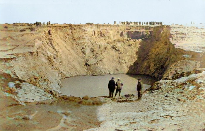
Sunken basin in Wallace County, Kansas, in 1926.
The county’s population peaked at 2,882 in 1930.
Warm weather in the early 1930s caused the jackrabbit population to increase in western Kansas. By 1935, an estimated 8 million rabbits lived in 30 western Kansas counties, including Wallace. The migratory animals ate green plants to their roots. Farmers already struggling with drought during the Dust Bowl fought to protect their gardens and field crops. Communities sponsored jackrabbit drives on Sunday afternoons to attempt to control the population.
In 2013, a Wallace County sinkhole in far western Kansas appeared without warning and then grew to more than 200 feet across and 90 feet deep. The Kansas Geological Society determined that natural dissolution of underground halite (rock salt) likely caused the catastrophic collapse. As it dissolved, groundwater seeped through fractures in layers of Cretaceous chalk and slowly carved a substantial hole in the 2,000-foot-deep, 200-foot-thick halite bed. When the salt bed could no longer support the weight of the overlying rock layers, everything from the surface down collapsed into the void. Kansas Geological Society scientists determined that the Permian-age salt bed probably extends beneath the collapse site, making groundwater dissolution of the salt the likely culprit.
Today, Wallace County USD 241 and Weskan USD 242 serve the county.
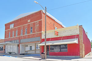
Business buildings in Sharon Springs, Kansas by Kathy Alexander.
Wallace County is home to Mount Sunflower, Kansas’s highest point at 4,039 feet. Mount Sunflower lies about 15 miles north-northwest of Weskan, less than one mile from the Colorado state line. It is one of four Kansas counties that use the Mountain Time Zone rather than the Central Time Zone used by the rest of Kansas.
©Kathy Alexander/Legends of Kansas, updated September 2026.
Also See:
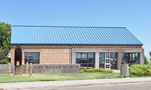
Fort Wallace Museum, in Wallace, Kansas, by Kathy Alexander.
Sources:
American Courthouses
Blackmar, Frank W.; Kansas: A Cyclopedia of State History, Vol. I; Standard Publishing Company, Chicago, IL 1912.
Kansapedia
Kansas Geological Society
National Register
Wikipedia