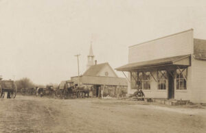
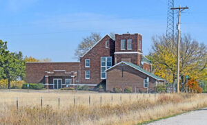
Aulne, Kansas – Dead in Marion County
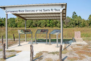
Cottonwood Crossing/Moore’s Ranch
More Extinct Towns:
| Town | Post Office Dates | Additional Information |
| Alvin | 1901-1905 | |
| Avilda | 1878-1879 | |
| Aulne | 1887-1954 | Located in Wilson Township, it was a station on the Chicago, Rock Island & Pacific Railroad six miles south of Marion. In 1910, it had a money order post office, a good local trade, did considerable shipping and had a population of 150. Today, the town still has a few buildings and an active church. |
| Bethel | 1870-1883 | |
| Canada | 1884-1954 | An unincorporated community, it was named for many Canadian immigrants coming to the area. It is located between Hillsboro and Marion. There are just a few buildings left today. |
| Clear Creek | 1867 | |
| Creswel | 1873-1901 | |
| Doyle | 1866-1871 | |
| Fair Play | 1877-1878 | It was located five miles south of Peabody. |
| Fred | 1883-1901 | Fred was between Peabody and Hillsboro. |
| Gale | 1883-1887 | |
| Gnadenau | None | Gnadenau was a communal village of German-speaking Mennonite immigrants from Russia who arrived in August 1874. Its name means Meadow of Grace or Grace Meadow. In 1879, the village dramatically declined when the Marion and McPherson Railway Company built a railway north of the village and established the nearby town of Hillsboro. No buildings remain at this former community site. But the Gnadenau Cemetery still exists. It was located about two miles southeast of Hillsboro. |
| Horner | 1898-1904 | Horner had a railroad station, cattle pens, and the Oscar Horner Quarry, which yielded magnesium limestone. It was located approximately three miles northeast of Peabody. |
| Kuhnbrook | 1887-1898 | |
| Menno | 1881-1886 | |
| Milton | 1872-1877 | |
| Moore | 1897-1899 | |
| Mud Creek | 1873-1886 | |
| Oursler | 1886-1889 | Oursler was named for W.E.M. Oursler, who came to Kansas in 1870 and kept a post office on his place for several years. After the Marion and McPherson Railway Company was built from Florence to Marion on the southwest side of Oursler, a depot was built, and mail was brought to the station early each day. In addition to the post office, there was a brick kiln and a small grocery store. On October 17, 1877, W.E.M. Oursler and his wife filed a plot for a small town named Oursler with a size of two blocks. But the town didn’t make it. Today no buildings remain. It was located about 3.5 miles southeast of Marion. |
| Quarry | 1888-1897 | Quarry had a railroad station and a limestone rock quarry. It was approximately 5.5 miles north of Marion. |
| Risley | 1873-1879 | The post office moved to Hillsboro. |
| Sampson | 1881-1883 | |
| Watchorn | None | Watchorn was a former oil boom community during the 1910s and 1920s. It is located at the corner of Timber Rd and 60th St. |
| Youngton | 1872-1873 1875-1901 |
Located northeast of Marion. |
© Kathy Alexander/Legends of Kansas, updated May 2024.
Also See:


