
Rock City Park in Ottawa County, Kansas by Kathy Alexander.
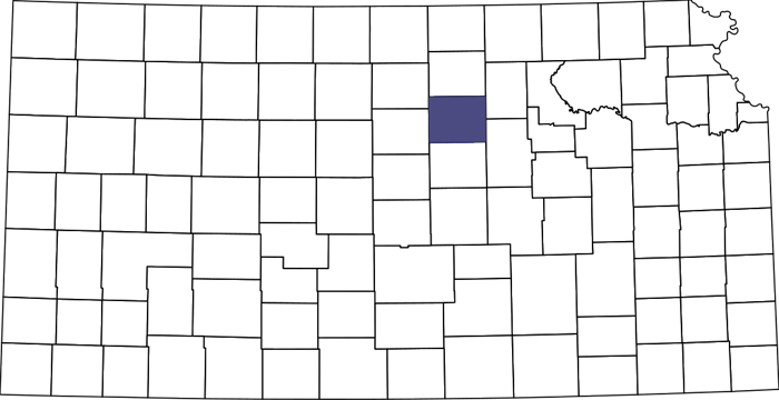
Ottawa County, Kansas Location.
Towns & Places:
Ada – Unincorporated & Extinct
Bennington
Delphos
Minneapolis – County Seat
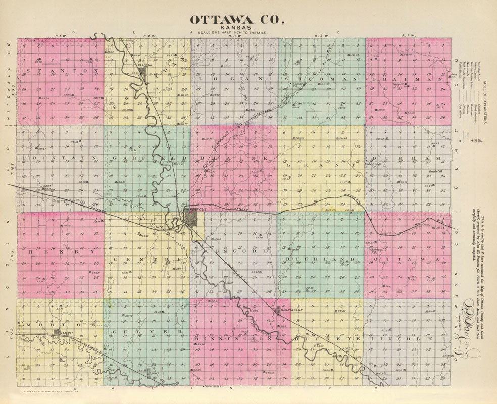
Ottawa County, Kansas Map by L. H. Everts & Co, 1887.
Tescott
Niles – Unincorporated & Extinct
Wells – Extinct
Extinct Towns of Ottawa County
Ottawa State Fishing Lake

Ottawa County, Kansas Landscape by Kathy Alexander.
Ottawa County, Kansas, is located in the north-central part of the state. Its county seat and largest city is Minneapolis. As of the 2020 census, the county’s population was 5,735, and it has a total area of 721 square miles, comprising 721 square miles of land and 0.6 square miles of water. The county was named after the Ottawa Indians.
Ottawa County is situated on the west side of the sixth principal meridian, 125 miles west of the Missouri River, and in the third tier of counties from the Nebraska line. It is bounded on the north by Cloud County; on the east by Clay; on the south by Saline, and on the west by Lincoln and Mitchell.
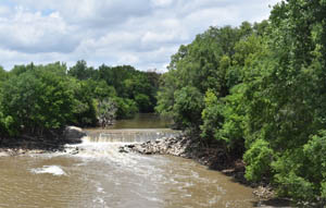
Solomon River in Minneapolis, Kansas by Kathy Alexander.
One of the best counties in Central and Western Kansas, it boasted rich soil and a desirable location. It was most admirably watered, with a good supply of timber and an abundance of excellent building stone, including red sandstone and limestone. The principal stream is the Solomon River, which enters the county from Cloud County in the northwest part and flows in a southeasterly direction to Saline County. Into it, the empty Pipe and Coal Creeks from the east and Salt Creek from the west. The Saline River traverses the southwestern portion of the county, going from Lincoln County to Saline County.
Along the rivers and most of the creeks, there was a good supply of timber, principally cottonwood and elm; but oak, box elder, walnut, ash, and huckleberry are also found in all parts of the county.
The surface in general is an undulating prairie with rough lands along the divides and slopes leading down to the bottom lands, which constituted about one-fourth of the total area of the county. Limestone, red sandstone, ocher, gypsum, and potter’s clay are plentiful.
One-third of the land in the county was valley, and two-thirds is table or gently rolling tableland, making it an agricultural and stock-raising section. The valley lands were exceedingly fertile, and there were a great many fine farms on the uplands which yielded large crops of grain. However, they were better adapted to grazing, as they are more subject to drought than the valley lands. The soil of the uplands, a dark, rich mold, was typically six inches to three feet in depth.
Coal was discovered in various parts of the county, principally along Coal Creek. However, no mines were tested to ascertain the extent of the supply, which was quite limited. There were several salt springs along the two rivers and Salt Creek, whose waters were highly saturated with saline matter.
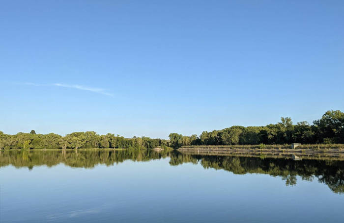
Ottawa State Fishing Lake, Kansas, courtesy Google Maps.
The largest lake is Ottawa State Fishing Lake, a 111-acre reservoir to the east of Minneapolis. The Kansas Department of Wildlife and Parks manages it.
The Ottawa Indians, who gave the county its name, were the original inhabitants.
The first settlers in Ottawa County were William Still, George Darling, and a Frenchman named La Pere. They built a cabin in May 1855 near the mouth of Coal Creek and cultivated a garden. They were part of the Reader colony, which settled at Solomon City, at the junction of the Solomon and Smoky Hill Rivers. However, by the fall, the Sioux War induced them to leave.
In June 1855, the Solomon Valley was prospected as a potential site for the settlement of a large colony from Ohio. However, it was not selected because it was considered unsafe, being located beyond the frontier.
William Frost located near the mouth of Coal Creek in 1858.
The first to establish homes for families were S.M. Wright and E. W. Branch, near the present site of Minneapolis, in 1859. Others who arrived that year included Jacob Humburger, H.R. Little, and Josiah Hocker.
The Legislature established the county on February 17, 1860. That year, Ottawa County suffered a great drought, which led to a decline in immigration.. The settlers received relief in the form of 10,810 pounds of provisions.
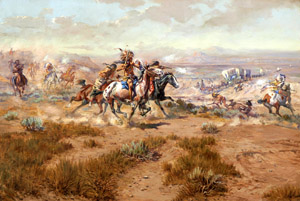
Indian Attack by Charles Marion Russell.
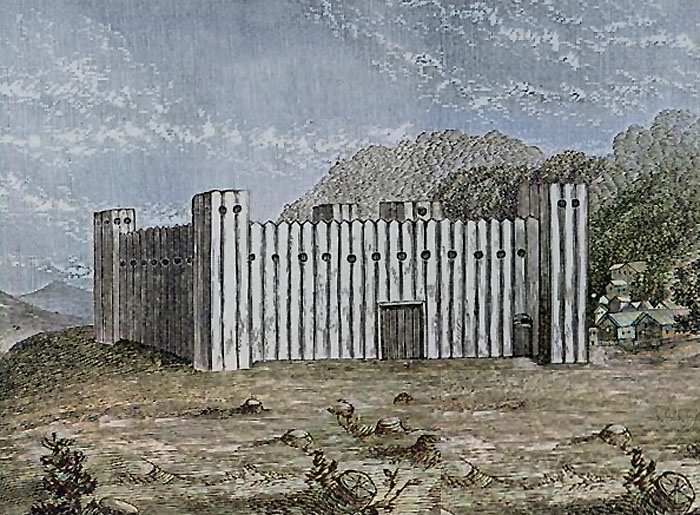
The outbreak of the Civil War the following year gave rise to numerous Indian raids that occurred at intervals from the fall of 1861 until about 1868. The settlers were driven out, but they returned, and in 1864, they banded together for protection. A garrison was established on the Solomon River, known as Fort Solomon. Several log cabins were built within the enclosure, and the settlers lived there during the summers of 1864 and 1865.
The first school in the county was taught at Concord in 1864 by Miss Charlotte Ingersoll. The school population was not more than 20 at that time.
That year, two post offices were established—one at Bennington with S.Z. The boss was the postmaster, and the other was at Ayresburg with J.C. Boblett as postmaster.
Fort Solomon was built in Ottawa County, Kansas, in the early part of 1864, when Indians became very troublesome. Their raids were frequent in adjoining counties, and six settlers in Saline, Ottawa, and Mitchell counties lost their lives.
Seymour Ayers and John Knight, appointed in 1864, were the first Justices of the Peace in the county.
Until 1865, Ottawa County, with Clay, Dickinson, and Saline Counties, and all the unorganized territory west of these counties, was attached to Davis County (now Geary County) for judicial purposes. R.H. Little, of Ottawa, was a member of the first grand jury that sat at Junction City, and Isaac Markley was the defendant in the first suit docketed in the District Court. Mr. Markley gained his suit. The Legislature of 1865 attached Ottawa to Saline County for judicial purposes. S.Z. Boss was appointed Justice for Ottawa.
 The first sermon was preached at the house of Mrs. Boss at Fort Solomon in 1865.
After the war, the county was rapidly settled by discharged soldiers.
J.C. Boblett, with Israel Markley, built the first mill in the county at Elkhorn, and the first store in the county was opened by Colonel John Kerwin at Fort Solomon in 1866.
In July 1866, Seymour Ayers prepared the papers for the organization of the county, as required by law to have a population of 500. The Legislature at that time appointed R.C. Whitney, Henry Martin, and a Mr. Branch as commissioners. The county was formally organized in 1866 in response to a petition from the citizens. Seymour Ayres prepared the papers for organizing the county. Governor Samuel Crawford appointed the following officers: J.H. Ingersoll, county clerk; Amasa May, Henry Dresher, and A.J. Willis, commissioners. Ayersburg was named the county seat. At the first election, held in November 1866, the following officers were elected: G.R. Ingersoll, A.H. Boss, and Silas Seaman, commissioners; H.S. Wooden, county clerk; George Culver, treasurer; D. Pierce, Sheriff; and J. H. Ingersoll, county attorney.
Ottawa County was divided into 20 townships, viz: Bennington, Blaine, Buckeye, Center, Chapman, Concord, Culver, Durham, Fountain, Garfield, Grant, Henry, Lincoln, Logan, Morton, Ottawa, Richland, Sheridan, Sherman, and Stanton.
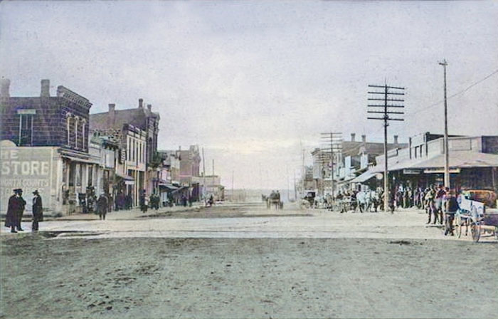
Vintage Minneapolis, Kansas.
Minneapolis was founded that year.
Minneapolis and Lindsey were candidates for county seat honors. They are equally distant from the county’s exact center. The Governor designated Ayersburg as the county seat until the people select a place. This was done in the fall of 1866, the vote resulting in favor of Minneapolis. The county rented a building in Minneapolis for its county offices, and a square was set aside where a substantial courthouse could be erected as soon as the county became sufficiently settled and wealthy.
A poor farm was well supplied with buildings.
With the exception of horse-stealing, comparative peace prevailed in this county from 1865 until 1868.
Until 1868, the various Indian raids had resulted in the death of but one Ottawa County man, Peter Miller. In that year, however, two disastrous raids occurred. The first was in August, when much property was destroyed, but fortunately, no one was killed, though a number saved themselves only by great coolness and good judgment. In October, a raid was made which resulted in the death of four men: Peter Kerns, an old gentleman by the name of Smith, Alexander Smith, and John Andrews. Mr. Virtue and Mr. Morgan were wounded, and the wife of the latter was carried away into captivity, from which she was rescued the following spring. The last raid occurred in June 1869, when an attack was made on Summerville, where the Indians were repulsed by Ben Markley and a son of Captain Pierce, on whose house the attack was made. At the same time, the Smithville post office was burned, and two young men—Mr. Dyer and John Weir were killed.
The grasshopper raid in 1874, which devastated the whole state, killed all the vegetation in the county, and the people were again obliged to ask for aid.
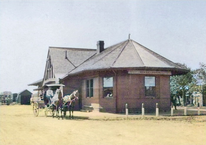
Union Pacific Railroad depot in Minneapolis, Kansas.
The Solomon Valley branch of the Kansas Pacific Railroad was built to Minneapolis in 1877 and extended to the county limits two years later. Bonds to the extent of $100,000 were issued to aid in the building. This road, which later became part of the Union Pacific Railroad, entered the southeast corner and followed the Solomon Valley northwest into Cloud County. Another line of the Union Pacific runs through the southwest corner of the county, and the Atchison, Topeka & Santa Fe crosses the central portion east and west.
On May 30, 1879, a tornado passed Ottawa County in a northeasterly direction, entering from the southwest. It did no damage until it reached the Salt Creek Valley, from which point it was very destructive, until it passed the northern line of this county, beyond which point it did no material damage. Within this short distance of about 12 miles, the fields were laid waste, 20 dwellings blown to pieces or badly wrecked, and six lives lost, besides considerable damage being occasioned to stock. The loss of property, excluding crops, was estimated to be over $15,000. The names of those killed are Katie Krone and her sisters, Mrs. Vosh and Mrs. Anna Vosh; Mr. McCalmot, and a traveler by the name of Jacob Garber from Center County, Pennsylvania, who had taken shelter from the storm under one of Mr. Krone’s sheds. There were a number of other persons seriously injured.

Delphos, Kansas Street.
Just ten days later, on the night of June 10, the flourishing village of Delphos, 12 miles northwest of Minneapolis, was partially destroyed by a tornado. It commenced at Cawker City and continued down the course of the Solomon River, devastating the center of Ottawa County. At the time it struck Delphos at about 10:00 p.m., the citizens of Minneapolis were gathered at an ice cream festival to benefit the victims of the former tornado. The charitable entertainment was not disturbed, as the hurricane passed to the north. Thirty-three houses were destroyed at Delphos, which was fully one half of the town and included almost its entire business portion. Remarkably, no lives were lost, but the damage to property was about $26,000. The path of the tornado crossed the latter at right angles, about two miles southeast of Delphos, and destroyed two new dwellings that were being built from the ruins of the first tornado.
By the early 1880s, the school population had grown to approximately 4,000. The schools were numerous, and generally in an advanced and flourishing condition. The buildings are well-maintained, and the latest and most up-to-date textbooks and school equipment are used. There were over 80 organized districts, with nearly as many good school-houses. The total valuation of all school property was about $50,000.
On June 9, 1881, a third tornado occurred in the southern part of the county, moving east from the Saline River. Six homes were destroyed, and three people—Mr and Mrs. L.F. Frothingham and George Combs—were killed. Many others were injured but recovered.
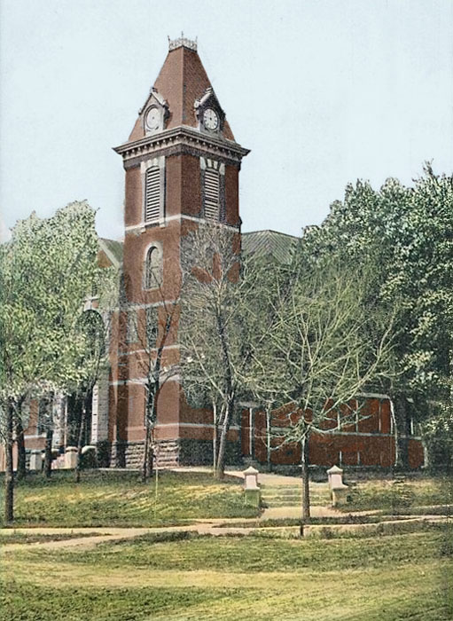
First Ottawa County Courthouse, 1910.
The first courthouse was a two-story brick structure built by Kelly & Stephenson in Minneapolis in 1886.
Ottawa County’s population peaked in 1890 at 12,581.
In the early 20th century, Ottawa County gained recognition for its thriving poultry industry.
In 1910, the area was 720 square miles or 640,800 acres, of which 350,397 acres were under cultivation. The value of the farm products at that time was $4,423,784, of which wheat amounted to $862,082; corn, $1,192,308; and oats to $235,765.53. The value of animals sold for slaughter was $1,443,246. The total assessed valuation of property was $27,124,816. The county’s population was 11,811, resulting in an average wealth per capita of over $2,300.
During World War II, the county contributed to the war effort with the establishment of the Salina Army Airfield.
Between 1956 and 1957, a new two-story, Modern-style courthouse, constructed of buff-colored limestone, glass, and concrete, was built. Designed by Williamson-Loebsack & Associates, it was built by the Johnson Brothers Construction Company. The rectangular-shaped building is located on landscaped grounds in the center of Minneapolis. The east front features vertical glass panels and a canopy at the main entrance. In the interior, the walls are lined with gray colored marble. The County District Court courtroom is located on the west side of the second story. The building houses the County District Court of the 28th Judicial District. On the west side is the two-story Sheriff’s Office and County Jail. It is located at 307 North Concord Street at the junction of West 3rd Street.

Ottawa County, Kansas courthouse in Minneapolis, Kansas by Kathy Alexander.
©Kathy Alexander/Legends of Kansas, updated July 2025.
Also See:
Sources:
American Courthouses
Blackmar, Frank W.; Kansas: A Cyclopedia of State History, Vol I; Standard Publishing Company, Chicago, IL 1912.
Choose Ottawa County
Cutler, William G.; History of Kansas; A. T. Andreas, Chicago, IL, 1883.
Kansas Post Office History
Wikipedia