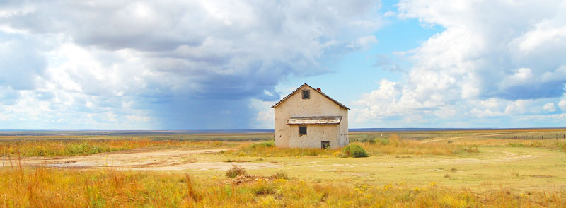
Kansas Prairie in Gove County by Kathy Alexander.
By Henry Howe, 1857.
In the remote West, so remote that a few years ago much of it was depicted on United States maps as the Great Unexplored American Desert, lies a country that has suddenly shot to prominence in social and political spheres.
The Territory of Nebraska extends from the British possessions in the North to Texas in the South, and from the western borders of Arkansas, Missouri, and Iowa in the East to the eastern boundaries of New Mexico, Utah, and Oregon in the West. This area covers 485,000 square miles. Within this vast expanse—large enough to fit 62 states the size of Massachusetts side by side—it is proposed that two territories, which will eventually become states, be formed. The aim is to spread the institutions, education, morals, and habits of republican freemen throughout the region.
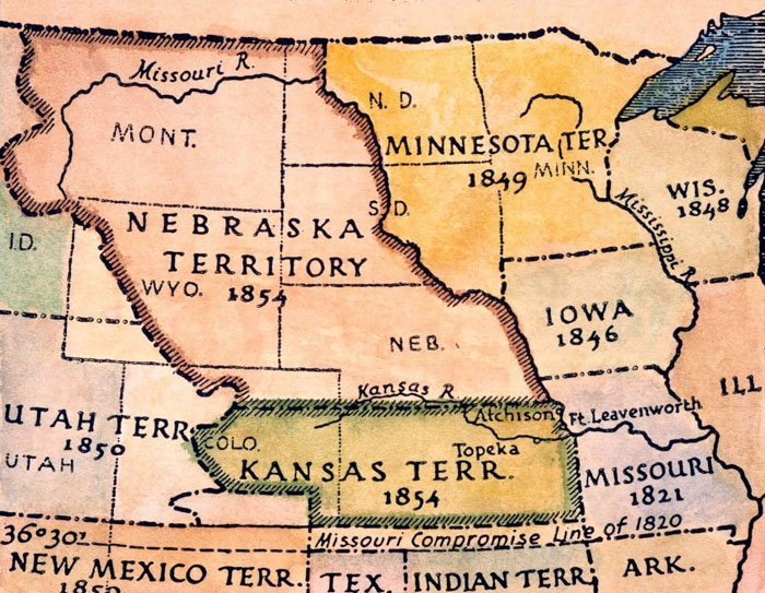
Nebraska Territory, 1854.
Previously, this territory was reserved as hunting grounds and homes for Indigenous tribes, some of whom have been hereditary inhabitants of the land. In contrast, others were expelled from areas that settlers had previously sought after. As a result, this land has been legally protected against encroachment by those seeking to claim it.
A small group, motivated by a desire for solitude or fear of the law, has ventured into the wilderness, establishing a settlement of nearly 1,000 settlers in a region that could become a key agricultural hub. This area has attracted speculators and sparked political interest. The first session of Congress in 1854 marked a pivotal moment, as it proposed creating two large territories from the Native Americans’ last home. This proposal ignited a fierce debate between the North and South over the issue of slavery in these new territories, particularly regarding the boundaries of Nebraska, the northernmost area.
Begin at the point on the Missouri River where the 100th parallel of latitude crosses it, then West on that parallel to the East boundary of Utah, on the Rocky Mountains to the British possessions, East to Minnesota, South to the Missouri River, and then down said river to the place of beginning.
The bounds of Kansas, as defined by the Congressional bill, were:
Begin at the point where the 37th parallel of latitude crosses the western limits of Missouri. West to New Mexico, then North to latitude 38 degrees, then along said boundary to Utah, then on the boundary of Utah to latitude 40 degrees, then East to Missouri, then South to the place of beginning.
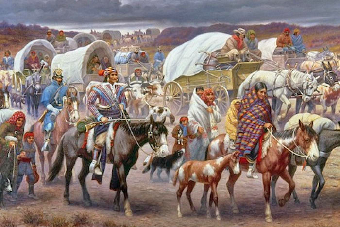
Forced removal of Native Americans.
The expansion of territorial institutions across this vast country will leave only a small portion of land—once entirely belonging to the Native Americans—to the remaining members of this marginalized group. Currently, the area between the northern boundary of Arkansas and the southern boundary of Kansas is the last part of the United States where civil institutions established by white settlers have not yet been extended, assuming this bill is passed. It is reasonable to wonder how long the greed of Christian America will restrain its desire to seize this final remnant of the race we have displaced, considering our past actions.
Until a territorial organization is established, any white person entering this area may face misdemeanor charges and immediate eviction. Some individuals have taken the risk to enter, and their impunity may encourage more to follow. The 18 to 20 Native American tribes in the proposed Nebraska and Kansas region are uniquely seen as “uncivilized” compared to even the wildest white pioneers.
Many Native Americans are eager to embrace new opportunities. Relocating to the western border of the Nebraska Territory could offer benefits for those who are uncertain. With the right support, they can thrive and inspire future generations to seize opportunities their ancestors overlooked. We have two positive paths forward: granting citizenship to those who wish to settle and engage in the community, or encouraging a reconnection with their ancestral lands in the Rocky Mountains.
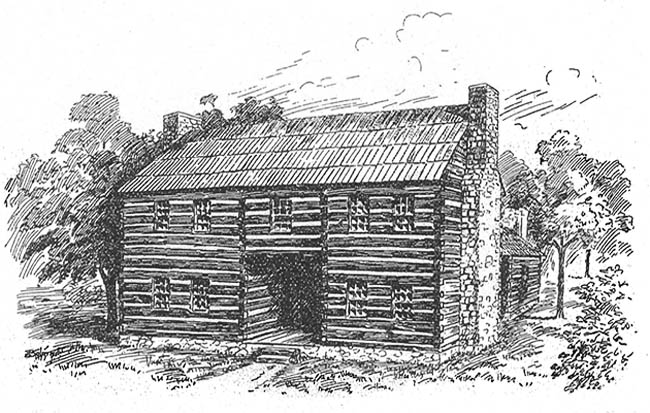
Shawnee Indian Mission in what would become Turner, Kansas.
The efforts of Christian missions alone are insufficient to civilize the race. Even our own claimed civilization, which Christianity has influenced for many centuries, would struggle to sustain itself if our material conditions were as unstable and unfavorable as those of others. A crucial factor in the progress of any society is the clear and distinct prospect of improving the conditions of all its members through organized industry and the practices of Christian morality. This motivation to strive for improvement is present among white populations but absent among Native Americans.
Currently, they are settled along the banks of the Missouri River, primarily due to the convenience offered by white settlers. However, they foresee that ten years from now, this same convenience from their more powerful counterparts may force them back into the wilderness of the Rocky Mountains, 500 miles farther away. They worry that their children may one day have no land they can genuinely call their own on a continent that was once entirely theirs.
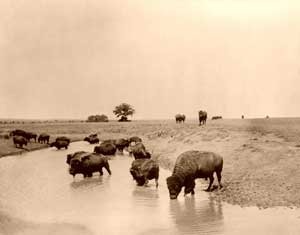
Buffalo at water by the Detroit Publishing Company 1904.
The California Gold Rush and the rapid settlement of the Pacific coast have caused immense harm to the Native Americans of Nebraska. Previously, the buffalo of the distant prairie served as their well-stocked cattle pen, providing a reliable food source. The abundant game in the forests was their constant supply of poultry, while the lush grass along countless waterways served as an unlimited pasture.
The wagon trains that consistently travel between the Missouri River and the Pacific Ocean have undeniably affected the resources vital to a nomadic lifestyle. While grasslands have been depleted and game populations affected, this situation presents an opportunity for new strategies and resilience among Indigenous peoples who have navigated challenging circumstances for generations. The loss of buffalo has indeed posed significant challenges, but the enduring spirit and adaptability of these communities shine through even in such trying times.
While diseases like cholera and smallpox have tragically affected Aboriginal populations, some observers note that food scarcity has contributed to even higher mortality rates. The struggles faced by these communities highlight their tenacity and ability to overcome adversity.
There is a common misconception that conflicts between emigrants and Indigenous tribes stem from lawlessness. Generally, the reality is often more intricate. Displaced individuals from different backgrounds, including emigrants, may act out of desperation, sometimes leading to violence. The Indians, recognizing the risks involved, have mostly chosen restraint. They understand that their actions could provoke a powerful response, and instead focus on preserving their way of life and cultural heritage amid adversity.
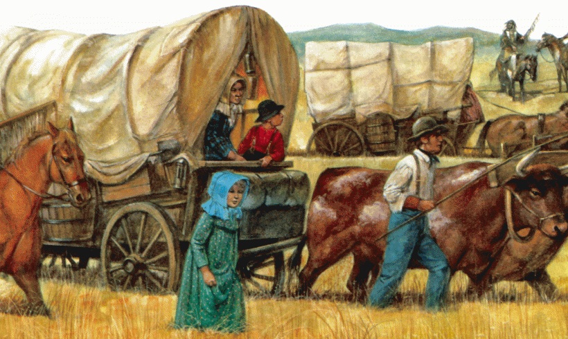
Wagon Train.
The government’s current policy, rooted in past conditions, needs a meaningful shift to promote natural justice and reflect our Christian values as our population grows. The previous approach has not effectively nurtured our communities or addressed Native American needs.
The valley of the Platte River, nearer the northern boundary, is low, but for some 250 miles it is very fertile, then changes into a deep sand. The two great ridges, between the Arkansas and Kansas Rivers, and the Kansas and the Platte Rivers, are a mixed loam and sand, or gravel, which makes a delightful soil to till, and returns heavy crops. The ridge between the Kansas and Platte Rivers is more beautiful and fertile than the other. The valleys are tolerably supplied with timber. There is also some timber along the Missouri River, and a slight growth is found along the small streams.
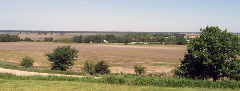
Platte River Valley of Nebraska, courtesy Wikipedia.
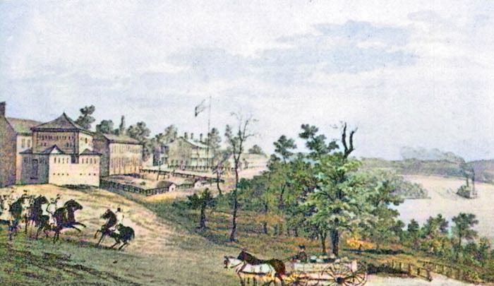
Fort Leavenworth, Kansas.
Fort Leavenworth, Kansas, is an important military post on the West bank of the Missouri River, 31 miles above the mouth of the Kansas River and four miles below Weston, Missouri. This is the oldest fort on the Missouri River, having been established in 1827. It is the great frontier depot for the other military posts on the Santa Fe and Oregon Trails and the general rendezvous for troops proceeding to western forts. The government reservation of nine square miles is in a handsome location, rising gradually from the river to a height of 150 feet. There is a good landing for steamboats. All the buildings are well constructed of stone and present quite an imposing appearance. They consist of the barracks for the troops, a large structure, three stories high; a hospital, which cost from $12,000 to $15,000; the Quartermaster’s building, a capacious warehouse, etc. Connected to the fort is a large farm. It is not unlikely that, in 1860, it will rank as one of the most flourishing towns in the Missouri Valley. In the vicinity are several very flourishing missions and manual labor schools.
The Kickapoo Village is in the state of Missouri, is about four miles above Fort Leavenworth, and is of note from its having been the place of a convention, held September 20, 1853, which made the arrangements for the election of a delegate to Washington, to urge upon Congress the organization of the new Territories of Nebraska and Kansas. The Kickapoo Tribe has made considerable progress in agriculture; many of them have comfortable houses, around which may be seen gardens, numerous domestic animals, fowls, etc., and these, with other indications of civilization, form a pleasing contrast with the condition of the other tribes within the great Nemahaw Agency.
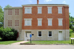
Iowa, Sac, & Fox Presbyterian Mission by Kathy Alexander.
The Iowa and Sac Mission and School is situated about 26 miles Northwest of St. Joseph, Missouri, on the emigrant road from that place. The Mission is said to have been established as early as 1837. The Mission-House is a spacious brick building that cost $8,000. The farm covers 115 acres; more than half of this is used for growing grain and other crops. Several assistants are employed in the school, which is composed of two departments for the respective sexes.
Delaware City, in Leavenworth County, Kansas, was a post office on the Kansas River, ten miles from its mouth. It contained two or three trading posts, and a blacksmith shop.
Briggvale, in the vicinity of Delaware, was the seat of a mission and school of the American Baptist Missionary Union, organized in 1847.
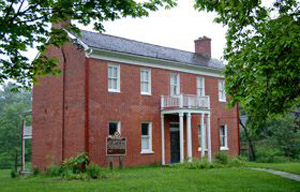
The Shawnee Methodist Mission still stands in Fairway, Kansas, by Kathy Alexander.
Shawnee Mission was three miles from Westport, Missouri, one mile from the State line, and about eight miles from the mouth of the Kansas River. Here was an Indian Mission Labor School, under the direction mainly of the Methodist Episcopal Church, South.
The Shawnee Baptist Mission was two miles northwest of the Methodist school.
The Friends’ Shawnee Labor School was situated three miles West of the Methodist school. The Friends had been laboring among the Shawnee for 50 years, including the period before their removal.
Saint Mary’s, on the Kansas River, 51 miles below Fort Riley, was an essential and immensely flourishing Missionary establishment among the Pottawatomi, and was the largest Roman Catholic establishment in Kansas. This Missionary establishment enjoyed great popularity among the Indians. Its site was said to be the most lovely spot in the Indian country. The Mission Buildings, with the adjacent trading-houses, groups of Indian improvements, and extensive cornfields, all gave it the appearance of a town.
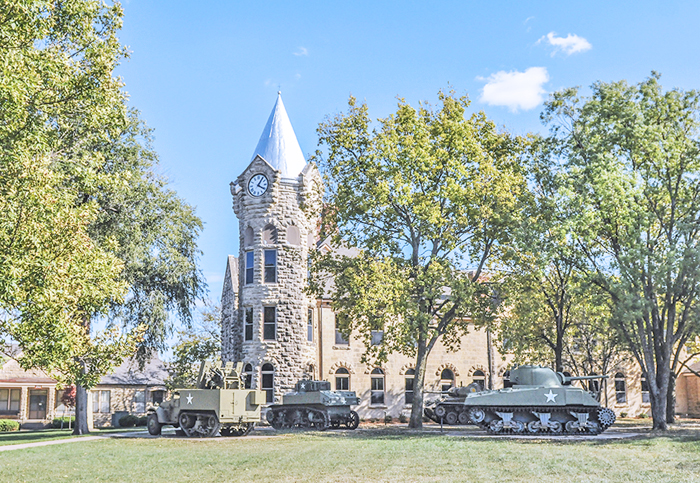
Fort Riley, Kansas Museum, courtesy of the US Army.
Fort Riley was a new military post at the junction of the two main branches of the Kansas River. It possesses excellent military advantages, being in the midst of a fertile country, which abounds in timber, building materials, good water, and grass. Hence, it is a desirable spot for permanent settlers, who can make a very profitable business furnishing the supplies of subsistence, forage, etc., required by the garrison and by the troops and emigrants going to California and New Mexico, who will halt here. In favorable seasons of the year, the Kansas River is navigable to this place. This vicinity, at the junction of the Forks of the Kansas, was formerly known as Grand Point, near which is a Methodist mission.
Fort Scott, formerly a post-office and military post, was on the Marmaton River, a small branch of the Osage River, about eight miles West of the Missouri State line and the boundary of Bates County. This place is visited at least once a month by the Catholic clergy from the Osage Mission on the Neosho River, which is 45 miles distant.
The Baptist Mission and Labor School, among the Potawatomi, in the eastern part of that nation, has at many times been in a very flourishing condition, and is reported as having done as much good as any other mission in the Indian Territory. It is under the direction of the American Indian Missionary Association of Louisville, Kentucky.
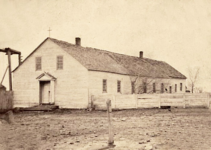
Osage Mission Catholic church, about 1870.
The Catholic Osage Mission, on the Neosho River, 45 miles from Fort Scott, is one of the largest missions and schools in Kansas. There are ten missionary stations in as many different Indian villages within 60 miles, attended monthly by this mission. The Catholic population of this district is reported to be between 600 and 700, and that of the upper country is 3,000.
Elm Grove, or Round Grove, Kansas, is a noted camping-place on the Santa Fe Trail, 25 miles from Westport, Missouri.
Council Grove, a noted stopping-place on the Santa Fe Trail, contains about half a dozen trading houses, a missionary establishment and school, and two blacksmith’s shops.
Fort Mann, on the North side of the Arkansas River, 24 miles above steamboat navigation, was formerly a military post on the Santa Fe Trail.
The Walnut Creek Post Office, at the mouth of Walnut Creek, which enters the Arkansas River, was established in May 1853. This place possessed the advantages of fine grazing, excellent water, and a comparatively good supply of timber. At this point, or vicinity, a new military post was established in June 1853 by the removal of Company D, Fifth Infantry, from Fort Atkinson.
Fort Atkinson, at the crossing of the Arkansas River, on the Santa Fe Trail, was formerly a Post Office and military post. It was established in the summer of 1850, after serving as the site of treaty talks with the Indians. It was first called “New Post” and later “Fort Sumner” before being renamed Fort Atkinson in 1851.
Big Timbers, on the Arkansas River, above Fort Atkinson, is noted for having been, at various times, a place for negotiating and making treaties with the Indian tribes of that region. For a long time, it has been their favorite wintering ground because there is an abundance of buffalo, antelope, deer, and elk year-round, along with good pasture and fuel.
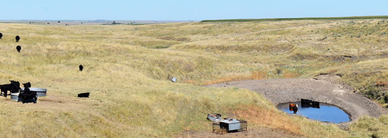
Rolling hills in Decatur County, Kansas by Kathy Alexander.
The surface of Kansas is nearly uniform from the Missouri line to the base of the mountains. It is a continuous succession of gently undulating ridges and valleys. The ridges are not uniformly North and South, or East and West; their general inclination is North and South, but they are thrown into various other directions by the course of the streams and the conformations of their valleys. Within the mountain chain is every variety of aspect peculiar to mountain districts.
The first district of the country, when traveling westward from any point on our western border, exhibits all the defining characteristics of the soil found within that border. This district stretches from the northern to the southern boundary and varies in width from 80 to 200 miles. It encompasses the sources of the Neosho, Verdigris, and Marais des Cygnes Rivers, as well as other tributaries of the Osage River and the lower section of the Kansas River.
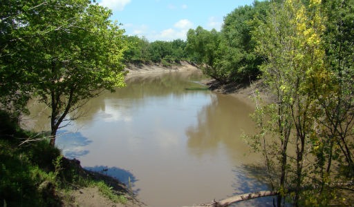
Marais des Cygnes River
This area is unmatched for the fertility of its soil, the quality of its timber and forest trees, the beauty of its expansive prairies, the abundance of its clear streams, and the healthiness of its climate. While it has slightly less timber than areas beyond the state line, it is identical in soil quality and agricultural production, with the added benefit of a purer, more vibrant atmosphere.
Interestingly, this fertile district does not gradually diminish as we move westward into the second district; rather, it ends abruptly. When traveling West from Independence, its boundary is marked by Sandy Creek, a tributary of the Kansas River, while Council Grove delineates it along the Santa Fe Trail.
Along the northern and southern boundaries of the territory, a 100-yard-wide serpentine belt contains two distinct soil types, marking the first and second districts.
The second district appears sandy but is nutrient-rich, supporting abundant grapes and rushes in its moist valleys. However, growth is stunted on ridges during June and July, and the soil becomes too dry to sustain crops after mid-September.
Primarily rural, this district lacks timber, with only a few cottonwood and willow trees found in the Kansas River Valley. Its geological structure confirms that it is unsuitable for agriculture and will remain so. The district extends from Sandy Creek westward to a line a few miles East of Fort Laramie, Wyoming, covering about 350 miles.
Kansas River at Perry, Kansas by Kathy Alexander.
The third district is composed of marl and earthy limestone and is a southward continuation of a similar district heretofore described as existing in Nebraska. It is in this district that buttes most frequently occur. These buttes are elevations varying in width from 100 feet to several hundred yards. They are not knolls or hills. Their surfaces are flat, and their sides are nearly perpendicular. They can be likened to nothing but the trap doors on the stages of theatres when elevated above the floors.
It seems as though the general surface has suddenly sunk, leaving features scattered across the plains. This formation has inspired traders to name certain objects along the Oregon and California Trails the Courthouse, the Cathedral, and the Chimney because of their fancied resemblance to these features. However, this is just a narrow, irregular belt, followed by a fourth district that lies between it and the Black Hills. This area is very fertile and well-suited for growing grains and vegetables, though it is completely devoid of timber.
The fourth district is somewhat similar to the first, especially along the base of the Black Hills, where it has been enriched over the ages by natural debris. This district has more trees than the previous one because the smaller tributaries of the major rivers are more numerous near the base of the Black Hills. The eastern portion of this district is pastoral, resembling the second district, while the western side, which adjoins the hills, features a broad expanse of fertile soil, is well-timbered and watered, and abounds with game, wild fruits, and flowers. It is considered one of the most beautiful and desirable regions on the continent.
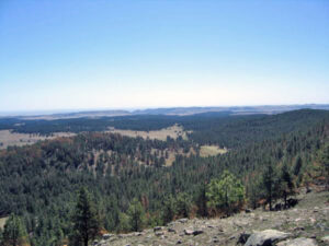
Black Hills of South Dakota, courtesy of the National Park Service.
The fifth district lies between the Black Hills and the main chain of the Rocky Mountains. Here, nature offers a stunning variety of landscapes and soil types. There are majestic mountains whose grandeur evokes both awe and fear. Beautiful valleys nestled among amphitheaters of hills seem like the perfect setting for mythical nymphs to roam, characterized by rolling hills, sparkling streams, and tranquil lakes. The ground is adorned with fruits and flowers, and vines drape elegantly from tree branches. Cascades of water spring from cliffs in vibrant hues, while ancient pines and cedars blanket the mountainsides. The towering peaks soar into the sky, capped with a shimmering crown of snow.
After a few hours of travel, we encounter a stark contrast to this scene of untouched beauty. Here lies a vast, barren expanse covered in swaying lines of sand, supporting only stunted Artemisia and a handful of other miserable plants. Rivulets vanish as they descend from the surrounding barren ridges, and their faint murmurs can be heard beneath the ground. The nearby peaks are massive outcroppings of bare granite, seemingly haphazardly thrown together by some great upheaval.
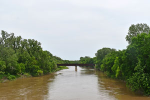
Smoky Hill River near Enterprise, Kansas, in Dickinson County.
In time, small settlements will arise in the rich valleys, forming happy little communities. The Republican and Smoky Hill forks originate in the Rocky Mountains and merge to create the Kansas River. The upper sections of these two forks are clad with poplar, cedar, pine, and other mountain trees; further East, the growth transitions to cottonwood, willow, and smaller shrubs. Across the first district to the state line, you’ll find hickory, ash, walnut, oak, and sugar maple.
The Kansas River Valley is only 20 to 40 miles wide at its broadest point in the first district, tapering as you move upstream. This valley features deep alluvial soil that is remarkably fertile for grains and vegetables. The tributaries of the Kansas River are few, and their valleys are narrow. Currently, the only areas suitable for agricultural use are the first district and the Kansas River Valley. The second district will likely be designated for flocks and herds indefinitely. The third district will remain primarily pastoral until the means to supply it with fuel can be established. The fourth district will eventually be a mix of agricultural and pastoral land, and the same is likely to be true of the fifth district.
~~
By Henry Howe, 1857 – Compiled and edited by Kathy Alexander/Legends of America, updated August 2026.
About the Author and Article: This article was a chapter in Henry Howe’s book Historical Collections of the Great West, published by George F. Tuttle, of New York, in 1857. Henry Howe (1816 -1893) was an author, publisher, historian, and bookseller. Henry wrote histories of several states. His most famous work was the three-volume Historical Collections of Ohio. As he collected facts for his writing, he also drew sketches, which helped create interest in his work. The article, as it appears here, is not verbatim, as it has been edited for the modern reader; however, the content remains essentially the same.
Also See:
Kansas Organized as a Territory
Documenting American History (Legends of America)