
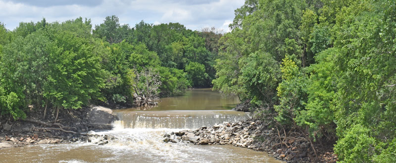
Solomon River in Minneapolis, Kansas, by Kathy Alexander.
The Solomon Valley of Northcentral and Northwest Kansas consists of a narrow floodplain and broad terraces that follow the path of the Solomon River and its major tributaries.
The Solomon River is formed by its two branches—the North and South—both of which rise in Thomas County, Kansas, within 10 miles of each other, and for the first 10 miles flow almost parallel to each other at a distance of not over four or five miles. The North branch flows in a northeasterly direction through Thomas County, the northwest corner of Sheridan County, the extreme southeast corner of Decatur County, the southern portion of Norton and Phillips Counties, the southwest corner of Smith County, and the northeast corner of Osborne County and into Mitchell County.
The south fork flows almost due East through the counties of Thomas, Sheridan, Graham, Rooks, and Osborne, and unites with the other branch about two miles East of the West line of Mitchell County. The main stream then bends southeast across Mitchell County, the southwestern part of Cloud County, across Ottawa County, and the extreme northeastern corner of Saline County, where it joins the Smoky Hill River near the town of Solomon. The Smoky Hill River then flows to Junction City, Kansas, where the Smoky Hill and Republican Rivers combine to form the Kansas River, which flows in an East direction to join the Missouri River in Kansas City, Missouri.
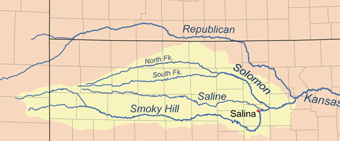
Solomon River Map.
Including its branches, the Solomon River is about 300 miles long, has several small affluents, and waters one of the prettiest sections of the state, covering approximately 6,000 square miles. The Legislature of 1864 declared the river unnavigable, although there is no history of its ever having been considered so.
Much of the land is a rolling upland plain moderately dissected by the tributaries of the Solomon River in the central and northern parts of the county and by those of Salt Creek in the southern part.
The Indians knew the Solomon River as the Nepaholla, meaning “Water on the Hill” — a reference to the legendary Waconda Spring located in the river valley.
In 1683, Jacques Marquette explored the Solomon Valley area and mentioned it in his journals.
Etienne Veniard de Bourgmond visited the area in 1712 and claimed it for France.
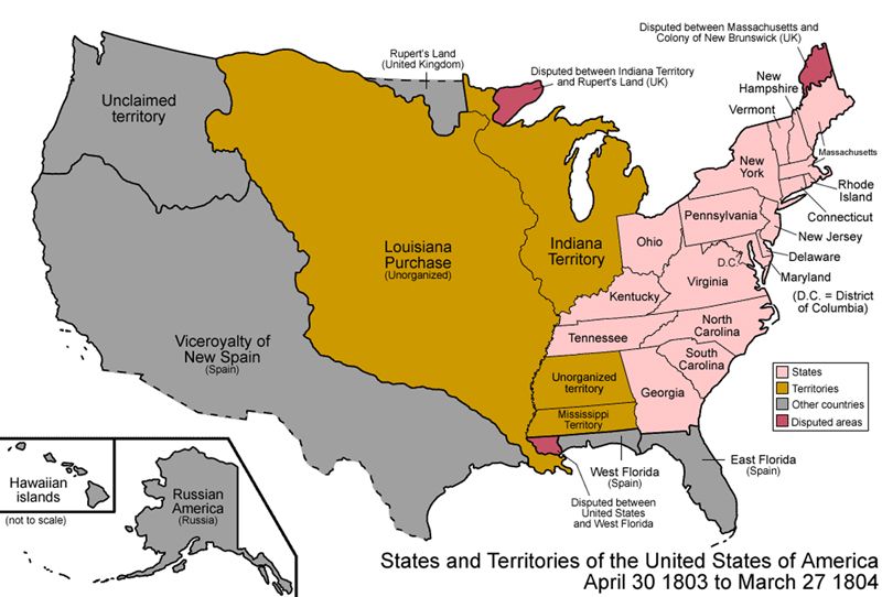
Louisiana Purchase Map.
In 1744, the French explored the river and wrote the first detailed report on the valley. They named the river in honor of the French Intendant of the Louisiana Territory, Salmon; later, the name was corrupted to Solomon.
As a result of the 1803 Louisiana Purchase, the area went from French to American control.
In October 1806, explorer Lieutenant Zebulon Pike of the United States Army camped on the North Fork of the Solomon River, two miles West of what is now the city of Downs. He coined the phrase “the Great American Desert” for the Great Plains, which became popular and unfairly hampered the settlement of this region for decades.
Regarded as one of the prime hunting grounds in the central plains region, the Solomon River Valley was visited by many tribes. The Pawnee, Delaware, Potawatomi, Cheyenne, Kanza, Osage, Arapaho, Kiowa, and Sioux all camped along the river and trapped otter and beaver while hunting deer, elk, antelope, bear, and buffalo.
The first pioneers came to the Solomon Valley via wagon trains to Kansas from the eastern United States. Initially landing in Atchison, Kansas, or St. Joseph, Missouri, pioneers seeking the Solomon Valley had several options in those early years.
When settlement of the Solomon River Valley began in earnest in the 1850s, people followed the river West. The first non-Indian men in the area were hunters and trappers. They lived in dug or found caves next to the river and enclosed them. The streams flowed high and swift, providing the homesteaders with water for their families, animals, and crops. Fish also provided a good source of food.
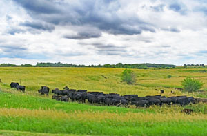
Glasco, Kansas Area Landscape by Kathy Alexander.
Beginning in the 1860s, enough settlers were claiming homesteads that towns were being founded one by one during the westward expansion up the valley. At that time, mail was a challenge. There was an important stop on the stagecoach line that helped overcome the communication barrier: Station #10, northwest of Glasco. The settlement was later called Welcome. By 1867, a permanent post office was established in Glasco. This stop was the farthest West station for people in the Solomon Valley.
The first stagecoach line was operated by the Pikes Peak Express starting in 1862.
Then, in 1865, the Butterfield Overland Despatch took over the Pikes Peak Express. The stage ran a four-horse Concord stagecoach. In some cases, an eight-mule team pulled the coach. Always, four men accompanied atop the stage. Each man had at his side one of the Colt’s revolving rifles, in a holster below one of Colt’s long revolvers, and in his belt a small Colt’s revolver, besides a hunting knife; so that these four men were ready, in case of attack, to discharge 68 shots without having to reload.
In 1865, when settlers first began to look at the valley for homesteads, husbands or scouts for the families made their way to the Solomon Valley. The most common way to do this was for them to travel from Atchison to Fort Leavenworth, then ride the stagecoach to Fort Riley, where they would rent a horse and supplies to scout for a suitable place to settle.
Often, men traveled back to Fort Riley to purchase horses, oxen, and other supplies. Afterward, they would visit the Land Office in Junction City to file a land claim and then return to their homestead to begin the “proving up” process. Soon after, they either traveled back to bring their families or sent word to them.
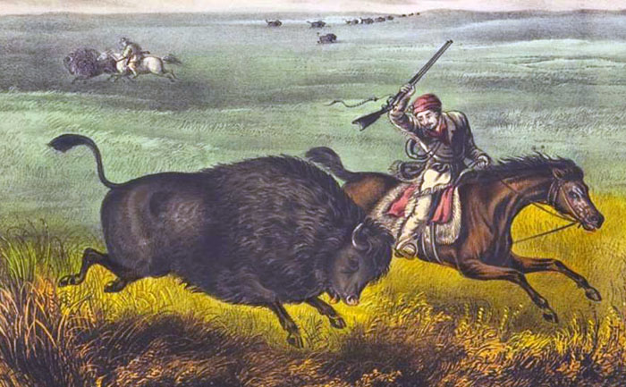
Buffalo hunting on the Plains by Currier & Ives, 1871.
A major negative effect of the stage lines on the Solomon Valley was mass hunting. An estimated 250,000 buffalo were killed between 1865 and 1869. So enormous was the stage traffic in the 1860s that the buffalo became shy, and hunters had to travel miles away from the line to find them. Many hunters stated that the Solomon Valley region and portions of southwest Kansas were the last good buffalo-hunting grounds in Kansas.
By the late 1860s, the western territories were suffering from railroad fever, and companies sprang up to lay routes across them. One such company was the Junction City, Solomon Valley & Denver Railroad, which was formed in September 1869. The new company’s board of directors needed to hire a president who could not only lead the business but also lead an expedition along the Solomon River to sell the region to settlers and railroaders. Soon, Robert McBratney filled the position.
The journey began on October 14, 1869. In addition to a senator, a geology professor, and a railroad agent, McBratney brought along a cook, an ambulance driver, a servant, and almost 100 state troops, changing as they moved from one location to another.
Weather plagued the journey almost from the start, with high winds and blizzards. Despite these difficulties, McBratney fell in love with the Solomon Valley. He wrote, “This is as fine a country as any in the state.” On October 28, he observed that “the hills were nearly covered with buffalo. We have seen more of them today than altogether. Saw deer, elk, and antelope as well. Also gray wolves, thousands of prairie dogs, coyotes, and sage hens.”
He declared, “The water of the Solomon and its tributary is clear, pure, and hard.” McBratney concluded that the railroad in this valley would do more for the people than the wilderness. The Solomon River, according to this early exploratory expedition, was fully capable of housing both industry and communities on its banks and bends.
The Junction City, Solomon Valley & Denver Railroad never came to be. Still, the Union Pacific Railroad built a branch line through the valley after McBratney’s letters to eastern periodicals enticed settlers.

Overland mail stagecoach.
Kansas companies had taken over the Kansas stage lines by 1871 and had extended routes past Welcome to other prospering towns in the Valley.
By the 1880s, railroads were moving into the Solomon Valley. This was the beginning of the end for the stagecoach lines.
©Kathy Alexander/Legends of Kansas, updated July 2026.
Also See:
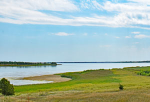
Waconda Lake at Glen Elder, Kansas.
Sources:
Blackmar, Frank W. Kansas: A Cyclopedia of State History, Vol. I. Standard Publishing Company, Chicago, IL, 1912.
Highway 24
Humanities Kansas
Kansas Geological Survey
Solomon River Drainage Basin