Towns & Places:
Yates Center – County Seat
Toronto
Neosho Falls
Piqua – Semi-Ghost Town
Ghost Towns:
Extinct Towns of Woodson County
Cross Timbers State Park
Neosho River
Verdigris River
Woodson State Lake
Yates Center Reservoir
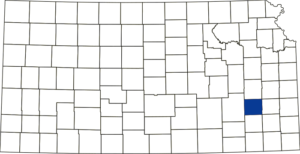
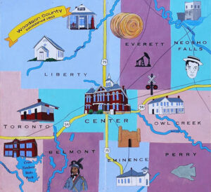
Woodson County, Kansas, is located in the southeast part of the state. Its county seat is Yates Center. As of the 2020 census, the county population was 3,115, and it has a total area of 505 square miles, of which 498 square miles is land and 7.4 square miles is water.
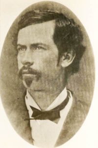
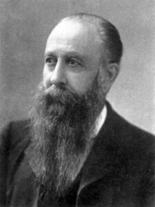
Woodson County was one of the counties created by the first territorial legislature of 1855. It was named after Daniel Woodson, territorial secretary and a five-time acting governor of Kansas Territory.
At that time, the county was not open to settlement as the lands of Woodson County belonged to the New York Indians. However, this did not keep out immigration, as white men eagerly took up some land.
Both native and emigrant Native Americans were “managed” by Indian Agents, men whom the Federal Government appointed. There was an agent in Neosho Falls whose primary responsibility was the Osage Indians, who were “native” to the area in Perry Township. His responsibilities increased when Indians, following Creek leader Opothleyahola, spread out from the Belmont/Fort Belmont area to settle temporarily on Turkey Creek near the Neosho River. There was an agent stationed at Fort Belmont whose primary responsibility was the survivors who walked the Trail of Blood on Ice into Woodson County. When the fort was disbanded, the agent went to Coffey County.
The county’s first permanent settlement of white men was made in 1856. These included David Cooper in Toronto Township, Reuben Daniels in Belmont Township, and John Coleman in Owl Creek Township. A trading post was established in 1856 by D.B. Foster at Belmont, where he carried on traffic with the Osage Indians.
In 1857, John Chapman, Jack Caven, John Woolman, and others located where Neosho Falls would later be settled. William Stockbrand, August Toddman, August Lauber in Center Township, and Thomas Sears in Liberty Township. The first business outside the trading post was a store opened in Neosho Falls in 1857 by Peter Stevens, the first postmaster in the county, who was in charge of the Neosho Falls post office, established on May 21, 1857.
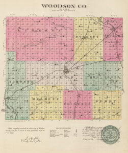
The first school in the county was taught in Toronto Township in 1858. Neosho Falls also had a school the same year. A board of supervisors was created, meeting at Neosho Falls in May 1858 and ordering that all official county business be transacted there. N.G. Goss & Co. donated a jail building to the county for so long that Neosho Falls should remain the county seat. That year, the county supervisors organized five townships: Neosho Falls, Liberty, Owl Creek, Belmont, and Verdigris. Later, this was changed to six townships — Neosho Falls, Liberty, Center, North, Perry, and Toronto. The first towns and villages were Yates Center, Burt, Coloma, Cookville, Finney, Griffin, Keck, Lomando, Neosho Falls, Piqua, Ridge, Rose, Toronto, and Vernon.
The first churches were the Methodist and the Baptist, organized in 1859. School District No. 1 was organized in Liberty Township that year.
In the meantime, the government found that the New York Indians declined to settle upon the land established for them and only maintained a temporary headquarters at Fort Scott, Kansas.
In common with the territory of that section, Woodson County was open to settlement in 1860.
The county is in the third tier of counties from the Missouri state line and the third tier from the Oklahoma line. It is bounded on the north by Coffey County, on the east by Allen, on the south by Wilson, and the west by Greenwood. When it was created and named, it contained very little of its present territory but occupied almost the identical land now in Wilson County. In 1857, the counties of the third tier were crowded northward until Woodson occupied about the same territory as it is now. In 1861, a slice of the southern part was cut off and given to Wilson County.
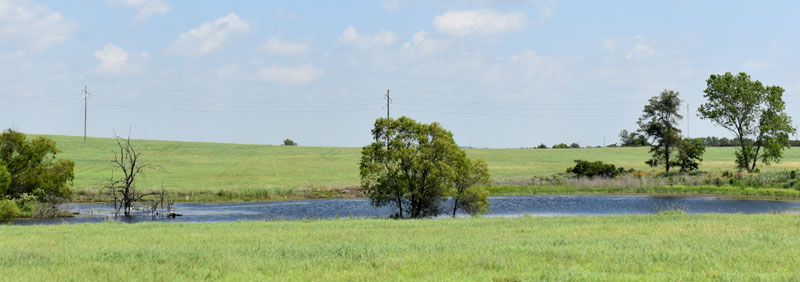
The surface of Woodson County was largely upland, especially toward the center, with bluffs rising from the Neosho River, and just ten percent of bottom land.
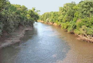
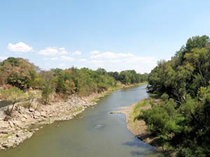
The Neosho River crossed the northeastern corner, and the Verdigris River crossed the southwest corner. Owl and Turkey Creeks are the principal tributaries of the Neosho River, and Sandy and Buffalo Creeks are the principal tributaries of the Verdigris River. The bottom lands along these streams averaged one and one-half miles in width and comprised about ten % of the area of the county. Forest covered six percent, with the remaining 94% being prairie. The principal native timbers that grew along the streams in belts of from one-fourth to one mile in width were oak, cottonwood, hickory, black walnut, elm, hackberry, honey-locust, pecan, sycamore, box-elder, and maple. Limestone and sandstone were found in commercial quantities, and large shipments were made from the quarries to other parts of the country. Potter’s clay and brick clay exist in considerable quantities, and thin veins of coal have been found. The surrounding counties were oil and gas-producing districts, and Woodson County was thought to be underlain with these products.
In the early days, Woodson County was a lively place to live. Men were shot for mere whims, most of the murders being committed for property or in drunken quarrels. Crimes were not uncommon in the days of border ruffianism and bushwacking. Many a man was shot in cold blood for little more than a whim of his murderer. In 1858, a settler named Coleman, living on Owl Creek, was called to his door and shot dead by unknown men. No reason was given for the act, except that he was known to be a Free State man.
One of the most notorious of the ruffians that infested the community was the infamous A.C. “Bully” Smith, who lived nearby on Martin Creek and had a long string of crimes laid at his door. Bully was a proslavery man and had thus been terrorizing the “Yankees” in the area.
Smith had a little difficulty with land entry with a neighbor named Ray in late 1860. Ray, knowing that an entry at the land office at Fort Scott would settle the question, started for that point and reached a ford on the Marmaton River, where he was overtaken and shot by Smith, who returned to the town and openly avowed what he had done. Many other crimes of this nature were attributed to Smith, and he never denied them.
Bully Smith contributed the first money that came into the county treasurer’s possession. Smith had been on a prolonged spree and, descending upon the town, looking for trouble. Being known as a desperate character, he began a promenade before Colonel N.S. Goss’s office, pouring out a torrent of profanity. When no attention was paid to his tirade, he hurled a stone through the window, hitting the Colonel. Goss came out instantly, and before Smith knew what had happened, a writ had been sworn out before Judge D.H. Miller, and the Sheriff arrested the man who boasted that no man could take him alive. A fine of $10 was imposed, and a gold coin was given to the judge. Smith left, vowing never to return. This coin was transferred to the County Treasurer Haughawout and reposed in his pocket, the only county safe, for months. Smith finally returned to the town and, apologizing to Colonel Goss for his action, suggested a compromise which was effected, the fine remitted, and a quantity of whisky procured on which a large party became exceedingly happy. Afterward, Smith moved to California, where it was reported he “died with his boots on.”
Woodson County did its duty to the government during the Civil War. In November 1861, a company of soldiers was organized for service in the Union army at Neosho Falls with B.F. Goss as captain and I.W. Dow as first lieutenant. This was part of the Iola Battalion and was consolidated with others to form the Ninth Kansas Cavalry, which took part in several engagements, including Wilson’s Creek, Missouri, Prairie Grove, and Pea Ridge, Arkansas, and many others. After two years of service on the border, they went south into Arkansas, where they remained until the close of the war. Many returned to Neosho Falls and other parts of the county, while others formed new ties and moved to other places.
Fort Belmont was used during the war, receiving refugees from the Trail of Blood on Ice. Creek Indian leader Opothleyahola is buried in an unmarked grave next to his daughter, who died at the fort.
School District No. 13 was organized in Center Township in 1862, and No. 5 in Owl Creek Township, also in 1862.
In 1865, the county officers had no suitable headquarters, and Dow’s Hall was rented at $36 per year.
In 1867, an election was called to select a permanent county seat. The contesting towns were Neosho Falls, Center, Coloma, and Yates Center, which was listed under its town and range description. Neosho Falls received 129 votes and Yates Center 118.
Efforts to build railroads in Woodson County began in 1867 but were unsuccessful for several years due to the bonds’ failure to carry.
At the second election held in September 1868, Neosho Falls received 313 votes and Chellis (later Kalida) 199.
The county seat question was not revived until 1873, when the vote stood as follows: Defiance, 506; Kalida, 530; Waldrip, 1. This made Kalida, two miles south of Yates Center, the county seat. Defiance was six miles east, and in the election held the following year, it was victorious.
In 1875, the year following the loss of crops, an effort was made to secure bonds worth $5,000 for the benefit of the state’s destitute, but the people, probably thinking that charity begins at home, the effort failed. In February, the vote was 199 to 395. That year, another county seat election was called, and Neosho Falls and Yates Center were the contestants. The first ballot gave no majority. The second ballot, which was hotly contested, was taken in September 1876 and resulted in favor of Yates Center. The matter was never brought up again.
In 1876, the county seat was moved to Yates Center, and Abner Yates purchased a building that had been moved from Defiance and placed on the southwest corner of Courthouse Square, which served as the first courthouse.
By 1878, there were 57 school districts with a population between the ages of five and 21 at 2,638, with 2,086 students enrolled.
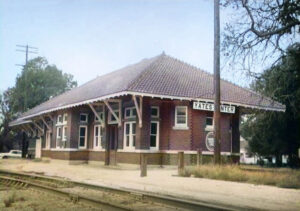
In June 1881, the St. Louis, Fort Scott & Wichita Railway (later, the Missouri Pacific) asked for $28,000 for Center Township and $22,000 for Toronto Township to build a cross-country railway. The measure met comparatively little opposition in either place and passed by 124 to 71 in Center and 64 to 14 in Toronto. Work began on the road and was completed throughout the county that same fall. It crossed the central part of the county in a northeasterly direction, passing through Toronto, Yates Center, Durand, and Piqua. Another line of the same road entered the county from Kansas City and ran south to Yates Center, connecting with the first line.
In 1882, there were 64 school districts with a population between the ages of five and 21 at 2,236, with 2,128 students enrolled.
By 1885, coal was mined locally in Toronto, Belmont, and Everett Townships. The St. Louis, Fort Scott & Wichita Railway ran across the county from the northeast to the southwest, passing through the county seat and the Neosho section of the Atchison, Topeka & Santa Fe Railroad, which passed through the northeast corner to Yates Center. Before long, a third line of the Missouri Pacific Railroad ran north from Wilson County. A line of the Atchison, Topeka & Santa Fe also crossed the southwest corner, and a line of the Missouri, Kansas & Texas Railway crossed the northeast corner, passing through Neosho Falls.
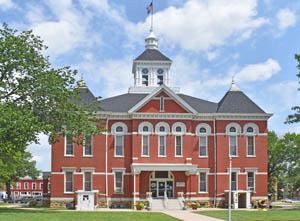
The second and present courthouse was constructed from 1899 to 1900. Located at 105 W. Rutledge Street, the two-story Richardsonian Romanesque Revival-style building was listed on the National Register of Historic Places as part of the Yates Center Courthouse Square Historic District in October 1985.
In 1900, Woodson County’s population reached a peak of 10,022. In the following decades, it declined.
In 1910, nearly three-fourths of the county’s 322,560 acres had been brought under cultivation. The value of the farm products was nearly $2 million annually. Corn, wheat, oats, potatoes, and Kafir corn were the leading field crops. Animals for slaughter, as well as butter, eggs, poultry, and dairy products, contributed significantly to the total output. The total property valuation at that time was upwards of $15,000,000, and the population was 9,450.
Woodson County is a short drive to many attractions and large cities today. It is a gateway to the Chautauqua Hills’ crossed-timbered area and the Flint Hills grasslands to its west; Woodson County provides a remarkable diversity of plant and animal life. Home to Cross Timbers State Park, Woodson State Lake, and Yates Center Reservoir, Woodson County is a great destination for fishing, hunting, and outdoor enjoyment.
Agricultural interests remain a significant influence today. Known as the “Prairie Hay Capital of the World,” the rich grasslands need no irrigation and provide excellent grazing for the abundant livestock. Wheat, soybeans, and corn are prominent grain crops, giving area farmers an uncommon diversity in many areas.
Woodson County offers many outdoor recreational opportunities for everyone! Swimming, fishing, hunting, golfing, water skiing, camping, boating, hiking, picnicking, bird watching, and wildlife viewing.
©Kathy Alexander/Legends of Kansas, updated April 2025.
Also See:
Sources:
1884-1885 State Gazetteer and Business Directory, R. L. Polk & Co., Chicago, IL.
American Courthouses
Blackmar, Frank W.; Kansas: A Cyclopedia of State History, Vol I; Standard Publishing.
Cutler, William G; History of Kansas; A. T. Andreas, Chicago, IL, 1883.
Southeast Kansas History
Wikipedia
Woodson County, Kansas

