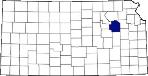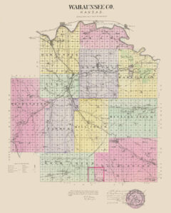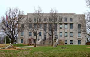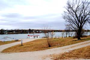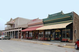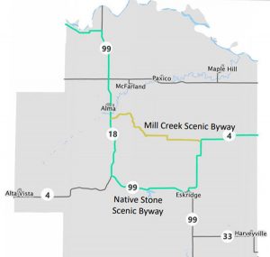
Wabaunsee County, Kansas, courtesy Travel Kansas.
Wabaunsee County is a large rural county just west of Topeka, the Kansas State Capitol. Located in northeast Kansas, Wabaunsee County is about 75 miles west of the Missouri River. Comprising 804 square miles, the county is bounded on the north by Riley County and the Kansas River, which separates it from Pottawatomie and Jackson Counties; on the east by Shawnee and Osage Counties; on the south by Lyon and Morris Counties; and on the West by Morris, Geary, and Riley Counties.
Towns & Places:
Alma – County Seat
Alta Vista
Maple Hill
McFarland
Wabaunsee – Extinct
One-Room, Country, & Historic Schools of Wabaunsee County
Alma City Reservoir
Mill Creek Scenic Byway
Along with much of Kansas, this region was an unorganized territory with various Indian reservations in 1850.
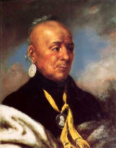
However, that changed when the Kansas Territory was opened to white settlement on May 30, 1853. Richardson County was one of the 33 counties created by the first territorial legislature in 1855. However, the land in the northeastern quarter of the county was part of the Potawatomi Indian Reservation, and no settlement was immediately allowed. In 1859, the county’s name was changed to Wabaunsee in memory of Potawatomi Chief “Wabonsee,” which meant “The Dawn of Day.” In 1868, the Indian lands were exchanged for a smaller permanent reservation, and the following year, the reserve was opened to white settlers. The Federal government also sold part of the land to the Santa Fe Railroad Company for $1 an acre to attract settlers and establish towns.
The county’s topography is broken and uneven, especially in the central portion, which is hilly with breaking bluffs along the streams. Numerous streams and creeks also break the face of the country. Some excellent timber grows on the banks of these watercourses, consisting of several varieties, including oak, hickory, walnut, cottonwood, dogwood, locust, and sycamore. The most significant stream in the county is Mill Creek, to which many of the smaller streams are tributary. The flatlands along these streams and creeks, called “bottomlands,” have exceedingly rich and productive soil perfect for crops.
It is hard to determine who the first white men were to visit this section of Kansas. Some claim that Francisco Vazquez de Coronado’s expedition passed through what is now Wabaunsee County in the winter of 1541-42, but that is hardly probable. Other historians place the first white visitors as French traders in the first quarter of the 17th century, who traded among the Pawnee Indians along the Kansas River. Some historians claim that the French explorer Claude Charles Du Tisne passed west through the valley of the Kansas River in 1720, and four years later, the Etienne Venyard Sieur de Bourgmont expedition followed the south bank of the Kansas River beyond the junction of the Republican and Smoky Hill Rivers. In 1842, the John Fremont Expedition passed up the Kansas River Valley on its way west. Fremont said, “We crossed at 10 a.m. (June 20) The Big Vermilion.”
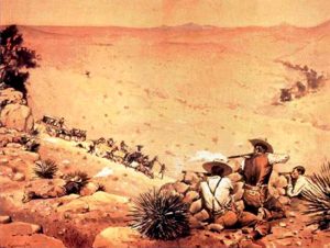
The story of the early settlement of the county is full of interest. The first white men outside the Indian reservations were pirates of the prairie. They built a log house in 1842 near present-day Harveyville. Their purpose was to rob travelers on several roads in the area. They could observe the Santa Fe Trail from a nearby high mound, which was used before 1800 and was well established by 1822. It was traveled by Mexican traders, paymasters, and gold-seekers. This nest of robbers was broken up after the killing of 27 Mexican traders, the robbery of 500 mules, and a treasure box said to contain $75,000 in gold. Government authorities were notified, a chase was given, 19 robbers were shot in the fight, and five were imprisoned for life. The money was never recovered, but there is a story that a mysterious Englishman dug up the treasure box from under the ruins of the log house in 1895 and immediately left the place.
One of the first settlers in the county was Jacob Terras, a German, who was located on Hendricks’ Creek, one mile east of Alma, in 1853. Before 1854, John P. Gleich, Joseph and Peter Thoes, Frank Schmidt, R. Schrauder, and C. Schwanke had settled in different parts of the county. The first collective settlement was made in 1854 on the Kansas River in Wabaunsee Township by a colony of about 34 people of mixed nationality. They made their settlement on government land just outside the reservation. Among them were D.B. Hiatt, Peter and Bartholomew Sharer, Clark Lapham, J. Smith, Reverend Leonard, Robert Banks, J. Nesbit, and Horace W. Tabor. J.H. Nesbit was a secretary in the Free State Convention at Topeka in 1855. Horace W. Tabor, afterward Senator from Colorado, was a representative from Richardson County in 1856. He was a member of the Free-State Party and left the State for Colorado in 1859, where he struck it rich in the mining business.
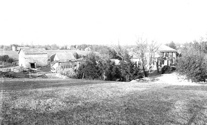
Wabaunsee County, Kansas Farm.
Reverend Harvey Jones and his wife were sent to this settlement as missionaries. He took up 160 acres of government land just outside the reservation on Emmons Creek, where he built a rude cabin. This house was used for several years as a church, school, and post office. Harvey Jones was both a preacher and a postmaster. The mail arrived once a week from Tecumseh. In 1855, a German colony, composed chiefly of single men, came to a place near the present site of Alma. Their plans for a town failed, and before a year passed, most of them abandoned their claims, and Gottlieb Zwanziger preempted their chosen townsite.
Among the Quakers who settled in Wilmington Township in 1854 was Henry Harvey, a historic character deserving more than passing mention. He had come from Ohio to Kansas in 1840 with the Shawnee Indians as their teacher in the Shawnee Mission School in Johnson County. He returned to Ohio in 1842 and began his “History of the Shawnee Indian from 1681 to 1854, Inclusive.” He was a great friend of the Indians and was appointed government agent to the Osage tribe in 1850 by President Zachary Taylor. In 1854, he settled with his two sons on Dragoon Creek, near the present site of Harveyville, which was named in his honor. His book was published in Ohio in 1855. The settlement prospered, and by the close of the Civil War, so many settlers had come that in 1869, a post office was established in Harveyville.
In 1856, the county’s population was increased by the Beecher Bible and Rifle Company, a group from New Haven, Connecticut, who organized to come to Kansas to make it a Free State. The colonists were assisted in their plans by citizens of their native State and Henry Ward Beecher and his church, which furnished 25 rifles at $25 each. Fifty-two rifles were bought for members not supplied, and when the colony left New Haven for Kansas on March 29, 1856, every one of its 70 men was armed with a Sharps rifle, a Bible, and a hymn book.
Their purpose was to aid in establishing liberty, good government, a church, a school, a town, and a farm for each person. The company consisted of all classes – ministers, merchants, doctors, mechanics, laborers, and two who had been in the Legislature of their native State. Five men brought their families, and all came well provided with provisions. Farm implements were purchased at St. Louis and Kansas City, where they also bought cattle.
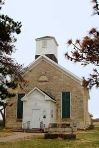
Sixty-five of the colony, exclusive of women and children, each with a Bible in his pocket and a rifle on his shoulder, encamped on May 1, 1856, in the northwest part of the county on the south bank of the Kansas River, where Wabaunsee now stands. The colonists proposed locating a townsite and securing a farm for each member. One of the company members purchased a sawmill in Kansas City and brought it to the settlement on the way west. With a good supply of timber in the vicinity, log cabins were soon built, and the mill kept busy supplying lumber for the pioneer homes. The colony members were all Congregationalists and soon erected the first church in the county and a two-story school building with funds partly furnished by the editor of the New York Sun. In time, the church was replaced by a fine stone structure. Soon after, the men organized a military company known as the “Prairie Guards,” one of the first organizations in the territory to be armed with Sharp’s rifles. This company took part in the border warfare of 1856. Many were the privations and struggles of this colony resulting from Indian depredations, drought, flood, sickness, prairie fires, and frequent Indian alarms. Many became discouraged and left the colony.
A second colony was formed by a party of Germans in Cincinnati, Ohio, who, upon their arrival in Wabaunsee County, selected a site near the two branches of Mill Creek and laid out the town of Alma. These people were poor, and within a short time, the Alma Town association broke up, the site being preempted by individuals. In 1857, many settlers came directly from Germany. The following year, Gottlieb Zwanziger built the first grist mill, and John Hankammer a sawmill. In 1857, the Wabaunsee colony was increased by S.H. Fairfield, S.R. Weed, and Enoch. L.H. and J.E. Platt, men from Mendon, Illinois, volunteered to go to Kansas to aid in securing its admission as a Free State. The county’s first church, the Wabaunsee Church of Christ, was founded in June 1857.
To complete the organization of Wabaunsee County, an election was held in March 1859. There were two voting precincts, one at Alma and the other at Wabaunsee. One hundred and eleven votes were cast, and county officers were elected. Before this time, Wabaunsee had consisted of one civil township, but at the board of commissioners’ meeting, they divided it into Alma, Wabaunsee, Mission Creek, and Wilmington townships. When the Potawatomi reservation was thrown open in 1870, the territory embraced within its limits was called Newbury Township. The first townships were divided into 13 civil townships as the population increased.
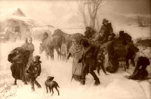
The Underground Railroad successfully operated in Wabaunsee County during the last few years of slavery. There were two stations in the County where escaped slaves sought freedom—one on Mission Creek in the southeast and one at Wabaunsee near the northwest corner.
Runaway slaves who arrived at Mission Creek were taken in charge by a conductor, who took them to Wabaunsee. There, they were placed in charge of another conductor to be taken to the next station and the next until they arrived in Fremont County, Iowa. As many as 18 people were transported at one time, and all travel was done at night to avoid attention.
At the outbreak of the Civil War, Wabaunsee County’s population was about 1,050. The voting population, however, was only 250. As nearly all the settlers were from New England, they responded loyally to the call for volunteers, and 112 men enlisted for service, earning Wabaunsee a long roll of honor in the nation’s military history.
The Wabaunsee County Herald, the first newspaper in the County, appeared on April 1, 1869. It was owned and edited by Sellers & Bertram. On October 1, 1869, a half interest in the paper was sold to S.H. Fairfield, who in 1871 became sole proprietor and changed the name to the Alma Union. On May 1, 1872, Fairfield resold to Sellers, and the newspaper’s name was again changed to the Wabaunsee County News. E. H. Sandford started the Landmark in the spring of 1871, but the publication was discontinued in 1874.
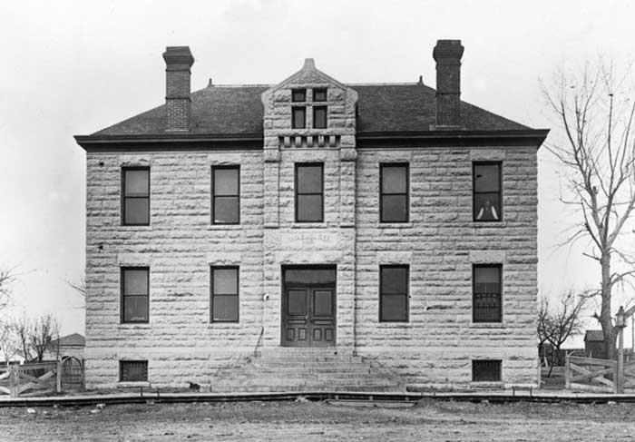
Old Wabaunsee County Courthouse in Alma, Kansas, in the 1870s. The building no longer stands today, as a new courthouse was built.
When the county was organized, Wabaunsee was made the seat of justice, as it was the only town in the county. Its location, however, was not central, and it was felt at the time that as the county settled up, efforts would be made to change the county seat to a point nearer the geographical center. No permanent county buildings were erected, and on November 22, 1866, the question of a permanent location was submitted to the people, Alma and Wabaunsee being the contesting points. The result was a majority of 28 votes for Alma, and in December, the county records and offices were transferred to a small frame building erected for county and courthouse purposes.
Still, the permanent location of the seat of justice hung in the balance, for Alma was a town in name only, there being only two buildings on the site in 1869. In 1870, the question of a change again arose, and excitement ran high. The contesting points were Alma, Newbury, and Eskridge. At the February 7, 1871, election, Alma received 369, Newbury 217, and Eskridge 256 votes. As there was no choice, another election was ordered for February 21. Circulars were scattered all over the county, each town setting forth the advantages it offered. Alma pledged to give the County “a safe, well-built, handsome stone building worth $6,000 to $10,000.” This election was 465 votes for Alma and 429 for Eskridge. According to the promise made, the people of Alma soon erected a stone courthouse at a cost of $8,000.
In 1871, the county suffered from a severe episode of smallpox. The disease was brought into the county by Herman Fink, who had immigrated from Germany. Though the entire ship had been infected with the illness, Mr. Fink had escaped the disease. However, his clothing and personal items had been contaminated. Nearly every Templin, Alma, and East Branch family was down with it. Several deaths occurred at each point; among those dying at Alma was N. H. Whittemore, County Attorney.
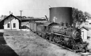
After years of resistance to a railroad and a halt of plans due to economic recession, in 1879, Wabaunsee County voters finally approved a railroad line to connect the coalfields near Burlingame with the Atchison, Topeka & Santa Fe Railroad. The Santa Fe and the Union Pacific Railroad jointly financed this project. Construction on the Manhattan, Alma, and Burlingame Railway began in 1880. At this time, there was not a single paved highway in Wabaunsee County; thus, railroads provided the region with reliable nationwide transportation. Afterward, the Chicago, Rock Island & Pacific was built in 1887, entering near the northeast corner and crossing the county southwest to Alta Vista. A branch of the same system left the mainland at McFarland and ran northwest through Manhattan.
In 1898, the Manhattan, Alma, and Burlingame Railway was sold, and the 22.32 miles of track from Alma to Manhattan were dismantled. However, the Atchison, Topeka & Santa Fe Railroad operated the remaining line from Burlingame to Alma for the next 75 years.
Corn was the principal crop in the county’s early days, though winter wheat, potatoes, millet, Kafir corn, and alfalfa were also raised. By the early 1900s, there were some 70,000 bearing fruit trees.
The county did not grow as quickly as expected, reaching its highest population of 12,813 residents in 1900 and then experiencing a steady decline.
In the 1920s, it became apparent that the county needed a new courthouse. In 1931, bids were opened and contracts were awarded for the various facets of the building construction. The new building was four stories high, counting the sub-basement, and set in the middle of the courthouse square. It was constructed of Carthage stone on the outside, giving it the appearance of a granite building when completed and polished. The former building was torn down in 1932, and the stone was used as gravel for the streets. In 1910, the county’s population was 12,721, and Alma was the principal town.
At about the same time, Kansas and much of the West began suffering a severe drought in 1930, which lasted until 1941. The drought, combined with the onset of the Great Depression, forced farmers off the land. The state became a participant in New Deal relief programs, such as the Civil Works Administration, the Federal Emergency Relief Administration, the Civilian Conservation Corps, and the Works Progress Administration, which put tens of thousands of Kansans to work.
One project was the construction of Lake Wabaunsee near Eskridge. A POW camp at the lake housed German POWs during World War II. The prisoners were paid $0.40 per hour and granted a daily noon lunch for their work on farms and bridges throughout the region. After the war, the lake returned to recreational uses with private homes and a golf course. Today, the spring-fed lake nestled into the Flint Hills offers recreational opportunities to the public, such as camping, fishing, boating, and swimming.
Today, the county has a population of approximately 7,000, with Alma having the largest population, at around 780 people.
While in Wabaunsee County, visitors can enjoy outdoor water sports at Lake Wabaunsee, go antiquing in Paxico’s Historic Downtown District, and learn more about the area’s history at the Wabaunsee County Historical Society Museum in Alma. Beautiful drives present themselves along the Flint Hills Barn Quilt Trail, which features nearly 50 Quilt Blocks that are painted on barns, homes, businesses, and other structures; the Native Stone Scenic Byway that runs between Wabaunsee County and Shawnee County along K-4 and K-99 that offers visitors a glimpse of walls, bridges, and buildings constructed of limestone native to the region; and Skyline Scenic Drive with views of Mill Creek and the Flint Hills that is described as one of the most beautiful drives in Kansas.
©Kathy Alexander/Legends of Kansas, updated September 2025.
Also See:
Wabaunsee County Photo Gallery
Sources:
Blackmar, Frank. W.; Kansas: A Cyclopedia of State History, Volume I, Standard Publishing Company, Chicago, IL, 1912
Cutler, William G.; History of the State of Kansas; A. T. Andreas, Chicago, IL., 1883
Flint Hills Region
Thomson, Matt; Early History of Wabaunsee County, Kansas, 1901
Wabaunsee County Courthouse
Wikipedia

