
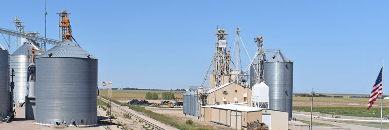
Sherman County train yard in Goodland, Kansas, by Kathy Alexander.
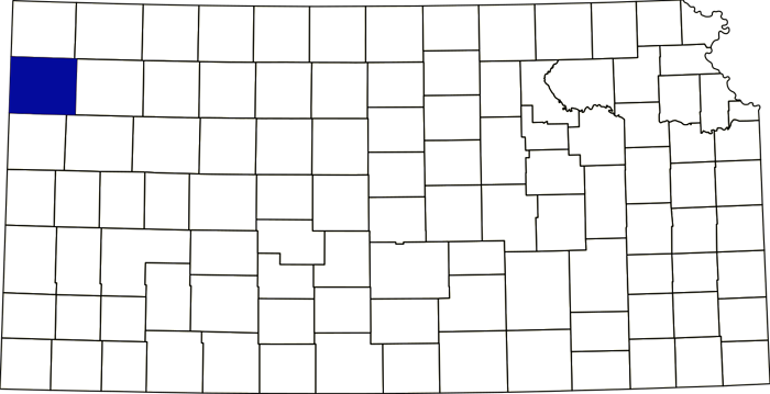
Sherman County, Kansas, location.
Towns & Places:
Goodland – County Seat
Kanorado
Ruleton – Extinct
Extinct Towns of Sherman County
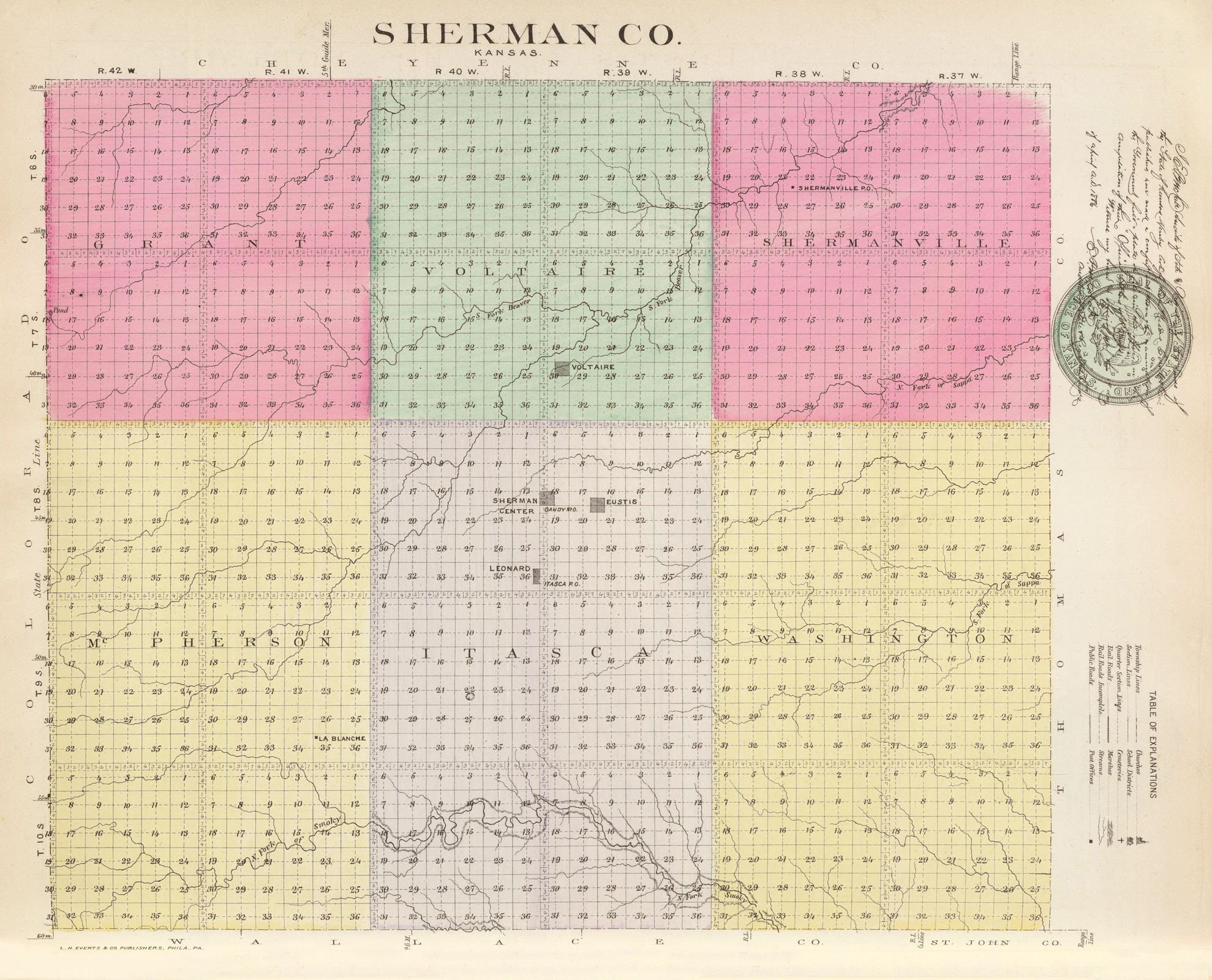
Sherman County, Kansas by L.H. Everts & Company, 1887.
Sherman County, Kansas, located in the northwest part of the state, was created by the Kansas Legislature in 1873 and named after General William Sherman, a Civil War general. Its county seat and largest town is Goodland. As of the 2020 census, the county population was 5,927, and it had a total area of 1,056 square miles, of which 1,056 square miles is land and 0.2 square miles is water.
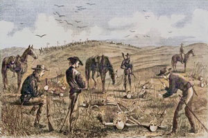
Kidder Massacre by Harper’s Weekly, 1867.
The Kidder Massacre occurred on July 2, 1867, near Goodland, Kansas, in northeast Sherman County. Lakota Sioux and Cheyenne warriors attacked a detachment of ten enlisted men and an Indian scout under the leadership of Second Lieutenant Lyman S. Kidder during Hancock’s War on the western plains. Eleven military men and one Lakota Sioux scout were killed.
No settlers lived in the county when Sherman County was created in 1873.
Sherman County, in the western tier, the second South of Nebraska, is bounded on the North by Cheyenne County; on the East by Thomas County; on the South by Wallace and Logan Counties; and on the West by the State of Colorado.
Sherman County was initially attached to Sheridan County for judicial purposes,
The general surface is undulating prairie, with a few bluffs and some rough lands along Beaver Creek and in the western part of the county. Kanorado is the highest point in the state, at an altitude of 3,906 feet. Timber was scarce, existing only in thin belts along the North Fork of the Smoky Hill River and on the middle fork of the Sappa Creek. Beaver Creek, Little Beaver, and both forks of Sappa Creek rise in this county, and the North Fork of the Smoky Hill River passes from Colorado into the South part of the county, and out of it into Wallace County.
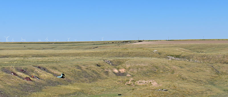
Sherman County, Kansas, landscape.
Initially inhabited by Native Americans, the area now known as Sherman County became home to J.F. Collier, a buffalo bone gatherer. He moved to the area in 1879, but did not establish a residence until 1882.
Other settlers, John Bray and a Mr. Darling, arrived in western Kansas in the spring of 1880 to establish ranches. Mr. Bray’s sheep ranch was on Beaver Creek, and Mr. Darling’s horse-and-cattle ranch was on the North Fork of the Smoky Hill River. The homes established on these ranches were the first in Sherman County.
In 1882, Barney McClusky established a cattle ranch on Beaver Creek, W.T. Clayton established a cattle ranch in the northeastern part of the county, and Mr. Holmes and Mr. Cox established a sheep ranch on the Smoky Hill River at about the same time. All of the gentlemen were the first settlers, and hundreds more joined them in the years that followed.
As prairie schooners began their westward sail from Colby or Oberlin, immigrants were gladdened to see the almost level surface and the dark, rich-looking soil.
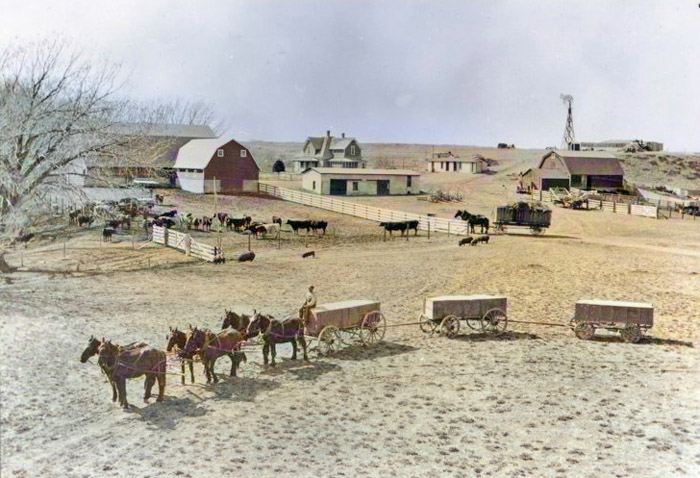
Cattle ranch in Sherman County, Kansas.
Free or inexpensive land was the reason many of these settlers came to this area. The foreign immigrants came from Germany, Sweden, and Austria.
The larger portion of Sherman County was entered at the land office, and the claims near the center of the county were deeded or proved up as soon as possible, so that the county seat might be located at that point, and the owner might find himself rich in a single day.
The first town, Inez, was laid out at the county’s geographic center in about 1880. It sat near the North Fork of the Sappa River, at the county’s geographic center. Four miles North was Big Indian Springs, a large expanse of water. However, Inez had disappeared before the county was organized in 1886. Big Indian Springs is also gone.
People settled in the northern part of the county first, where several ranches could be “proved up.”
Dr. J.L. Gandy established Gandy as Sherman County’s first town in June 1885. The Tecumseh, Sherman County’s first newspaper, began publication there on November 11, 1885.
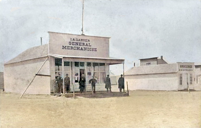
I.A. Garver Store, in Voltaire, Kansas, in about 1886.
The town of Voltaire was laid out on a ranch. The county’s second newspaper, the Voltaire Advertiser, was founded in December 1885 by Ernest J. Scott. Voltaire was four miles North of the center.
At about the same time, the town of Leonard was laid out and platted. It was named Leonard after Thomas P. Leonard, one of the platters and a member of the Sherman County Land Association. Later, the town’s name was changed to Itasca. It was located near the county’s center.
By the end of the year, the county had 2,605 head of livestock valued at $12,138.
The Chicago, Rock Island & Pacific Railroad issued a charter to the Chicago, Kansas, and Nebraska Railroad on March 19, 1886, to build tracks into Colorado. The railroad built tracks to Goodland and onto the Colorado border.
Early in the spring of 1885, several men, with P.S. Eustis and O.R. Phillips at the head, organized the Lincoln Land Company and laid out the town of Eustis.
By then, the influx of new settlers had made the population large enough to organize the county. The citizens of Voltaire tried to organize before the newer settlers in the Southwest part of the county were eligible to vote, hoping to have their town made the county seat. In June, they secured the appointment of O.T. McCormick as census taker, and he was instructed to make all possible haste in the enumeration so that the election to complete the organization could be held no later than the middle of September. He did not make his returns until August 30, and the people of Voltaire, learning that he had been given several lots in the town of Eustis, ascribed the delay to that fact. The returns showed a population of 2,820, of whom 975 were householders.
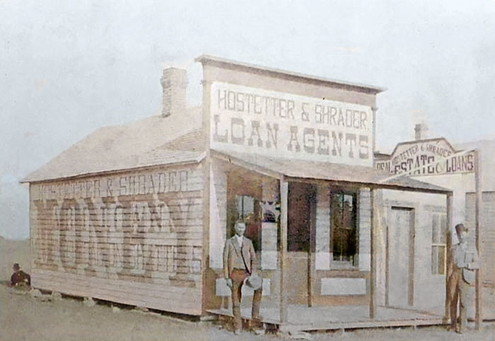
Eustis, Kansas building in the 1880s.
To delay the organization, the Eustis men claimed the county had fewer than 400 voters. However, their petition to the governor to make Eustis the county seat had 2,500 signatures. Opponents of Eustis claimed that hundreds of these names belonged to residents of adjoining counties, but they did not prove it, and Eustis was designated the temporary county seat. The following officers were appointed: county clerk, J.H. Tate; commissioners, L.J. Gandy, O.D. Dickey, and R.R. Edwards. The other candidates for the county seat were Itasca, Shermanville, and Voltaire.
The county was officially organized per Governor John A. Martin’s proclamation of September 20, 1886. Taxable property totaled $362,960, of which $129,320 was real estate.
Itasca soon moved to Shermanville, which was later called Sherman Center. Voltaire also tried to move, and the Voltaire newspaper strongly favored joining forces against Eustis and making Sherman Center the county seat. About half of Voltaire’s residents moved. On November 8, 1886, Sherman County voters elected which town would serve as the temporary county seat: Sherman Center or Eustis. Those who had remained in Voltaire sided with Eustis, which won by 61 votes. The following officers were elected: county clerk, G.W. Benson; sheriff, R.G. Albright; treasurer, J.E. Rule; superintendent of public instruction, F.S. Palmer; register of deeds, E. W. Penny; county attorney, W.K. Brown; probate judge, L.E. Tobias; clerk of the district court, P.C. Brown; surveyor, L.M. Harwood; coroner, A. E. Tice; commissioners, C.E. Bennett, John Bray, and E.L. Lyons. Eustis then began constructing a courthouse.
At their first meeting, the commissioners divided the county into six townships: Grant, Voltaire, Shermanville, McPherson, Itasca, and Washington. Later, they organized Iowa, Lincoln, Llanos, Logan, Smoky, State Line, and Union, bringing the total to 13. The Chicago, Rock Island & Pacific Railroad crossed the center of the county from East to West, a distance of 36 miles.
By the end of the year, the county had 4,409 head of livestock, valued at $100,087. Field crops amounted to $82,628, the wool clip to $1,548, the produce to $2,000, and the milk sold to $100.
In the spring of 1887, Goodland was founded just South of the county’s geographic center and not far from Sherman Center. The latter town was induced to move to the new site. The county seat question was voted on again in November 1887. The vote was not properly canvassed, and the Supreme Court issued a mandamus the next spring to compel a canvass of all the election returns. The court found that Goodland had a majority, and the town became the permanent county seat. Eustis then moved to Goodland, and the county seat contest ended.
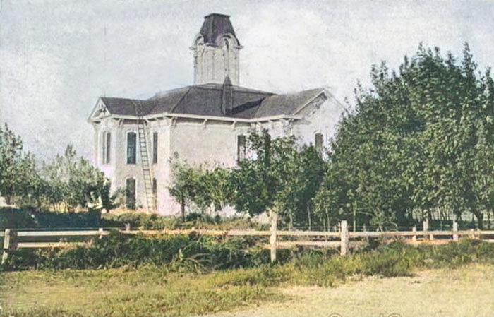
First Sherman County courthouse in Goodland, Kansas.
Three new towns were established along the railroad in 1888, including Ruleton on June 22; Lanborn, soon after, which was renamed Kanorado on July 5; and Edson on August 10, 1888. That year, they built Goodland’s first courthouse.
Goodland and Kanorado were the only towns to be incorporated.
The county’s population in 1890 was 5,261, nearly twice that of 1886. Over the next ten years, the population fell because of poor crops and heavy immigration to the southwestern states.
By 1893, the Sherman County Immigration Association was established to promote the area.
In 1900, the county had dropped to 3,341, and the entire population was white, with 8.9% foreign-born.
Over the next decade, the county’s population increased, and by 1910, it had reached 4,549. Property was assessed at $9,343,387 that year. The average wealth per capita was $2,054, several hundred dollars above the state average. That year, livestock was valued at $1,035,082, and the number of head was 19,756. The value of animals sold for slaughter in the same year was over $66,000; the value of corn, the largest field crop, was $158,214; barley, $126,694; wheat, $137,569; hay, $94,863; sorghum, $45,465; oats, $22,540; poultry and eggs, $18,203; dairy products, $53,230. The total value of farm products in 1910 was $776,149.
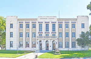
Sherman County Courthouse in Goodland, Kansas by Kathy Alexander.
A new Sherman County Courthouse was built from 1931 to 1932. Routledge & Hertz designed it in the Art Deco style, and Blaser & Vollmer built it. The rectangular three-story building is made of buff-colored brick, limestone, and concrete. It is located on landscaped grounds in the center of Goodland. The West front has three stone arches at the entrance with recessed doorways and a balustrade above. Stone towers are at each corner. The roofline is flat. Inside, the County District Court courtroom is on the second story on the North side. The building houses the County District Court of the 15th Judicial District, which includes Cheyenne County, Logan County, Rawlins County, Sheridan County, Thomas County, and Wallace County. The courthouse is located at 813 Broadway and East 8th Street in Goodland, Kansas.
Sherman County’s population peaked at 7,792 in 1970.
Sherman County remains largely agricultural and ranching-based.
It is one of only four Kansas counties to observe Mountain Time.
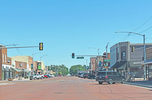
Main Street in Goodland, Kansas, by Kathy Alexander.
Two school districts serve Sherman County: USD 314 in Brewster and USD 352 in Goodland. Goodland also has the Northwest Kansas Technical College.
The Kansas Land and Sky Scenic Byway runs through the county.
©Kathy Alexander/Legends of Kansas, updated September 2026.
Also See:
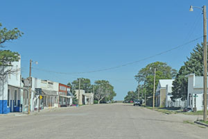
Kanorado, Kansas Main Street by Kathy Alexander.
Sources:
American Courthouses
Blackmar, Frank W.; Kansas: A Cyclopedia of State History, Vol I; Standard Publishing Company, Chicago, IL 1912.
Cutler, William G.; History of Kansas; A. T. Andreas, Chicago, IL, 1883.
City of Goodland
Fitzgerald, Daniel; Faded Dreams: More Ghost Towns of Kansas, University Press of Kansas, 1994.
Fort Hays State University
Olson, Daryl A. “A History of Sherman County, 1880-1960”. Master’s Thesis, Fort Hays Kansas State College, 1966.
“They Came to Stay”. Sherman County Historical Society, 1980.
Wikipedia