Towns & Places:
Burdick – Near Ghost Town
Council Grove – County Seat
Delavan – Ghost Town
Diamond Spring – Ghost Town/Extinct Town
Dunlap – Near Ghost Town
Latimer – Near Ghost Town
Parkerville – Near Ghost Town
Skiddy, aka Camden – Ghost Town
One-Room, Country, & Historic Schools of Morris County
Santa Fe Trail Through Morris County
Border Troubles in Morris County
Cheyenne Outbreak of Morris County
Seth Hays – Founder of Council Grove
~~
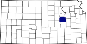
One of the oldest and most historic counties in the state, Morris County is located in eastern Kansas and was one of the original counties formed, first called Wise County. Its history predates Kansas becoming a territory, with the site of Council Grove first mentioned by travelers as early as 1820. The various Indian tribes initially held the region as neutral ground, on which all had a common right to hunt on its soil and fish in its streams.
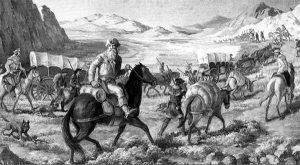
In a treaty concluded with the Indians in 1825, the U.S. Government secured the right-of-way for a public highway from the Missouri River to the eastern boundary of Mexico, which, once established, became known as the “Santa Fe Trail.” This trail ran through Morris County; part of it now constitutes Council Grove’s Main Street.
A treaty was made with the Kanza Indians in the latter part of 1846 or early in 1847, by which a tract of land measuring 20 square miles was obtained as a reservation, including the land on which Council Grove would later be built.
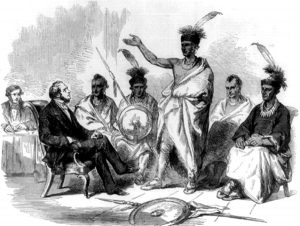
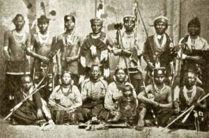
Conference of Kanza Indians with U.S. Commission of Indian Affairs, the Illustrated London News, 1857.
In the spring of 1847, the Kanza tribe was relocated to land within the reservation boundaries. Up until this time, no white men had settled in the area. However, that changed in the fall of 1847 when Seth M. Hays, a citizen of Westport, Missouri, obtained a license from the government to trade with the Indians; he soon resettled near the Kanza reservation and established a trading post at what would become Council Grove. Other traders followed soon, including the Choteau Brothers in 1848 and Kennedy in 1849.
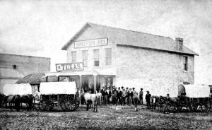
Waldo, Hall & Co. gained a contract with the government in 1849 to carry the United States mail to Santa Fe, New Mexico, 700 miles west of the Missouri River. For several years after the trail was opened, Council Grove was the only trading post between Independence, Missouri, and Santa Fe. Consequently, it became a point of considerable importance to westward-bound travelers.
In 1850, the Methodist Episcopal Church entered into a contract with the government to establish a school for the education of the Kanza Indians. The Board of Missions erected a stone mission at Council Grove the same year. In addition to the mission school, several other buildings were constructed in 1850, including a depot for storing government supplies and other military materiel. The mail company also put up several buildings. All the inhabitants of Morris County were either employed by the government or by companies with government contracts, numbering about 25.
At that time, the Kanza Indians on the reservation numbered approximately 1,700, and relations with them remained peaceful until 1854, when Kansas became an official territory. Seth M. Hays built the first house in Morris County, a log store on the west bank of the Neosho River on the Santa Fe Trail.
In 1854, Kansas became a territory following the passage of the Kansas-Nebraska Act. Andrew Horatio Reeder was appointed as the first governor of the new territory. Soon after that, with a full corps of staff officers, he arrived at Council Grove, where he contemplated making the capital. He failed, however, because the land required could not be obtained from the Indians.
Until this time, no attempts at settlement had been made anywhere else in the county until J.C. Munkers took a claim upon what became known as Munkers’ Creek in 1854.
One of Governor Reeder’s first official acts was to order an election for members of the Territorial Legislature. During this period, excitement was high in the region as new settlers sought to control the territory as either a Free State or a Pro-Slavery State. Two men, one from each party, were submitted for the legislature.
A.I. Baker was the Free-State candidate, and Mobillon McGee was the pro-slavery candidate. The election was held on March 30, 1855, and Baker fairly won. However, on a trumped-up pretext, McGee contested the seat with him, and, as the first legislature was composed mainly of pro-slavery advocates, Baker was denied the seat and replaced by McGee. One of the first duties of the legislature, since referred to as the “Bogus Legislature,” was to divide a large portion of the territory into counties. What would later become Morris County was first named Wise County for Henry A. Wise, who would later become the Governor of Virginia during the John Brown seizure of Harpers Ferry. The county was consolidated with adjacent counties for management, judicial, and revenue purposes.
However, in 1858, the county was separated from the others; separate officers and officials were appointed, and the county seat was designated as Council Grove. In the meantime, the Free-Staters had taken control of the territory. In February 1859, the county’s name was changed from Wise to Morris in honor of Thomas Morris, a United States Senator from Ohio in 1832, who distinguished himself as an opponent of slavery. The population in 1859 was approximately 600.
In the meantime, as more and more white settlers were encroaching upon their lands, the Kanza Indians finally rebelled, and 400 of them entered Council Grove on June 2, 1859, in a full feathered headdress, painted and equipped for war. Though negotiations were attempted, a battle erupted in which two white men were wounded, and a bloody war was averted only by the Indians giving up the two warriors who had done the shooting. The white settlers immediately hanged them. That same year, in October, the Kanza reservation was set apart and assigned in severalty to various tribal members.
In 1860, Morris County settlers suffered greatly from a drought—not a single bushel of corn was raised. In the winter of 1860, about 62,000 pounds of food from the relief supply at Atchison were issued to Morris County people. Before the opportunity to plant another crop, the Civil War broke out. The total population was about 800, and many were divided in their sympathies between the North and the South.
However, before the war ended, Morris County had furnished 125 Union soldiers. Several Kanza Indians also enlisted, which raised the total to 180. During the Civil War and for several years afterward, guerrillas and horse thieves molested Morris County, and several lynchings and murders took place.
Shortly after the war ended, a new influx of settlers arrived in the county, particularly ranchers who drove large herds of cattle into the area for pasture. The county received its last Indian scare in June 1868 when some 400 Cheyenne Indians flooded Council Grove armed and painted for war. Though they were destined for a confrontation with the Kanza Indians, the settlers of Council Grove, taken entirely by surprise, held themselves in readiness for whatever might happen. An Indian battle occurred with the Kanza Indians, known as the Cheyenne Outbreak of Morris County.
By 1871, several new settlements had sprung up in the county, and a county seat contest ensued when Parkerville became an incorporated town. Challenging Council Grove for the county seat, an election was called to settle the matter. Both sides resorted to various forms of deception, including enlisting hundreds of men to vote. At that time, the county’s population was 2,225. The number of votes cast was 1,312, of which 899 were for Council Grove and 413 for Parkerville. The question was not brought up again.
That same year, the county saw a disastrous prairie fire that swept in from the west in the summer. The blaze was fought by all the male citizens of Council Grove under the leadership of Patrick Maloney, who was said to be the best firefighter in the state. The women pumped water, and small boys wetted sacks. Before the fire had run its course, the crops and grass of much of the county were destroyed.
Two years later, in 1873, the remaining Kanza Indians were removed from the county to Indian Territory (Oklahoma), and their remaining lands were opened to white settlement. By 1875, the county’s population had grown to nearly 4,600, and the area had become a significant center of farming and ranching.
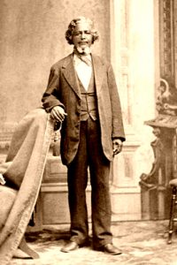
In the spring of 1878, Benjamin “Pap” Singleton, a former slave who escaped to freedom in 1846, claimed land in Morris County in a settlement named Dunlap. Before long, freedmen known as “Exodusters” came by the hundreds from the post-Reconstruction South to seek homesteads in the area. In the early 1880s, the Presbyterian Church in Dunlap founded the Freedmen’s Academy to educate Exodusters in Kansas. However, the Academy closed in the mid-1890s. Today, Dunlap is a semi-ghost town.
By 1890, the county population had increased to 11,381. In the next ten years, as many counties in Kansas lost population due to the money panic, hard times, and the boom in the southwestern states, Morris County showed a small gain, with a population of 11,967 in 1900.
The flood of 1903 raised the Neosho River several feet above its normal level, recorded high watermarks, and destroyed considerable property. Another severe flood occurred in 1908. However, the county continued to thrive and, by 1910, had three railroads running through it, more than $3 million in annual farm products, and a population of approximately 12,400.
Morris County moved forward over the next century while retaining its rich history and agricultural base. However, like many other Kansas counties whose economic base is primarily farming and ranching, its population has gradually declined, reaching 5,386 in 2020.
Numerous sites representing its fascinating Santa Fe Trail history can still be seen, including a historical tour in Council Grove, Diamond Springs, a famous stop along the trail, numerous ruts from wagon trains visible across the Flint Hills, and more. Although Dunlap is nearly a ghost town today, its history as an African American city is worth a visit. The county is also home to the Council Grove Federal Reservoir, which provides fishing, water sports, and camping.
More Information:
Morris County
501 W. Main
Council Grove, Kansas 66846
©Kathy Alexander/Legends of Kansas, updated January 2026.
Also See:
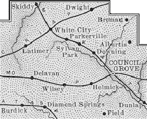
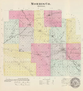
Morris County Map, 1899.
Benjamin “Pap” Singleton – Leading the Exodusters
Santa Fe Trail – Highway to the Southwest
Sources:
Blackmar, Frank W.; Kansas Cyclopedia, Standard Publishing, 1912
Cutler, William G.; History of the State of Kansas, A. T. Andreas, 1883
Wikipedia

