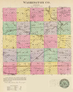
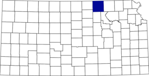
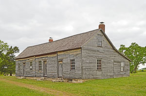
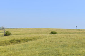
Washington County, Kansas, is in the northcentral part of the state and was named for George Washington, the United States’ first president. Its county seat and largest city is Washington. As of the 2020 census, the county population was 5,530, and its total area was 899 square miles, of which 895 square miles was land and 3.9 square miles was water.
Towns & Places:
Barnes
Clifton
Greenleaf
Haddam
Hanover
Hollenberg
Linn
Mahaska
Morrowville
Palmer
Vining
Washington (County Seat)
Extinct Towns of Washington County
Indian Troubles in Washington County
Washington State Fishing Lake
—
Washington County’s earliest history began in 1542, when Coronado’s Expedition marched from Mexico to the northern boundary of Kansas, crossing the Little Blue River near the eastern boundary of Washington County. As early as 1724, French traders went among the Pawnee Indians, who hunted from the Platte River as far south as the Arkansas River.
In 1820, Major Stephen H. Long’s expedition crossed that portion of the “Great American Desert,” now known as Washington County. A few years later, this portion of the State became seamed with roads converging towards Santa Fe, and traders, missionaries, and herders repeatedly moved along the land but didn’t make it a permanent abiding place.
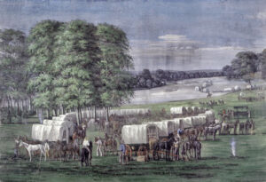
In the spring of 1842, a party of emigrants passed through Washington County on their way to the Columbia River in Oregon. They were in charge of Dr. Elijah White, an agent of the government in Oregon Territory. John C. Fremont, in his report of the expedition to the Rocky Mountains the same year, reported on June 22 that “a pack of cards, lying loose on the grass, marked an encampment of Oregon emigrants; and it was at the close of the day when we made our bivouac amid some well-timbered ravines near the Little Blue.”
Within a few years, this part of the state became marked by many trails. Missionaries, traders, and gold seekers all passed over the well-worn highways, but few stopped to make their homes.
In 1845, Mormons passed through the county on the way to their new homes in Utah. One of their favorite camping grounds was at Mormon Springs, on Ash Creek, three miles south of Washington. The Mormon Trail could be traced through the county for many years afterward. It was especially plain northwest of the Little Blue River near the Nebraska state line. Until the spring of 1854, traders, missionaries, and Indian agents were practically the only white men in this portion of Kansas.
In 1849, a trail known as the “Parallel Road” to the gold mines passed nearly east and west through the central part of Washington County.
The first territorial legislature created Washington County in 1855, with the following described boundaries: “Commencing at the southern boundary of the territory of Kansas, 15 miles west of a due south course from the mouth of Walnut Creek, on the Arkansas River, and then running north 100 miles, then west to the east line of Arapahoe County, then to the south line of Kansas, then east to the place of beginning.”
As described by this act, the southeast corner was on the state’s southern boundary, about six miles west of the present line separating Sumner from Cowley County. The northeast corner was about three miles east of the little village of Waldeck in Marion County. As initially created, old Washington County included the present counties of Reno, Stafford, Pawnee, Edwards, Hodgeman, Kearny, Hamilton, Stanton, Grant, Haskell, Gray, Ford, Kiowa, Pratt, Kingman, Harper, Barber, Comanche, Clark, Meade, Seward, Stevens and Morton; the southern part of McPherson, Rice, Barton, Russell, Ness, Lane, Scott, Wichita and Greeley; nearly all of Sumner, Sedgwick and Harvey and a little of the southwest part of Marion. Peketon County was created by the legislature of 1860 and embraced all of Washington County as created by the act of 1855.
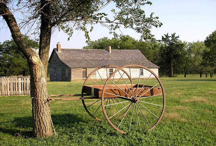
The Oregon–California Trail, the Overland Stage Line Line, and the Pony Express ran through Washington County. In 1857, the same year, the Hollenberg Way Station opened and operated until 1872 in the county’s northeast corner.
The boundaries of Washington Township were defined by the Territorial Legislature of January 1857. It was attached to Marshall County for judicial and municipal purposes.
The first permanent white settler in Washington County was James McNulty, who came to Kansas from Iowa in July 1857 and the following February, located on Mill Creek about five miles west of present-day Washington. He built a cabin, the first in the county, and brought his family to live there. Ralph Ostrander accompanied McNulty and his family and settled on an adjoining claim.
In the spring of 1858, Gerat H. Hollenberg, George G. Pierce, and D.E. Ballard arrived, and the following year, they located a townsite a little north of the center of the county. However, this location was abandoned in the fall, and Washington was chosen as the site.
In May 1858, Gerat H. Hollenberg, one of the most respected citizens in Washington County, settled on Fort Kearney Road and started a ranch called “Cottonwood.” He labored for the county’s advancement for 17 years as a private citizen and public officer. At one time, he was a Representative and acted as County Commissioner for many years.
Jacob and Daniel Blocker staked out claims on Mill Creek, in Mill Creek Township, in the fall of 1858. At the time, they were the only settlers west of Washington City. William Mercer also laid claim to the stream that now bears his name. Rufus Darby and a man named Woodard, with their families, stopped near Ballard’s crossing of the Little Blue River in July of the same year, but when the survey was completed, it was discovered that their claims were on school land, and the following year, they moved to Mill Creek. S.F. Snider, who later became the first probate judge of the county, built three cabins northeast of Washington in what is now Charleston Township; Jonathan Snider and S. Stonebreaker located in the same section; and in the winter of 1858-1859, George Foster took up land in the southeastern part of the county.
In the fall of 1858, the first election was held in Washington County to choose a representative of the Sixth District. Dr. J.P. Miller was elected, receiving 300 votes; T.S. Vail, Miller’s successor, 58. The township cast just 30 ballots upon this occasion.
In 1859, present-day Washington County was created with the following boundaries: “Beginning at the northwest corner of Marshall County, then west along the northern boundary of the territory to the intersection of the 6th principal meridian; then south to the 1st standard parallel; then east to the southwest corner of Marshall County; then north with the western boundary of Marshall County to the place of beginning.”
The county was not organized originally but was known as Washington Township of Marshall County, remaining practically unorganized territory until 1860. In April 1859, George G. Pierce was elected township supervisor, D.E. Ballard clerk, and William Tarbox treasurer.
Washington County is fifth in the first tier of counties stretching west from the Missouri River. The county is bounded on the north by the State of Nebraska, on the east by Marshall County, on the south by Riley and Clay Counties, and on the west by Cloud and Republic Counties. It is 30 miles square and has an area of 900 square miles.
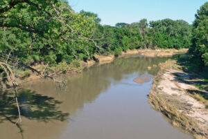
The county is embraced within the fertile territory between the Blue and Republican Rivers as they flow southeast into the Kansas River. The Little Blue River pays particular attention to Washington County, draining, with its branches, all except its southwestern portions. This section, comprising Strawberry, Clifton, and Sherman Townships, is watered by Parson Creek, East Branch, Peach Creek, and other streams flowing south into the Republican River. Mill Creek flows east through Mill Creek Township into the Little Blue River; Pierce Creek flows southeast through portions of Union, Hollenberg, and Washington Townships into the same; and Coon Creek takes the same general direction through Lincoln Township and also empties into the Little Blue River. The Little Blue proper drains much of the county in Hanover, Charleston, Washington, and Little Blue Townships. Joy Creek, Devil Creek, and other tributaries of the Little Blue River in the northern part of the county serve to further advance its reputation as an abundantly watered section of the State. Springs also abound, with good well water reached from ten to 60 feet. The streams were bordered with timber, the belt averaging from forty rods to half a mile in width. The county’s surface is rolling, except in the western part and along some of the streams, where it is hilly.
The native tree varieties were oak, walnut, hickory, elm, cottonwood, ash, locust, and elder. Trees were planted throughout the county, the best varieties being cottonwood, box elder, soft maple, black walnut, and elm. The best grazing land was found in the northern part of the county. Limestone and sandstone were plentiful in all portions of the county; mineral paint existed near Hollenberg; there were several veins of cement stone; salt springs existed in Mill Creek townships; deposits of salt underlied the central and western portions, and a bed of gypsum 60 feet thick, underlied the northeastern portion, at a depth of 200 feet.
In May 1859, a man named Daniel Sigmun, from Missouri, who had been visiting friends in the area, was found lying dead upon the old Mormon Trail, about three miles southeast of Washington. The man was stabbed in the side and shot under the chin. E.B. Cook and W. Way had been with William Hemphill on the Republican River near the bend, assisting Judge Adams in building a ferry boat to make a more direct route between Atchison, Kansas, and Denver, Colorado. They discovered the body and noticed the grass was trampled around him and other evidence of a desperate struggle. Mr. Way feared that he might be suspected of murder, and a strong suspicion in those days was almost equivalent to a lynching. He, therefore, left the body where it was, and some California emigrants buried it. Friends of Mr. Sigmun, learning of his fate, began their search for the murderer. Two theories were advanced. The same day that Sigmun was found dead, a band of Otoe Indians had passed along the trail, closely pursued by settlers from Wild Cat Creek from whom they had stolen horses. They might have found the man in their path and killed him. Also, upon the day that Sigmun was found dead, James McCarty had sold his claim on Coon Creek and was traveling the murdered man’s way.
Many settlers decided upon the latter theory, and in June, McCarty was arrested. There was no justice officer in the county, but McCarty was arrested and confined in a little log house this side of Waterville. The citizens then induced Rufus Darby, expecting an appointment as Justice of the Peace, to try the prisoner before a citizens’ court. He was not qualified to administer oaths, so the witnesses were not sworn. The testimony, however, was so purely circumstantial and “lame” that the prospective Justice of the Peace discharged McCarty. That same month, Mr. Darby received his appointment, and the suspected murderer was tried again, with a fortunate result. The second trial was held at Mr. Darby’s house, and the testimony of the defense seemed to prove an alibi quite strongly. The crowd in attendance was large and highly excited, and had the verdict been different, McCarty, no doubt, would have met the close embrace of “Judge Lynch.”
The town of Washington was incorporated in the fall of 1859.
Washington County was organized on the second Monday in April 1860, and on the fourth Monday, an election was held for county officers. George F. Caldwell, Joseph Malin, and William Hoffhine were elected commissioners; D.E. Ballard, clerk and register of deeds; M.G. Driskell, treasurer; William Langsdale, sheriff; James O’Neill, surveyor; Thomas M. Bowen, county attorney; John M. Hoffhine, superintendent of public schools; S.F. Snider, probate judge; William Mercer, assessor; and Charles Bruce, coroner. George Pierce was the first man to represent the county in the lower house of the last territorial legislature, and D.E. Ballard represented the county in the first state legislature.
In the fall of 1860, E. Woolbert built a large two-story log house, where he operated a hotel and post office.
The election to determine the permanent location of the county seat was ordered for November 1860. Washington, Rogersville, and West Union (a paper town) were the contesting towns about four miles west of Washington. The Washington Town company promised to give several lots to the county as an inducement to the voters to favor it as the county seat. Judge S.F. Snider withdrew Rogersville on election day and threw its seven votes to Washington, which became the county seat.
The commissioners’ first meeting was held in a log house built by the town company, and the county was divided into Washington and Mill Creek Townships. As the population increased, in the subsequent years, the original townships were divided to form Barnes, Brantford, Charleston, Clifton, Coleman, Farmington, Franklin, Grant, Greenleaf, Haddam, Hanover, Highland, Independence, Kimeo, Lincoln, Linn, Little Blue, Logan, Lowe, Mill Creek, Sheridan, Sherman, Strawberry, Union, and Washington.
In 1860, the population of Washington County was 383
School District No. 1 was organized in 1861, with Miss Agnes Hallowell serving as the first teacher. The school was first held in the “Company’s House.”
The Civil War necessitated the withdrawal of the troops from the frontier posts. The Indians, learning that the soldiers were occupied elsewhere, began to agitate the settlers.
In 1864, School District No. 2 was established in Charleston Township.
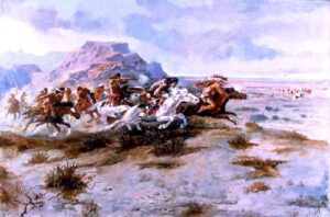
In the spring of 1864, Cheyenne and Arapaho appeared on the warpath along the Little Blue River in Marshall and Washington Counties, following the Otoe to their village. They first attacked John Ferguson’s house on Mill Creek, plundered O.S. Canfield’s home, took Rufus Darby prisoner as he was returning from Marysville, and then marched toward Washington, where another band was plundering the Hallowell cabin. They followed down the creek and took the household goods at G.M. Driskell’s. Rich Bond and Andy Oswald were taken prisoners but were soon released. The people living in the southern part of Washington County and the northern part of Clay County fled south and gathered at Orville Huntress’ cabin near the present-day Clay Center, where about 200 remained encamped for a month.
In August 1864, a war party of the Arapaho and Cheyenne again appeared on the Little Blue River about six miles above the present town of Hanover, where they murdered and scalped a family named Eubanks. In the fall, there were continued Indian troubles, and several settlers gathered at Hume’s log cabin at Washington for safety.
When E. Woolbert resigned as postmaster in 1865, he sold his large two-story log house to S.F. Snider for $250.
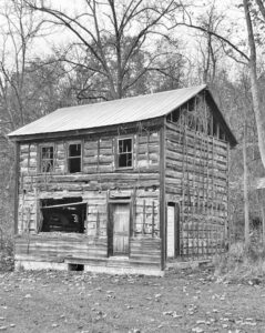
In 1867, the county bought the stockade house and established county offices, forming the first Washington County Courthouse. It housed offices for the clerk, treasurer, commissioners, sheriff, surveyor, school superintendent, probate judge, district judge, district court clerk, assessor, and coroner.
In 1868, another Indian raid was made in Cloud, Republic, and Washington Counties, but so far as is known, only one man was killed, and the Indians confined themselves to plundering and running off stock.
That year, S.F. Snider sold his sizeable two-story log house to the county, which became known as the old Stockade Courthouse.
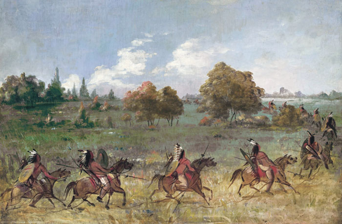
Indian Raid.
The first newspaper was the Western Observer, which appeared on March 11, 1869. M.J. Kelly was the owner and editor; his office was in the old Stockade Courthouse. That year, Gerat H. Hollenberg laid out the city of Hanover and worked for it night and day.
That year, the school district issued bonds, and the “old stone” schoolhouse was built. These were the first bonds issued for educational purposes in the county.
The first courthouse was destroyed by fire in the early morning of March 31, 1870. The building was a total loss, and all records of school lands, titles, and deeds to property were destroyed. The retiring county treasurer was later charged with arson and embezzlement but was acquitted. In 1870, the county’s population was 4,081.
The second County Courthouse was a two-story frame structure completed in 1871. That year, the 12th judicial district was created. A.S. Wilson was appointed judge, and William Hoffhine was clerk.
The first railroad to enter the county was the St. Joseph & Western, built across the northeast corner in 1872. After crossing the eastern boundary, it ran southwest to Hanover, followed by the Little Blue River northwest to Hollenberg.
On December 15, 1872, the Stockade Courthouse burned a second time. Most of the county records were burned because the fire began early Sunday morning and was not discovered until it had made significant progress. The building was insured for $2,000 and rebuilt by the Insurance Company in July 1873. The third County Courthouse was a large, elaborate, ornate brick building.
The Junction City & Fort Kearney Railroad was built in 1877-78. It crossed the eastern boundary about three miles south of the Little Blue River, ran northwest to Greenleaf, then southwest to Clifton, with a branch diverging at Greenleaf to Washington.
In January 1879, the Otoe Reservation lands in Washington County came into the market, and that tract was annexed to Hanover Township.
By the early 1880s, excellent transportation facilities were provided by the Chicago, Burlington & Quincy Railroad, which crossed the county from northeast to southwest; the St. Joseph & Western, which later became the St. Joseph & Grand Island; the Missouri Pacific Railroad, formerly the Junction City & Fort Kearney; the Chicago, Rock Island & Pacific, which crossed both the northwest and the southwest corners of the county. This gave the county 106 miles of main-track railroad.
The county was divided into 120 school districts. Of the 6,000 school-age people, nearly 5,000 were enrolled in district schools, and about 60% were in attendance. The value of school property was about $50,000, and 110 teachers were employed. The average wages of females were $27 per month, and of males $33.
By this time, less than 28% of the county’s 532,000 taxable acres of land were under cultivation. Corn and wheat were the great products. Livestock was also a “paying” investment. Besides farming and stock-raising, horticulture also received considerable attention, and excellent varieties of fruits were raised, including plums, strawberries, grapes, raspberries, mulberries, and gooseberries.
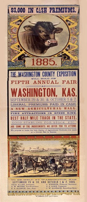
The Washington County Exposition was organized on July 9, 1881. The exposition owned 56 acres of ground, including 16 acres in a good trotting park. The grounds were fenced with hedges, and exhibition buildings were erected. The track was a half mile. The capital stock of the exposition was $5,000.
In 1882, the county’s population was 15,668. By townships and cities it was: Charleston, 501; Washington, 982; Sherman, 2,050; Washington City, 1,020; Strawberry, 1,232; Union, 672; Mill Creek, 1,321; Clifton, 1,580; Hollenburg, 1,047; Hanover, 1,563; Little Blue, 1,301; Lincoln, 1,399; Hanover City, 627; Greenleaf City, 373.
The value of all taxable lands in the county in 1882 was $1,565,170; of town lots, $153,043; of personal property, $618,162; of railroad property, $361,141.74 — Total $2,697,516.74. Her citizens possess over 6,000 horses, 6,000 milch cows, 10,000 other cattle, 11,000 sheep and 21,000 swine. The figures above speak for themselves and proclaim it a prosperous county.
The population of Washington County peaked in 1890 at 22,894.
In the mid-1890s, the county courthouse survived an earthquake that shook down its highest tower, which was never replaced.
In 1910, the chief agricultural products were corn, Irish potatoes, millet, and oats. Winter wheat, sorghum, Kafir-corn, and alfalfa were also raised. In 1907, there were 325,000 bearing fruit trees in the county. The population in 1910 was 20,239, and the assessed property valuation was $39,917,625. The total value of farm products for the year was $5,603,358.
On July 4, 1932, Washington was hit with a deadly tornado that left a path of death and destruction from Kansas through Nebraska. The beautiful courthouse and many other buildings did not survive.
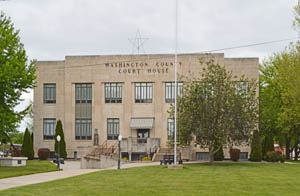
The cornerstone for the fourth Courthouse was laid on March 11, 1933, and the courthouse was dedicated on March 4, 1934. Today, the simple and elegant Art Deco-style courthouse is surrounded by many trees.
In 2010, the Keystone-Cushing Pipeline (Phase II) was constructed north to south through Washington County, with much concern over tax exemption and environmental issues if a leak occurs. The pipeline was shut down on December 7, 2022, after a leak was detected near the community of Washington. It reopened on December 29, 2022.
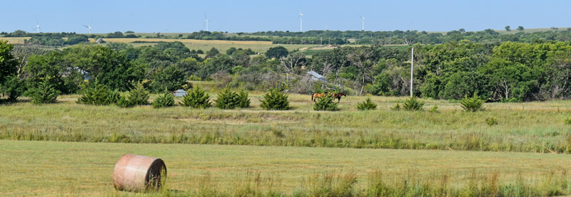
Today, Washington County is primarily an agricultural area that grows wheat, milo, corn, soybeans, alfalfa, and prairie hay; sunflowers and state flowers can also be found. Cow-calf herds and dairy cattle scatter throughout the 30-square-mile boundary, while prairie skyscrapers (grain elevators) dot the horizon from corner to corner.
The Pony Express Hollenberg Station, a state historic site, is the only unaltered station remaining at its original location. It looks much like it did in 1857, making it a great place to stop along your journey.
Washington County is located in North Central Kansas on U.S. Highway 36.
©Kathy Alexander/Legends of Kansas, updated January 2026.
Also See:
Washington County Photo Gallery
Sources:
Blackmar, Frank W.; Kansas: A Cyclopedia of State History, Vol I; Standard Publishing Company, Chicago, IL 1912.
Cutler, William G; History of Kansas; A. T. Andreas, Chicago, IL, 1883.
Washington County, Kansas
Wikipedia

