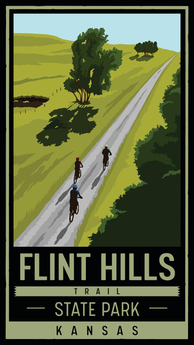
Flint Hills Trail State Park.
The Flint Hills Trail State Park in Kansas, an old railroad corridor, stretches for 118 miles across east-central Kansas. As its name suggests, the trail crosses the beautiful Flint Hills, from Osawatomie in the east to Herington in the west, and passing through Rantoul, Ottawa, Pomona, Vassar, Osage City, Miller, Admire, Allen, Bushong, and Council Grove through Miami, Franklin, Osage, Lyon, and Morris Counties. The trail lies within 90 minutes of three of the state’s largest cities—Kansas City, Topeka, and Wichita.
The Flint Hills represent one of the last remaining tallgrass prairie ecosystems in the world. It is home to abundant prairie plants and wildlife, spectacular views, national historic sites, and a diverse range of recreational areas. The eastern portions of the route travel alongside the Marais Des Cygnes River, between rushing waters and towering bluffs, through rolling farmland and riparian woodlands.
The Flint Hills Trail is the eighth-longest rail-trail in America, and the longest trail in Kansas. It follows the general route of the Santa Fe Trail and forms a component of the coast-to-coast American Discovery Trail. It was designated a state park in 2018 and is now managed by the Kansas Department of Wildlife and Parks. Kanza Rail-Trails Conservancy built over 60 miles of the trail, and the Kansas Department of Wildlife and Parks completed it. Not only is the trail designated as a National Recreation Trail, but it was also inducted into the Rails-to-Trails Conservancy’s Trail Hall of Fame.
The route was originally developed in the late 1880s as the Council Grove, Osage City & Ottawa Railway. It became the Missouri Pacific Railroad in the late 1800s, running from Kansas City to Pueblo, Colorado.
The Missouri Pacific Railroad discontinued service in the 1980s, and it was subsequently abandoned. The Rails-to-Trails Conservancy acquired the corridor in 1995 and later transferred ownership to the Kanza Rail-Trails Conservancy.

Flint Hills State Park Map.
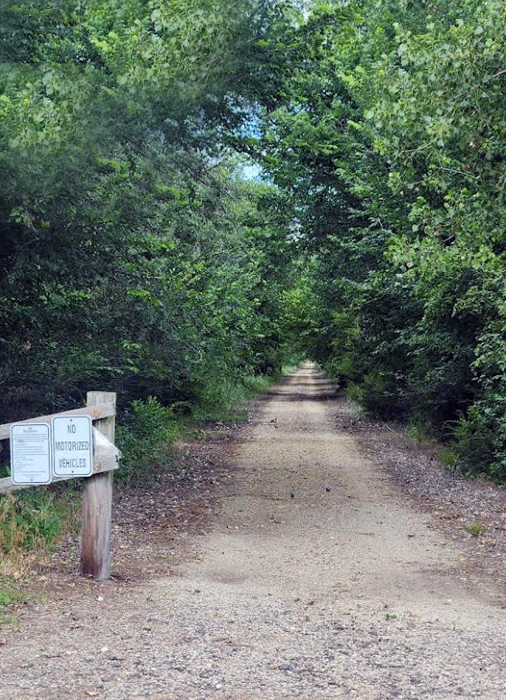
The 118-mile rail-trail across Kansas from the Marais des Cygnes River Valley near Osawatomie to the heart of the Flint Hills is the new Flint Hills Trail State Park. It is the state’s second linear state park and intersects with its first, the Prairie Spirit Trail State Park in Ottawa. About 96 miles of the trail are now open for non-motorized traffic. Horseback riders, bikers, hikers, and even families with strollers can safely enjoy this recreational path that winds through the rural countryside and small-town communities of eastern Kansas.
Flint Hills Trail.
The trail is great for biking, cycling, horseback riding, birding, and side-trip exploration.
©Kathy Alexander/Legends of Kansas, updated May 2026.
Also See:
Every Place in Kansas
Kansas Destinations
Kansas State Parks
Kansas Waterways
Sources:
Kanza Trails
Kansas Department of Wildlife & Parks
Rails to Trails Conservancy
Travel Kansas