
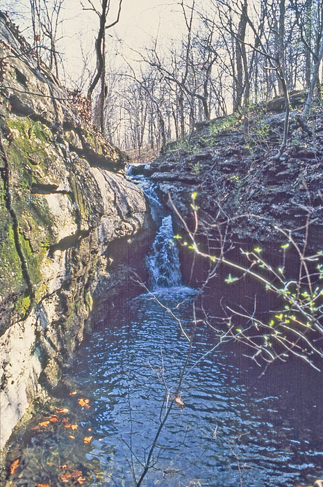
Butcher Falls near Sedan, Kansas by Kathy Alexander.
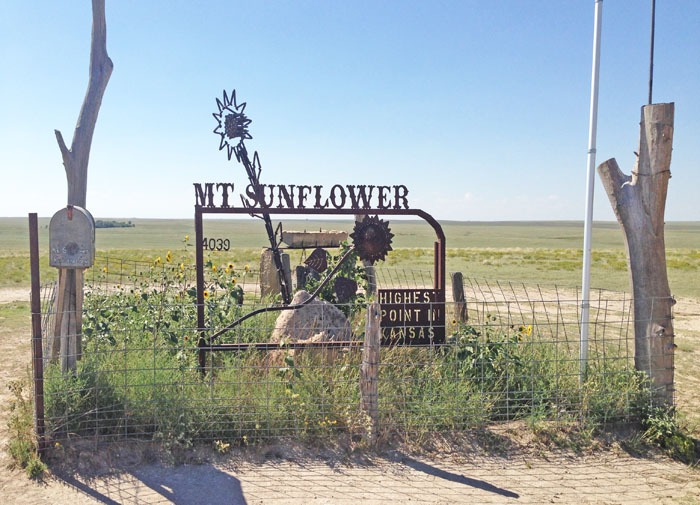
Although Mount Sunflower in Wallace County, Kansas, is not a mountain, it is the highest natural point in the state of Kansas. Photo courtesy of Wikipedia.
Located midway between the East and West Coasts of the United States, Kansas has a unique position as a geographic hub. Despite images to the contrary, Kansas has a unique geography as a transition between the historic farmlands of the east and the open range of the west. The land rises gently from 679 feet above sea level in the southeast to 4,039 feet at Mount Sunflower in northwest Kansas, near Wallace County. In between, the land is interspersed with a mixture of large and gently rolling hills and soils that become progressively drier as you pass the middle of the state, near Salina, on the way west.
Kansas is uniquely positioned as a geographic hub, located midway between the East and West Coasts of the United States. Despite common misconceptions, the state features a varied geography that shifts from historic farmlands in the east to expansive open ranges in the west. The elevation gradually increases from 679 feet above sea level in the southeastern part to 4,039 feet at Mount Sunflower in the northwest. In the central region, particularly near Salina, the landscape consists of gently rolling hills and soils that steadily become drier as one travels westward.
Kansas is bordered by Nebraska to the north, Missouri to the east, Oklahoma to the south, and Colorado to the west. The state is divided into 105 counties, with 628 cities. Its largest county by area is Butler County. The geographic center of the 48 contiguous states is in Smith County near Lebanon. Until 1989, the Meades Ranch Triangulation Station in Osborne County was the geodetic center of North America, serving as the central reference point for all maps of North America. According to the Kansas Geological Survey, the geographic center of Kansas is near Bushton in northwest Rice County.
With a total area of 82,282 square miles, the state’s 2,937,880 residents (as of 2020) reside in the 15th-largest state among the 50 states. Kansas was the 34th state to join the United States, doing so on January 29, 1861.
The western two-thirds of the state, located in the Great Central Plain of the United States, has a generally flat or undulating surface, while the eastern third is hilly and forested. The land gradually rises from east to west; its altitude ranges from 684 feet along the Verdigris River at Coffeyville in Montgomery County to 4,039 feet at Mount Sunflower, located 0.5 miles from the Colorado border in Wallace County. It is a common misconception that Kansas is the flattest state in the nation. In fact, Kansas has a maximum topographic relief of 3,360 feet, making it the 23rd flattest U.S. state measured by maximum relief.

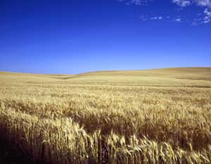
High Plains in Barton County, Kansas, by Kathy Alexander.
Elevation is one of the major factors influencing the weather and climate of Kansas. Apart from the significant terrain features of the hill systems in Kansas, there is a general increase in elevation from east to west. In the eastern part of Kansas, elevations range from 600 to 1,300 feet to over 3,900 feet in the west. The higher elevations in the west are deceptively flat. Breaks and draws established in old waterways are not very visible.
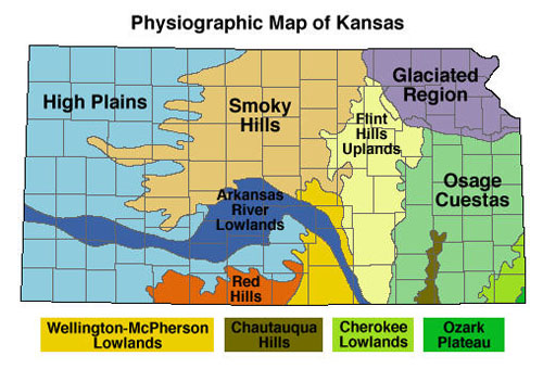
The Kansas landscape was formed by alternating periods of deposition and erosion. This landscape divides Kansas into eleven regions based on physical geology, also known as physiography.
Each region is different, and this difference is primarily determined by geology, along with other factors such as climate.
Waterfall over Mississippian-age limestone in Cherokee County, Kansas, courtesy of the Kansas Geological Survey.
The Ozark Plateau in extreme southeastern Kansas is composed of rocks deposited during the Mississippian Period of geological history, approximately 350 million years ago. Landforms in the Cherokee Lowlands, Osage Cuestas, and the Chautauqua Hills are all of Pennsylvanian age, deposited approximately 300 million years ago. The Flint Hills of east-central Kansas and the Red Hills in south-central Kansas are both of Permian age, approximately 250 million years old.
The Flint Hill region, situated in the east and west-central parts of the state, represents one of the last remaining true tallgrass prairies, characterized by its golden fields in spring and early summer, gentle streams, free-roaming cattle, and a quietness that evokes images of cowboys and campfires. In the northeast, the hills are more sharply defined by a rockier terrain. They are heavily wooded, a remnant of the last significant glacial advance that moved across the North American landscape.
From the 100th meridian westward, the land becomes drier and the hills less prominent as you approach the western border. Here, the Great Plains dominate, and a sandhills region is exposed, typifying a physical geography that extends from Mexico to Canada. It is also representative of a time when significant parts of the continental interior of the United States were covered by ocean waters, which, along with glaciers from the ice ages, have helped shape the American landscape.
Cretaceous-age rocks, deposited about 100 million years ago during the time of the dinosaurs, form the landscape in the Smoky Hills. The High Plains of western Kansas are composed of rock debris washed off the face of the Rocky Mountains over the past few million years. The Arkansas River Lowlands and the Wellington-McPherson Lowlands are areas of recent deposition that border rivers. Glaciers moved into Kansas about 750,000 years ago and sculpted the northeastern corner of the state.
Kansas’s waters have played an essential role in its development. Early settlers to the region found their way by following the Missouri River upstream from St. Louis, Missouri, to the point where the Kansas River joins it, making a significant turn to the north. By the 1820s, this convenient location had become a critical warehousing and distribution center as early Kansas City took shape, providing support for the Santa Fe and Oregon Trails. Other major waterways that continue to serve the state are the Kansas, Republican, and Smoky Hill Rivers in the north, and the Arkansas River, which forms a somewhat east-west transect in the southern half of the state on its way from the Rocky Mountains to the Gulf of Mexico. Kansas is also home to one of the largest underground aquifers in the United States, the Ogallala. The use of water from this aquifer has dramatically expanded the agricultural potential of the drier, sandier soils in the western part of the state, allowing a shift from dryland to irrigated production practices.
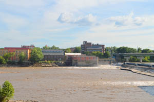
The Kansas River at Lawrence, Kansas, by Kathy Alexander.
Nearly 75 miles of the state’s northeastern boundary is defined by the Missouri River. The Kansas River, formed by the junction of the Smoky Hill and Republican Rivers at appropriately-named Junction City, joins the Missouri River at Kansas City, after a course of 170 miles across the northeastern part of the state.
The Arkansas River, rising in Colorado, flows with a bending course for nearly 500 miles across the western and southern parts of the state. With its tributaries, including the Little Arkansas, Ninnescah, Walnut, Cow Creek, Cimarron, Verdigris, and the Neosho, it forms the southern drainage system of the state.
Kansas’s other rivers are the Saline and Solomon Rivers, tributaries of the Smoky Hill River; the Big Blue, Delaware, and Wakarusa, which flow into the Kansas River; and the Marais des Cygnes, a tributary of the Missouri River. Spring River is located between Riverton and Baxter Springs.
Waving wheat in Kansas by Carol Highsmith.
Kansas is historically an agricultural state, ranking third behind Texas and Montana in total agricultural acreage. While Kansas is the nation’s top wheat grower and also the leading producer of grain sorghum and corn, manufacturing and service industries have recently surpassed agriculture as the primary income producers. The two leading industries are the manufacture of transportation equipment and industrial and computer machinery. Other important manufactures are petroleum and coal products, as well as non-electrical machinery. Additionally, the state is a significant producer of crude petroleum and possesses extensive reserves of natural gas, helium, and salt. Cattle and calves represent the single most valuable agricultural product, and the Kansas City stockyards are among the nation’s largest.
Economically, the state can be divided into several distinct production zones. In the wooded northeast, the manufacturing of a variety of products, including automobiles, dominates in the Kansas City region. The southeast has a strong aircraft manufacturing sector centered in Wichita, as well as railroad shops, flour mills, meatpacking plants, grain elevators, and oil fields. Coal production along the eastern border corridor with Missouri has long helped meet the region’s energy needs for electricity. The southwestern part of the state, around Garden City, is home to several major meatpacking firms, as well as feedlot operations and natural gas and helium production facilities. The central, northwest, and north-central portions of the state retain the economic stability that has come to be known as the “heartland,” characterized by large-scale, scientifically managed farming operations.
The state’s main population centers include the Kansas portion of metropolitan Kansas City in the northeast, Wichita, the state’s largest city, in the south-central part of the state, Topeka, the state capital, and Lawrence in the northeast.
©Kathy Alexander/Legends of Kansas, updated October 2025.

Flint Hills in Bazaar, Kansas by Kathy Alexander.
Also See:
Sources:
Geography
Kansas Geological Survey
Kansas Geological Survey-2
Kansas State University
Wikipedia