
I-70 crossing on the Lewis and Clark Viaduct over the Kansas River from Kansas to Missouri in Kansas City, courtesy Wikipedia.
Interstate 70 (I-70) is a mainline route of the Interstate Highway System connecting Cove Fort, Utah, to Baltimore, Maryland. In Kansas, it extends for just over 424 miles from the Colorado border near Kanorado to the Missouri border in Kansas City.
I-70 in Kansas is the first segment of the Interstate Highway System to be paved and completed. The route passes through several of the state’s principal cities, including Kansas City, Lawrence, Topeka, and Salina. The route also passes through Junction City, Abilene, and Colby.
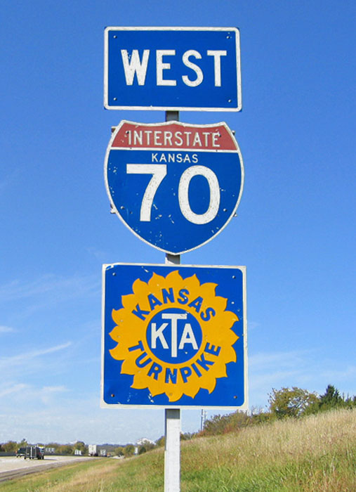
I-70 Kansas Turnpike.
The section of I-70 from Topeka to the Missouri border is co-designated as the Kansas Turnpike; with only the section between Topeka and just west of Kansas City, Kansas, is tolled.
I-70 enters Missouri via a main northern route on the Lewis and Clark Viaduct above the confluence of the Kansas and Missouri Rivers, and a route designated “Alternate I-70,” which has signs for I-70 and I-670 just south of the Kansas City, Kansas, downtown area.
From exit 275 at Abilene to the Missouri state line, the road is named the Dwight D. Eisenhower–Harry S. Truman Presidential Highway. It retains the designation until exit 16 at Independence, Missouri, the location of Truman’s presidential library.
The section of I-70 that is now the Kansas Turnpike was finished by 1956 and opened to traffic. West of Topeka, the freeway was constructed from west to Salina at its junction with U.S. 81, and from Ogallah to Grainfield. The freeway from Salina to Wilson was completed the following year. On October 9, 1959, the section of I-70 opened from Junction City west to Abilene through a ribbon-cutting ceremony. A segment of I-70 from Levant through Ogallah was finished by 1965. Another section was built the following year, connecting Wilson to Grainfield. The freeway was completed through Kansas, with the final section near the Colorado border, in 1970. Building the full route through Kansas took 14 years.
The highway travels through the following counties, from east to west: Wyandotte, Leavenworth, Douglas, Shawnee, Wabaunsee, Riley, Geary, Dickinson, Saline, Lincoln, Elsworth, Russell, Ellis, Trego, Gove, Logan, Thomas, and Sherman.
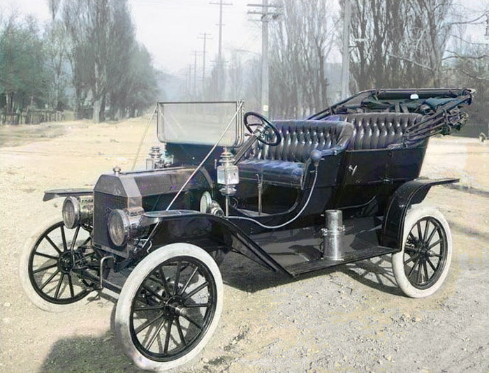
Model-T.
The introduction of the automobile marked one of the most significant transformations for the nation. Ira Thompson, an early businessman in Rexford, is recognized as the first owner of an automobile in Thomas County, which he acquired in 1903. In 1908, Henry Ford launched the Model T, a car that was affordable, dependable, and efficient.
Prior to 1910, there were few automobiles; however, once “car fever” began, almost every issue of the Colby Free Press carried news stories about prominent citizens purchasing new ones. On one occasion, John Ackard drove the 20 miles from Brewster to Colby in 45 minutes at nearly 27 miles an hour, which was considered high-speed travel at the time.
The most significant early highway of the county was the Golden Belt Road, established in 1910. It ran from Oakley to Colby and then west. Another road was the Sunflower Trail, which connected to the Golden Belt Road and ran east to Beloit. There was also the Rock Island Highway (later called the Pikes Peak Ocean-to-Ocean Highway) that ran alongside the railroad to Norton. The Pikes Peak Ocean-to-Ocean Highway ran from New York City to Los Angeles, California, and was built between 1914 and 1926.
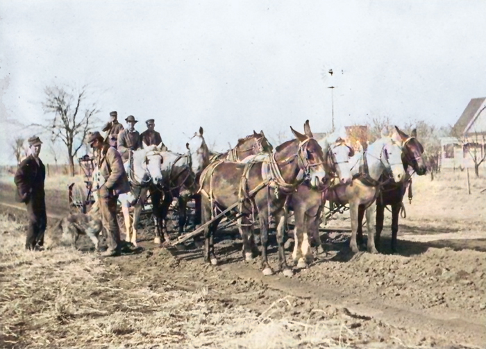
Road construction in Sheridan County, Kansas, 1915.
In the years just before the outbreak of World War I, road-building fever spread across the country. Thomas County businessmen and other interested parties played an active role in seeking good roads not only in Thomas County but also across all of Northwest Kansas.
In the period following the war, automobile advertisements and news items about accidents and the need for better roads became commonplace in the newspapers. The Victory Highway, established after the war, was a memorial to veterans and included sections of the Golden Belt Road.
During the 1920s, extensive road construction resumed after the war had delayed it. The Federal Bureau of Highways was planning three major transcontinental highways across the United States. Colby businessmen hoped the proposed central route, U.S. 40, created in 1925, would pass through town. For years, the Kansas portion of Highway 40 consisted of roads constructed, supervised, and maintained by the counties.
There were two possible routes from Manhattan west through Kansas. One was to follow the Union Pacific Railroad, and the other was over the Roosevelt Midland Trail through Clay Center, Beloit, and Hill City to Colby. In either case, Colby hoped to secure this roadway, for the people felt the logical route of the former road would come north from Oakley to Colby over the Victory Highway rather than going west from Oakley along the Union Pacific Railroad. Many meetings were held, and representatives from Colby attended state gatherings and even a national meeting in Chicago, Illinois, to secure passage of U.S. 40 through Thomas County and Colby.
Early in 1926, a decision was reached to run highways over both proposed routes. The Union Pacific route was designated U.S. 40 South, and the northern Manhattan through Colby route is designated U.S. 40 North.
By 1929, all county roads were recognized as improved earth roads and graded. In June,1929, the Highway Bureau decided to designate the road west from Norton through Decatur, Rawlins, and Cheyenne Counties as U.S. 36. The towns from Colby west into Colorado were unhappy, for it meant that instead of auto traffic flowing down to U.S. 40-N by way of the Rock Island Highway, such traffic would go to Denver, Colorado by way of Oberlin, Atwood, and St. Francis. The businessmen of the towns along U.S. 40-N, in an attempt to change the Highway Bureau’s decision, presented many arguments. All these efforts were to no avail, however, and U.S. 36 became a reality.
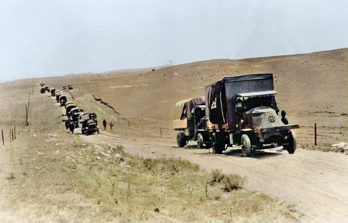
Eisenhower’s 1919 Army Convoy.
Long before Dwight D. Eisenhower became President, he realized the importance of highways. His first realization of the value of good highways occurred in 1919, when he participated in the U.S. Army’s first transcontinental motor convoy from Washington, D.C. to San Francisco. On the way west, the convoy experienced an endless series of mechanical difficulties. Vehicles got stuck in mud or fell through wooden bridges. After 62 days on the road, the convoy finally reached San Francisco.
By the late 1930s, pressure to build transcontinental superhighways was building in Washington. President Franklin D. Roosevelt repeatedly expressed interest in constructing a network of toll superhighways to create more jobs for the unemployed.
In 1936, U.S. 40 North became U.S. 24, and U.S. 40 South became U.S. 40.
During World War II, General Eisenhower recognized the advantages of the Autobahn highway network and the Allies’ enhanced mobility upon entering Germany. These experiences shaped Eisenhower’s views on highways. Interstate 70 was formed the day President Eisenhower signed the Federal-Aid Highway Act on June 29, 1956. The Kansas State Highway Commission’s monthly newsletter, Highway Highlights, for the month of June 1956, written before Eisenhower signed the bill, laid out the proposed route.
“As presently approved, the system includes the turnpike from Kansas City to Topeka; west along U.S. 40 to Oakley; north to the vicinity of Colby; and west along U.S. 24 to the Colorado line.”
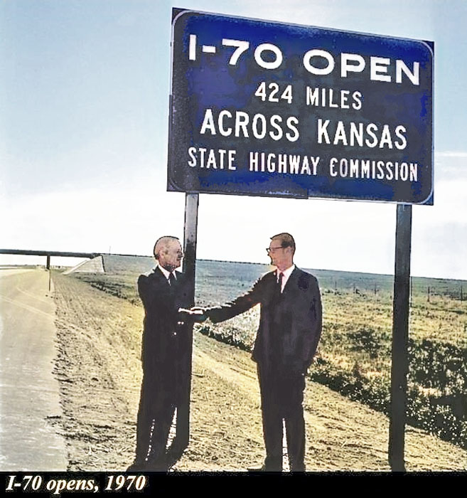
I-70 opens in Kansas in 1970.
A 1962 Colby Free Press article reported that officials stated:
“Traffic projections indicate that by 1975, the average daily traffic on the portion of Interstate 70 across Thomas County will be about 8,000 vehicles per day. When completed in 1964 or 65, the Thomas County section will be about 40 miles in length with five interchanges costing an estimated $11,900,000. I-70 will run from Baltimore, Maryland, to Richfield, Utah, and will connect Thomas County citizens with important cities such as Kansas City, Topeka, Kansas; Denver, Colorado; and St. Louis, Missouri. The entire route will be four lanes… the new interstate would increase the traffic flow into Colby. The interchange in the Colby area is a full interchange, which will be located 1.5 miles south of the city limits, where I-70 intersects K-25.”
A major milestone for the Kansas State Highway Commission took place when the final section of Interstate 70 in the Sunflower State was formally opened in 1970.
I-70 runs concurrently with U.S. Highway 24 (US 24) from the Colorado state line until US 24 splits at Levant and runs north of I-70. At Colby, I-70 turns southeast until it reaches Oakley, where US 40 joins I-70 for a concurrent journey through most of the state. Initially, the route remains high and unusually level as it follows a projection of the High Plains into the state. From exit 140 (Riga Road), the route lowers from the High Plains into the Blue Hills region, as indicated by gentle undulations in the road and the unusual appearance of stone posts in the countryside. As it approaches Russell, the route passes over three active sinkholes, the largest being the Crawford Sinkhole at mile 179. Past Russell, the route follows a ridge between the Smoky Hill River and its tributary, the Saline River, where the highway passes through the Smoky Hills Wind Farm. Reaching the county line between Russell and Ellsworth counties, the road begins to traverse the Smoky Hills.
At Salina, I-135 begins its journey southward toward Wichita, and I-70 continues through Abilene and Junction City, where the road begins to run through the Flint Hills.
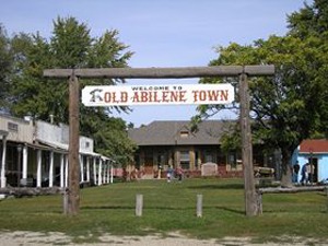
Old Abilene Town by Kathy Alexander.
In Topeka, I-70 intersects I-470 twice. The second time it is intersected, the Kansas Turnpike merges, making I-70 into a toll road. This is one of only two sections of I-70 that are tolled (the other is along the Pennsylvania Turnpike); as of 2024, the maximum toll for cars with a K-TAG on this section is $2.74. I-70 and the turnpike are concurrent from Topeka to Bonner Springs, the turnpike’s eastern terminus. From Bonner Springs to 18th Street and extending on to the eastern border of Kansas, the highway is free.
Traveling through the Sunflower State on America’s first interstate highway, Kansas offers a unique blend of history, folklore, and agricultural pride. From Dorothy’s iconic journey showcased at the Oz Museum in Wamego, to the endless wheat fields and even the spooky legends of Stull Cemetery, this state is full of imagination and surprises.
Along the way, visitors can check out numerous museums, quaint small towns, large cities, historic sites, state parks, and more.
©Kathy Alexander/Legends of Kansas, January 2026.
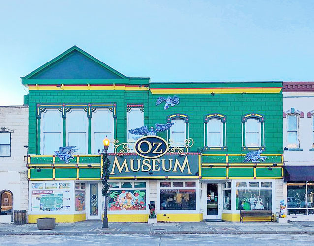
OZ Museum in Wamego, Kansas.
Also See:
Frontier Trails
Historic Sites
Kansas History
Scenic Byways
Sources:
Interstate Signways
Static 1 Square Space
Transportation History
Wikipedia