A B C D E F G H I J K L M N O P Q R S T U V W X Y Z
M
| Place Name | County | Place Type | Post Office Dates | More Information |
| McAllaster | Logan | Lost Town | 1887-1897 1903 1906-1953 |
It was located on the Smoky Hill Trail and the Union Pacific Railroad, about 15 miles northwest of Russell Springs.
|
| McCandless | Franklin | Lost Town | 1900-1901 | |
| McCamish | Johnson | Lost Town | None | The McCamish community was laid out in 1857 by Richard D. McCamish on Bull Creek about two miles northeast of Edgerton. The area had been previously known as Hibbard and had an established post office. In 1858, the rival town of Lanesfield, which was named in honor of General James H. Lane, was established on the other side of Bull Creek. McCamish was eventually “deserted and outstripped” by its rival, Lanesfield. |
| McClains | Sedgwick | Lost Town | ||
| McCracken | Rush | Current Town | McCracken was founded as an old railroad town. | |
| McCue, Friend | Finney | Lost Town | Named after Basil M. McCue from Hastings, Nebraska, the organizer of the Garden City Western Road. It was on the St. Louis and San Francisco Railroad. The town’s name was changed to Friend. | |
| McCune | Crawford | Current Town | 1875-Present | Named for pioneer Isaac McCune, McCune, Kansas, is a small town in southwest Crawford County on the divide between the Neosho River and Lightning Creek. As of the 2020 census, the city’s population was 370, and its total area was 0.31 square miles. |
| McDonald | Rawlins | Current Town | Named for R. L. McDonald, a pioneer rancher. | |
| McDowell Creek | Riley | Lost Town | Now part of Fort Riley. | |
| McFarland | Wabaunsee | Current Town | 1887-1966 | On the Chicago and Rock Island Railroad in 1887. The post office closed on December 30, 1966. |
| McGee’s | Osage | Lost Place | On 110 Creek, Santa Fe Trail. | |
| McGregor | Sheridan | Lost Town | 1883-1884 | |
| McHale | Rooks | Lost Town | ||
| McKinney | Douglas | Lost Town | 1857-1868 | |
| McLain | Harvey | Lost Town | 1886-1906 | Named for Earnest McLains, a banker. Located on the Missouri Pacific Railroad, five miles southeast of Newton. In 191, it had a population of 26. |
| McLouth | Jefferson | Current Town | Named for Amos McLouth, the townsite owner. | |
| McPherson | McPherson | Current Town | County seat. Named in honor of General James B. McPherson. It was on the Chicago and Rock Island Railroad in 1887. | |
| McPherson College | McPherson | Current College | NA | McPherson College, located in McPherson, Kansas, was chartered in August 1887 by German Baptist Brethren church leaders who recognized the need for a college west of the Mississippi River to meet the educational needs of settlers moving westward. |
| McPherson County | McPherson | Current County | NA | Created from an unorganized area in 1867. McPherson is the county seat. |
| McWhinneyville | Morris | Lost Town | South of White City. | |
| Mabel | Kingman | Lost Town | 1884-1887 | |
| Mace | Russell | Lost Town | 1872-1874 | |
| Macgraw | Sheridan | Lost Town | 1888-1905 | Located on the north fork of the Solomon River, this hamlet was 12 miles north of Hoxie. In 1910, it received its mail from Dresden, the nearest railroad station. |
| Mackie, Mackie Camp, 42 Camp | Cherokee | Lost Town | None | Coal mining camp. |
| Macksville | Stafford | Current Town | Named for George Mack, a pioneer. | |
| Macon | Wallace | Name Change | The name changed to Dinas. | |
| Macyville/Ten Mile | Cloud | Lost Town | 1871-1879 1879-1905 |
The town’s name changed from Ten Mile to Macyville on August 22, 1879. It was in Summit Township, nine miles southwest of Concordia and about 11 miles northeast of Glasco. |
| Madeline | Wichita | Lost Town | 1888-1891 | |
| Madison | Geary | Name Change | At the junction of Madison Creek and Republican River at or near Bachelder, now Milford. | |
| Madison | Greenwood | Current Town | ||
| Madison Junction | Was on the Howard and Benedict Branches of the Atchison, Topeka & Santa Fe Railroad. | |||
| Madura | Clay | Lost Town | 1869-1871 | It was two miles south of Wakefield. |
| Madura | Kingman | Lost Town | 1869-1871 | |
| Magda | Lyon | Lost Town | 1890-1904 | A hamlet located nine miles south of Plymouth. It was on the Atchison, Topeka & Santa Fe Railroad. |
| Magna City | Butler | An oil boom town east of Douglas. | ||
| Magic | Riley | Lost Town | 1882-1892 | |
| Magnolia | Allen | Lost Town | 1862-1863 | |
| Magnolia | Atchison | Lost Town | ||
| Magnolia | Bourbon | Lost Town | ||
| Magnolia | Sedgwick | Lost Place | 1877-1889 | The post office moved to Andale. |
| Mahaska | Washington | Current Town | 1887-Present | Mahaska, Kansas, is a small town situated one mile south of the Nebraska state line in Union Township, Washington County. As of the 2020 census, its population was 46. |
| Mairestown | Shawnee | Lost Town | 1857-1862 | Mairestown was founded by Thomas W. Mairs in 1855. |
| Maize | Sedgwick | Current Town | ||
| Majella | Bourbon | Lost Town | 1892-1902 | The post office was in the home of M.E. Remnsider, the first postmaster. He added a room to add a store. It was nine miles northeast of Bronson. |
| Mall Creek | Clay | Lost Town | ||
| Malta | Cloud | Lost Town | 1875-1884 | |
| Malvern | Osage | Lost Town | ||
| Manchester/Keystone | Dickinson | Ghost Town | 1877-1993 | A tiny town located in the northwest corner of Dickinson County. Though it is officially “extinct” because it no longer has a post office, it had a population of 47 as of the 2020 census. |
| Mandova or Mandovi | Anderson | Lost Town | Laid out in 1858 and abandoned in 1860, it consisted of three log cabins, but it also boasted the finest lithographed map of any town in Kansas. | |
| Manhattan | Riley | Current Town | County Seat. Two settlements were established — Canton and Poleska in 1854. They were consolidated and renamed Boston. When a large colony of new settlers arrived, the name was changed to New Amsterdam, and later to Manhattan. It occurred on the Kansas Pacific Railroad between 1865 and 1866. | |
| Manila | Ford | Lost Town | 1898-1899 | |
| Mankato | Jewell | Current Town | Originally called Jewell Center. | |
| Manley | Marshall | Lost Town | 1881-1890 | |
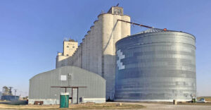
| Manning | Scott | Extinct Town | 1887-1955 | When the Missouri Pacific Railway conducted its final survey in 1887, Manning, Kansas, was established next to the tracks. The area still features a grain elevator, several silos, and buildings. |
| Mann’s Fort, Fort Mann | Ford | Lost Place | 1845 | Fort Mann was located on the Santa Fe Trail just a few miles west of present-day Dodge City. |
| Mansan | Allen | Lost Town | ||
| Mansfield | Linn | Lost Town | 1866-1875 | Mansfield got its start in the early 1860s. |
| Mansion, Munsion | Morris | Lost Town | ||
| Mantanzas | Chautauqua | |||
| Manteno | Ness | Lost Town | 1880-1914 | A country post office, Manteno, was located on Guzzlers Gulch Creek, 15 miles southwest of Ness City, the county seat. In 1910, the community had a post office and a population of 25. |
| Manter | Stanton | Current Town | ||
| Mantey | Linn | Extinct Town | 1894-1903 1904-1905 |
Named after a pioneer. Mantey still sports an old business building and the 1882 Oxford No. 99 school. |
| Mantua | Allen | Lost Town | 1859-1862 | Also spelled Mantau and Mantan. |
| Mannville | Brown | Lost Town | 1871-1876 | |
| Maple City | Cowley | Lost Town | 1872 -?? | The post office moved from Clarence. It still has several homes in the area and a community church. |
| Maple Hill | Wabaunsee | Current Town | Founded by George Fowler in 1882. It was on the Chicago and Rock Island Railroad in 1887. It is 17 miles northeast of Alma. | |
| Maple Grove | Clay | Lost Town | 1873 | The post office was open for less than six months. |
| Maple Grove | Pottawatomie | Lost Town | 1874-1880 | |
| Mapleton | Bourbon | Current Town | 1857-Present | |
| Maplewood | Allen | Lost Town | 1872 | The post office was open for less than six months. |
| Marak | Brown | Lost Town | 1870-1882 | Named for the first postmaster, Franz Marak. |
| Marble Falls | Marshall | Lost Town | None | This settlement was established in 1867 by Judge Lewis, the father of Mrs. E.A. Berry of Waterville. When the railroad was located in Waterville, the Marble Falls buildings were moved there. |
| Marburg | Leavenworth | Lost Town | Eight miles west of Kickapoo. | |
| Mareno | Hodgeman | Lost Town | ||
| Marengo/Bellevue | Sumner | Lost Town | 1877-1880 | On March 15, 1878, the name changed from Bellevue to Marengo. When the post office closed, it moved to Mayfield. |
| Margaret | Lincoln | Lost Town | 1882-1902 | A hamlet located 20 miles southwest of Lincoln and five miles northeast of Wilson, in Ellsworth County, was the nearest shipping point. |
| Margaretta | Chase | Paper Town | None | This town was incorporated in 1860 by several men from Cottonwood Falls. It was probably named for Margaret, the wife of S.N. Wood. It was probably nothing more than a paper town. |
| Maria | Leavenworth | Lost Town | 1873-1890 | |
| Mariadahl | Pottawatomie | Lost Town | 1876-1903 | John A. Johnson laid out the town on April 12, 1871. |
| Marienthal | Wichita | 1902-2017 | The post office closed on November 18, 2017. | |
| Marietta | Marshall | Current Town | 1890-1895 | Marietta was located in Oketo Township on the Union Pacific Railroad eight miles north of Marysville. |
| Marietta | Reno | Lost Town | 1878-1887 | |
| Marietta | Saline | Lost Town | 1874 | The post office was open for less than five months. |
| Marion | Marion | Current Town | County seat. Settled in 1860 on the north bank of the Cottonwood River on the Santa Fe Trail. | |
| Marion | Morris | Lost Town | It was a trading post, stage stop, and post office in 1863. Located near White City. | |
| Marion/Globe | Douglas | Lost Town | 1870-1894 | Located on the Santa Fe Trail. The name changed to Globe on August 24, 1881. |
| Marion County | Marion | Current County | NA | Created in 1860 from an unorganized area. Marion is the county seat. |
| Mariposa | Saline | Lost Town | The first town in Saline County. Founded by Plumb, Hunter, and Pierce Counties in 1856, on the south side of the Saline River, near its mouth. | |
| Mark | Pottawatomie | Lost Town | 1884 | The post office was only open for about six months before it was moved to Fostoria. |
| Markleys Mill | Ottawa | Lost Town | ||
| Marmaton/Marmiton | Bourbon | Lost Town | 1857-1918 | The name changed from Marmiton to Marmaton on March 20, 1882. |
| Maple Grove | Pottawatomie | Lost Town | 1874-1880 | |
| Mariadahl | Pottawatomie | Lost Town | 1876-1903 | John A. Johnson laid out the town on the Blue River, in the northwest corner of Pottawatomie County, on April 12, 1871. It was 18 miles from Louisville and 60 miles by wagon road from Topeka. |
| Mark | Pottawatomie | Lost Town | 1884 | The post office was only open for about six months before it was moved to Fostoria. |
| Marney | Cheyenne | Lost Town | 1886-1887 | |
| Marquette | McPherson | Current Town | ||
| Marsh Valley | Jewell | Lost Town | 1872-1875 | |
| Marshall | Douglas | Lost Town | Incorporated by several men on the California Trail south of Lecompton. | |
| Marshall | Sedgwick | Lost Town | 1876-1883 | Marshal died when the Atchison, Topeka & Santa Fe Railroad bypassed it to the South. |
| Marshall County | Marysville | Current County | NA | One of the original 36 counties, it was created in 1855. |
| Marshall’s Ferry | Marshall | Lost Place | NA | Established in 1852 on the Big Blue River at Marysville. Francis J. “Frank” Marshall, Proprietor. Tradition holds that Marshall also operated a ferry at Independence Crossing during the summers of 1849-51, returning to Missouri during the winter months. |
| Marshall | Saline | Lost Town | ||
| Marshall | Sedgwick | Lost Town | ||
| Martin | Ellis | Lost Town | 1875-1894 | Located in North Central Ellis County on the Saline River. |
| Martindale | Coffey | Lost Town | 1871-1880 | |
| Martinsburg | Atchison | Lost Town | ||
| Martinsburg | Johnson | Lost Town | ||
| Marvin | Phillips | Lost Town | ||
| Mary | Chase | Lost Town | See Bazaar. | |
| Marydel | Saline | Lost Town | 1885-1891 | |
| Marysville | Miami | Lost Town | See St. Marysville. | |
| Marysville | Marshall | Current Town | County seat. It was a Pony Express Station on the Oregon Trail. | |
| Masmer | Ellsworth | Lost Place | 1882-1895 | |
| Mason | Gray | Lost Town | ||
| Massasoit | Shawnee | Lost Town | On Mission Creek, near Dover. | |
| Massillon | Sumner | Lost Town | 1878 | The post office was open for only about 4 months. |
| Matanzas | Chautauqua | Lost Town | ||
| Matteson | Phillips | Lost Town | 1875-1894 | A post office in the northeastern part of Phillips County, Matteson was 18 miles from Phillipsburg, the county seat, and 200 miles northwest of Topeka. |
| Matfield Green | Chase | Current Town | 1867-1995 | The post office closed on September 30, 1995. |
| Mathewson-Strauss | Labette | Lost Town | 1878-1914 | The plat for Mathewson, on the Neosho River, was made in 1879. William Downs constructed a building in which he resided, operated a store, and managed the post office. The railroad’s name was Strauss. |
| Maud | Kingman | Lost Town | 1881-1886 | The post office moved to Calista after it closed in Maud. |
| Maxson | Osage | Lost Town | 1882-1910 | |
| Maxwell Spring | Nemaha | Lost Place | NA | An emigrant campsite on Fort Leavenworth-Fort Laramie Military Road east of Seneca. William L. Maxwell purchased this land in about 1890. |
| May | Atchison | Lost Town | ||
| May Day/May Day Spring | Riley | Lost Place | 1871-1954 | Emigrant campsite on the Mormon Trail at the crossing of Fancy Creek. Later, it was a small village. It was located in the northern part of the county. |
| Mayetta | Jackson | Current Town | ||
| Mayfield | Sumner | Current Town | 1880-Present | Mayfield is a small town in Osborne Township. |
| Mayline/Carlisle | Hamilton | Name Change | The name changed to Carlisle. | |
| Maynard | Doniphan | Lost Town | Later called Troy Junction. | |
| Mayton | Washington | Lost Town | ||
| Mayview | Jewell | Lost Town | 1872-1904 | Mayview was established in 1871 on the stream of the same name. In 1880, it had a Methodist Episcopal church society, a school, a district, a general store, and a population of 25. |
| Maywood | Wyandotte | Lost Town | 1872-1909 | Maywood was a small hamlet, prettily situated amid a beautiful prairie country, five miles west of White Church. The town obviously struggled because its post office closed and reopened several times. It was named for a pioneer storekeeper. |
| McDonald | Rawlins | Current Town | 1888-Present | McDonald, Kansas, is a small town in Celia Township of Rawlins County. As of the 2020 census, the city’s population was 113. It has a total area of 0.22 square miles, all of which is land. |
| McKinley | Washington | Lost Town | 1892-1895 | Although the post office was authorized, it was never operational. |
| Meade, Meade Center | Meade | Current Town | County seat. On the Chicago and Rock Island Railroad in 1887. | |
| Meade County | Meade | Current County | Formed from Finney, Ford, and Seward Counties in 1885. | |
| Meade’s Trading Post | Sedgwick | Current Town | Site of Wichita. | |
| Meadow Brook | Johnson | Lost Town | 1875-1881 1882-1885 1887-1896 |
|
| Media | Douglas | Lost Town | ||
| Medina-Perryville | Jefferson | Lost Town | 1866-1901 | A settlement called Perryville was established here in 1865 with the arrival of the Union Pacific Railroad in the county. |
| Medicine Lodge | Barber | Current Town | County seat. Medicine Lodge Peace Treaties, October 1867. 15,000 Indians representing the Kiowa, Comanche, Arapaho, Apache, and Cheyenne tribes met here with 600 representatives of the Federal Government. | |
| Medina | Jefferson | It was on the Kansas Pacific Railroad. | ||
| Medora | Reno | Extinct Town | 1887-1988 | It was located at the junction of the Chicago and Rock Island Railroad’s main lines with the St. Louis and San Francisco Railroad. |
| Meeker | Neosho | |||
| Melba | Barber | Lost Town | 1911-1917 | |
| Melior | Barber | Lost Town | 1886-1891 | |
| Mellville | Ottawa | Lost Town | 1878-1890 | |
| Melon Springs | Clay | Lost Town | 1876-1877 | A small place in Clay County, 18 miles northwest of Clay Center, the county seat. |
| Melrose | Cherokee | Lost Town | 1877-1905 | Located about 15 miles southwest of Columbus and seven miles from Faulkner. |
| Melvern | Osage | Current Town | ||
| Memphis | Bourbon | Lost Town | ||
| Menager | Wyandotte | Lost Town | 1888-1901 | |
| Menda | Lyon | Lost Town | 1900-1901 | A small hamlet seven miles from Hartford, the nearest railroad station. |
| Mendota | Decatur | Lost Town | ||
| Mendota/Halton | Ellis | Lost Town | 1878-1909 | Mendota was a small town about 20 miles northwest of Hays on the Saline River. |
| Mendota | Labette | Lost Town | Now Parsons. | |
| Mendota | Neosho | Lost Town | ||
| Menlo | Thomas | Extinct Town | 1888-1992 |
Menlo, Kansas, is a small town in Thomas County’s Thomas Township. As of the 2020 census, the city’s population was 33. |
| Menno | Hamilton | Extinct Town | 1907-1924 | This was a country post office in Lamont Township, which had a population of 25 in 1910. It was about 18 miles southeast of Syracuse, the county seat, and eight miles from Kendall, the nearest shipping point. |
| Menno | Marion | Lost Town | 1881-1886 | |
| Menoken | Shawnee | Lost Town | 1877-1910 | Located in Menoken Township, five miles northwest of Topeka. It was on the Union Pacific Railroad. The population in 1910 was 25. |
| Mentor | Saline | Extinct Town | 1881-1995 | Located in Smolan Township, it was on the Union Pacific Railroad. The town was named by settlers who came from Mentor, Ohio. |
| Mercier/Germantown | Brown | Extinct Town | 1897-1972 | Germantown, in Mission Township, was a station on the Chicago, Rock Island & Pacific Railroad. |
| Meredith | Cloud | Lost Town | 1871-1910 | Meredith was a small town in Cloud County, about 15 miles south of Concordia and eight miles from Delphos, its nearest banking and shipping point. In 1894, it had a general store, a blacksmith, a carpenter and wagonmaker, a barber, a hotel, and a justice of the peace. The population in 1910 was 78. |
| Meriden | Jefferson | Current Town | When Newell Colby came to Kansas from Meriden, New Hampshire, he named the town of Meriden in Kaw Township. It was on the Atchison, Topeka & Santa Fe Railroad. | |
| Meridian | Sumner | Lost Town | The post office was only open for about six months. It was located at 800 E. 50th St. South, three miles south and four miles east of Wellington. | |
| Merna | ||||
| Merriam | Johnson | Current Town | ||
| Merrimac | Marshall | Lost Town | 1859-1862 | Merrimac was located 10 miles southeast of Irving in 1858, but it was abandoned in 1864 |
| Mertilla | Meade | Lost Town | Vacated 1893. | |
| Messer, Brownsville | Cherokee | Lost Town | 1874-1906 | Located on the St. Louis and San Francisco Railroad, five miles north of Galena. |
| Metz | Chautauqua | Lost Town | 1874-1888 | |
| Miami | Lyon | Lost Town | ||
| Miami County | Miami | Current County | NA | One of the original 36 counties, it was created in 1855. It was first called Lykins County. Paola is the county seat. |
| Miami Junction | Linn | Lost Town | ||
| Miami State Fishing Lake & Wildlife Area | Miami | Place | NA | Miami State Fishing Lake & Wildlife Area includes 101 acres of water bounded by 149 acres of timbered hillsides in a scenic valley along the Marais des Cygnes River. |
| Miami Village | Miami | Lost Town | Post office 1850. One mile north of New Lancaster. | |
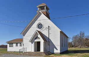
| Michigan Valley | Osage | Ghost Town | 1870-1967 | A couple of old business buildings and a church remain. |
| Middle Branch | Hodgeman | Lost Town | 1878-1888 | |
| Middle Creek | Chase | Lost Town | 1862-1873 1875-1877 |
Located on a creek of the same name, J.S. Shipman was the first postmaster. The post office moved to Elmdale. |
| Middletown, Butler’s | Jefferson | Lost Town | Established in 1858. It was midway between Lecompton and Leavenworth. | |
| Middletown | Wilson | Lost Town | 1873-1903 | Located in Verdigris Township, 14 miles north of Fredonia and eight miles west of Buffalo, the nearest railroad station is. When its post office closed, it received its mail by rural route from Buffalo. |
| Midian | Butler | Lost Town | 1918-1950 | Company-owned Oil Town. |
| Midland | Butler | Lost Town | 1872-1873 | The post office moved to Minneha. |
| Midland | Douglas | On the Chicago and Rock Island Railroad and the Kansas Pacific Railroad. | ||
| Midland | Republic | Lost Town | 1876-1878 | The post office moved from Mimosa. |
| Midland/Midland Park | Sedgwick | |||
| Midlothian | Harper | Lost Town | ||
| Midson | Franklin | Lost Town | ||
| Midway/Nyack | Crawford | Lost Town | 1871-1878 1886-1912 |
A mining camp in the eastern part of the county. It was also a railroad station on the Kansas City Southern Railroad. |
| Midway | Dickinson | Lost Town | 1880-1886 | |
| Midway | Jewell | Lost Town | Paper Town, candidate for the county seat. | |
| Midway | Johnson | Lost Town | Incorporated in 1857. | |
| Midway | Miami | Lost Town | ||
| Milan | Sumner | Extinct Ghost Town | 1975-2011 | Milan is a tiny ghost town on the Chikaskia River. As of the 2020 census, its population was 56, and its total area was 0.13 square miles, all of which is land. The town is also extinct, as it no longer has a post office. |
| Milberger | Russell | Lost Town | 1903-1911 | Named for Charles Milberger, the postmaster. A country post office in Lincoln Township, 13 miles south of Russell. |
| Mildred | Allen | Ghost Town | 1907-1973 | An unincorporated community and near ghost town, the community’s population, as well as that of the surrounding areas, was 25 as of the 2020 census. |
| Milford | Geary | Current Town | ||
| Mill Creek | Bourbon | Lost Town | ||
| Millard | Barton | Lost Town | 1877-1906 | Named for Francis Millard, the postmaster. |
| Millard | Geary | Name Change | Site of the present Junction City. | |
| Millbrook | Graham | Lost Town | Vacated 1895. | |
| Miller | Douglas (?) | Lost Town | Post office 1855, abolished 1856. | |
| Miller | Lyon | Extinct Town | 1887-1905 1912-1958 |
Miller, Kansas, is an extinct town in Waterloo Township of northeast Lyon County. It was named for the Miller brothers, ranchers. |
| Miller | Morris | Lost Town | 1855-1856 | Arthur Baker served as the first postmaster of Miller’s post office. He soon left and established Agnes City in Lyon County. |
| Miller’s Creek | Dickinson | Lost Town | ||
| Miller’s Grove | Woodson | Lost Town | 1869-1873 | The post office moved to Everett when it closed. |
| Miller’s Springs, Millersburg | Douglas | Lost Town | On the California Trail. | |
| Millersburg | Cherokee | Lost Town | 1868-1876 | Located eight miles northwest of Columbus. |
| Millersburg | Lyon | Lost Town | ||
| Millerton/Rolling Green | Sumner | Lost Town | 1875-1912 | The name changed to Millerton on December 3, 1884. It was located eight miles east and three miles north of Conway Springs, at the intersection of 120th Avenue and Drury Road. |
| Milligan | Sheridan | Lost Town | 1880-1882 | The town was in Spring Brook Township. |
| Million’s Ferry | Atchison | Lost Place | NA | Established in 1850 on the Missouri River at Atchison. |
| Millwood | Leavenworth | Lost Town | 1871-1904 | Settled in 1870, the village was located on Stranger Creek in the northern part of the county. William Kelsey was the first postmaster. At one point, it had two flour mills, a school, and a tri-weekly stage to Atchison. In 1878, the population was 45. It was located three miles from Easton. |
| Milo | Lincoln | Lost Town | 1872-1938 | A country trading point on the Atchison, Topeka & Santa Fe Railroad, about 16 miles northeast of Lincoln. In 1910, it had two stores, an express office, a money order post office with one rural route, and a population of 50. |
| Milroy | Hodgeman | Lost Town | 1887-1895 | |
| Milton | Kingman | Lost Town | 1878-1885 | The post office moved to Norwich after it closed in Milton. |
| Milton | Marion | Lost Town | 1872-1877 | |
| Milton | Sumner | Current Town | 1878-Present | Milton, Kansas, is an incorporated community of Eden Township in the northwest corner of Sumner County. |
| Miltonvale | Cloud | Current Town | ||
| Milwaukee | Butler | Lost Town | See New Milwaukee. | |
| Milwaukee | Barton | Lost Town | ||
| Mimosa | Republic | Lost Town | 1871-1876 | Mimosa was a small settlement on the Republican River in the western part of Republic County, 14 miles from Belleville, the county seat. When the post office closed, it moved to Midland. |
| Mina | Marshall | Lost Town | 1889-1925 |
This was once a trading point between Axtell and Summerfield. It was located on the Missouri Pacific Railroad. |
| Minersville | Cloud | Lost Town | 1877-1899 | Minersville was a coal town located near the northern border of Cloud County, Kansas. |
| Minerva | Labette | Lost Town | 1874-1892 | |
| Mingo-Thurford | Thomas | Extinct Town | 1888-1940 |
This place was first called Thurford when a post office was opened on October 3, 1888. It was the last town to be formed in Thomas County and was the midpoint between Oakley and Colby. The town and post office were renamed Mingo on April 4, 1894. |
| Mingona | Barber | Lost Town | 1885-1893 | |
| Minneapolis | Ottawa | Current Town |
County seat. |
|
| Mineola-Minneola | Clark | Current Town |
On the Chicago and Rock Island Railroad in 1887. |
|
| Minneha | Butler | Lost Town | 1877-1880 |
Located in Bruno Township, Minneha was settled in western Butler County in 1871. |
| Minneha/Manchester | Sedgwick | Lost Town | 1871-1900 |
Located in Minneha Township, it was a station on the St. Louis and San Francisco Railroad. |
| Minneola/Saint Bernard | Franklin | Lost Town | 1855-1865 |
The name changed from Saint Bernard on November 26, 1858. When it closed, the post office moved to Centropolis. |
| Mimosa | Republic | Lost Town | ||
| Mineral | Cherokee | Lost Town | 1895-1925 | The post office originally moved from Cherry. |
| Mineral City | Cherokee | Lost Town | 1898 | The post office was only open for six weeks after the order of change was rescinded. |
| Minersville | Cloud | |||
| Minersville | Republic | Lost Town | ||
| Minerva | Labette | Lost Town | ||
| Minety | Rooks | Lost Town | ||
| Mingona | Barber | Lost Town | Vacated 1901. | |
| Minneapolis | Ottawa | On the Atchison, Topeka & Santa Fe Railroad. | ||
| Minneha | Butler | Lost Town | 1877-1880 | The post office moved to Cloud. |
| Minneola | Franklin | Lost Town | ||
| Mirriam | On the Atchison, Topeka & Santa Fe Railroad. | |||
| Mission | Johnson | Current Town | ||
| Mission | Shawnee | Lost Town | 1871-1872 | The post office was open for less than a year. |
| Mission Centre | Brown | Lost Town | 1877-1882 | The post office moved to Willis. |
| Mission Creek | Wabaunsee | Lost Town | ||
| Mission Hills | Johnson | Current Town | ||
| Mission Woods | Johnson | Current Town | ||
| Missler, Jasper | Meade | On the Chicago and Rock Island Railroad in 1887. | ||
| Missouri City | Johnson | Lost Town | Incorporated in 1857. | |
| Missouri Farm | Doniphan | Lost Town | ||
| Missouri Flat | Sumner | Lost Town | 1879-1881 | |
| Mitchell County | Mitchell | Current County | NA | Created in 1867 from an unorganized area. Beloit is the county seat. |
| Mitchellville | Stanton | Lost Town | Vacated 1895. | |
| Mobile | Elk | |||
| Modell | Norton | Lost Town | 1878-1882 | Modell was a village on the Solomon River in southern Norton County. In 1885, it was on the Missouri Pacific Railroad, from which it shipped livestock. At that time, its population was 80. Modell was ten miles south of Norton, the county seat and the nearest bank. |
| Modena | Butler | Lost Town | 1874-1882 | |
| Modoc | Jewell | Lost Town | 1875-1876 | |
| Modoc-Plummer | Scott | Extinct Town | 1887-1992 | When this place began, it was called Plummer. When the townsite was purchased by the Atchison, Topeka & Santa Fe Railroad, it surveyed and platted 200 acres into town lots. The old community still displays a grain elevator, numerous silos, a few homes, and closed businesses. Modoc is about nine miles west of Scott City, the county seat. |
| Modoc | Wichita | Extinct Town | 1886-1992 | The post office closed on March 21, 1902. |
| Mohon | Bourbon | Lost Town | 1878-1883 | Located in the southeast corner of the county, it was 12 miles southeast of Fort Scott. Wesley Calkins made the first settlement in 1878. John McDonald was the only postmaster and also opened a store. |
| Mole Hill | Dickinson | Lost Town | 1877-1880 | |
| Moline | Elk | Current Town | On the Howard Branch of the Atchison, Topeka & Santa Fe Railroad. | |
| Mon Fort | Lost Town | Chartered 1879. | ||
| Mona | Reno | Lost Town | 1879-1901 | A German Mennonite settlement on the Ninnescah River, it was about five miles west of Ost. |
| Moneka | Linn | Lost Town | 1857-1866 | Moneka got its start in February 1857. Chartered 1858. Two miles east of Mound City. |
| Money Creek | Jefferson (?) | Lost Town | ||
| Monique | Shawnee | Lost Town | Incorporated 1857 | |
| Monitor | McPherson | Lost Town | 1874-1902 | |
| Monmouth | Crawford | Extinct Town | 1866-1955 |
Located in southwest Crawford County, four miles east of McCune. Still has houses and a church. |
| Monmouth | Shawnee | Lost Town | ||
| Monotony | Wallace | Lost Town | On the Kansas Pacific Railroad. | |
| Monroe | Lincoln | Lost Town | 1871-1886 | Mrs. Skinner taught the first public school in Lincoln County, at Monroe, in 1870. |
| Monrovia | Atchison | Extinct Town | 1857-1955 | Monrovia started as a stage stop on the Overland Stage Route in 1856. Named by S. J. H. Snyder, the townsite owner. It was on the Missouri Pacific Railroad. Located west of Atchison. |
| Mont Cenis | Dickinson | Lost Town | 1872-1882 | |
| Mont Ida/Oneida | Anderson | Extinct Town | 1880-1944 | The name was changed from Oneida to Mont Ida on February 9, 1881. |
| Montana | Crawford | Lost Town | 1859 | The post office was open for less than nine months. |
| Montana | Labette | Lost Town | 1866-1918 | Located in Liberty Township, it was founded in April 1866. A fire destroyed most of the buildings in 1895. |
| Mont Cenis | Dickinson | Lost Town | 1872-1882 | Also spelled Mount Cenis, this was a post office in Sherman Township, 20 miles northeast of Abilene. Junction City is its usual railway point. The mail was delivered to Jesse Dever, the postmaster, five times a week. |
| Montaque | ||||
| Montefiero | Pratt | Lost Town | None | The Montefiero Agricultural Aid Society, located in New York, founded the colony of Montefiero in March 1884. The colony initially consisted of 15 Jewish families from Russia. |
| Monterey | Riley | Lost Town | 1890-1899 | |
| Montezuma | Gray | Current Town | On the Cimarron Branch of the Santa Fe Trail. | |
| Montgomery | Dickinson | Lost Town | Twenty miles west of Fort Riley. | |
| Montgomery | Linn | Lost Town | ||
| Montgomery | Montgomery | Lost Town | 1869-1871 | Started by R.W. Dunlap at the mouth of Drum Creek and on the Verdigris River, a few miles southeast of Independence, in 1869. |
| Montgomery County | Montgomery | Current County | Formed from Wilson County in 1867. Independence is the county seat. | |
| Monticello | Johnson | Lost Town | 1858-1905 | One of the first white farmers in the Monticello area was John Owens, who made his claim along Mill Creek around 1840. |
| Montrose | Elk | Lost Town | See Cave Springs. | |
| Montrose-Delta | Jewell | Lost Town | 1872-1974 | The name changed from Delta to Montrose on January 6, 1888. In 1910, the town had banking facilities, a post office, express and telegraph services, a thriving local trade, and a population of 156. |
| Monument | Gove | Lost Town | None in Gove County |
Monument was established in 1865 as a stage station in Gove County and later became a military post. The troops and post office were relocated 35 miles northwest on June 24, 1868, to a site in Logan County, previously known as Antelope Station, where the post office operated as Monument until September 25, 1868. |
| Monument | Logan | Ghost Town | 1868 1880-1997 |
Located in northeast Logan County, it is an unincorporated ghost town. It was on the Kansas Pacific Railroad. |
| Monument Rocks | Gove | Current Place | NA | |
| Monument Station | Jefferson | Lost Town | ||
| Monument Station/Fort Monument | Gove | Lost Place | Originally a Butterfield stage station along the Smoky Hill Trail to Colorado. Troops were first sent there in 1865 to protect the station and travelers from Indian attacks. | |
| Moody | Coffey | Lost Place | None | A station on the Missouri, Kansas & Texas Railway. |
| Moodyville | Pottawatomie | Lost Town | 1879-1927 | Moodyville was laid out in April 1882. Nearby was Moodyville Springs, one of the best Mineral springs in the state. |
| Mooney | Leavenworth or Jefferson | Lost Town | ||
| Moonlight | Dickinson | Lost Town | 1894-1905 | |
| Moore | Marion | Lost Town | 1897-1899 | |
| Moorehead | Labette | Lost Town | ||
| Moore’s Ranch | Marion | Lost Town | On Santa Fe Trail, Post office 1861; discontinued 1870. | |
| Moore’s Summit/Summit | Leavenworth | Lost Town | It is located in Stranger Township, near the Union Pacific Railroad. It was named after Captain Crawford Moore, a local landowner, but the name was later changed to Summit. | |
| Moore’s Toll Bridge | Nemaha | Lost Place. | Established 1854-55, South Fork of Nemaha River at Moorestown (future Baker’s Ford). W. W. Moore & Walter D. Beeles, proprietors. | |
| Moorestown/Urbana | Nemaha | Lost Town | 1855 | W.W. Moon started the settlement in 1854 at Baker’s Ford on the South Fork of the Nemaha River. John Jett was the postmaster at the Urbana post office. |
| Moran/Morantown | Allen | Current Town | On the Missouri Pacific Railroad and the Missouri, Kansas & Texas Railway. | |
| Moravian Mission | Leavenworth | Lost Town | 1839 | On the Missouri River between Delaware City and Leavenworth. |
| Moray/East Norway | Doniphan | Lost Town | 1871-1938 | The name was changed from East Norway to Moray on December 17, 1894 |
| Morehead | Neosho | Extinct Town | 1873-1954 | It was on the Atchison, Topeka & Santa Fe Railroad and was named after a conductor on the railroad. Very little is left today. |
| Morena | Clay | Name Change | Now Broughton. | |
| Morgan | Chase | Lost Town | 1876-1902 | Probably named for W. A. Morgan, the editor of the Chase County Leader. The postmistress, Julia E. Kinne. It was at the head of Rock Creek, southwest of Bazaar. |
| Morgan City | Clay | Name Change | Now Morganville. | |
| Morgan | Montgomery | Lost Town | 1870-1872 | Founded by the Morgan brothers in the summer of 1869. It was located about two and a half miles northeast of Independence. |
| Morganville | Clay | Current Town | ||
| Mormon Springs | Washington | Lost Place | None | Mormon Springs, located on Ash Creek in Washington County, Kansas, was a favored camping ground for the Latter-day Saints as they traveled to Utah along the South Fork of the Mormon Trail. |
| Morning Star | Norton | Lost Town | None | The Morning Star Christian Church was located eight miles northwest of Almena on the G.S. Colip farm. Mr. Colip donated one acre of land on the northeast corner of his farm to the church. The neighbors and friends did most of the work to build the church, which was dedicated in 1910. |
| Mortimer | Labette | Lost Town | 1883-1902 1906-1907 |
Mortimer was platted by Emanuel Mortimer in 1883. It was a St. Louis & San Francisco Railroad station in Osage Township of Labette County. It was located 23 miles northwest of Oswego, the county seat, and about 12 miles west of Parsons, from which place it received daily mail after its post office closed. |
| Morton City | Hodgeman | Lost Town | None | African American Exodusters began arriving in Hodgeman County from Kentucky in 1879. Establishing Morton City, they farmed, homesteaded, and raised families. However, life was difficult, and they struggled to make ends meet. The town was eventually abandoned. |
| Moscow | Cowley | Lost Town | 1875-1880 | |
| Mound | Phillips | Lost Town | 1873-1882 | Mound was a post office in Phillipsburg Township, Phillips County. There was a daily stage to Phillipsburg, from which the mail was delivered to Harrison D. Rogers, the postmaster, six times per week. In 1878, it had a blacksmith and a wagonmaker. It was 11 miles west of Phillipsburg, the county seat, and 75 miles south of Kearney, Nebraska. |
| Mound Springs | Wilson | Lost Town | 1870-1872 | |
| Mount Airy | Woodson | Lost Town | 1860-1864 | |
| Mount Gilead-Walker | Anderson | Lost Town | 1857-1866 | When a post office was established in May 1857, this place was first called Walker. On May 20, 1861, the town’s name was changed from Walker to Mount Gilead. By the early 1880s, all that remained was one building, which was used as a grain storage facility. It was two miles southwest of Greeley. |
| Mount Liberty | Reno | Lost Town | 1873-1886 | Mount Liberty is a small town in Haven Township. The first post office in the township was established on March 1, 1873, with S. J. Wilson as postmaster. |
| Mount Mitchell Heritage Prairie Park | Wabaunsee | Place | NA |
Mount Mitchell is a 50-acre hilltop in Wabaunsee County that looms over the Kansas River Valley. In 1856, William Mitchell and his fellow abolitionist colonists arrived in the Kansas Territory to ensure that Kansas would join the Union as a free state, free from the institution of slavery. |
| Mount Nebo | Pratt | Lost Town | 1879-1888 | |
| Mount Olive | Norton | Lost Town | None |
John G. Palmer and Matilda Palmer deeded a tract of land for the Methodist Episcopal Church and cemetery. The church is no longer there, but the cemetery remains. |
| Mount Olivet | Leavenworth | Lost Town | 1877-1900 | A post office was located at the head of Salt Creek in the western part of the county. The postmaster was H. M. Dubois. It was located six miles from Leavenworth. |
| Mount Roy | Brown | Lost Town | 1857-1858 1871-1882 |
|
| Mount Sterling | Bourbon | Lost Town | 1862-1871 | The first postmaster was T.S. Brockman. |
| Mount Vernon/Landondale | Doniphan | Lost Town | Platted 1857-58 on land purchased from Sampson, Isaac & Daniel Graves. It had a general store, a warehouse, and a physician. The Kansas Legislature vacated the townsite in 1863. | |
| Mount Zion | Phillips | Lost Town | 1875-1876 | Mount Zion was located in Deer Creek Township on the Old Deer Creek, Phillipsburg to Kirwin Road. It had a store and a post office established in 1875, with Homer C. Spaulding serving as postmaster. |
| Mulberry | Clay | Lost Town | 1868-1869 | The post office moved to Riverdale. |
| Mulberry | Crawford | Current Town | 1869-Present | Mulberry, Kansas, is a small town in Lincoln and Washington Townships in eastern Crawford County. As of the 2020 census, the city’s population was 409, and its total area was 50 square miles. |
| Mulberry | Saline | Lost Town | 1871-1890 | |
| Muldrow | Sherman | Lost Town | 1888-1900 | |
| Mumford | Barber | Lost Town | 1885-1906 | It was located about ten miles northeast of Medicine Lodge. When the post office closed, it received its mail by rural delivery from Nashville, Kingman County, six miles north, and the nearest railroad station. |
| Mumm | Sheridan | Lost Town | 1881-1882 1886 |
|
| Murdock | Butler | Lost Town | 1872-1873 1875-1902 |
In Murdock Township, it was 12 miles west of Eldorado and six miles north of Benton, the nearest shipping point. |
| Museum | Sheridan | Lost Town | 1882-1898 | |
| Mushroom State Park | Elsworth | State Park | NA |
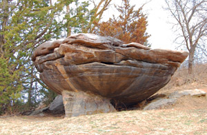
Located in the Smoky Hills southwest of Salina, Kansas, Mushroom Rock State Park includes beautiful sandstone formations and is rich in early Kansas history and railroad lore. |
| Myers Valley | Pottawatomie | Lost Town | 1870-1903 | In Pottawatomie Township, Myers Valley had a post office located at a country store in 1878. It was located six miles south of Westmoreland, 19 miles northwest of Louisville, and 50 miles northwest of Topeka. |
| Myra | Woodson | Lost Town | 1884-1895 | |
| Myrtle | Phillips | Lost Town | 1878-1904 | A country hamlet, Myrtle was located 14 miles north of Phillipsburg, the county seat, and miles east of Woodruff on the Chicago, Burlington & Quincy Railroad, the nearest shipping point, and seven miles south of Alma, Nebraska, the post office from which it received its mail after its post office closed. |
| Mystic | Sheridan | Lost Town | 1887-1889 | |
| Myton | Reno | Lost Town | None |

